Current Weather Conditions
John A. Weeks III
Saturday, July 27, 2024, 4:00:39 AM CDT
Home Photo Tours Rail Fan 12 Easy Steps
Aviation Spacecraft Highways & Bridges About The Author
 
Google Search
Maps   Groups   Images   Search
 
  Home
  • 12 Easy Steps
  • Aviation
  • Spacecraft
  • Highways & Bridges
    » Bridge Photography
      - MSP River Bridges
      - C & D Canal
      - Illinois River
      - Minnehaha Creek
      - Minnesota River
      - Mississippi River
      - Missouri River
        › Fort Peck Area
        › Eastern Montana
        › Western North Dakota
        › Central North Dakota
        › South Dakota Interior
        › Nebraska - S Dakota
        › Nebraska - Iowa (N)
        › Omaha Area
        › Nebraska - Iowa (S)
        › Nebraska - Missouri
        › Kansas - Missouri
        › Kansas City Area
        › West Central Missouri
        › East Central Missouri
        › St. Louis Area
      - St. Croix River
      - St. Louis River
      - Wisconsin River
      - Best Miss River Photos
      - Cable Stayed Bridges
      - McGilvray Road Bridges
      - I-35W Bridge Disaster
      - Miscellaneous Bridges
      - Madison County Bridges
      - Hist Br Weekend 2013
    » Road Geek Topics
  • Photo Tours
  • Rail Fan
  • About The Author
 
Site Search By JRank
Highways, Byways, And Bridge Photography

The Bridges And Structures
Of The Missouri River

First Edition — July 2008


Missouri River

Fort Peck Area
Eastern Montana
Western North Dakota
Central North Dakota
South Dakota
Nebraska—South Dakota Border
Nebraska—Iowa Border (North)
Omaha Area
Nebraska—Iowa Border (South)
Nebraska—Missouri Border
Kansas—Missouri Border
Kansas City Area
West Central Missouri
East Central Missouri
Saint Louis Area
This is my sixth installment visiting the bridges and structures of a great American river. In this outing, we visit the bridges, locks, and 
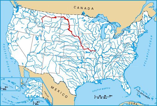
dams on the Missouri River. The mighty Missouri is the longest river in North America, wandering from its source in western Montana and heading south and east to its confluence with the Mississippi River at Saint Louis, Missouri.

The Missouri River has three distinct sections. The lower river runs 735 miles from its confluence with the Mississippi River at Saint Louis, through Kansas City, and then to the river head of navigation just north of Sioux City, Iowa. The river is characterized by running through relatively flat territory that is prone to extreme flooding. The US Army Corps of Engineers has attempted to channelize the river, but once the river overflows its banks, it flows along the path of least resistance.

The upper river flows through the Dakotas and eastern Montana, where the river is characterized by a series of monumental dams and giant river bridges. It is amazing to consider that these huge dams, some of the largest on the planet, are located over 1000 miles from the Gulf of Mexico.

The headwaters area is located between the start of the Missouri River at the Three Forks, and continues east through Montana until the river enters Fort Peck Lake, the reservoir behind Fort Peck Dam. Through much of Montana, the river is much like a mountain stream. The highlight of the headwaters area is the waterfall at Great Falls, a key obstacle faced and conquered by the Lewis & Clark Expedition.

Made With Macintosh
Authored by John A. Weeks III, Copyright © 1996—2016, all rights reserved.
For further information, contact: john@johnweeks.com