Bridge #5 was a wooden king post bridge that spanned 65 feet. It deteriorated
to the point that it was no longer salvageable and was removed by the DNR in
1986. At the time of the restoration project in the mid-1990s, a pony style
through truss bridge became available in Pierce County. That bridge was
dismantled, trucked to New Amsterdam, refurbished, and installed in place
of Bridge #5. Given that most of the steel truss bridges from the early and
mid-1900s have disappeared, this bridge is historically significant in its
own right.
A pony style truss bridge is built from two truss beams. The truss beams
consist of two parallel horizontal beams with cross-beams running in a
zigzag fashion. The beam stays rigid by having alternate cross-beams in
compression and tension modes (being squeezed towards the middle or being
pulled on at the ends). In a pony style truss, the truss rises up above
the bridge deck, but does not rise high enough to be above the traffic level.
When local residents learned that the bridges on McGilvray Road were to be
demolished, they began to organize and raise funds. They formed the
‘The Friends of McGilvray Road, Inc’ to coordinate the
community efforts. The group signed up sponsors and sold T-shirts and
caps to raise funds. Later, a series of limited edition fine art prints
generated over $350,000 for the bridge restoration. The DNR and the state
Historical Society endorsed the project, leading to the State of Wisconsin
approving the project and allowing the bridges to be saved.
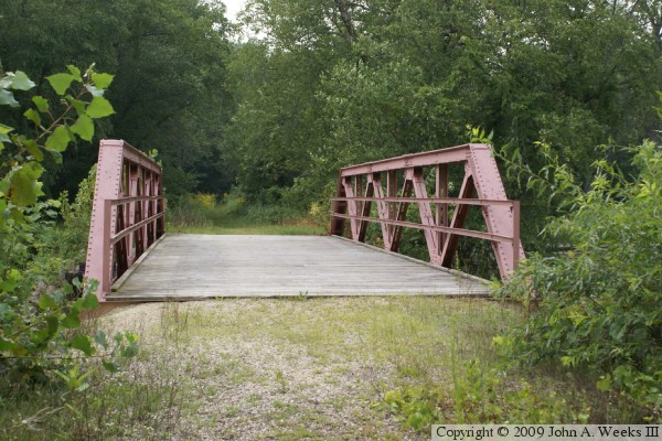
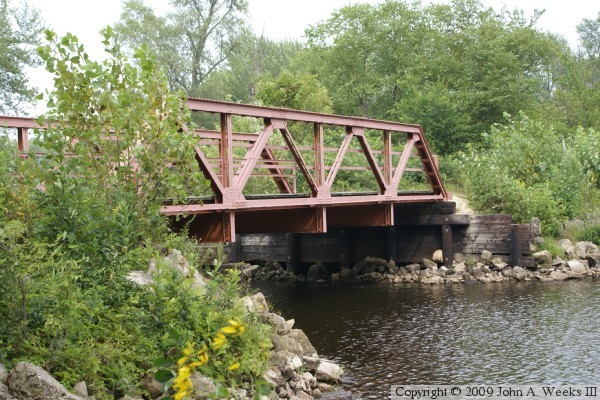
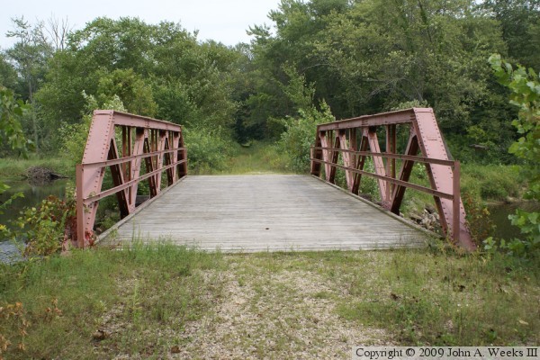
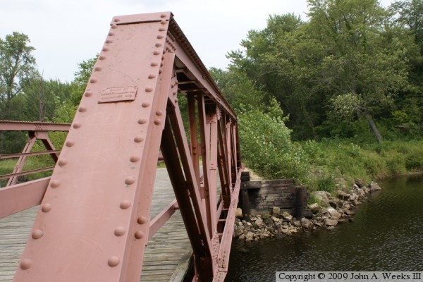
The photo above is a view of Bridge #5 as one would approach the bridge while
heading west on McGilvray Road. The photo below is a profile view of the
downriver face of Bridge #5 as seen from near the water level southwest of
the structure. Unlike the bowstring arch bridges, this bridge sits directly
on the wooden abutments.
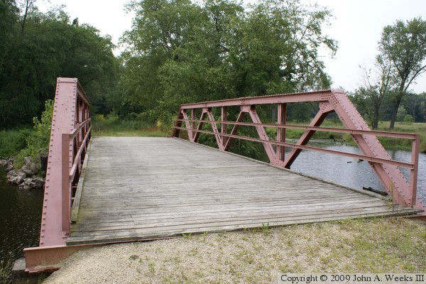
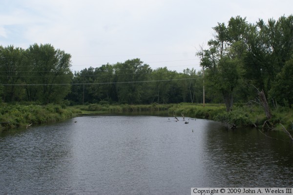
The photo above is looking west from the southeast corner of Bridge #5. The
photo below is looking east down the length of the bridge deck. Note the
beaver lodge on the far left side of the photo on the far side of the river
channel.
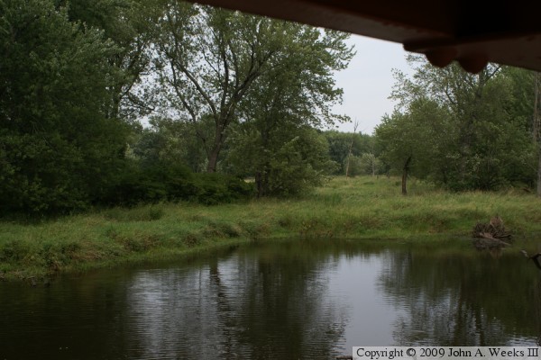
The photo above is looking north from the deck of Bridge #5. The photo below
is looking south from the deck of Bridge #5. The power line that parallels
McGilvray Road is located 400 feet south of the bridge due to the road
having shifted 325 feet to the north between Bridge #3 and Bridge #4. While
the river channel looks to be fairly large at this location, the water is
actually a lake that has formed using an old river channel.
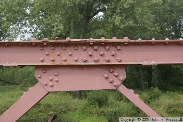
The photo above is looking east along the downriver face of Bridge #5. The
photo below is a gusset plate near the center of the bridge truss. While
most of the bridge fasteners are rivets, we find that half of the fasteners
at this joint are bolts. This appears to be where the bridge was split
apart prior to being moved to this location. The bridge would have been
disassembled by drilling out key sets of rivets, and those rivets were
replaced by bolts when the bridge was put back together.
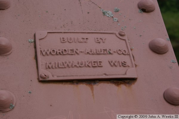
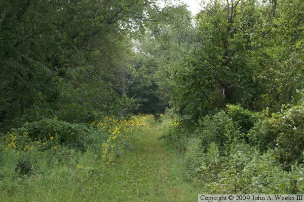
The photo above is the bridge builder's plate. The photo below is looking
west down McGilvray Road towards Bridge #6, located 1,700 feet west of Bridge
#5. The trail begins to narrow and the roadway is much more uneven and rough
west of Bridge #5.