Current Weather Conditions
John A. Weeks III
Saturday, April 20, 2024, 3:41:05 AM CDT
Home Photo Tours Rail Fan 12 Easy Steps
Aviation Spacecraft Highways & Bridges About The Author
 
Google Search
Maps   Groups   Images   Search
 
  Home
  • 12 Easy Steps
  • Aviation
  • Spacecraft
  • Highways & Bridges
    » Bridge Photography
      - MSP River Bridges
      - C & D Canal
      - Illinois River
      - Minnehaha Creek
        › Minnetonka
        › Hopkins & SLP West
        › SLP East & Edina
          · Louisiana Av Bridge
          · Methodist H Boardwalk
          · Excelsior Blvd Footbr
          · Excelsior Blvd Bridge
          · Meadowbrk GC Br #2
          · Meadowbrk GC Br #1
          · Soo Line RR Bridge
          · Brookside Av Bridge
          · 44th St Bridge
          · MN-100 Bridge
          · Browndale Ave Br
          · Edina Mill Site
          · 50th St Bridge
          · Wooddale Ave Bridge
          · Arden Pk Footbridge
          · 54th St Falls
          · 54th St Bridge
          · 56th St Bridge
        › Minnehaha Pkwy West
        › Minnehaha Pkwy Cntrl
        › Minnehaha Pkwy East
        › Minnehaha Falls Area
      - Minnesota River
      - Mississippi River
      - Missouri River
      - St. Croix River
      - St. Louis River
      - Wisconsin River
      - Best Miss River Photos
      - Cable Stayed Bridges
      - McGilvray Road Bridges
      - I-35W Bridge Disaster
      - Miscellaneous Bridges
      - Madison County Bridges
      - Hist Br Weekend 2013
    » Road Geek Topics
  • Photo Tours
  • Rail Fan
  • About The Author
 
Site Search By JRank
Highways, Byways, And Bridge Photography
Louisiana Avenue Bridge
Minnehaha Creek Street Crossing
Saint Louis Park, MN

Louisiana Avenue Bridge

• Structure ID: NBI 27564.
• Location: River Mile 13.2.
• River Elevation: 890 Feet.
• Structure Type: Street Bridge.
• Construction: Prestressed Concrete Girder.
• Length: 93 Feet, 31 Foot Longest Span.
• Width: 58 Feet.
• Height Above Water: ??? Feet.
• Date Built: 1971.
Louisiana Avenue is a busy north and south connector street through Saint Louis Park, Minnesota. It crosses the Minnehaha Creek towards the south end of its three and one-third mile length just north of its intersection with Excelsior Boulevard. This area was historically a large wetland. In fact, it was flooded in the late 1800s by the dam built just downstream at the site of the Globe Mill. The area was drained around the turn of the 20th century. Since then, the area has been filled in as building sites for both light industrial and multi-unit housing construction. A large chunk of the wetlands were filled in for the Methodist Hospital. Louisiana Avenue is built on this fill, and it appears to be located on dry land, other than where it crosses the Minnehaha Creek.

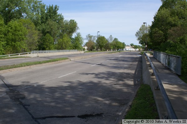
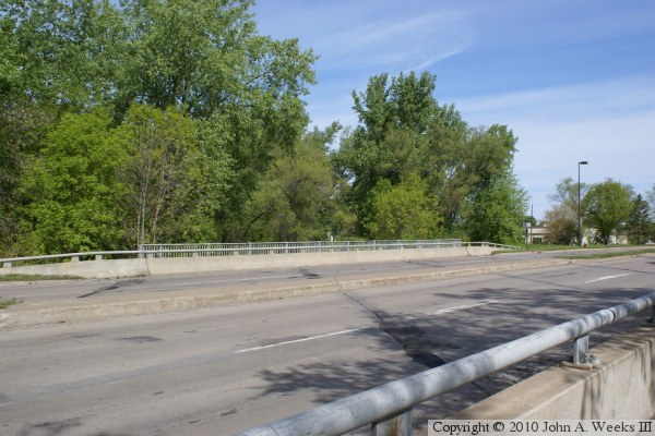
The photo above is a view looking northbound down the length of the bridge 
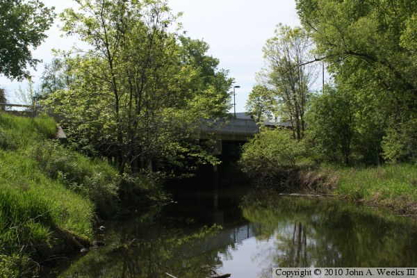
deck from the edge of the northbound traffic lanes. The photo below is a view looking southeast towards the upstream west face of the Louisiana Avenue Bridge from a canoe landing on the north bank of the creek. Yes, there is a bridge hidden behind the trees and brush


Louisiana Avenue Bridge
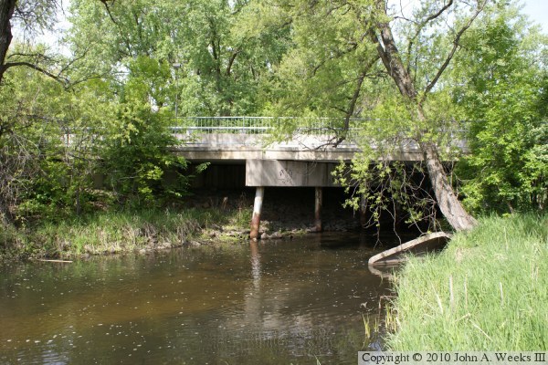
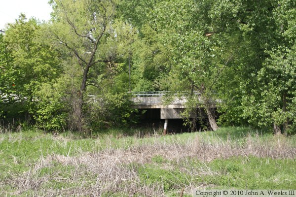
These two photos are views of the downstream east face of the Louisiana Avenue Bridge. The photo below is from the edge of the north bank of the creek near the bridge. The photo below is a wider view from about 150 feet east of the structure, one of the few spots in this swampy area that could support my weight.

Louisiana Avenue Bridge
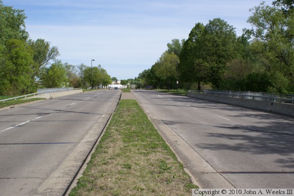
The photo above is looking north down the length of the bridge deck from the center median between the traffic lanes. The photo below is looking northwest across the bridge deck. The creek crosses the road at a 45 degree angle, resulting in the bridge deck being built at an angle.

Louisiana Avenue Bridge
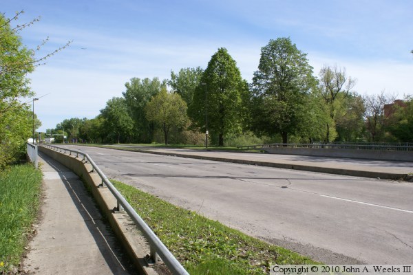
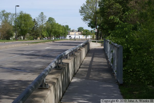
The photo above is looking northeast across the bridge deck from near the southwest corner of the structure. While the bridge deck starts 25 feet north of us on this side of the street, we are even with the start of the bridge deck on the far side of the road. The photo below is looking north along the sidewalk on the east side of the bridge.

Louisiana Avenue Bridge

Made With Macintosh
Authored by John A. Weeks III, Copyright © 1996—2016, all rights reserved.
For further information, contact: john@johnweeks.com