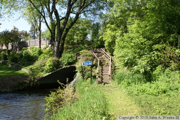
The France Avenue Culvert was installed in 1954 when this area of Edina was
subdivided. The land dips about 25 feet along the creek. It was desired
to level off France Avenue, so a culvert was installed and an embankment
was built to carry the street. The embankment is much wider than the street
at its base, resulting in the culvert being a long tunnel for canoe traffic.
Canoeists often report that the culvert is spooky since you cannot see light
at the far end when you enter the tunnel heading downstream. There is no
view of the creek from the highway. In fact, there is no indication of a
bridge or a creek other than the green highway signs that carry the creek
name.
The land on the east side of France Avenue looks like a small city park. It
apparently is private property. No matter the ownership, it is landlocked an
difficult to access without trespassing. The property owners on the south
side of the creek built the steps and walkway over the culvert that is
shown in two photos below. They also built a footbridge about 75 feet
downstream of the culvert. It is a very scenic location that is probably
only seen by a few invited guests and the adventurous folks who canoe the
Minnehaha Creek.
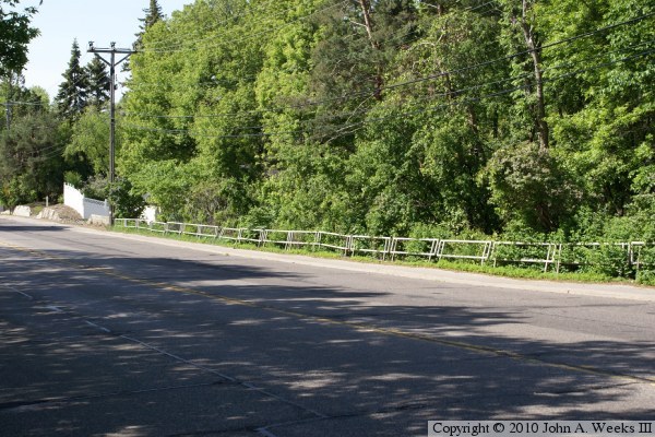
The photo above is a view looking north down the length of the bridge deck.
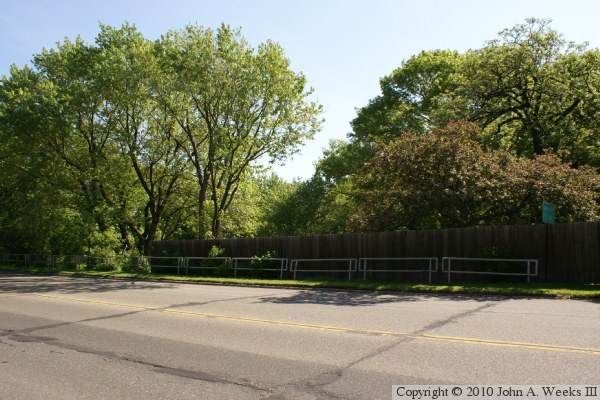
The photo below is looking northeast across France Avenue towards the bridge
railing on the east side of the street. The culvert is located under the
clump of trees on the left side of the photo.
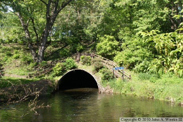
These two photos are views looking towards the downstream outlet of the
France Avenue Culvert. The photo above is a view from the north bank of the
Minnehaha Creek, while the photo below is a view from the Ewing Avenue
Footbridge located 75 feet downstream.
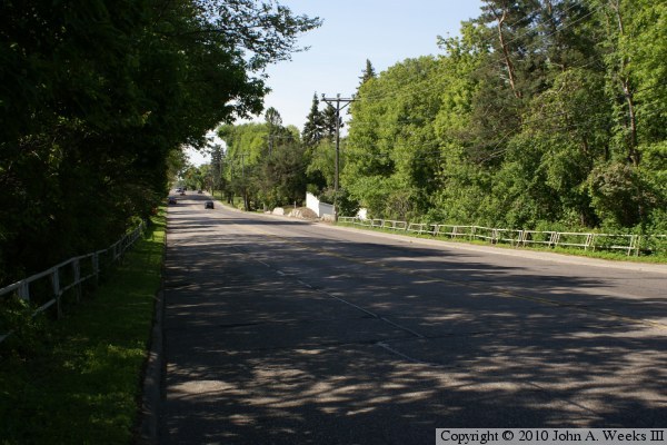
The photo above is looking south down the length of the bridge deck. The
photo below is a view of the bridge railing on the west side of France
Avenue. Once cannot see the creek from either side of the street.