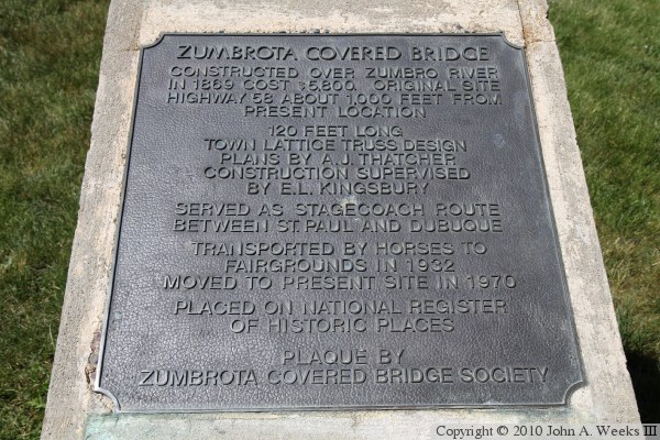
The Zumbrota Covered Bridge was built in 1869 to replace an earlier wooden
bridge that was washed out in a flood. It carried a stagecoach line across
the North Branch of the Zumbro River. The stagecoach path was incorporated
into the local highway system. Eventually, MN-58 used the bridge.
The bridge was retired in 1932, at which time it was moved to the nearby
Goodhue County Fairgrounds. It remained on display at the fairgrounds for
65 years until it was moved to a city park in 1997. The park was named
Covered Bridge Park in honor of the bridge. Sources differ on where the
bridge was originally located. Some say the original location was 100 yards
away, others say 1,000 feet. The current MN-58 bridge is 300 feet east.
Mill Street is located 1,000 feet west of the current bridge location, which
makes sense as a possible bridge site, and it correlates well with the 1,000
foot number used on the historical marker.
The Zumbrota bridge was not always a covered bridge. It was built as a timber
truss bridge. The side boards and roof was added in 1871. That is actually
a pretty common story with bridges of this era. The roof was added to
protect the very expensive timber that make up the truss structure, and to
keep the deck from rotting. The pier at mid-span is not original. It was
added to help support the bridge when it was installed in its current
location.
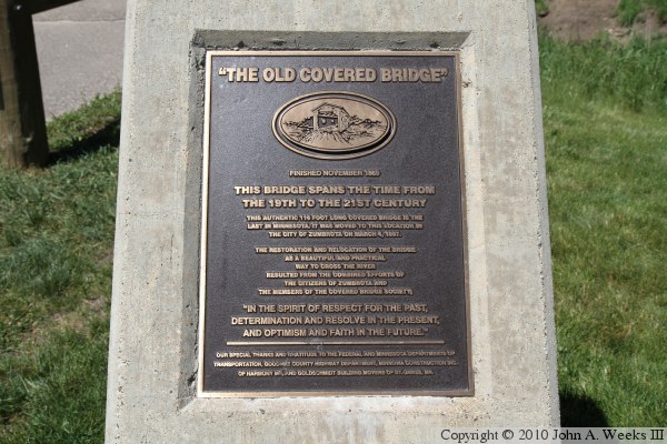
The Zumbrota Covered Bridge is the only surviving authentic wooden covered
bridge in the State of Minnesota. There are a number of other covered bridges
located in the state, but all appear to have been built since 1970.
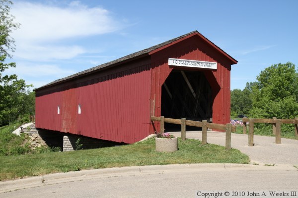
The photo above is a view of the bridge looking northeast towards the southwest
corner of the structure. The south end of the bridge is located close to the
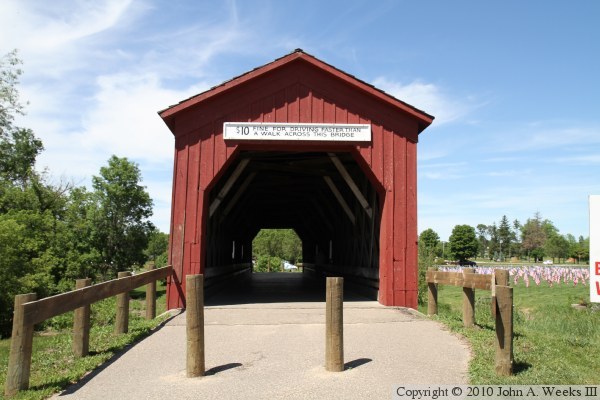
public library parking lot. The photo below is the south bridge portal.
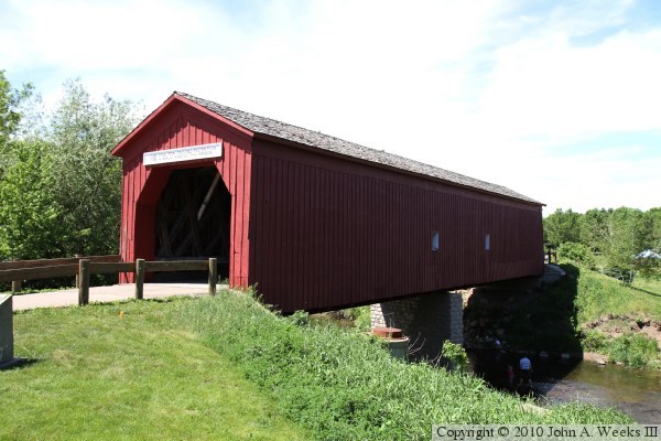
The photo above is the east side of the bridge. Given it was a bright day,
and the red paint is relatively dark, the side of the bridge is very dark.
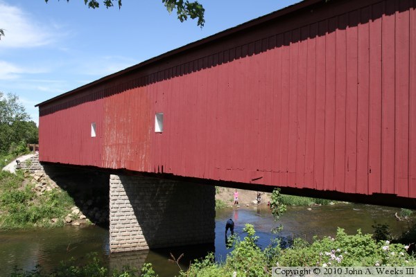
The photo below is the west side of the bridge. The abutment and pier are
concrete with a brick texture.
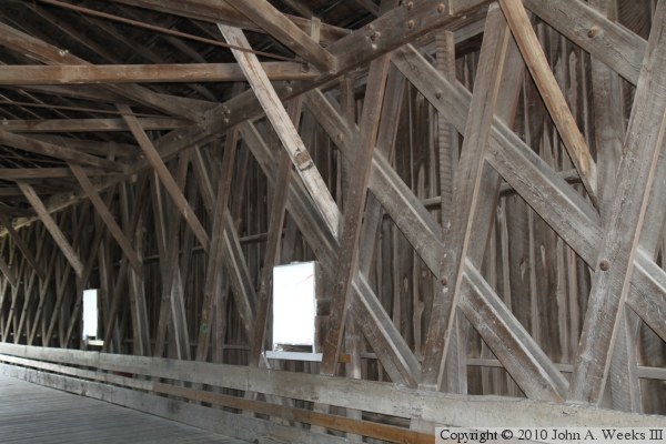
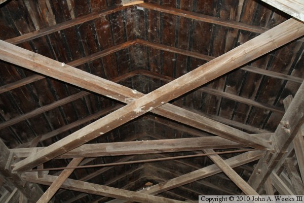
These two photos are views from inside the bridge. The photo above is the
east side of the truss. Rather than using large timbers, the bridge uses
parallel pairs of planks. The photo below is looking up towards the roof.
The larger crossmembers are structural components of the bridge. The roof
itself is very lightly constructed using rafters rather than trusses.
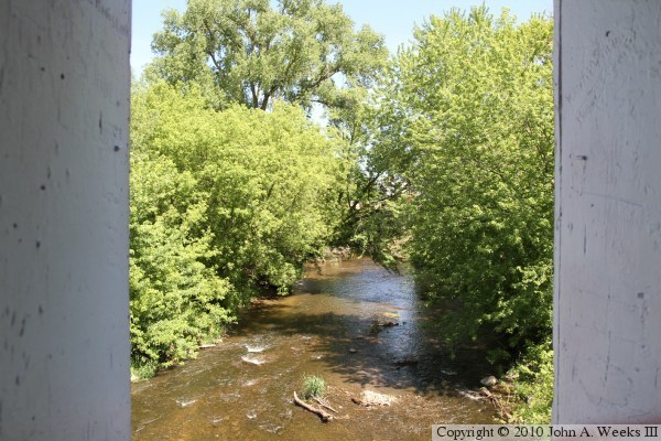
The photo above is looking downstream out one of the window portals on the
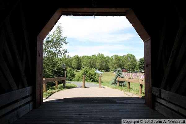
east side of the bridge. The photo below is a view looking out the north
bridge portal.
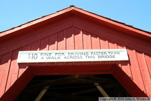
The photo above is a sign that is posted above the bridge portal. The photo
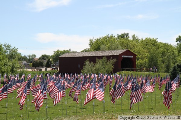
below is looking southwest across Covered Bridge Park. The flags are part of
a display for Memorial Day.
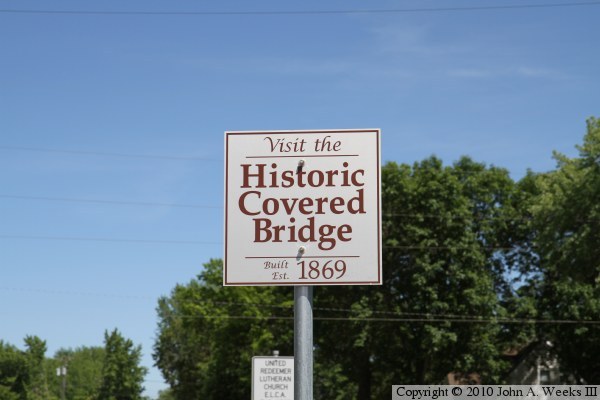
The photo above is a highway sign located on 5th Street, just east of the
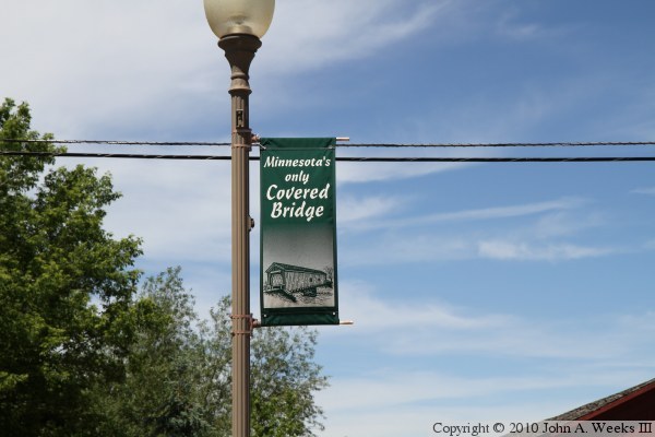
highway interchange with US-52. The photo below is an example of a banner
that is flying on street lamp poles in the downtown area of Zumbrota.
These two photos are markers that are located near the south end of the
covered bridge.