|
|
| Highways, Byways, And Bridge Photography |
Nicollet Co 23 - Blue Earth Co 42 Bridge
Minnesota River Highway Crossing
Judson, MN
|
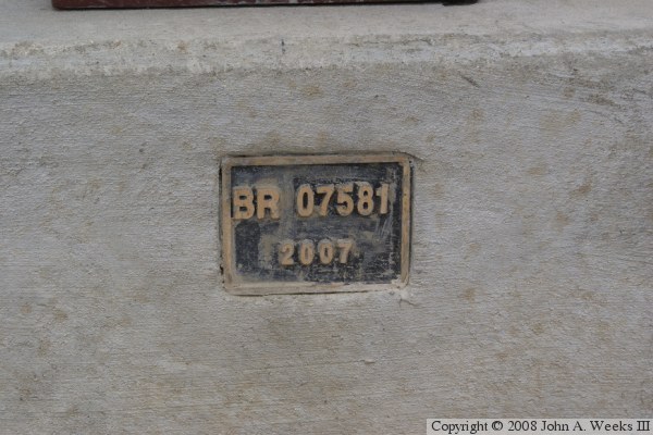
• Structure ID: |
NBI: 07581. |
|
• Location: |
River Mile 126.1. |
|
• River Elevation: |
761 Feet. |
|
• Highway: |
Nicollet Co 23, Blue Earth Co 42. |
|
• Daily Traffic Count: |
1,100 (2001, Data For Old Bridge)). |
|
• Bridge Type: |
Prestressed Concrete Girder, Concrete Deck. |
|
• Length: |
505 Feet, 140 Foot Longest Span. |
|
• Width: |
44 Feet, 2 Lanes. |
|
• Navigation Channel Width: |
Non-Navigable. |
|
• Height Above Water: |
???. |
|
• Date Built: |
Opened Fall 2007. |
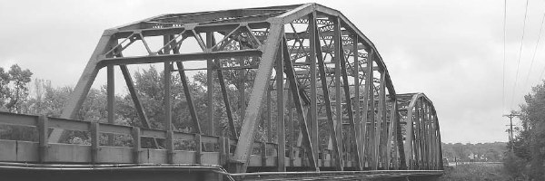
The existing bridge at Judson, Minnesota, was a steel through truss bridge
built in 1954. The 1954 bridge was 479 feet long, consisting of two truss
sections that were each 200 feet long, plus a 79 foot steel girder span on the
south end. The bridge was 24 feet wide. That bridge was determined to be
obsolete, too narrow for modern agricultural needs, and did not meet
current traffic standards. The two adjacent counties, Nicollet and Blue
Earth, considered a project to replace the deck, fix selected problems with
the structure, and repaint the bridge. The costs for this project were well
over half the price of a new bridge. As a result, the two counties agreed
to replace the bridge.
A consulting company was hired to pick a new bridge style and draw blueprints
for the new structure. The new bridge would be about the same length as the
old bridge, but the road deck would be 16 feet wider. It would also feature
a wide sidewalk to be used as part of a future regional trail. The bridge
approaches would be built higher than the 100 year flood level. Those plans
were completed and delivered in 2006.
The two counties agreed to bid out the bridge and share the costs, but each
county would design, bid, and build their own approach roads. The bids for
the bridge were as follows:
| Lunda Construction Co. |
$4,308,926.50 |
| Minnowa Construction Co. |
$4,566,396.15 |
| Robert R. Schroder Constr., Inc. |
$4,710,049.10 |
| Edward Kramer & Sons Inc. |
$5,099,788.63 |
| Ames Construction, Inc. |
$5,120,515.30 |
| C.S. McCrossan Construction, Inc. |
$6,717,797.05 |
Much of the cost of the new bridge was covered by federal highway funds
through the Minnesota County State Aid Highway fund. Nicollet County bid
out the approach road on the north end of the new bridge. Bids for the
roadwork were as follows:
| Southern MN Construction Co., Mankato, MN |
$327,034.30 |
| Midwest Contracting LLC, Marshall, MN |
$362,159.85 |
| Mathiowetz Construction Co., Sleepy Eye, MN |
$362,507.55 |
In each case, the low bid was accepted. The new bridge was built next
to the old bridge, allowing traffic to use the river crossing during the
construction phase. The old bridge closed August 14, 2007. The new
bridge was still closed at that time since it was used as a staging
platform for removing the old bridge. The new bridge opened in October,
2007, and remained open during the winter. It was closed again in the
spring of 2008 for final grading. The bridge opened again on March 18,
2008. It will have to be closed one more time in August, 2008, for
paving the approach roads.
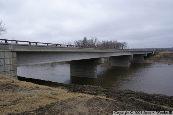
The photo above is looking north across the Minnesota River along the
downriver east side of the structure.
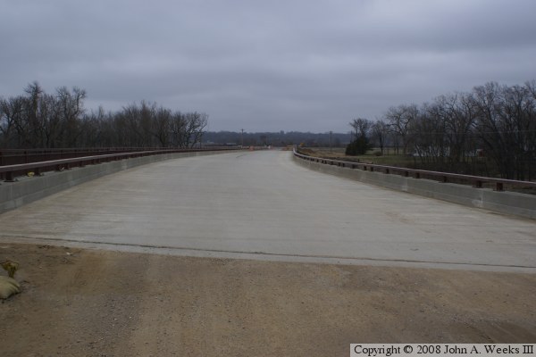
The photo above is looking north down the length of the bridge deck towards
Nicollet County from the center of Blue Earth County highway 42. The bridge
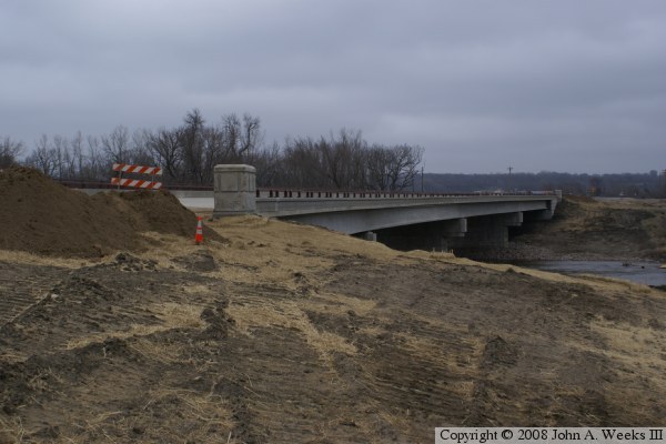
approaches have not yet been paved when this photo was taken. The photo below
is looking north across the Minnesota River along the east face of the highway
23 and highway 42 bridge. The old bridge stood on this side of the new
bridge, and was only recently removed when this photo was taken.
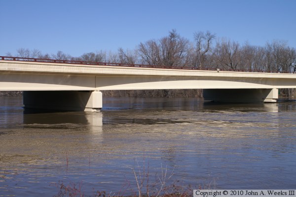
These two photos show the completed bridge over the Minnesota River. The
guardrails have been installed, the approaches have been paved, and the
bridge has been painted. Both photos are looking north towards Nicollet
County.
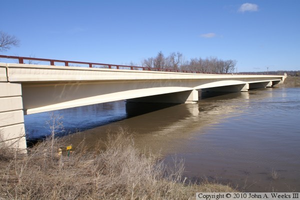
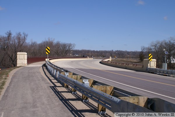
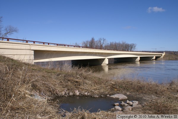
These two photos are views of the downriver east face of the Highway 23 and
Highway 42 bridge as seen during the spring flood of 2010. This is the
first test of the new bridge during the high water, and it passed with
flying colors.
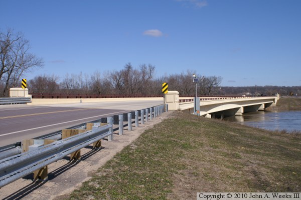
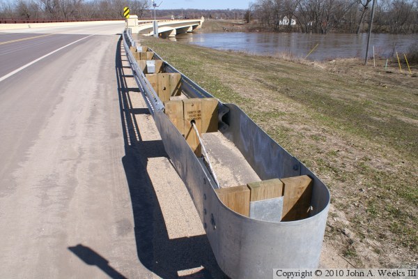
The photo above is looking northwest towards one of the main river channel
spans. The photo below is a relatively complicated guard rail that has
been installed along the northbound traffic lane at the south end of the
bridge. Note the lack of corrugation on the first segment of the metal,
a cable running down the middle through the posts, and holes drilled in
several more lengths of guardrail allowing it to collapse and absorb energy.
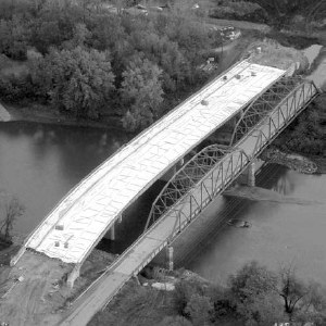
These two photos are clipped from the project newsletter for the bridge
replacement. The photo above is an aerial view looking northwest. The photo
below is looking north across the river along the downriver east face of
the truss spans.
The photo below is the bridge plate.
|
|
