| Highways, Byways, And Bridge Photography |
Grenville Dodge Memorial Bridge
I-480 Missouri River Highway Crossing
Omaha, NE
|
• Structure ID: |
NBI 45670 (IA), S48000413 (NE). |
|
• Location: |
River Mile 615.9. |
|
• River Elevation: |
961 Feet. |
|
• Highway: |
I-480, US-6. |
|
• Daily Traffic Count: |
51,595 (2010). |
|
• Bridge Type: |
Steel Plate Girder. |
|
• Length: |
1,687 Feet, 425 Foot Longest Span. |
|
• Width: |
109 Feet, 8 Lanes. |
|
• Navigation Channel Width: |
400 Feet. |
|
• Height Above Water: |
54 Feet. |
|
• Date Built: |
Opened November 21, 1966. |
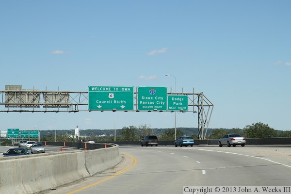
Interstate highway I-480 is an inner loop beltway that passes to the
north and west of downtown Omaha, Nebraska. This five mile long freeway
passes very near the President Gerald Ford Birthplace historic site,
and as a result, the state of Nebraska named its segment of
the highway after our 40th President, the Gerald R. Ford Freeway.
The three-fourths mile of I-480 on the Iowa side of the river in
Council Bluffs is not, however, officially named.
While Interstate I-480 is named after a Nebraska native, the bridge over
the Missouri River is named after a famous Council Bluffs resident,
Grenville Dodge. Dodge was a Civil War hero and served in Congress,
but is most famous as the chief engineer of the Union Pacific Railroad
during the construction of the Transcontinental Railroad. Dodge's home
in Council Bluffs is now a National Historic Landmark.
The Missouri River bridge section of I-480 consists of 8 spans. Going east
to west, the bridge starts about one-half mile west of Interstate I-29.
The first 800 feet of the bridge crosses the river flats area in the
Council Bluffs Riverfront Park. The bridge then has two over-water spans
totaling about 700 feet. The final 200 feet of the bridge crosses over
the riverbank on the west side of the Missouri River and joins the
elevated freeway section of I-480. I-480 continues westbound as an elevated
freeway for just over a mile before dropping down to ground level.
The Grenville Dodge Memorial Bridge is a typical late 1960's style steel
plate girder bridge. Large plates of steel were cut in the shape of the
beams, and then caps were welded onto the edges of the plates to form
massive I-beams that feature sculpted curves. This type of beam could not
have been made using the more traditional rolling process in a mill.
Beyond this design feature, the bridge is very institutional looking
with no decorative features, typical of the early Interstate highway era.
The Grenville Dodge Bridge was rehabbed in 2001. Despite that work, the
bridge is showing signs of age. For example, there is rust visible under
the structure and some of the drain pipes have fallen off of the structure.
Despite those issues, the bridge is basically sound, and its design with
five main beams has the redundancy required to provide decades of additional
service given some basic maintenance.
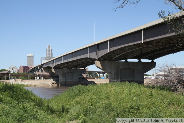
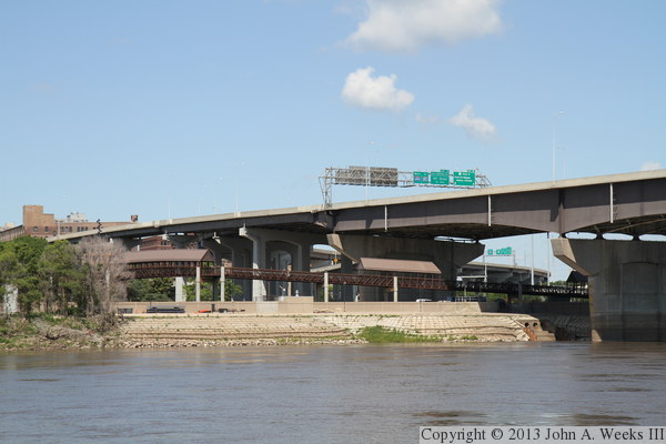
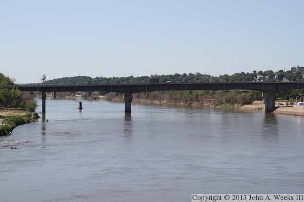
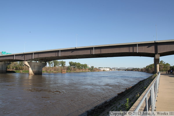
The photo above is looking west along the south face of the Grenville
Dodge Memorial Bridge across the Missouri River from the east riverbank.
The downtown skyline of Omaha is visible on the far side of the river.
The vantage point is located in the Council Bluffs Riverfront Park.
The park was extensively damaged in a record flood during 2011. The
city of Council Bluffs was not only cleaning up the damage, but also
redeveloping the park. New trails were being added along the riverfront
in addition to the existing bicycle trail that runs along the levee.
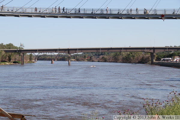
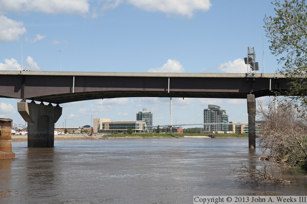
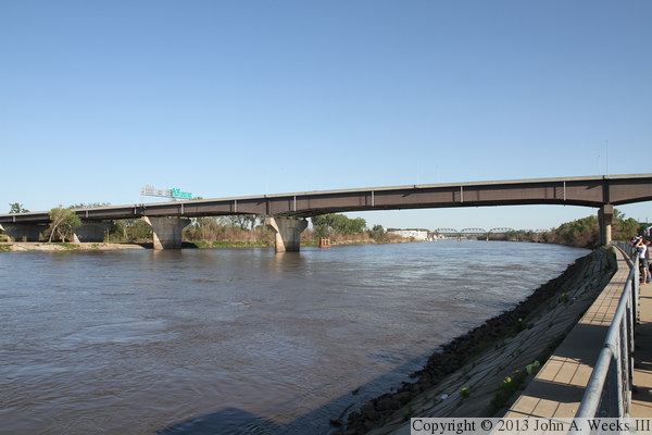
The photo above is looking downstream from an observation deck on the
west bank of the Missouri River near the Riverfront Place residential
towers. We see the deck of the Bob Kerrey Pedestrian Bridge in the
foreground, the north face of the highway I-480 Grenville Dodge bridge
in the center, and the Union Pacific Missouri River Bridge in the
background. The photo below is looking upstream towards the I-480
bridge from the east bank of the Missouri River. The metal structure
in the river is a remaining pier from the Ak-Sar-Ben Bridge. That
bridge was removed in 1968, but this one bridge pier still remains.
These two photos are the first of 8 viewing the bridge spans in detail
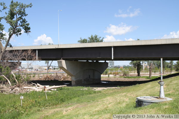
from east to west, from a vantage point on the east river bank. The
photo above is the bridge abutment as seen from the levee bicycle
trail. The photo below is the other half of the first bridge span,
also seen from the levee bicycle trail.
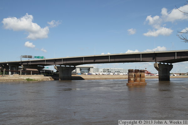
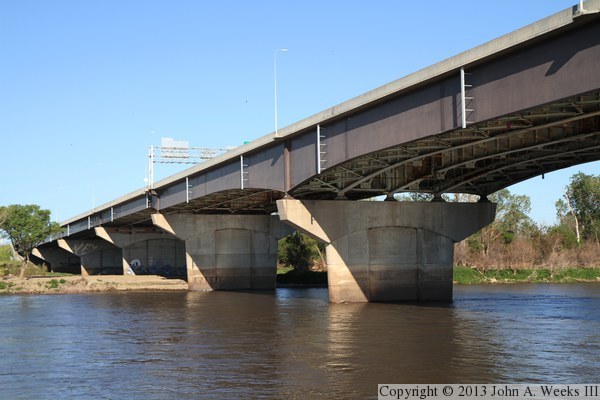
These two photos continue our east to west tour of the bridge. The photo
above is the second and third spans as seen from a new trail that was
being built between the riverbank and the levee. The photo below is
the eastern river navigation channel. The building in the background
is the Lewis & Clark Trail Visitor Center, as well as the Riverfront
Plaza residential towers.
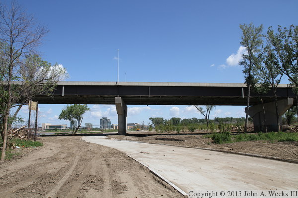
These two photos conclude our east to west tour of the bridge. The
photo above is the western of the two navigation channels. The photo
below is the west end of the bridge. A long elevated walkway carries
pedestrians between the Lewis & Clark Landing area to the Heartland
Of America Park, which are separated by railroad tracks and a floodwall.
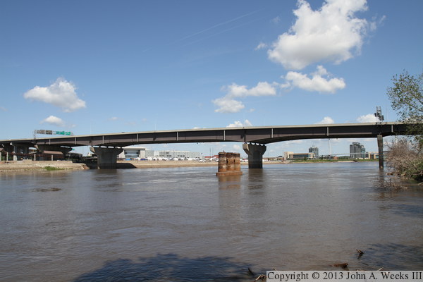
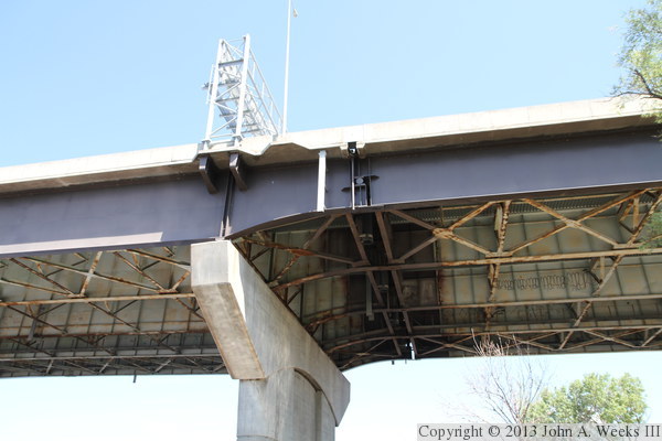
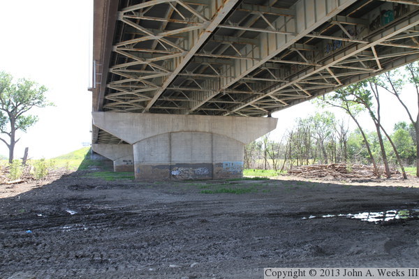
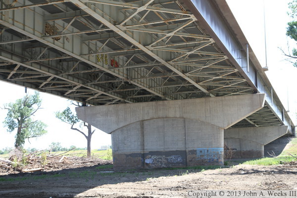
The photo above is the underside of the Grenville Dodge Memorial Bridge
on the east side of the Missouri River where the steel girders transition
from a shorter and lighter size to being taller and heavier. The photo
below is a close view of the top of the bridge pier at the transition
point. Note the roller pin in the joint just to the right of the pier.
This allows the bridge spans to freely move during thermal expansion
and contraction cycles.
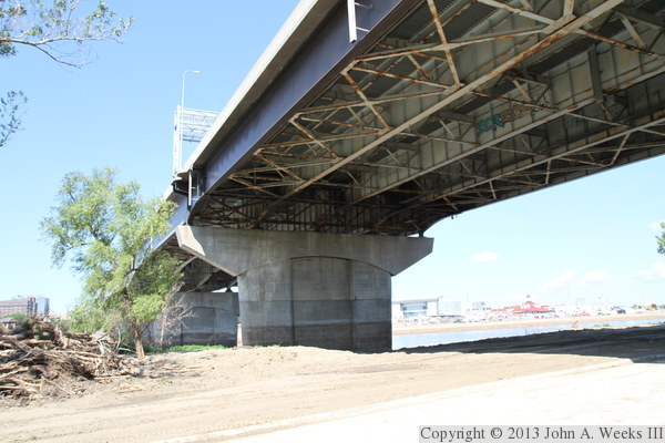
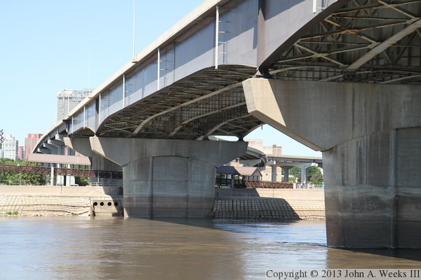
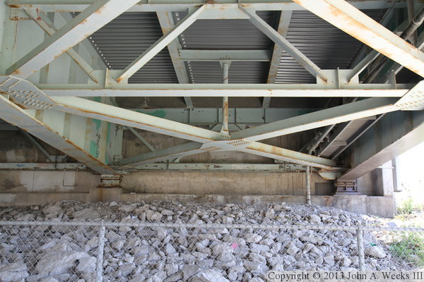
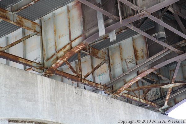
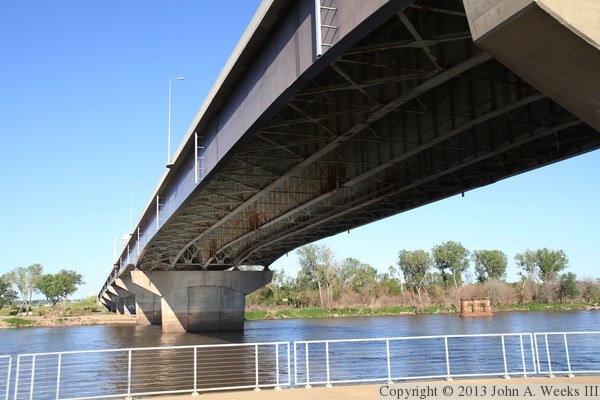
These two photos are the undersides of the main river spans. The photo
above is the eastern of the two navigation channels, while the photo below
is the bridge span over the western of the two navigation channels. These
photos are somewhat underexposed to allow the details under the bridge to
be seen. They would otherwise be in a dark shadow.
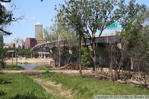
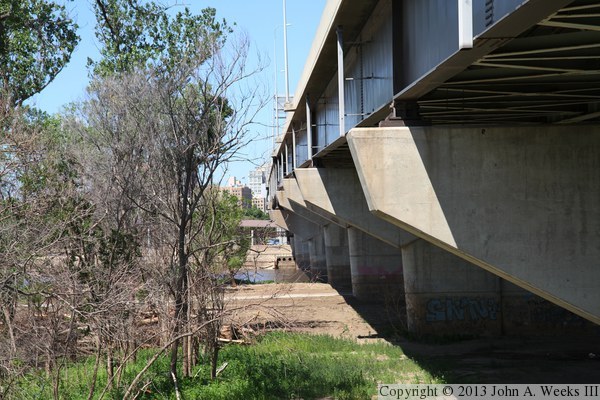
These two photos are views looking west along the south face of the Grenville
Dodge Memorial Bridge. The photo above is a wider view that looks through a
gap in the trees created when a drainage ditch was brushed out and regraded
following the flood of 2011. The photo below is looking down the length
of the bridge from under the south edge of the bridge deck. The bare silt
is material that is being cleaned up after it was deposited by the flood.
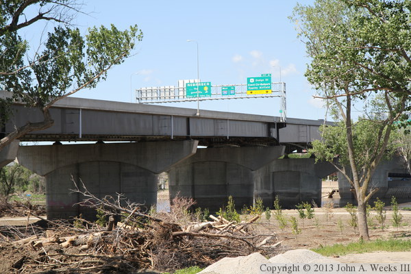
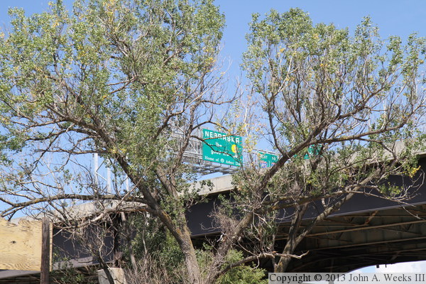
These two photos are views of the bridge showing the sign gantry that
supports the ‘Welcome To Nebraska’ sign. The photo above
is looking southwest from north of the bridge, while the photo below
is looking northeast from south of the bridge. Both views are again
from the Council Bluffs Riverfront Park.
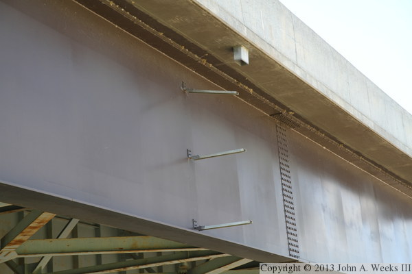
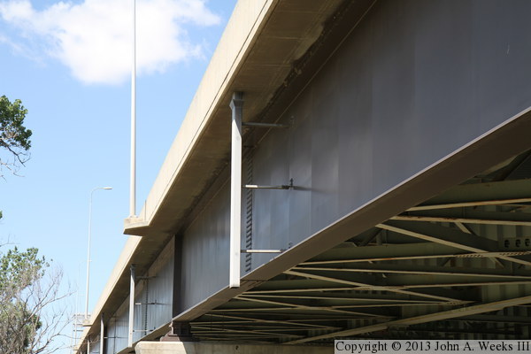
These two photos are views of drainage downspouts on the side of the
bridge. In the photo above, we see that the downspout pipe is missing,
while the photo below, from the other side of the bridge, shows what
it is supposed to look like. The missing pipe is not that big of an
issue, but you certainly wouldn't want to get hit by it when it fell.
These two photos, and the 7 that follow, show a typical bridge crossing
heading westbound from Iowa traveling into Omaha, Nebraska. The photo above
is heading westbound on highway I-480 just after coming through the I-480
and I-29 interchange. The ramp entering on the right is from North 40th
Street, which sneaks on to the highway only 200 feet beyond the ramp
entering from I-29. Fortunately, it is a lightly used ramp. In the photo
below, we have just entered the Grenville Dodge Memorial Bridge.
These two photos continue our westbound crossing of the I-480 bridge.
In the photo above, we are nearing the midpoint of the Missouri River,
having passed the Nebraska welcome sign. In the photo below, we are
at the end of the Grenville Dodge bridge, but we are entering a mile
long section of elevated highway as I-480 passes over the downtown
area.
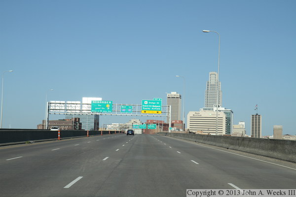
These two photos continue our westbound crossing of the I-480 bridge.
In the photo above, we are rounding a curve towards the northwest as
I-480 jogs north to pass around the heart of downtown Omaha. In the
photo below, we are starting to curve back to the west as we pass
in front of the CenturyLink Center, a large downtown arena and civic
center. The building directly ahead is the Hilton Omaha hotel.
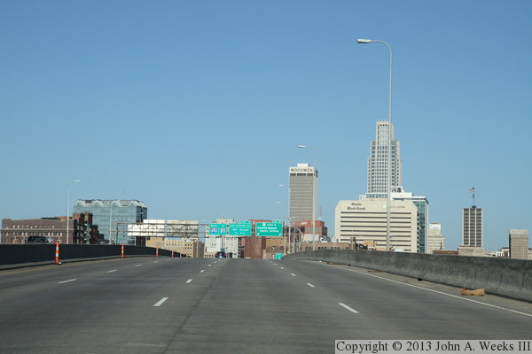
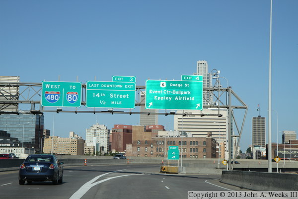
These two photos continue our westbound crossing of the I-480 bridge.
In the photo above, we are passing exit 3, North 14th Street, which is the
second of two downtown exist. The other downtown exist was right at
the west end of the bridge proper just before the highway made the
curve to the northwest. The photo below is heading uphill as we are
passing over North 14th Street. The tall buildings on the left side of
the highway are part of Creighton University.
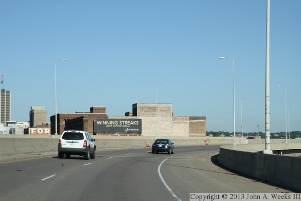
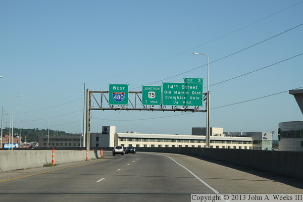
The photo above concludes are westbound bridge crossing. At this point,
I-480 passes over North 20th Street, and then returns to ground level.
An interchange with US-75 is just over the hill, with I-480 making a
90 degree turn to the south, where it later rejoins I-80. The photo
below is looking south down the Missouri River towards the north face
of the Grenville Dodge Memorial Bridge. The vantage point is the deck
of the Bob Kerrey Pedestrian Bridge, which rises nearly 60 feet above
the river.
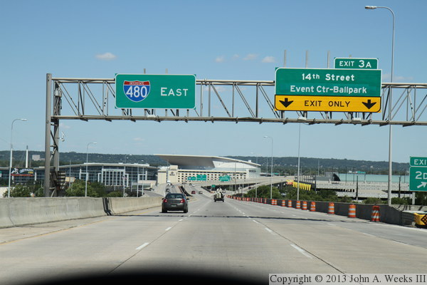
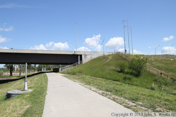
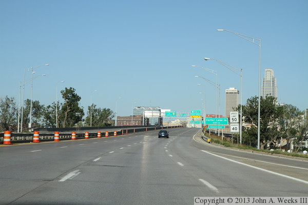
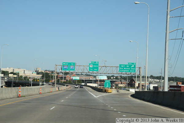
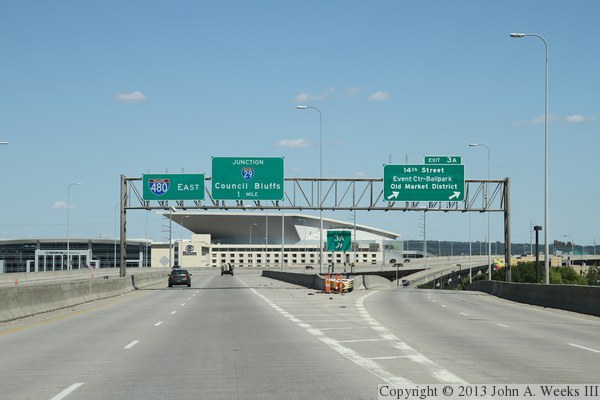
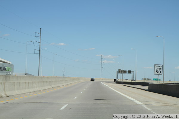
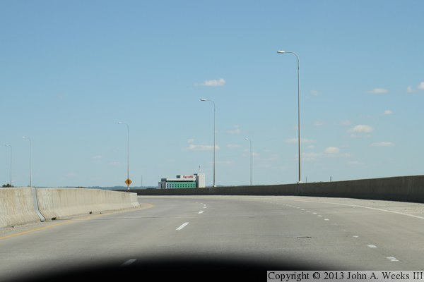
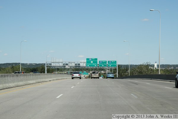
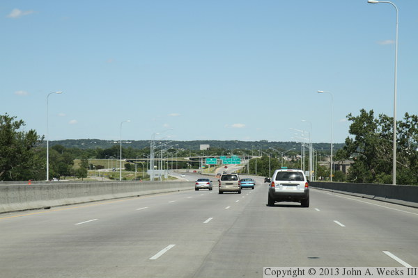
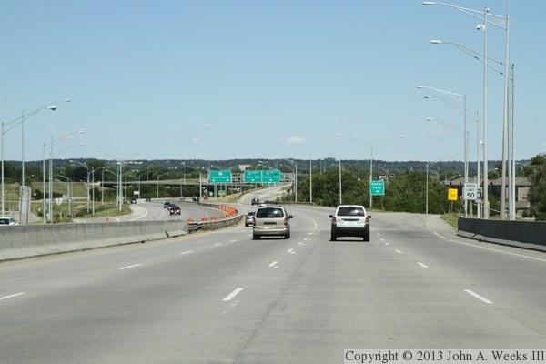
These two photos, and the six that follow, show a typical crossing of the
Grenville Dodge Memorial Bridge heading eastbound from Omaha across the
Missouri River into Council Bluffs, Iowa. The photo above is heading
eastbound on highway I-480 coming down the hill from the interchange with
US-75. There is a one mile segment of elevated highway leading up to the
bridge over the Missouri River. At this point, we are passing the exits
for South 20th Street and Capitol Avenue. The photo below is at the exits
for 14th Street, with the Hilton Omaha and CenturyLink arena straight
ahead.
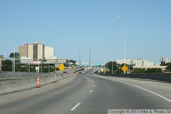
These two photos continue our eastbound crossing of the Grenville Dodge
Memorial Bridge. In the photo above, we are heading southeast towards the
Missouri River, passing in front of the CenturyLink Center. In the
photo below, we curve back to the left to line up with the Grenville
Dodge bridge, which crosses the river heading directly east. Harrah's
Hotel & Casino is visible in the distance.
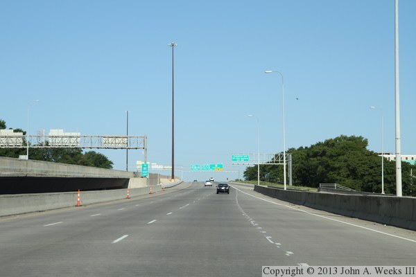
These two photos continue our eastbound crossing of the Grenville Dodge
Memorial Bridge. In the photo above, we make the final turn to the left
to approach the west end of the bridge structure. In the photo below,
we are now on the bridge crossing the Missouri River.
These two photos conclude our eastbound crossing of the Grenville Dodge
Memorial Bridge. In the photo above, we are on the final spans on the
east end of the bridge passing over the Council Bluffs Riverfront Park.
In the photo below, we are just exiting the bridge, and will shortly be
on dry land. The interchange ahead is where I-480 ends at I-29.
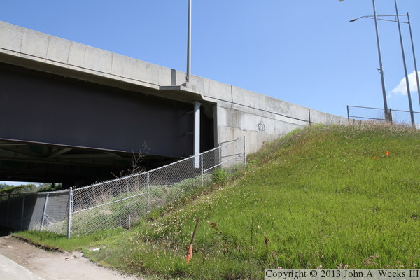
The photo above is a close view of the bridge abutment at the east end of
the Grenville Dodge bridge. The photo below is the underside of the bridge
structure at the abutment. The vantage point for these two photos is the
bicycle train that runs along the top of the levee.
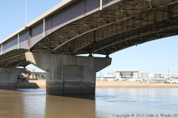
These two photos are views of the underside of the third bridge span when
counting from the east end of the structure. The photo above is taken
from just below the north face of the structure, while the photo below
is from just south of the south face of the structure. The vantage point
is a new paved trail that was under construction when I visited in late
spring of 2012. Both photos are a bit underexposed to show the details
in the steelwork under the bridge deck.
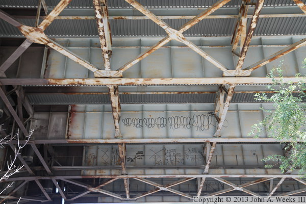
These two photos are detail views of the steelwork under the bridge
deck. There are catwalks that run the length of the bridge between each
of the five main bridge girders. Based on the amount of graffiti, it
appears that these catwalks are popular places for youth to hang out
despite the bridge abutment being fenced off.
These two photos are views of the Grenville Dodge Memorial Bridge as seen
from the riverfront in Omaha. Our vantage point is at Lewis & Clark
Landing, located just upstream from the bridge. These photos were taken
late in the evening when the sun was far enough north in the sky to
light up the north side of the bridge. The photo above is a wider angle
showing more of the bridge spans, while the photo below is a closer view
focusing on the western of the two river channel spans.
These two photos are additional views from the Omaha side of the river,
taken in the evening when the sun was lighting up the north face of the
structure. The photo below is looking across the Missouri River towards
the riverfront park in Council Bluffs. The photo below is looking east
along the north face of the structure. The sun reflecting off of the
water is lighting up the underside of the bridge near the middle of
the river.
|
