
|
John A. Weeks III
Wednesday, February 11, 2026, 10:24:47 PM CST |
|||
| Home | Photo Tours | Rail Fan | 12 Easy Steps |
| Aviation | Spacecraft | Highways & Bridges | About The Author |

|
|
|||||||||||||||||
Minnesota Named HighwaysA Photo Tour Of Highway Guide Signs
|
| • Minnesota Named Highways—With Logo Signs |
| • Minnesota Named Highways—With Guide Signs |
| • Minnesota Named Highways—With Street Signs |
| • Minnesota Named Highways—Unsigned |
| • Miscellaneous Named Highways Within Minnesota |
Each highway type and their members are described below. As of June, 2010, I have visited each of these named highways and have photographed an example of their marker signs, if any are posted. If any new named highways are designated, I will track them down and add them to this list.

|
Sergeant Joseph Bergeron Memorial Highway
MN-36 just east of Interstate highway I-35E is named after Maplewood officer Joseph Bergeron. Bergeron, a 26 year veteran, was shot and killed on May 1, 2010, as he got out of his squad to question two suspects in a carjacking. This photo was taken through a car windshield since it is not safe to stop at this location. |

|
Amish Buggy Byway
The Amish folks moved into the area near Harmony starting in 1974. Since their modes of transportation are buggy and bicycle, the high speed on US-52 quickly became an issue. These green signs were posted as much for the safety issue as opposed to creating a formal scenic byway. As a result, this is a named highway as opposed to a scenic byway. There are official scenic byways focused on the Amish way of life in other states. |
|
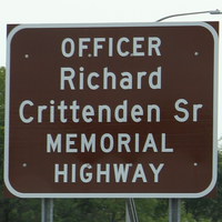
Officer Richard Crittenden Sr Memorial Highway
MN-36 in North Saint Paul, just west of I-694, is named in honor of Officer Richard Crittenden Sr. He was shot and killed when attempting to protect a woman from being attacked by a male subject in a domestic situation. Crittenden's partner was also wounded. Crittenden, 57, also served with the US Army in Vietnam. |
|
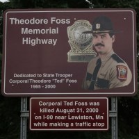
Ted Foss Memorial Highway
State Patrol officer Ted Foss was struck and killed by a semi-truck while making a routine traffic stop on I-90 in south-eastern Minnesota. As a result of this accident, the state legislature enacted the move over or slow down law that requires motorists to give law enforcement, emergency, and service vehicles room when they are parked on the side of the highway. |
|
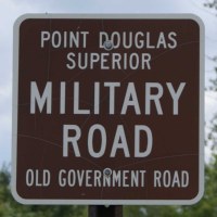
Military Road
The Military Road was established in 1855 as a way to move troops north from Prescott, WI, to Superior, WI. The route was heavily used by civilian and commercial traffic despite never having been finished. It faded from use after the railroads arrived in the early 1870s. The road is marked along MN-23 and MN-123. |

|
Moberg Trail
US-8 in Chisago county, Minnesota, is designated the Moberg Trail. Vilhelm Moberg is a famous Swedish writer. He wrote about the immigrant Swedish farmers who were dropped off by riverboat, and were to forge ahead and build a life in the new world. The logo on the sign is a representation of the statute of Moberg as it sits in a city park just off of US-8. |
|
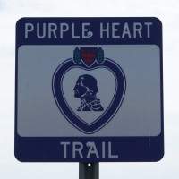
Purple Heart Trail
The Purple Heart Trail was established in 1992 by a congressionally chartered veteran service organization known as the Military Order Of The Purple Heart. As of 2009, 45 states have designated a highway or bridge as part of the Purple Heart Trail. The entire length of I-94 in Minnesota is part of the trail. Marker signs are located at rest areas along the highway. |
|
Red Bull Highway
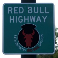
I-35 and I-535 in Minnesota, and US-34 in Iowa, are named in honor of the US Army 34th Infantry Division, nicknamed the Red Bull. Much of the division is made up of the Iowa and Minnesota National Guard. The Red Bull fought in WWI and WWII. Over half of the first US Army Ranger division was selected from the Red Bull. |
|
Arthur V. Rohweder Memorial Highway
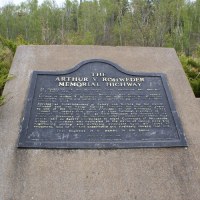
Rohweder was a safety advocate. While he worked for the DM&IR Railroad, he also served on the Minnesota Safety Council and the National Safety Council. Rohweder worked tirelessly towards preventing accidents and saving lives. 21 miles of US-61 along the north shore between Lester Park in Duluth and Two Harbors is named in honor of Rohweder. |
|
Officer Shawn Silvera Memorial Highway
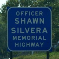
Shawn Silvera was a Lino Lakes city Police Officer. He was killed in the line of duty on September 6, 2005, while assisting in a high speed chase. He deployed stop sticks on I-35. The suspect driver saw the stop sticks, and choose to drive around them and strike Officer Silvera. Silvera was killed instantly. The section of I-35 from exit #131, Broadway Avenue in Forest Lake, and the I-35E/I-35W split is named in his honor. |
|
Viking Trail
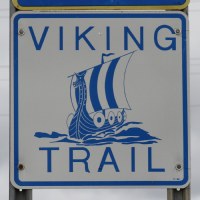
The Viking Trail passes through an area of west central Minnesota where Vikings reportedly explored in the 1300s, well over 100 years before Columbus discovered the New World. The trail covers county, state, and US highways between the Minnesota and North Dakota border just north of Fargo to Sauk Center at the intersection of US-71 and I-94. |
|
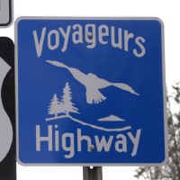
Voyageurs Highway
The Voyageurs Highway runs the length of the state of Minnesota. It commemorates the early fur trappers and explorers who traveled the state on canoe. The highway is signed starting on MN-33 at its interchange with I-35, and the signs continue north on US-53. It is hoped that this route will someday act as a gateway to the proposed Voyageurs National Park. |
|
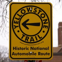
Yellowstone Trail
The Yellowstone Trail was established as a coast to coast route in 1912. It was one of the earliest named auto trails. It was organized by a marketing group to encourage travel, and to encourage the road to be upgraded. The route roughly followed the present-day paths of US-12, MN-7, MN-5, US-212, and MN-7 through the state of Minnesota. Today, US-212 is officially designated as the Yellowstone Trail but it is not signed by the state. The historic route is gradually being signed the Yellowstone Trail Association. |
|
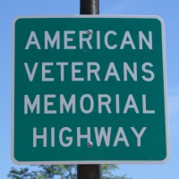
American Veterans Memorial Highway
Marked for 275 miles along Interstate Highway I-90 across the southern edge of Minnesota. The signs are only posted at rest areas. |

|
C. Elmer Anderson Memorial Highway
Clyde Elmer Anderson, born in Brainerd, was the state governor from 1951 to 1955. He later served as mayor of Brainerd. A 6 mile stretch of MN-371 near Baxter is named in honor of the Governor. |
|
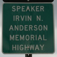
Speaker Irvin N. Anderson Memorial Highway
Irvin Anderson was speaker of the state House of Representatives in the 1990s. He was from the International Falls area. US-53 from the north city limits of Virginia to MN-11 in International Falls is named in his honor. |

|
State Trooper Timothy J. Bowe Memorial Highway
The 14 miles of MN-95 from Cambridge to North Branch is named in honor of fallen State Trooper Timothy J. Bowe. He was killed in a gun battle near this highway in 1997. |
|
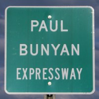
Paul Bunyan Expressway
The Paul Bunyan Expressway includes US-2 between Cass Lake and Bemidji, plus parts of MN-371. The route is 126 miles long. It is named in honor of the mythological lumberjack who cleared the forests of northern Minnesota. |

|
Capitol Highway
This is a relatively old designation that seems to be fading from history. It once covered MN-56 from the Iowa state line to Anoka. The northern parts of MN-56 were trimmed back, with parts surviving as MN-47 and MN-156. I saw only 2 signs for this route, both of which were badly faded. I had to use a flash to make the lettering visible. |
|
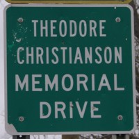
Theodore Christianson Memorial Drive
This route is named after Minnesota Governor Theodore Christianson, a Dawson native, who served from 1925 to 1931. He is remembered as a strong fiscal conservative. This route has 2 sections. The unsigned section follows MN-7 from Minneapolis into western Minnesota, plus some secondary roads near Lac Qui Parle. The signed section follows MN-119. |
|
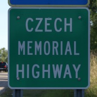
Czech Heritage Highway
The Czech Heritage Highway recognizes the contribution of the large numbers of Czech people to settled in the Montgomery and New Prague areas. The route is marked along MN-13 and MN-21 for 8 miles between these two cities. MN-DOT has signed the route as the Czech Memorial Highway rather than Czech Heritage Highway for unknown reasons. |
|
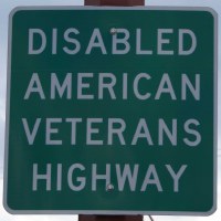
Disabled American Veterans Highway
Marked for 120 miles on US-61 south of Saint Paul to the Iowa state line. |

|
B. E. Grottum Memorial Highway
A one mile segment of US-71 in Jackson is named after Bjarne Edgar Grottum. Grottum was a local attorney who served in the US Army during WWI and was later elected to the Minnesota state senate. |
|
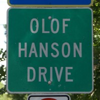
Olof Hanson Memorial Highway
Olof Hanson is a noted architect who happened to be deaf. He once taught at the Minnesota State Academy for the Deaf in Faribault. The route is marked for the entire 1 mile length of MN-299. |
|
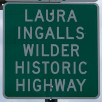
Laura Ingalls Wilder Historic Highway
This historic highway was named after Laura Ingalls Wilder, who wrote the series of books related to life in the ‘Little House on the Prairie’. The road was first designated in 1995 to include US-14 from Mankato to near the South Dakota state line. The road network has since been expanded to include Iowa and South Dakota with an extension to the Wisconsin state line at Lake City, MN. |
|
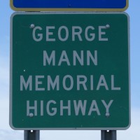
George Mann Memorial Highway
George Mann was a grain farmer from Windom who served in the state legislature from 1958 to 1984. He was a strong advocate for farmers. The 85 miles of MN-60 between Brewster and Mankato are named in his honor. |
|
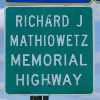
Richard J. Mathiowetz Memorial Highway
Richard Mathiowetz worked for 40 years in his family-owned construction company, serving as its chairman for many years. The company worked on many state construction projects, and Mathiowetz was very active in community projects near his home in Sleepy Eye. This route is signed for 25 miles along MN-4 between Sleepy Eye and Saint James. |
|
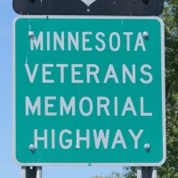
Minnesota Veterans Memorial Highway
All 160 miles of US-212 in Minnesota is designated the Minnesota Veterans Memorial Highway to honor all Minnesotans who have served in the armed forces. |
|
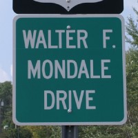
Walter F. Mondale Drive
A 3 mile section of US-53 between Superior Street and Central Entrance in Duluth is named in honor of Walter F. Mondale. Mondale served as a US Senator, US Vice-President, and Ambassador to Japan. |

|
Augie Mueller Memorial Highway
Augie Mueller was a long-time college professor who was instrumental in the establishment of a veterinary school in Minnesota. This route is designated along 45 miles of MN-5 between Chanhassen and Gaylord. |

|
Wally Nelson Highway
The Wally Nelson Highway is a 2 mile loop off of US-14 in Redwood County that serves a University of Minnesota test farm. Nelson was a civil rights and farm family advocate. |
|
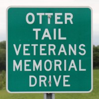
Otter Tail Veterans Memorial Drive
This named highway runs for 4 miles along US-59 near Pelican Rapids in west central Minnesota. |
|
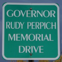
Governor Rudy Perpich Memorial Drive
Rudy Perpich was governor of Minnesota from December 1976 to January 1979, and again from January 1983 to January 1991, making him the longest serving Minnesota state governor. His innovative ideas lead to him being known as Governor Goofy, but his work to promote industry and tourism resulted in a booming state economy during the 1990s and early 2000s. The memorial drive covers 60 miles of Saint Louis County Highway 4 running from Duluth to Biwabik, reflecting Perpich's iron range roots. |
|
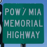
POW/MIA Memorial Highway
The POW/MIA Memorial Highway covers 74 miles in central Minnesota. The route includes US-169 from Elk River to Garrison (on the west shore of Mille Lacs Lake), then heads west on MN-18 to Brainerd. |

|
Purple Heart Memorial Highway
MN-371 between Little Falls and Cass Lake is named in honor of the more than 600 Minnesotans who have received the medal. The designations were passed into law in 2005, and the signs were unveiled in May of 2006. The signs were paid for by the family of Stewart Mills, who founded the Mills Fleet Farm stores. |

|
Don Rickers Memorial Highway
Don Rickers was a noted photographer from Worthington. The 6 miles of MN-60 between Brewster and Worthington is named in his honor. |
|
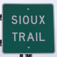
Sioux Trail
The Sioux Trail is an older named highway that starts at the Mendota Bridge and roughly follows the Minnesota River to Ortonville. It has not been marked for many years, but these signs were erected in the late 2000s on the westernmost segments, such as this example on MN-7 near Appleton. |
|
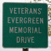
Veterans Evergreen Memorial Drive
The Veterans Evergreen Memorial Drive has been promoted to be an official Minnesota Scenic Byway. As a result, this old style sign is being replaced by a new sign that features a red, white, and blue logo. The route covers 50 miles of MN-23 from I-35 near Sandstone to the Wisconsin state line near Duluth. |

|
Veterans Memorial Highway
Route is signed for 33 miles of MN-15 between MN-60 and the Iowa state line. There is a second Veterans Memorial Highway running for 7 miles along MN-115 on the south edge of the Camp Ripley Military Reservation. |

|
Victory Drive
I have not determined why Victory Drive was given this designation, but such names were commonly used to commemorate the armistice following World War I. The route is marked along the 16 miles of MN-22 between Mankato and Mapleton. |
|
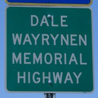
Dale Wayrynen Memorial Highway
MN-210 in Aitkin County is named for Dale Wayrynen, a Congressional Medal of Honor winner. Wayrynen threw himself on a grenade in 1967 while serving in Vietnam, saving the lives of many troops. |

|
Ruby Hughes Boulevard
Ruby Hughes founded the La Creche Early Childhood Center just off of Olson Memorial Highway in northwestern Minneapolis. She was killed in a domestic incident. The boulevard is only a single block, and it is marked with a standard street sign. |

|
Johnson Memorial Drive
A 55 mile section of US-169 between I-494 in Bloomington to Saint Peter is named in honor of Governor John A. Johnson, a native of Saint Peter. Johnson was the first Minnesota state Governor to be born within the state. He was in the national limelight when he ran for President in 1908. |

|
Olson Memorial Highway
Floyd B. Olson was governor of Minnesota in the early 1930s. Olson became famous for his opposition of radical labor groups. He died of stomach cancer at the age of 44. Minnesota highway 55 is designated as the Floyd B. Olson Memorial Highway in his honor. At this time, only the segment of MN-55 west of downtown Minneapolis is signed, and only with traditional street signs. |

|
Clearwater County Veterans Memorial Highway
This named highway runs along MN-200 and MN-92 near Bagley in northwest Minnesota. Clearwater County is located just west of Bemidji and includes the headwaters of the Mississippi River. |

|
Colvill Highway
MN-19 between Gaylord and Red Wing is named in honor of Colonel William J. Colvill. Colvill was state Attorney General and served in the state legislature. He is best remembered for leading the 1st Minnesota Volunteer Infantry in the Battle of Gettysburg. Colvill is buried in Cannon Falls, and a city park is named in his honor along US-61 south of Red Wing.
|

|
P. H. McGarry Memorial Drive
Approximately 4 miles of MN-371 near Walker is named in honor of Patrick H. McGarry, an early settler to the area. He served as the first village president of Walker, Cass County Commissioner, Postmaster, and he served in both houses of the state legislature. I was not able to locate any signs when I visited during the spring of 2010. |

|
Dallas Sams Memorial Highway
Dallas Sams was a state senator from Staples in central Minnesota. He died of brain cancer at age 54 in March, 2007. He was a champion of rural and outdoors issues. MN-210 between Motley and Staples is named in his honor. |

|
Bobby Aro Memorial Highway
Saint Louis County has designated County Road 7 as the Bobby Aro Memorial Highway. County Road 7 runs for 52 miles between Twig, located northwest of Duluth, and the city of Virginia on the Iron Range. Bobby Aro was a popular musician and radio personality who had a million selling song titled ‘Highway No. 7’. Aro was born and lived near the town of Zim. |


|
Avenue Of The Saints
The Avenue Of The Saints is a 550 mile route from Saint Paul to Saint Louis. The concept was proposed in the 1980s and became a ‘high-priority corridor’ in 1991. The route was originally signed along US-52 through Rochester. However, it was decided that the route should be an expressway or freeway resulting in I-35 being selected in Minnesota. Minnesota does not sign the route. Iowa (above) and Missouri (below) signs are shown. |
|
Blue Star Memorial Highway
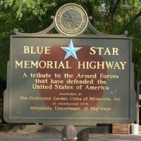
Blue Star Memorial Highways were started by the National Garden Club in 1945 following World War II. Blue stars were placed in windows or on flags for people to show that they had a loved one serving in the war. After the war, the blue star was remembered by the garden club. They would improve a highway or rest area landscaping, and then post a marker. Some states have designated highways as Blue Star Memorial Highways. In Minnesota, that includes I-35, I-35E, I-35W, and I-94. |
|
Bushaway Road
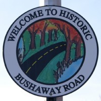
Bushaway Road was one of the first highways to be surveyed after the founding of the state of Minnesota. It once ran from Dayton to Shakopee. More recently, it was part of Minnesota state highway MN-101 until it was turned back to local control after officials could not agree on a plan to fix a dangerous intersection. The route is marked south of Wayzata and on the causeway across Lake Minnetonka. |
|
Dodd Road
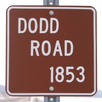
Dodd Road was constructed by Captain William Dodd in the spring of 1853. This privately funded road ran for 70 miles between Fort Snelling and Saint Peter. The federal government purchased the road and extended it to Sioux City. This marker is located south of Kesota in Le Sueur County. |

|
Bob Dylan Way
Several miles of Superior Street and London Road along the waterfront in Duluth is named in honor of musician Bob Dylan by the city of Duluth. Dylan was born in Duluth and spent 7 years in the city before moving to Hibbing. |
|
Eisenhower Interstate System
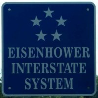
The future General Eisenhower took part in an Army convoy that crossed the USA in 62 days. Eisenhower later saw how quickly Germany could move troops across their country using the Autobahns. As a result, Eisenhower worked to create the Interstate Highway system. Congress tried to honor Eisenhower by requesting that states sign the route that Eisenhower took on that 62 day journey. That effort never caught on. The program was later modified so any Interstate highway can display the blue 5-star sign. In Minnesota, you typically find those signs when exiting rest areas. |

|
Hiawatha Pioneer Trail
The Hiawatha Pioneer Trail was proposed by the American Petroleum Institute in 1961. The states of Illinois, Iowa, Minnesota, and Wisconsin adopted the route. It was on maps until 1975. In recent years, the route has been abandoned by these states, with Iowa being the last to drop the trail in 2008. The signs have been removed, and only a few remain. This example is located on US-61 near the intersection with US-10. |

|
High Bridge Route
The High Bridge Route is marked along MN-149 in the city of Saint Paul. The route commemorates the Smith Avenue High Bridge, which connects the West Side neighborhood of Saint Paul to the core of the city. |
|
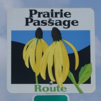
International Prairie Passage Route
The International Prairie Passage Route was developed to identify a route that passes through the former tallgrass prairie region of the Midwest. It is hoped that this program can help bring awareness to the remaining native prairie land, and help spur restoration of land back to the prairie. The route follows I-90 across southwestern Minnesota, then north along highways such as MN-23 and US-75 to the Canadian border. |

|
Lake Superior Circle Tour
The Lake Superior Circle Tour is a marked 1,000 mile path using existing highways that totally circles Lake Superior. The trip will take several days to complete. The route is sponsored and marked by a non-profit marketing organization created to encourage tourism around the lake. They publish both an electronic and paper guidebook to attractions and events along the scenic tour route. |
|
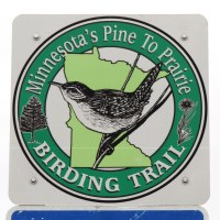
Minnesota's Pine To Prairie Birding Trail
The Pine To Prairie Birding Trail was established in 2009 as the first International Birding Trail in the state. It runs along US-59 north from Fergus Falls through Detroit Lakes and Thief River Falls, then along MN-32 and MN-11 through Roseau to Warroad. Three other state bird trails are also being developed. |
|
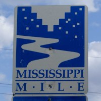
Mississippi Mile
The Mississippi Mile is a group of streets located along the Mississippi River in downtown Minneapolis between I-35W and Plymouth Ave. Its purpose is to highlight the history and attractions along the river section that made Minneapolis what it is today. |

|
MOM's Way
MOM's Way is a 400 mile long route from Winnipeg to Thunderbay using highways 11 and 12. The name stands for Manitoba, Ontario, and Minnesota. The route was under development since 1999 and was officially established in 2005. |

|
Natural Preservation Route
Natural Preservation Routes are typically state-funded county roads that follow the natural terrain over hills and around curves. The thought is that rebuilding the road to modern standards would wipe out the natural feel of the road, so the road is being preserved in its hilly and curvy alignment. The sign is to alert drivers that there may be slower drivers who are sight-seeing as a means of trying to prevent accidents. |
|
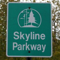
Skyline Parkway
Skyline Parkway runs about 25 miles along the top of the face of the bluffs in Duluth, MN. The parkway runs from the far south part of the city near Gary and New Duluth to as far north as the Seven Bridges Road near the Lester River on the north side of Duluth. The road is well marked, but can be a little tricky to follow. No matter where you end up, the views will be superb. This particular sign is the version installed by the City of Duluth before Skyline Parkway became an official state byway. |
|
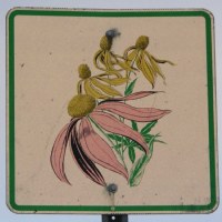
Wildflower Route
Many states have official programs to plant and maintain native wildflowers. The state of Minnesota has a program to restore native wildflowers to key highways. Those highways are then marked as Wildflower Routes using these highway signs. This particular sign is on MN-56 near the Iowa state line. |
|
|
Authored by John A. Weeks III, Copyright © 1996—2016, all rights reserved. For further information, contact: john@johnweeks.com
|