Current Weather Conditions
John A. Weeks III
Saturday, April 20, 2024, 1:03:32 AM CDT
Home Photo Tours Rail Fan 12 Easy Steps
Aviation Spacecraft Highways & Bridges About The Author
 
Google Search
Maps   Groups   Images   Search
 
  Home
  • 12 Easy Steps
  • Aviation
  • Spacecraft
  • Highways & Bridges
    » Bridge Photography
      - MSP River Bridges
      - C & D Canal
      - Illinois River
      - Minnehaha Creek
      - Minnesota River
        › Ortonville - Odessa
          · Traverse Gap
          · BS Co 30 Bridge
          · BNSF RR Ortonville
          · Big Stone Lake Dam
          · US-12 Bridge
          · Old US-12 Bridge
          · Headwaters Trail N
          · Flood Diversion Chnl
          · Headwaters Trail S
          · Auto Tour Route Br
          · BS Co 19 LQP Co 15
          · BS 19 LQP 15 (Old)
          · Highway 75 Dam
          · US-75 Main Channel
          · Township Road #159
          · US-75 Tailrace Br
        › Correll - Wegdahl
        › Granite Fls - Rdwd Fls
        › Morton - Judson
        › Mankato - Jordan
        › MSP West Metro
        › MSP South Metro
      - Mississippi River
      - Missouri River
      - St. Croix River
      - St. Louis River
      - Wisconsin River
      - Best Miss River Photos
      - Cable Stayed Bridges
      - McGilvray Road Bridges
      - I-35W Bridge Disaster
      - Miscellaneous Bridges
      - Madison County Bridges
      - Hist Br Weekend 2013
    » Road Geek Topics
  • Photo Tours
  • Rail Fan
  • About The Author
 
Site Search By JRank
Highways, Byways, And Bridge Photography
US-12 Bridge
US-12 Minnesota River Highway Crossing
Ortonville, MN

US-12 Bridge

• Structure ID: NBI: 6456.
• Location: River Mile 328.1.
• River Elevation: 961 Feet.
• Highway: US-12.
• Daily Traffic Count: 4,300 (2004).
• Bridge Type: Concrete Girder, Concrete Deck.
• Length: 63 Feet.
• Width: 30 Feet, 2 Lanes.
• Navigation Channel Width: Non-Navigable.
• Height Above Water: 3 Feet (Estimated To Low Concrete).
• Date Built: 1953.
The current US highway system was established in the early 1920s, with the numbering system being put in place in 1925. US-12 was established as a route starting in Detroit, crossing Lake Michigan, running through central Wisconsin, Minnesota, northeast South Dakota, southwest North Dakota, Montana, and ending in Lewiston, Idaho. Over the years, the route has changed and much of US-12 now follows Interstate highways. Most notably, the routing now runs through Chicago rather than across the lake and through central Wisconsin.

Early in the car era, business promoters named US-12 as the Yellowstone Trail to help promote travel to Yellowstone Park over US-12. That name became official in several western states. Ironically, the route of US-12 was extended west and, as a result, it was moved away from Yellowstone Park. US-212 now serves the northern entrance to the park. Even more ironic, US-12 became nationally recognized as the Yellowstone Trail, complete with yellow and black highway markers to mark the route much like the Great River Road has its own green and white signs.

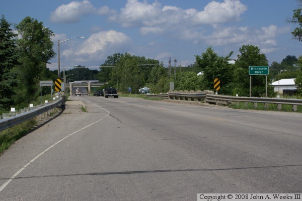
After WWII, the existing US-12 bridge at Ortonville, a concrete rainbow arch bridge, was found to be too narrow for modern vehicles, which had become larger, wider, and much heavier in the late 1940s and 1950s. As a result, a new alignment for US-12 was designed and built through Ortonville, MN, and Big Stone City, SD. That new route included the current bridge over the Minnesota River. Since this was a new alignment, the old bridge was thankfully left in place.

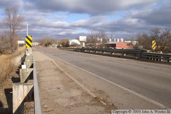
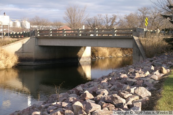
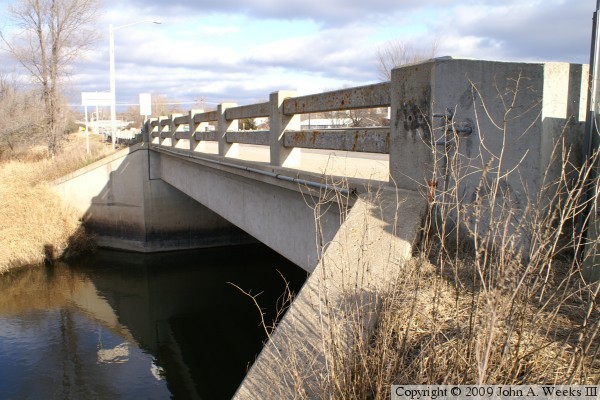
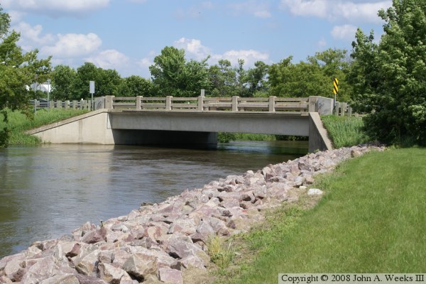
The 1953 structure is a very generic concrete bridge from the era. It would have been built very quickly. First, piles would be driven, and the abutments would be built supported by those pilings. The roadway would be backfilled to the abutments. Next, concrete beams would be placed across the span. Temporary wood forms would be built between beams, and the roadway would be poured. To finish off the project, a concrete guardrail would be installed.

Those concrete guardrails are inadequate for today's traffic. MN-DOT has attempted to mitigate the problem buy attaching the very ugly metal guardrails. While this is a stop-gap at best, it only has to work for a few more years. MN-DOT has announced that this bridge will be removed and replaced in 2012.

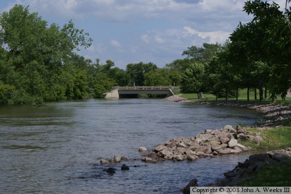
The photo above is a profile view of the bridge from a vantage point on the south shore of the river just upstream of US-12.


US-12 Bridge
These two photos are views looking downstream from near the Big Stone Lake Dam. In the photo above, the water is high due to spring runoff. The photo below is a summer view where the water in the channel is relatively low.

US-12 Bridge
US-12 Bridge
These two photos are views of the bridge deck as seen from the southwest corner of the structure. The photo above is from early summer, while the photo below is from late fall. It is interesting to note how much of the scenery in the photo below is obscured by trees in the photo above. The image above is a telephoto shot, which pulls the background towards the viewer, while the photo below is a wide-angle shot, which makes the background look even further away. The bridge looks much shorter in the photo above.

US-12 Bridge
US-12 Bridge
These two photos are views of the upstream west face of the bridge. The photo above is a profile view, while the photo below is a view from the southwest corner of the structure. Note how much more clearance is under the bridge at low water levels as compared to the photo at the top of the page.

US-12 Bridge

Made With Macintosh
Authored by John A. Weeks III, Copyright © 1996—2016, all rights reserved.
For further information, contact: john@johnweeks.com