Current Weather Conditions
John A. Weeks III
Wednesday, May 8, 2024, 4:35:55 PM CDT
Home Photo Tours Rail Fan 12 Easy Steps
Aviation Spacecraft Highways & Bridges About The Author
 
Google Search
Maps   Groups   Images   Search
 
  Home
  • 12 Easy Steps
  • Aviation
  • Spacecraft
  • Highways & Bridges
    » Bridge Photography
      - MSP River Bridges
      - C & D Canal
      - Illinois River
      - Minnehaha Creek
      - Minnesota River
      - Mississippi River
        › Lake Itasca Area
        › Bemidji Area
        › Cass Lake - Ball Club
        › Grand Rapids Area
        › Blackberry - Crosby
        › Brainerd Lakes Area
        › Little Falls Area
        › St. Cloud Area
        › North Metro Area
        › Port Of Minneapolis
        › St. Anthony Falls Area
          · WI Central RR Br
          · East Channel RR Br
          · Nicollet Island RR Br
          · First Avenue Bridge
          · East Channel Bridge
          · Father Louis Henn Br
          · Merriam Street Br
          · Third Avenue Bridge
          · U St Anthony F L&D
          · St Anthony Falls PP
          · St Anthony Falls Lab
          · Father Hennn Bluffs
          · Stone Arch Bridge
          · MPLS Eastern Trestle
          · Mill Ruins Park Br
          · Endless Bridge
          · Lower Bridge Ruins
          · Southeast Steam Plant
          · MPLS Western Bridge
          · L St Anthony F L&D
          · St Anthony Falls Br
          · I-35W Bridge (Old)
          · 10th Avenue Bridge
          · NP RR Bridge #9
        › Mississippi Rvr Gorge
        › St. Paul Area
        › S St. Paul - Hastings
        › Red Wing - Winona
        › La Crosse Area
        › Lansing - Clinton
        › Quad Cities Area
        › Muscatine - Louisiana
        › St. Louis Area
        › Chester - Cairo
        › Miss - Tenn - Ark
        › Ark - Miss - Louisiana
        › Louisiana Structures
      - Missouri River
      - St. Croix River
      - St. Louis River
      - Wisconsin River
      - Best Miss River Photos
      - Cable Stayed Bridges
      - McGilvray Road Bridges
      - I-35W Bridge Disaster
      - Miscellaneous Bridges
      - Madison County Bridges
      - Hist Br Weekend 2013
    » Road Geek Topics
  • Photo Tours
  • Rail Fan
  • About The Author
 
Site Search By JRank
Highways, Byways, And Bridge Photography
Southeast Steam Plant
Historic Mississippi River Structure
Minneapolis, MN

Southeast Steam Plant

• Structure: Southeast Steam Plant.
• Location: River Mile 853.4.
• River Elevation: 750 Feet.
• Date Built: 1903.
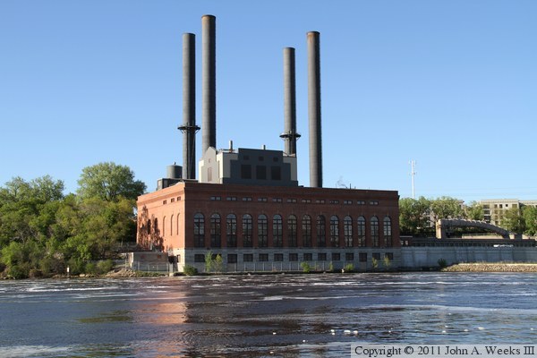
This structure is the University of Minnesota Southeast Steam Plant. It is used generate steam that is used to heat most of the buildings on the Minneapolis campus. While this structure is built right on the river, it is not a hydro power plant. Rather, it was built in 1903 to generate electricity for the street car system using coal fired boilers. When the street car system shut down in the early 1950s, Northern States Power took over the steam plant to generate commercial electrical power. The University of Minnesota acquired the facility in 1976 to provide steam heat to the east and west bank campus buildings.

It was hoped that this building would be removed when it became obsolete in the 1980s. There was a move to shut down the steam plant and covert the land to park use that was widely supported within state and local government. However, the University invested millions to rebuild the plant, scuttling the effort to reclaim the riverfront. This investment effectively rules out using much of the east bank of the river for parkland for many years into the future.

Fans of the rock band Pink Floyd think of the album Animals when they see this building. While this building resembles the powerplant on the cover of Animals, that power plant is the Battersea Power Station on the River Thames.

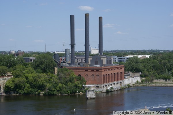
The photo above is a summer view of the Southeast Steam Plant as seen from the Endless Bridge at the Guthrie Theater on the south bank of the Mississippi River. The bridge pier in the river channel is from the Lower Bridge, a bridge that was demolished 1943.


Southeast Steam Plant
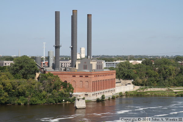
The photo above is a same view from the Endless Bridge a few years later under 
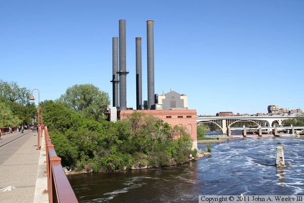
better lighting conditions. The photo below is the west side of the Southeast Steam Plan as seen from the deck of the Stone Arch Bridge.

Southeast Steam Plant
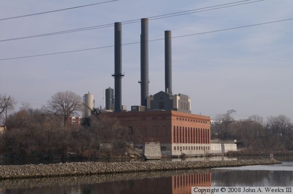
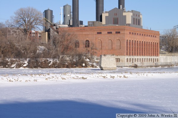
These two photos are views of the Southeast Steam Plant as seen from the same location on the Stone Arch Bridge. The photo above is a view from the fall of 2008, while the photo below is a view from the winter of 2009.

Southeast Steam Plant
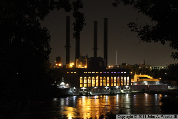
The photo above is looking across the Mississippi River towards the Southeast Steam Plant from the riverbank access road leading to the upstream side of the Lower Saint Anthony Falls Lock & Dam. The late evening sun leaves the south face of the plant in a shadow. The river flow is heavy and turbulent due to an unusually heavy winter snowfall total. The photo below is a similar view from the overlook at the I-35W Bridge Memorial as seen around midnight on a midsummer evening.

Southeast Steam Plant

Made With Macintosh
Authored by John A. Weeks III, Copyright © 1996—2016, all rights reserved.
For further information, contact: john@johnweeks.com