Current Weather Conditions
John A. Weeks III
Friday, April 19, 2024, 2:50:10 PM CDT
Home Photo Tours Rail Fan 12 Easy Steps
Aviation Spacecraft Highways & Bridges About The Author
 
Google Search
Maps   Groups   Images   Search
 
  Home
  • 12 Easy Steps
  • Aviation
  • Spacecraft
  • Highways & Bridges
    » Bridge Photography
      - MSP River Bridges
      - C & D Canal
      - Illinois River
      - Minnehaha Creek
      - Minnesota River
      - Mississippi River
        › Lake Itasca Area
        › Bemidji Area
        › Cass Lake - Ball Club
        › Grand Rapids Area
        › Blackberry - Crosby
        › Brainerd Lakes Area
        › Little Falls Area
        › St. Cloud Area
        › North Metro Area
        › Port Of Minneapolis
        › St. Anthony Falls Area
        › Mississippi Rvr Gorge
          · Washington Ave Br
          · Dartmouth Bridge
          · East River Flats Br
          · FW Cappelen Mem
          · Short Line Bridge
          · Meeker Island L&D
          · Lake Street Bridge
          · Intercity Bridge
          · Lock & Dam #1
          · Fort Road Bridge
          · Fort Snelling High Br
          · Fort Snelling Br (Old)
        › St. Paul Area
        › S St. Paul - Hastings
        › Red Wing - Winona
        › La Crosse Area
        › Lansing - Clinton
        › Quad Cities Area
        › Muscatine - Louisiana
        › St. Louis Area
        › Chester - Cairo
        › Miss - Tenn - Ark
        › Ark - Miss - Louisiana
        › Louisiana Structures
      - Missouri River
      - St. Croix River
      - St. Louis River
      - Wisconsin River
      - Best Miss River Photos
      - Cable Stayed Bridges
      - McGilvray Road Bridges
      - I-35W Bridge Disaster
      - Miscellaneous Bridges
      - Madison County Bridges
      - Hist Br Weekend 2013
    » Road Geek Topics
  • Photo Tours
  • Rail Fan
  • About The Author
 
Site Search By JRank
Highways, Byways, And Bridge Photography
Washington Avenue Bridge
CSAH-122 Mississippi River Crossing
Minneapolis, MN

Washington Avenue Bridge

• Structure ID: NBI: 9360.
• Location: River Mile 852.60.
• River Elevation: 725 Feet.
• Highway: Washington Avenue, CSAH-122.
• Daily Traffic Count: 18,700 (2001).
• Bridge Type: Steel Plate Girder.
• Length: 1,131 Feet, 251 Foot Longest Span.
• Width: 62 Feet, 4 Traffic Lanes.
• Navigation Channel Width: 229 Feet.
• Height Above Water: 54 Feet.
• Date Built: 1965.
The first bridge at this location was built in 1884. The 1884 structure was reconstructed in 1890 to accommodate streetcars. Streetcar service ended in 1952, and the bridge was determined to be obsolete shortly after that time and was dismantled in 1965.

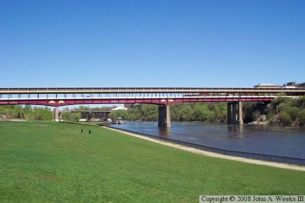
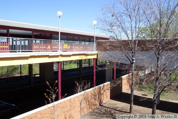
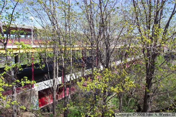
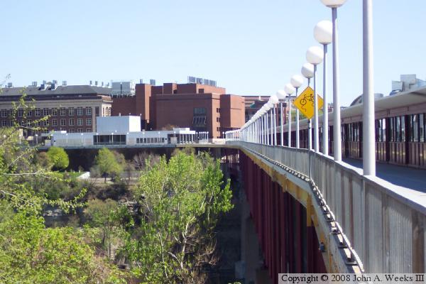
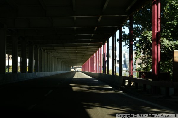
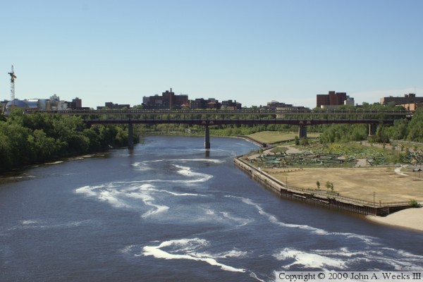
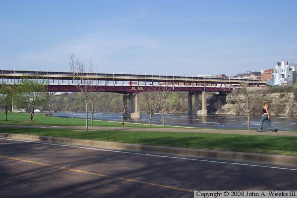
The current Washington Avenue bridge was built in 1965. It is a large steel plate girder bridge with a main span of 251 feet. A plate girder bridge is built with large steel beams that are fabricated in a steel shop as opposed to being forged or rolled in a steel mill. This allows engineers to design thicker and thinner spots in the girders to meet the load requirements. A second deck was built on the bridge to be used as a pedestrian walkway for the University of Minnesota, which was just starting to build a large complex on the west side of the Mississippi River.

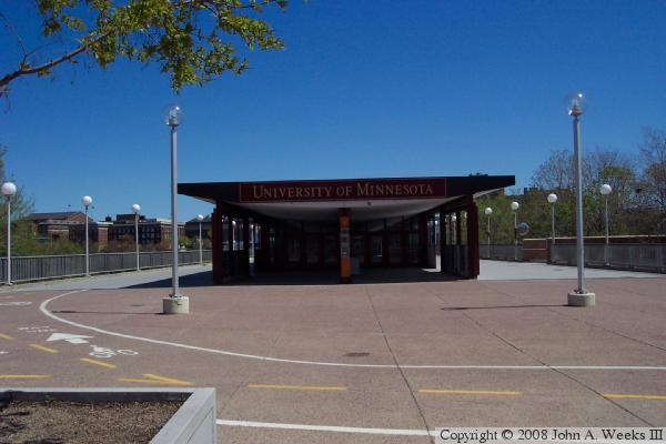
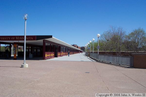
Harsh winter winds made crossing the bridge quite an ordeal in the middle of the famous Minnesota winters. About 5 years after the bridge opened, the enclosed walkway was built on top of the top deck. The walkway was intended to be heated, but the energy crisis in the early 1970s ended that plan. There are some heaters in the walkway to create some warm spots, but due to drafts, the walkway can drop down below the freezing point. The major function of the walkway is to act as a windbreak, and to keep people dry during rain and snow storms.

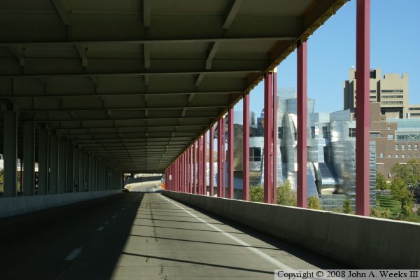
The Washington Avenue bridge was painted gray when it was built. The upper deck was painted in the university colors of maroon and gold in the late 1990s. The rest of the structure was painted school colors in the early 2000s. According to the Wikipedia article, that effort was tedious and slow due to the old paint containing lead, which had to be removed, collected, and disposed of. The end result is a colorful signature structure for the university, which happens to sit next to the Frank Gehry designed Weisman Art Museum, another even more stunning signature structure at the University of Minnesota.

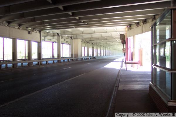
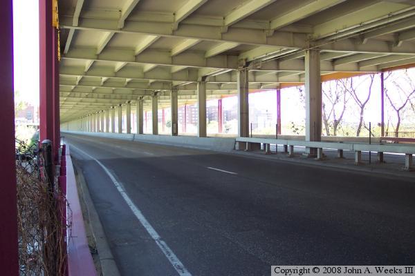
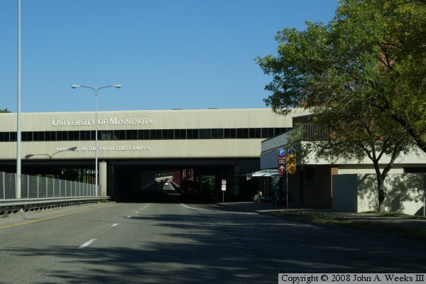
This bridge connects the heart of the University of Minnesota East Bank Campus to the freeway system. While the roadway is widely known as Southeast Washington Ave, it also carries the designation of Hennepin County Highway 122, also known as County State Aid Highway 122. The road is a short section of freeway that runs between the Metrodome and the Mississippi River. It has a partial interchange with I-35W and a diamond interchange with Cedar Avenue South. The bridge and highway carried the designation of US-12 until US-12 was moved to I-94, then carried MN-122 until the road was turned back to the county in 1997.

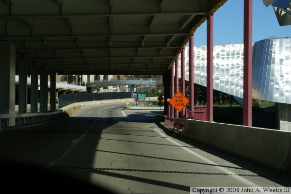
The Washington Avenue bridge was in the news again in 2008. The next phase of the light rail system is planned to run between the two downtown city centers along University Avenue. The light rail will exit downtown Minneapolis through the U of M west bank buildings, cross the river using the Washington Avenue bridge, and continue down the center of Washington Ave to reach University Avenue. A consulting company was hired to determine how to retrofit light rail onto the Washington Ave bridge. As part of that project, the consulting company found that the upper deck supports are not strong enough to meet current standards. The vertical steel supports appear to be just strong enough to support the dead weight of the upper deck, but do not have the margin of safety needed to support the live loads on the bridge. Until the bridge retrofit is completed, both pedestrian and bicycle traffic is confined to a single narrow path down the middle of the upper deck.

On a sad note, the Washington Avenue bridge is also known as the bridge where poet and professor John Berryman committed suicide in 1972.


MN-122 Washington Avenue Bridge
The photo above is a profile view of the bridge. Note the odd configuration of the steel girders. The steel girders taper to a point near the two piers on the left, but do not taper near the pier on the right. Photo was taken from the park at Bohemian Flats along the West River Parkway.

The photo below is a view of the signature feature of the Washington Avenue Bridge, the enclosed walkway on the top level.


MN-122 Washington Avenue Bridge
The photo above is another view of the top deck of the bridge and the enclosed walkway. The photo below shows one of the plaza walkways that connects to the west end of the bridge. There are elevated plazas at each end of the bridge, each with several elevated connections to buildings.

Washington Avenue Bridge
These two photos are views from the south side of the west end of the bridge. The photo above is a view down the side of the bridge. Thick vegetation and brush prevent a clear view. It looks like there is a well worn trail going under the bridge, but given that there is a very tall sheer drop on the edge of the trail, it did not look worth the risk. The photo below is a view of the traffic deck from the bus stop on the south side of the west end of the bridge.

Washington Avenue Bridge
These two photos are views from the north side of the west end of the bridge. The photo above is a view down the side of the bridge from the level of the upper deck. The photo below is from the same location, but is a view of the traffic deck.

Washington Avenue Bridge
These two photos are the first of 4 views that show a typical crossing of the Washington Avenue Bridge heading eastbound from the west end to the east end of the bridge. The photo above is the west portal of the bridge. The structure is the West Bank Skyway, which spans MN-121 between Willey Hall (MN Population Center and a theater) and Blegen Hall (houses geography and archeology labs). The photo below is a view just after entering the bridge. Traffic is on the lower level, while bicycles and pedestrians use the upper level.

Washington Avenue Bridge
These two photos are the final two photos in our crossing of the Washington Avenue bridge heading eastbound. In the photo above, we are about halfway across the main river span. The maroon colored vertical supports are the structural members whose strength has been called into question. The silver building on the far side of the river is the Weisman Art Museum, which was designed by Frank Gehry. The photo below is nearing the east end of the bridge. The road drops down to a 25 mile per hour surface street and becomes heavily congested through the University of Minnesota east bank area. The exit ramp allows access to the East River Parkway.

Washington Avenue Bridge
The photo above is a view of the Washington Avenue Bridge as seen from the Northern Pacific Bridge #9 located just upriver. The view is looking south into the bright morning sun. The material on the riverbank is the remains of the I-35W bridge, which collapsed 18 months prior to this photo being taken. The bridge bridge truss sections were partially reassembled at this location. The photo below is from a historic display located on the University of Minnesota campus. It shows the original Washington Avenue Bridge circa 1905. This iron truss bridge was in place from 1884 to 1965.

Washington Avenue Bridge

Made With Macintosh
Authored by John A. Weeks III, Copyright © 1996—2016, all rights reserved.
For further information, contact: john@johnweeks.com