Current Weather Conditions
John A. Weeks III
Friday, April 19, 2024, 12:58:12 AM CDT
Home Photo Tours Rail Fan 12 Easy Steps
Aviation Spacecraft Highways & Bridges About The Author
 
Google Search
Maps   Groups   Images   Search
 
  Home
  • 12 Easy Steps
  • Aviation
  • Spacecraft
  • Highways & Bridges
    » Bridge Photography
      - MSP River Bridges
      - C & D Canal
      - Illinois River
      - Minnehaha Creek
      - Minnesota River
      - Mississippi River
        › Lake Itasca Area
        › Bemidji Area
        › Cass Lake - Ball Club
        › Grand Rapids Area
          · Sheldon L. Olds Br
          · BNSF Cohasset Br
          · Pokegama Dam
          · Verne V. Skallman Br
          · Blandin Dam
          · US-169 Br (G Rapids)
          · Robert K. Horn Br
          · Bill Powers Trail Br
        › Blackberry - Crosby
        › Brainerd Lakes Area
        › Little Falls Area
        › St. Cloud Area
        › North Metro Area
        › Port Of Minneapolis
        › St. Anthony Falls Area
        › Mississippi Rvr Gorge
        › St. Paul Area
        › S St. Paul - Hastings
        › Red Wing - Winona
        › La Crosse Area
        › Lansing - Clinton
        › Quad Cities Area
        › Muscatine - Louisiana
        › St. Louis Area
        › Chester - Cairo
        › Miss - Tenn - Ark
        › Ark - Miss - Louisiana
        › Louisiana Structures
      - Missouri River
      - St. Croix River
      - St. Louis River
      - Wisconsin River
      - Best Miss River Photos
      - Cable Stayed Bridges
      - McGilvray Road Bridges
      - I-35W Bridge Disaster
      - Miscellaneous Bridges
      - Madison County Bridges
      - Hist Br Weekend 2013
    » Road Geek Topics
  • Photo Tours
  • Rail Fan
  • About The Author
 
Site Search By JRank
Highways, Byways, And Bridge Photography
BNSF Bridge — Cohasset
Mississippi River Railroad Crossing
Cohasset, MN

BNSF Bridge Cohasset

• Location: River Mile 1184
• River Elevation: 1,273 Feet
• County: Itasca
• Railroad: BNSF Railroad
• Daily Traffic Count: 1 Train Per Day (Estimated)
• Bridge Type: Wood Trestle
• Bridge Length: 340 Feet, 32 Foot Longest Span
• Bridge Width: 1 Track
• Height Above Water: 20 Feet
• Date Built: December, 1953
This bridge is part of a rail spur built to service the Tioga Iron Mine near Grand Rapids, Minnesota. The mine has since closed down, but the rail line still services a plywood factory. The bridge was built by the Great Northern Railway, which became part of the BNSF following the merger in 1970.

The drawing in Mary Costello's book (Climbing The Mississippi River Bridge By Bridge, Volume 2) shows a wooden trestle on the west end of this railroad bridge. That section appears to have been replaced by a steel girder bridge featuring piers that are capped with concrete. This rebuild would have happened between the 2000 date on Costello's drawing and fall of 2007 when these two photos were taken.

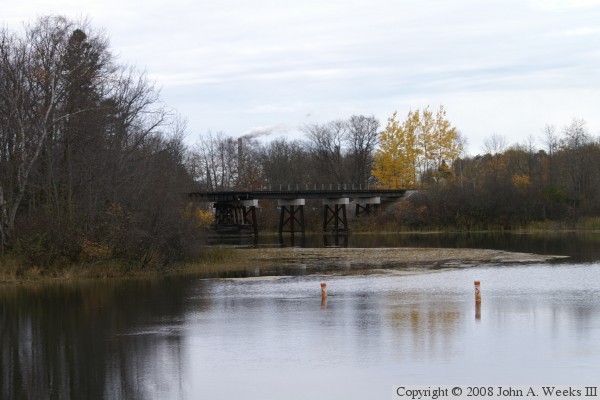
The photo above is a view of the bridge from the northeast. The east end of the bridge is obscured by trees as the river makes a bend. This photo was taken from the park at the Pokegama Dam.


BNSF Bridge Cohasset
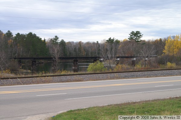
The photo above is a view of the bridge from a parking lot located on the north side of US-2. The BNSF mainline is located on the far side of the highway. The track that crosses the bridge branches off of the mainline about one-half mile to the west of this location. The bridge has a steel girder section with steel piers on the right side, a steel girder section with wood piers in the middle, and a trestle section on the left side. The photo below is a view of the north face of the bridge. The center span has the large wooden guard structures protecting the piers.

BNSF Bridge Cohasset
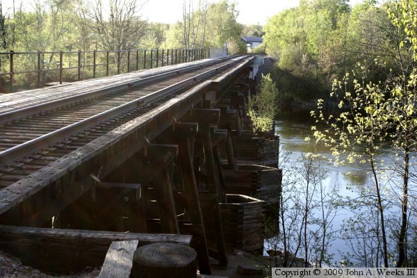
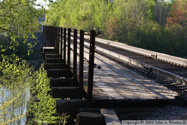
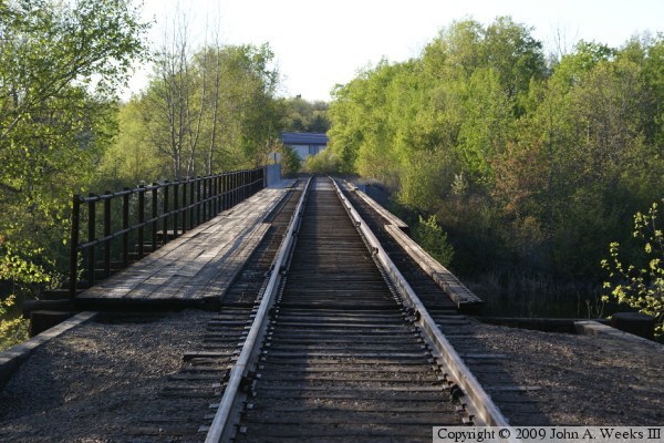
The photo above is the trestle section located at the east end of the structure. The photo below is looking west down the walkway on the south side of the bridge.

BNSF Bridge Cohasset
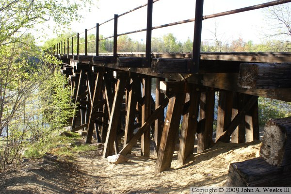
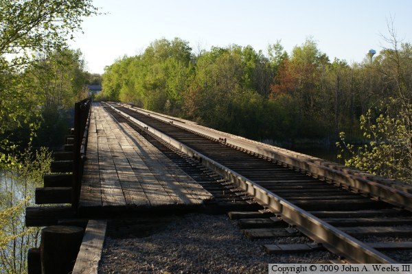
The photo above is a view of the upriver face of the bridge. The photo below is the bridge deck as seen from the center of the railroad track. Both views are looking west. The river flows to the right in these photos.

BNSF Bridge Cohasset

Made With Macintosh
Authored by John A. Weeks III, Copyright © 1996—2016, all rights reserved.
For further information, contact: john@johnweeks.com