| Highways, Byways, And Bridge Photography |
Blanchard Hydro Electric Station
Mississippi River Dam
Near Royalton, MN
|
• Location: |
River Mile 956.5 |
|
• County: |
Morrison |
|
• Structure Type: |
Concrete Structure |
|
• Structure Width: |
750 Feet Main Structure, 2400 Foot Embankment |
|
• River Elevation (Pool): |
1,082 Feet |
|
• River Elevation (Outflow): |
1,036 Feet |
|
• Water Fall: |
46 Feet |
|
• Date Opened: |
1925 |
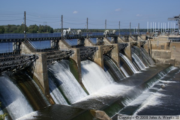
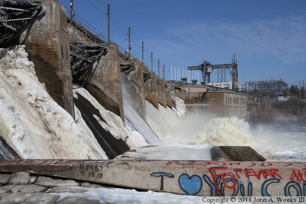
The Blanchard Dam is one of the taller dams on the Mississippi River, rivaled
only by the Ford Dam, Upper St Anthony Falls Dam, and the Keokuk Power Dam.
The water action looks impressive in these spring high water level photos.
During much of the year, the gates on the dam are closed, and the only water
that exits the structure does so by flowing through the power house. As a
result, fishermen are able to walk across the bottom of the falls, using the
concrete outcropping as a fishing platform. Note that walking on the apron
is extremely dangerous because the dam is subject to being opened at any
time. Minnesota Power has installed a warning horn on the dam to alert
sport fisherman that the dam will be opening.
The power plant at the Blanchard Dam produces 18-megawatts of electricity.
The facility is operated by remote control from a control center located
at the Thomson Dam near Duluth, Minnesota. The Little Falls Dam is also
operated from this same control center.
Most people are familiar with Pike's Peak in Colorado, named after Zebulon
Pike. What is lesser known is that Pike, an Army Lieutenant, lead an 1805
expedition to find the headwaters of the Mississippi River. Along the way,
Pike ran into winter near Little Falls. His expedition established a small
fort and stayed the winter. That location was flooded out when the Blanchard
Dam was erected in 1925. Just before the fort site was flooded, a marker was
placed so it could be found again in the future. As it happens, the Blanchard
Dam was drained in 1984 for repairs. While the water level was low, historians
were able to locate the site of the fort and do a new excavation. The walls
and buildings were mapped out and documented before the dam repairs were
finished. The dam was unexpectedly drained again in 1985 for pipeline work.
Historians were able to do additional excavation, this time, finding a musket
from the 1805 expedition.
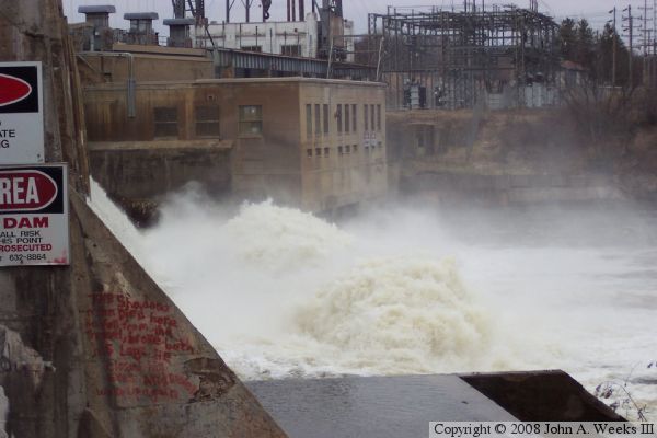
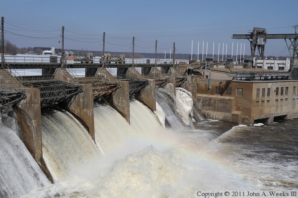
The photo above is a view of the dam and power house during the spring
high water season. The sound and spray of the water surging through the
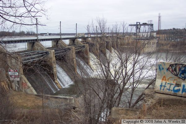
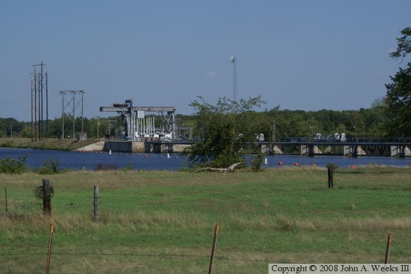
dam is incredible. The photo below is an overview of the dam site as
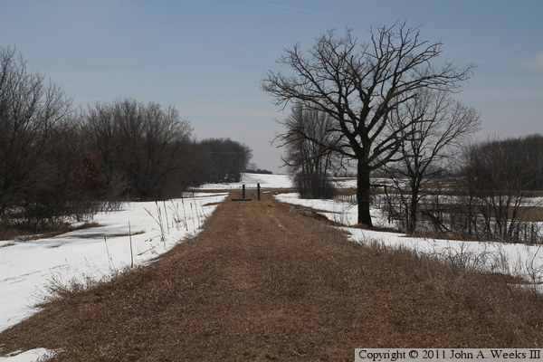
seen from the Soo Line Trail bridge. The bridge was not yet open to the
public when these spring photos were taken, but was open when the summer
photos below were shot. The Soo Line Trail bridge is located just below
the Blanchard Dam and features spectacular views of the structure.
The photo above is an early spring view of the upriver side of the dam
control structure. The photo below is a view looking east down the
length of the control structure from the west side of the river.
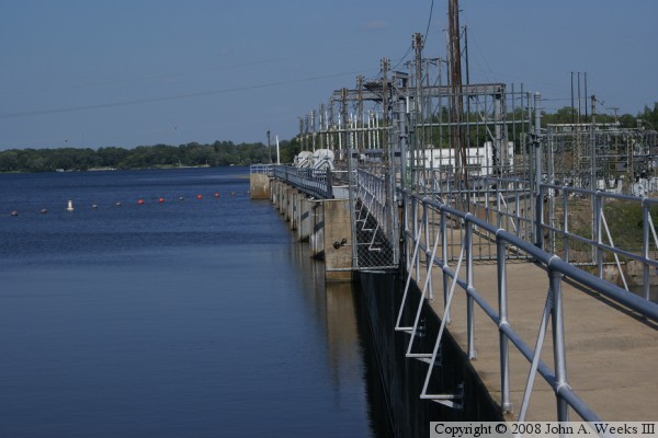
The photo above is the control structure that regulates the height of the
reservoir behind the dam. The photo below is a view of the upriver side
of the control structure.
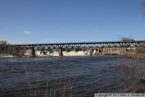
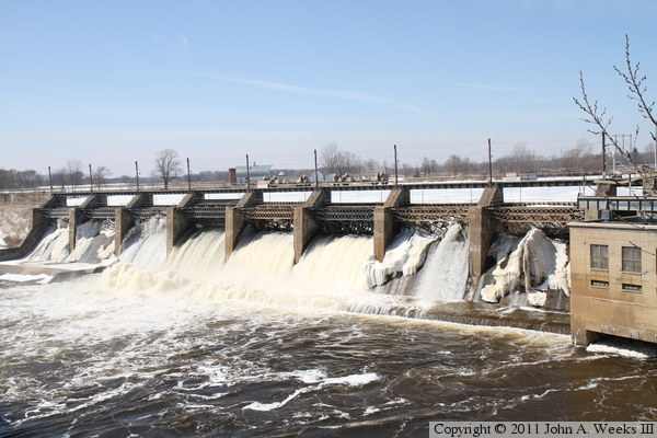
This photo, and the nineteen that follow, are views from early April, 2011,
during the spring runoff. The photo above is looking north from the east
bank of the river towards the downstream face of the Blanchard dam. The
photo below is a close view of the dam control structure. The Soo Line
Trail Bridge, located just downstream of the Blanchard Dam, offers a great
vantage point to watch the dam in operation.
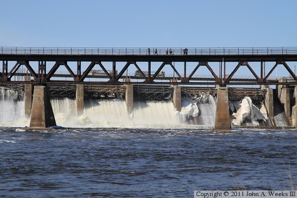
These two photos are views from under the east end of the Soo Line Trail
Bridge. The photo above is several of the dam gates on the main control
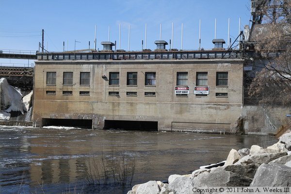
structure. The photo below is the power house. Since more water was flowing
through the dam gates than was flowing through the power house, water
currents were actually flowing into the powerplant outflow channels. This
is an example of the unexpected and dangerous currents that can develop
near a dam.
These two photos, and the seven that follow, are views of the dam as seen
from the deck of the Soo Line Trail Bridge. The photo above is the west
end of the main dam control structure. The photo below shows the first
two dam gates, which are choked with ice that accumulated from small leaks
in the dam gates.
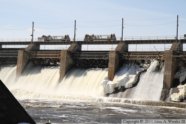
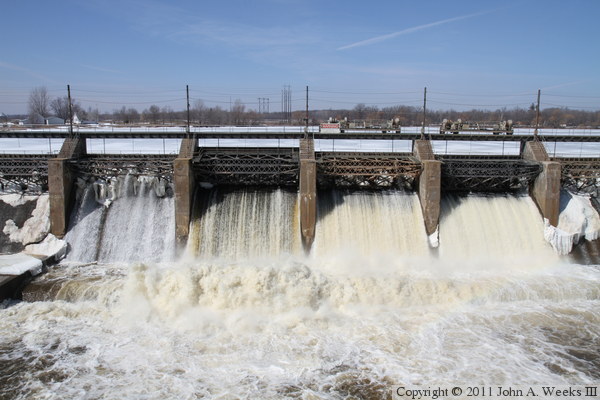
These two photos are views of the center dam gates. Three gates are open,
and two more are leaking a noticeable amount of water. Of the three open
gates, the gate on the left is open the furthest, while the two on the
right are connected to remotely controlled winches. These winches can
raise and lower the dam gates to fine-tune the water flow volume.
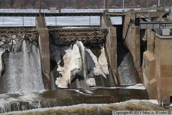
The photo above is the gate closest to the power house. A small leak in the
gate has lead to ice accumulating on the face of the dam. This ice is
blocking the leak, causing the water to spray up into the air, creating
a large rooster-tail. The photo below is the downstream side of the power
house.
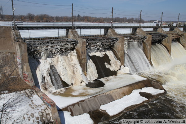
The photo above is looking to the northwest towards the dam control
structure. All eight movable gates are visible in this view. The photo
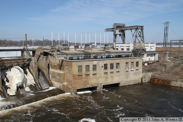
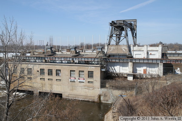
below shows the white mechanical and control building located to the east of
the power house. The large metal structure is a traveling crane. It can
move back and forth over the power house. It can hoist equipment into and
out of the power house through access doors in the roof of the building.
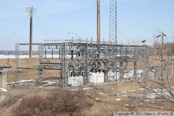
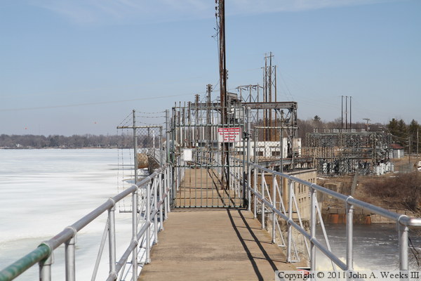
The photo above is the electrical substation located to the east of the
power house. These transformers combine the output from the generators
and step up the voltage to a level where it can be efficiently carried by
transmission lines. The tower that extends off the top of the photo supports
a microwave dish. The dish is pointed towards the northeast, presumably to
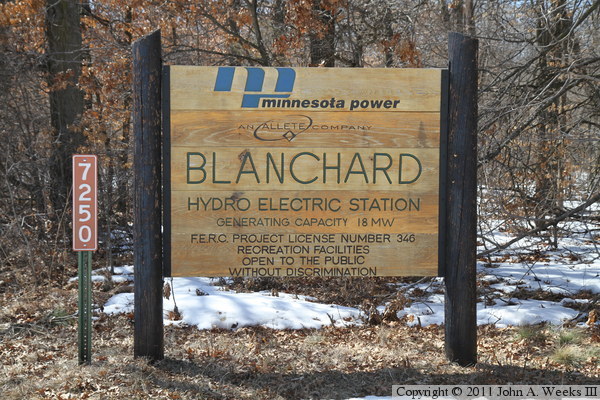
link the dam with the control center at the Thomson Hydro Project. The photo
below is the sign posted at the access road leading to the east end of the dam.
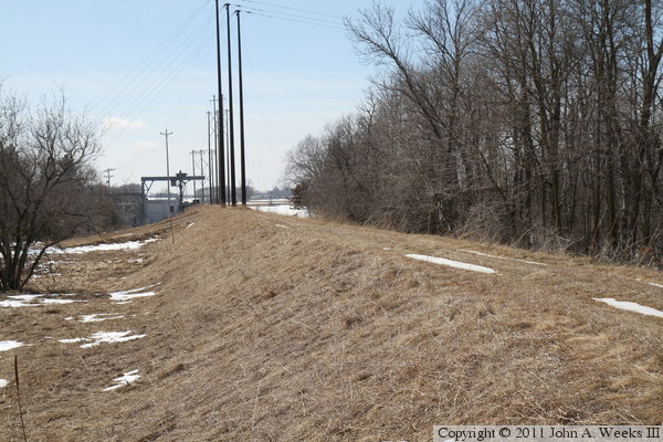
The photo above is looking west down the front side of the dam embankment.
The photo below is the access road leading to the west side of the dam,
which also serves as the embankment on the west end of the structure.
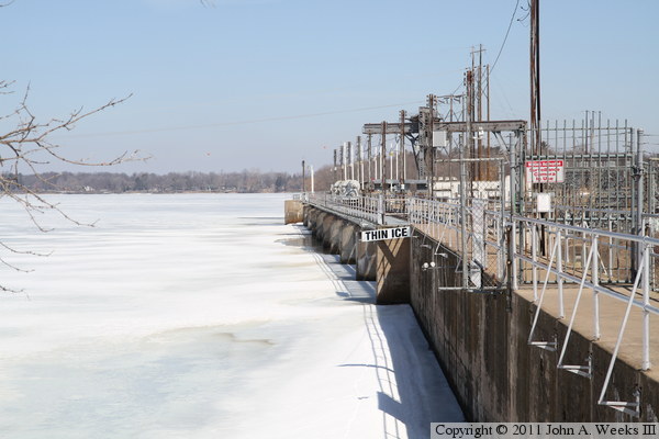
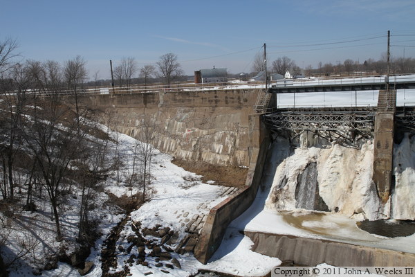
The photo above is looking east along the upriver side of the dam. Unlike
the summer photo above, the pool behind the dam is still covered with winter
ice. The photo below is looking east along the top of the dam.
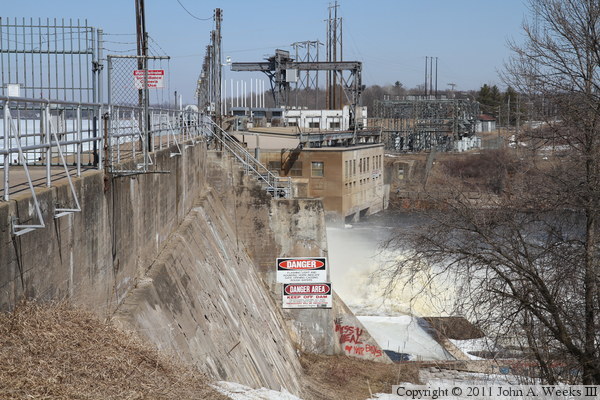
The photo above is looking along the downriver front side of the dam from
the top of the structure. It is approximately 55 feet down to the water
level from the top of the dam. The signs warn people to not climb out
onto the apron in front of the gates. The photo below is looking east
along the dam structure from the west end of the apron.
|
