Current Weather Conditions
John A. Weeks III
Thursday, March 28, 2024, 11:46:49 PM CDT
Home Photo Tours Rail Fan 12 Easy Steps
Aviation Spacecraft Highways & Bridges About The Author
 
Google Search
Maps   Groups   Images   Search
 
  Home
  • 12 Easy Steps
  • Aviation
  • Spacecraft
  • Highways & Bridges
    » Bridge Photography
      - MSP River Bridges
      - C & D Canal
      - Illinois River
      - Minnehaha Creek
      - Minnesota River
      - Mississippi River
        › Lake Itasca Area
        › Bemidji Area
        › Cass Lake - Ball Club
        › Grand Rapids Area
        › Blackberry - Crosby
        › Brainerd Lakes Area
        › Little Falls Area
        › St. Cloud Area
        › North Metro Area
        › Port Of Minneapolis
        › St. Anthony Falls Area
        › Mississippi Rvr Gorge
        › St. Paul Area
        › S St. Paul - Hastings
        › Red Wing - Winona
        › La Crosse Area
        › Lansing - Clinton
        › Quad Cities Area
        › Muscatine - Louisiana
        › St. Louis Area
        › Chester - Cairo
          · Chester Bridge
          · Texas-Illinois Pipeline
          · Bill Emerson Mem Br
          · Thebes Bridge
          · I-57 Bridge
          · US-60/US-62 Bridge
        › Miss - Tenn - Ark
        › Ark - Miss - Louisiana
        › Louisiana Structures
      - Missouri River
      - St. Croix River
      - St. Louis River
      - Wisconsin River
      - Best Miss River Photos
      - Cable Stayed Bridges
      - McGilvray Road Bridges
      - I-35W Bridge Disaster
      - Miscellaneous Bridges
      - Madison County Bridges
      - Hist Br Weekend 2013
    » Road Geek Topics
  • Photo Tours
  • Rail Fan
  • About The Author
 
Site Search By JRank
Highways, Byways, And Bridge Photography
US-60/US-62 Bridge
US-60/US-62 Mississippi River Crossing At Cairo
Cairo, Illinois

US-60/US-62 Bridge

• Structure ID: NBI 000002000500887.
• Location: River Mile 1.3.
• River Elevation: 279 Feet.
• Highway: US-60, US-62.
• Bridge Type: Steel Truss Through Deck.
• Daily Traffic Count: 4,450 (2003).
• Length: 5,175 Feet Overall, 701 Foot Main Span.
• Width: 20 Feet, 2 Lanes.
• Navigation Channel Width: 675 Feet.
• Height Above Water: 114 Feet.
• Date Built: Opened 1929, Reconstructed 1983.
Cairo is famous as being the southern tip of the state of Illinois, and the place where the Mississippi and Ohio meet. The city itself has seen better days since it is no longer a shipping hub. It does have three major bridges, the US-60/US-62 structure, a second Mississippi river crossing on I-57, and the US-51/US-60 crossing over the Ohio River. That latter bridge has its west approach starting exactly behind the spot where the photo above was taken.

There is a story floating around about a student pilot that flew a loop around this bridge in 1956. While the story is not confirmed, many people who were stationed at nearby Malden Air Base at the time have recounted these events. A student pilot flying a T-28 trainer was obsessed with the idea of flying a loop around the Cairo highway bridge. Once day, after spending many hours studying the problem, he found himself flying in the area alone. He decided that today was the day. After taking a pass to make sure that there was no barge traffic in the area, he flew out a few miles to line up his flight and gain some speed. Unfortunately, he picked up a little too much speed. He flew under the bridge OK, but by the time he pulled up into the loop, he was well beyond the bridge. As he went inverted, he could see that he would come down right about where the bridge was. If he tried to tighten up the loop, he might have hit the bridge. If he tried to lengthen the loop, he might stall and crash into the river. As it happens, he just cleared the bridge, so he pulled back hard to start to pull up under the bridge to finish the loop. By the time the airplane started to climb, he had hit the water, damaging the skin on the wings and about 12 inches of the outer tips of the propeller. He flew back to the air base, parked the airplane, and wrote it up as having a rough engine. Officials at the base figured out what had happened, and the cadet was ejected from the flight training program.

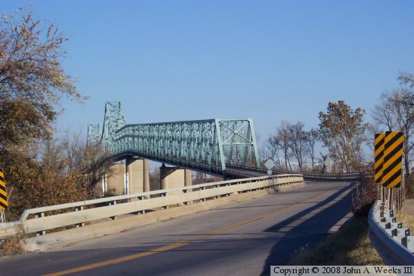
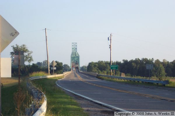
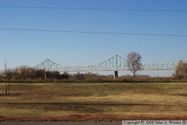
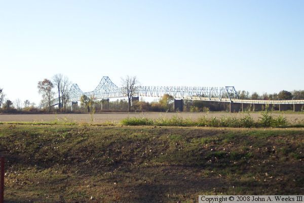
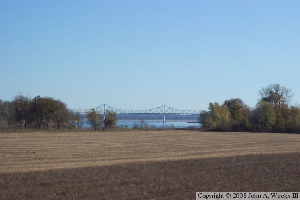
The photo above is a view from near the northeast corner of the bridge. The vantage point is from behind a service building for the Fort Defiance Park located at the intersection of US-51, US-60, and US-62. The US-51 Ohio River bridge begins just to the left of this photo. The photo below is the south end of the bridge near Bird's Point. The nearby US-51 bridge over the Ohio River is visible in the trees just above the guardrail leading to the US-60/US-62 bridge.

US-60/US-62 Bridge
US-60/US-62 Bridge

The photo above is looking south towards the bridge structure. The photo below is a view while traveling southbound on the bridge over the main channel of the Mississippi River. The bridge deck is relatively narrow, making it a tight fit when we pass the oncoming semi-truck visible in the photo.

US-60/US-62 Bridge
US-60/US-62 Bridge
These two views are looking west from Fort Defiance Park. The photo above is from the edge of the riverbank looking due west. The photo below is from an observation deck in the park looking to the southwest. The park is located at the convergence point where the Mississippi and Ohio rivers meet.

US-60/US-62 Bridge
US-60/US-62 Bridge
The photo above is a view from a farmer's field located about 1/2 mile to the southwest of the structure. The photo below is looking east from the levee on the west side of the river. This location is 2 miles due west of the bridge. I would have liked to have walked across this field to get a clear view of the bridge, but since it was hunting season, I did not dare leave the safety of my vehicle.

US-60/US-62 Bridge

Made With Macintosh
Authored by John A. Weeks III, Copyright © 1996—2016, all rights reserved.
For further information, contact: john@johnweeks.com