Located near the old South Saint Paul Stockyards, the old Wakota Bridge has
been a southeast metro area landmark since it was built. While the bridge
was still sound, it was simply overwhelmed by traffic, with significant
backups many hours each day. Once the first span of the new Wakota Bridge
was opened to traffic, the this bridge was removed during the winter of
2006 and 2007 to make room for the second span of the new Wakota Bridge.
While the word Wakota sounds like the name of a Native American band, it
actually came from a 1960 bridge naming contest. Wakota was suggested by
a grade school girl. It is a combination of Washington and Dakota, the
two counties on either end of the bridge.
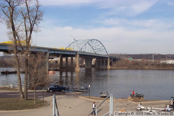
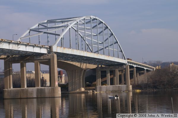
The old Wakota Bridge is an example of a tied-arch bridge. The main span
is supported by a large steel arch. The bottom ends of the arch are tied
together by a long horizontal steel beam. This keeps the arch from sagging
and having the ends push themselves off of the top of the main piers. The
deck is suspended under the arch by a series of vertical supports. In this
case, those supports are steel beams. The other three tied-arch bridges
that cross the Mississippi River all use cables as the vertical support
for the traffic deck.
This bridge was refurbished and modified in the early 1990s. In addition
to sand-blasting and painting, the west end of the bridge was widened to
make room for merging lanes for the freeway interchange for Hardman Avenue.
The west abutment was made wider. New piers were added, and the existing
piers were modified to carry two new plate girders on the south side of
the structure. This resulted in several interesting pier configurations.
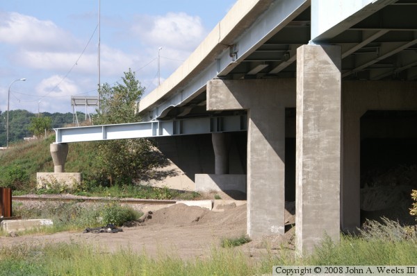
The most interesting is the steel supports at the west end of the bridge.
Due to a railroad track and a street that pass under the bridge, it was
not possible to install a pier under the new steel beams. The solution
to the problem was to build several smaller piers, and install a support
beam crosswise under the main bridge beams to support those main beams.
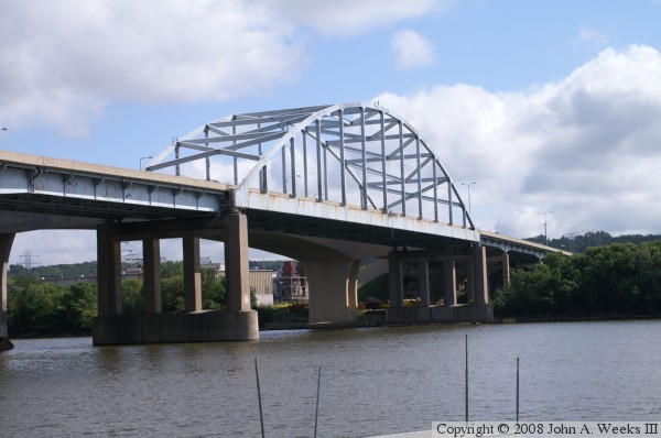
The photo above shows the old bridge while it was still in operation. The
westbound span of the new bridge is visible behind the old bridge. The
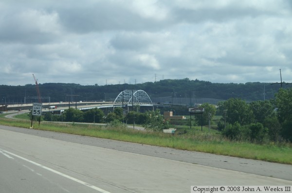
photo below is a view of the bridge project traveling eastbound from Inver
Grove Heights towards the Mississippi River. One lane of the new bridge is
open at this point, but most traffic is still using the old bridge.
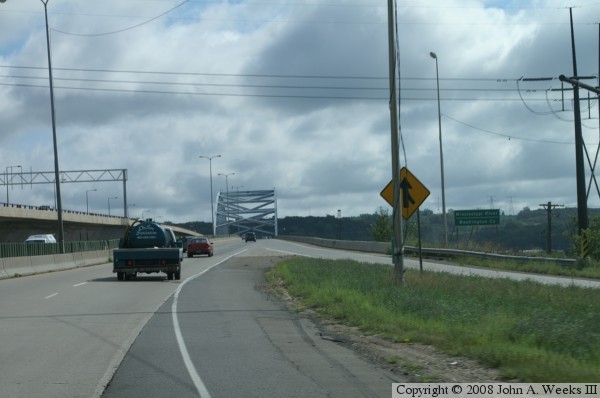
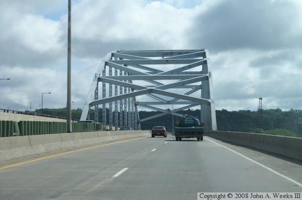
These two photos show views from a typical river crossing heading west to
east. In the photo above, we are just entering the bridge. Hardman Avenue
is entering from the right. In the photo below, we are approaching the
main span arch.
These photos are two more views from 2006 while the old bridge was still
in operation. The photo above is a view from the regional bicycle trail
that runs under the bridge. Note the detail on the nearest pier. This
pier was made wider to accommodate a longer merge lane on the Hardman Avenue
entrance ramp. Two smaller girder were placed on the edge of the pier, and
the pier was filled in to make it stronger.
The photo below is a view from the boat ramp and park just south of the
old bridge. The yellow equipment on top of the bridge is actually on the
new bridge, not the old bridge. These yellow machines are form travelers,
and the move out over the edge of the bridge to allow more bridge structure
to be built from concrete.
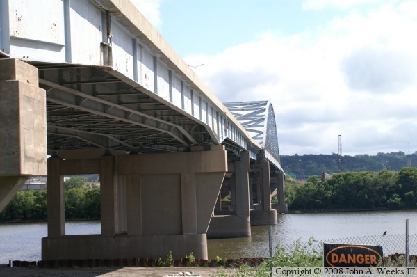
The photo above shows an unusual detail of the bridge. When it was rebuilt
in 1988, the entrance and exit ramps for the interchanges on each end of the
bridge were flared into the bridge to lengthen the acceleration and
deceleration areas. On the southwest corner of the bridge, it was impossible
to make the pier wider to accommodate adding the steel to make the bridge
wider. That was due to a rail line that ran under that section of the bridge.
To solve the problem, two small piers were built, and a steel beam was set
parallel to the rail line. That steel beam carried the girders that formed
the wider entrance ramp from Hardman Avenue.
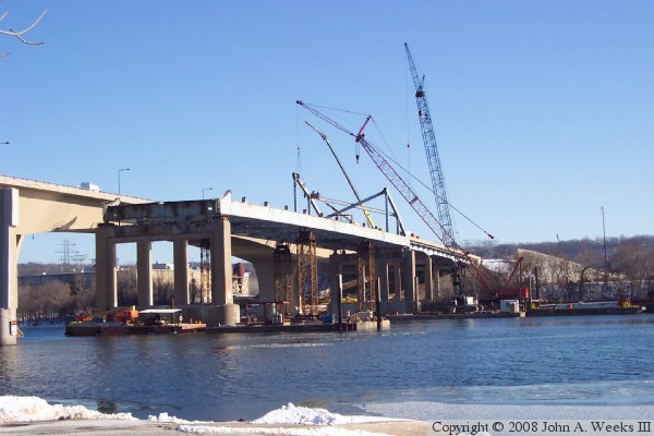
The photo below is a view of the bridge removal from the winter of 2006 and
2007. The concrete deck and railings have been removed from the main span
and the western approaches.
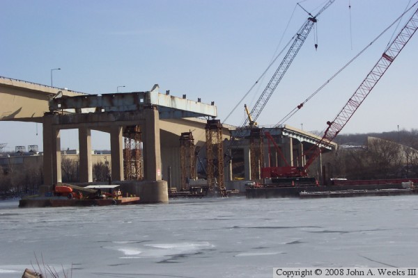
These two photos are more views of the old bridge being removed in the
winter of 2006 and 2007. In the photo above, we can see that a few girders
remain on the east end, and a small part of the arch is still present. In
the photo below, the arch has been fully removed, and half of each main
channel girder has been removed. The remainder of the bridge is being
supported by temporary piers. Note that part of the bridge on the east
side of the river crossing has not been removed. That section of bridge
is being used as a landing zone and staging area for the project.