The MN-610 Mississippi River crossing was built as part of a new north
crosstown freeway that is planned to parallel I-94 and I-694 across the
north metro area. This freeway has been built in stages. The westbound
span of the bridge opened in 1987. At that time, the bridge connected
between MN-252 west of the river and US-10 east of the river. Since
that time, US-10 has been rebuilt on a new freeway alignment from I-35W
heading west to MN-47. MN-610 has been widened to 3 lanes in each
direction from MN-47 west to the river. Finally, the second span of
the Mississippi River crossing was completed in 1999.
This freeway project was proposed in the 1960s, and studied in the 1970s.
One Brooklyn Park mayor commented that the project was moving so slowly
that they could probably fast-track it by buying the Brooklyn Bridge
from New York City and rebuilding it across the Mississippi River.
Heading west from the river, a major section of MN-610 was built between
MN-252 and US-169. This section of roadway was built just beyond the
end of the urban development, and it will serve as a major catalyst in
filling in the remaining empty spaces between I-94 and the Mississippi
River. Target Corporation established a large operations center just
off of MN-610 shortly after this section of highway opened for traffic.
The section of MN-610 from US-169 to I--94 is on the drawing board and
scheduled to be completed by 2016. The right of way has been purchased.
MN-DOT is slowly working to have utilities moved and the right of way
cleared. A new interchange with the future MN-610 and MN-83 was competed
in the mid-2000s. With all the pre-work being completed in advance, the
actual highway project should move very quickly once it finally is funded.
The westbound span was opened first. It operated as a 4 lane bridge
with two lanes of traffic in each direction. When the eastbound span
was opened in 1999, the bridges were reconfigured to handle 4 lanes of
traffic in each direction. The eastbound bridge has 3 through lanes,
and one lane that ends as an exit ramp to east river road. The westbound
bridge has 4 lanes, with the outside line joining the highway just before
the start of the bridge, and the 4 lanes splitting into 2 highways each
with 2 lanes on the west end of the structure. There is also a sidewalk
and regional trail on the south side of the eastbound span, resulting in
that bridge being the wider of the two spans.
The structure looks like one very wide bridge when traveling on the
bridge deck. Photos from above and below the bridges show that there
is actually a gap between the two structures. The center guardrails
serve to hide that gap.
The bridge is named after Richard P. Braun. Braun is a former commissioner
of the Minnesota Department of Transportation, the Chairman of the
Metropolitan Airports Commission, the first director of the University of
Minnesota Center for Transportation Studies, and a director at Image Sensing
Systems. Image Sensing Systems developed and manufactures a video camera
able to return real-time data on traffic volumes.
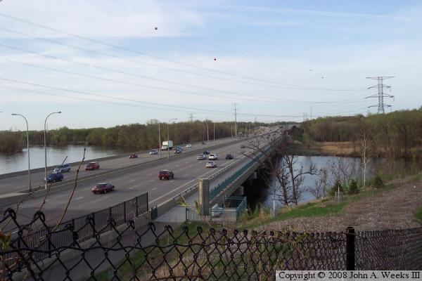
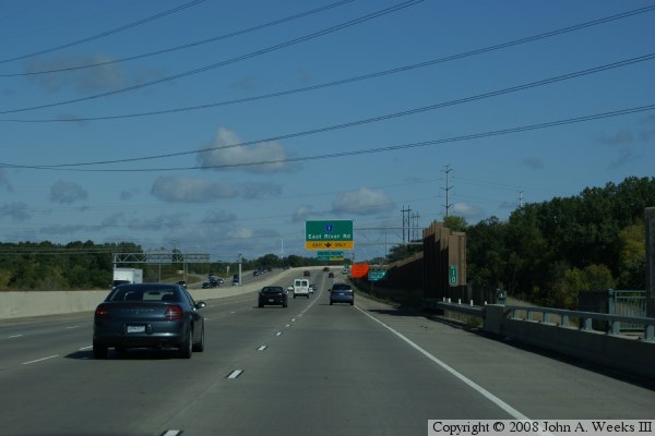
The photo above is a view of the MN-610 bridge taken from an overpass on
the west end of the bridge looking to the northeast. The photo below is
a view from the east end of the structure looking to the southwest.
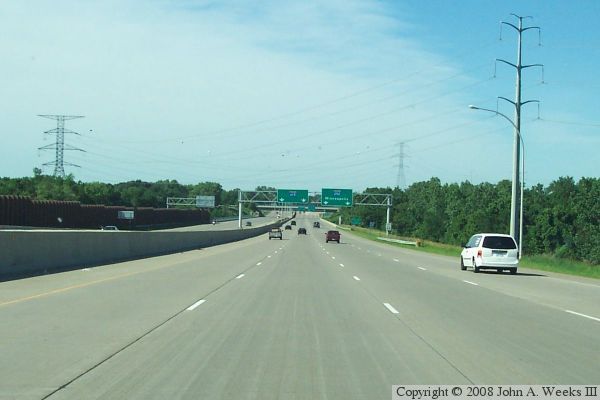
The photo above is the first of three photos showing a typical crossing
of the MN-610 bridge heading eastbound. In this photo, we are just entering
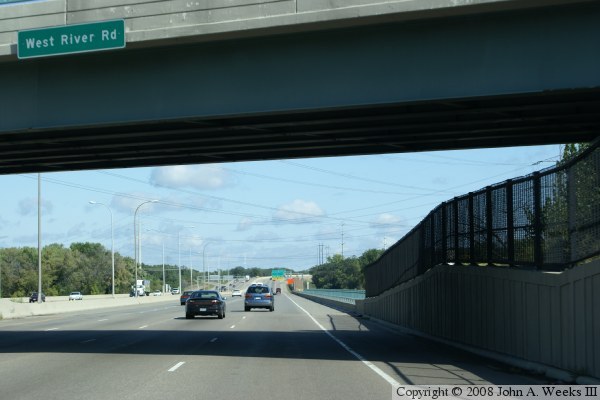
the eastbound span. The photo at the top of this page was taken from the
overpass for West River Road that is visible at the top of this photo.
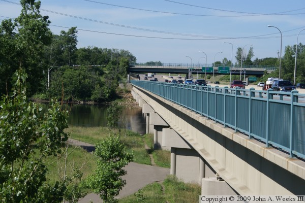
The photo below is a view from about halfway across the MN-610 bridge.
The regional trail crossing is on the right side of this span. Notice
how there is a concrete divider between the traffic lanes and the sidewalk.
This is the modern way of protecting trail users from the 65 mile per hour
traffic flow.
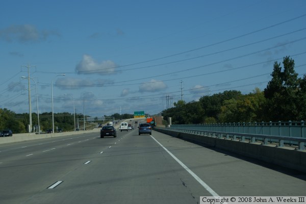
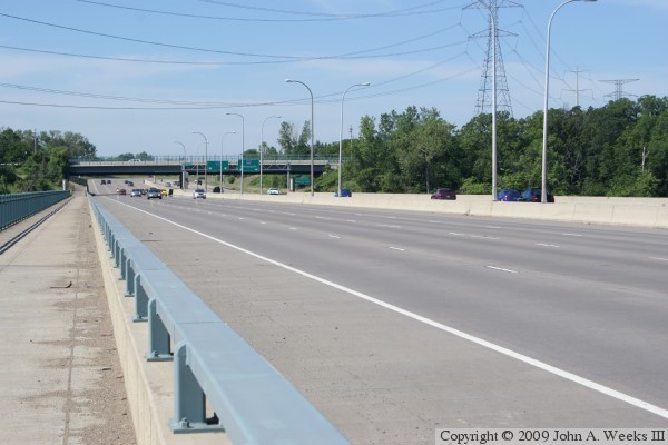
The photo above is the final view of crossing the MN-610 bridge eastbound.
We are just exiting the bridge. The right-most lane has an exit-only to
East River Road, while the remaining 3 lanes carry eastbound through traffic.
The photo below is view of the bridge heading westbound.
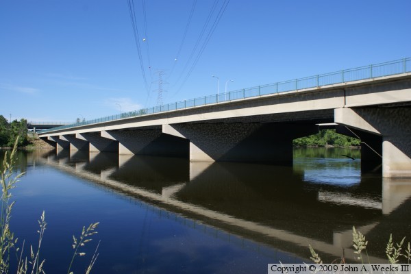
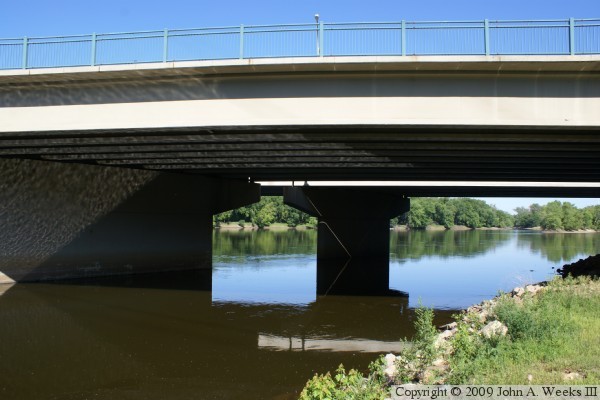
The photo above is the south face of the river crossing spans of the
Richard P. Braun Bridge. The photo below is a view looking west along
the south face of the structure. The bright sun reflecting off of the
water creates an interesting reflection on the underside of the bridge.
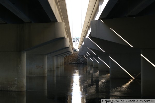
The photo above is looking north under a bridge span that crosses the
east bank of the Mississippi River. The photo below is looking west
between the two bridge structures. The newer westbound span is on the right
side of the photo.
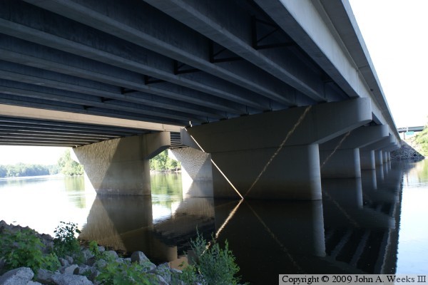
These two photos are views of the north face of the MN-610 bridge. The
photo above is looking west along the north face of the structure. The
photo below is looking to the south at the underside of both bridge spans.
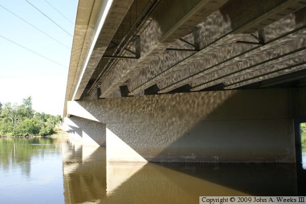
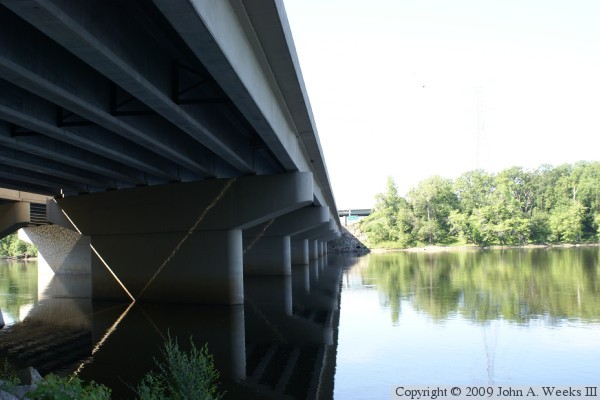
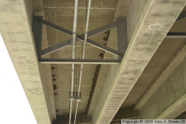
The photo above is the structure and wiring runs located under the bridge
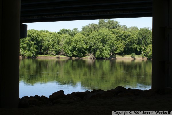
deck. The photo below is a view of the west river bank of the Mississippi
River framed by the bridge structure under the bridge on the east side of
the river.
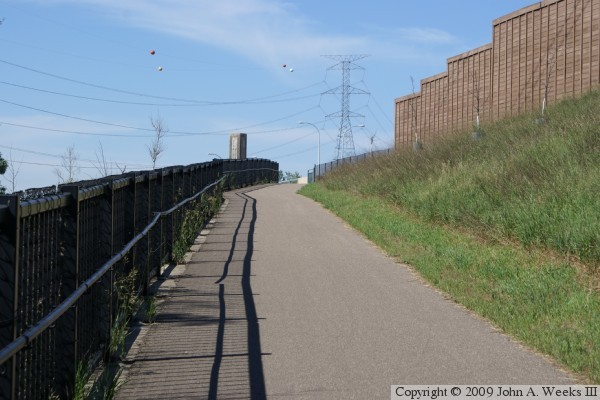
The photo above is the trail leading to the pedestrian and bicycle path on
the downriver side of the bridge. The photo below is the observation deck
and a view of the path on the south side of the structure.
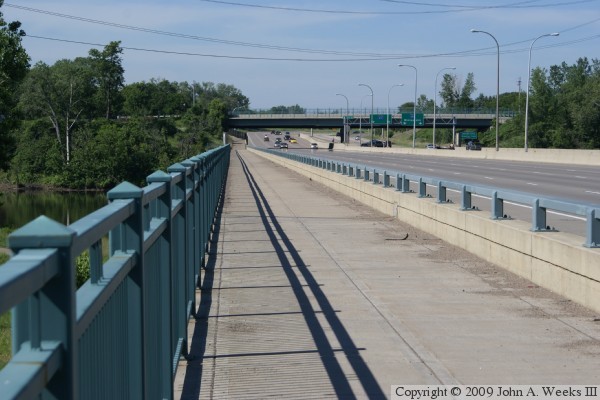
The photo above is looking west down the length of the pedestrian and
bicycle path on the south side of the south bridge span. The photo below
is a view of the traffic deck as seen from the bridge observation deck.
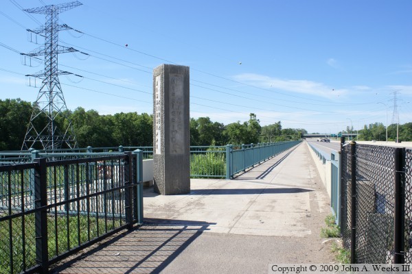
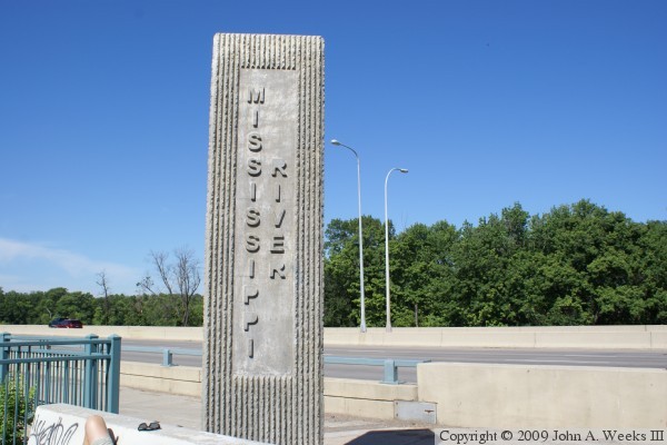
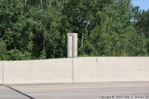
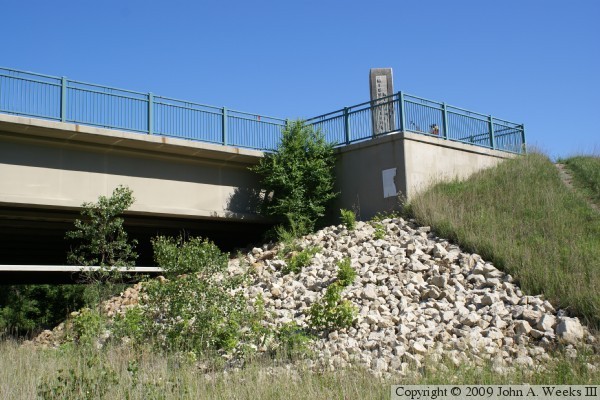
The photo above is the monument at the observation deck on the southeast
corner of the structure. The photo below is a view of the monument on
the northeast corner of the structure. There is no pedestrian or bicycle
access to the north side of the bridge.
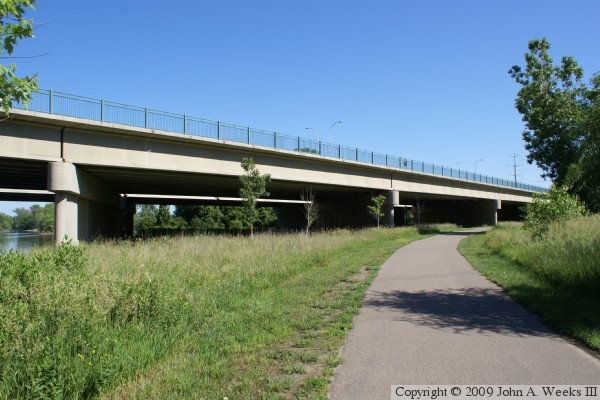
The photo above is a view of the observation deck as seen from ground level
on the east side of the river. The photo below is three bridge spans that
cross the river flats area.