Current Weather Conditions
John A. Weeks III
Friday, April 19, 2024, 3:23:49 AM CDT
Home Photo Tours Rail Fan 12 Easy Steps
Aviation Spacecraft Highways & Bridges About The Author
 
Google Search
Maps   Groups   Images   Search
 
  Home
  • 12 Easy Steps
  • Aviation
  • Spacecraft
  • Highways & Bridges
    » Bridge Photography
      - MSP River Bridges
      - C & D Canal
      - Illinois River
      - Minnehaha Creek
      - Minnesota River
      - Mississippi River
        › Lake Itasca Area
        › Bemidji Area
        › Cass Lake - Ball Club
          · Beltrami Hwy 8 (E)
          · Beltrami Co Hwy 33
          · Knutson Dam
          · Beltrami Co Hwy 39
          · Third River Bridge
          · FR-2171 Bridge Ruins
          · Winnibigoshish Dam
          · Cass & Itasca Hwy 9
          · US-2 Ball Club Br
          · BNSF Ball Club Br
          · Co Hwy 3, 18 Br (W)
          · Co Hwy 3, 18 Br (E)
          · MN-6 Br (Deer River)
        › Grand Rapids Area
        › Blackberry - Crosby
        › Brainerd Lakes Area
        › Little Falls Area
        › St. Cloud Area
        › North Metro Area
        › Port Of Minneapolis
        › St. Anthony Falls Area
        › Mississippi Rvr Gorge
        › St. Paul Area
        › S St. Paul - Hastings
        › Red Wing - Winona
        › La Crosse Area
        › Lansing - Clinton
        › Quad Cities Area
        › Muscatine - Louisiana
        › St. Louis Area
        › Chester - Cairo
        › Miss - Tenn - Ark
        › Ark - Miss - Louisiana
        › Louisiana Structures
      - Missouri River
      - St. Croix River
      - St. Louis River
      - Wisconsin River
      - Best Miss River Photos
      - Cable Stayed Bridges
      - McGilvray Road Bridges
      - I-35W Bridge Disaster
      - Miscellaneous Bridges
      - Madison County Bridges
      - Hist Br Weekend 2013
    » Road Geek Topics
  • Photo Tours
  • Rail Fan
  • About The Author
 
Site Search By JRank
Highways, Byways, And Bridge Photography
BNSF Bridge — Ball Club
Mississippi River Railroad Crossing
Ball Club, MN

BNSF Bridge Near Ball Club

• Location: River Mile 1221.5
• River Elevation: 1,278 Feet
• Counties: Cass, Itasca
• Railroad: BNSF Railroad
• Daily Traffic Count: 8 Trains Per Day (Estimated)
• Bridge Type: Steel Deck Plate Girder
• Bridge Length: 597 Feet Overall, 115 Foot Longest Span
• Bridge Width: Single Track
• Height Above Water: 26 Feet
• Date Built: 1967, Built On 1908 Piers
The Great Northern Railroad built this railroad line along Highway 2 in the 1890s. The line opened for traffic on September 25, 1898. At the time, a wooden trestle was built over the Mississippi River. Wood posts from that trestle are still visible in the water. The trestle was replaced with a new bridge in 1908. This bridge featured the concrete piers, two truss spans, and a swing span. Note the large octagonal pier in a photo below where the swing span once pivoted.

The current bridge was built in 1967. River traffic was no longer an issue, so the swing span was removed, as were the truss spans. The piers were raised 5 feet, and the deck plate bridge spans were installed. This new bridge would allow much heavier rail traffic to cross the river. That was short lived, however, as the demand for rail service tailed off in northern Minnesota in the 1970s.

This bridge is the third of five Mississippi River crossings where the river is the boundary between Cass County and Itasca County.

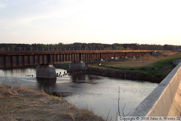
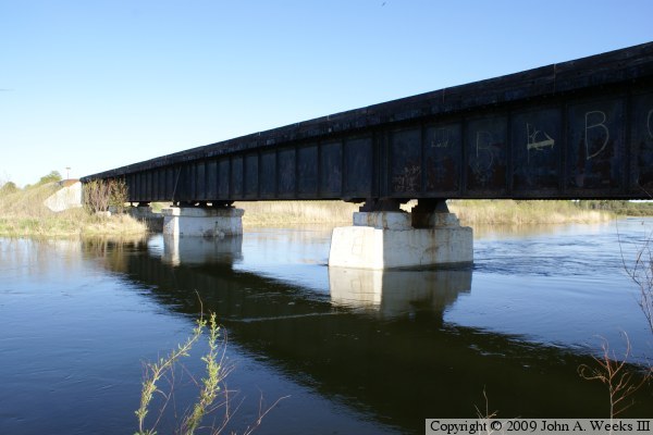
The photo above is a view looking southwest towards the bridge. The vantage point is standing on the US-2 highway bridge located adjacent and just upriver from the railroad bridge. 
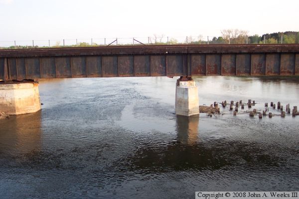
The photo below is the main channel span. The large pier on the left is the pivot point for the swing span. The bridge plate girders have a joint above the smaller pier. Note the two different styles of bearings supporting the girders on top of the smaller pier. Also note the cut off pilings that are remains of an earlier trestle at this location.


BNSF Bridge Near Ball Club
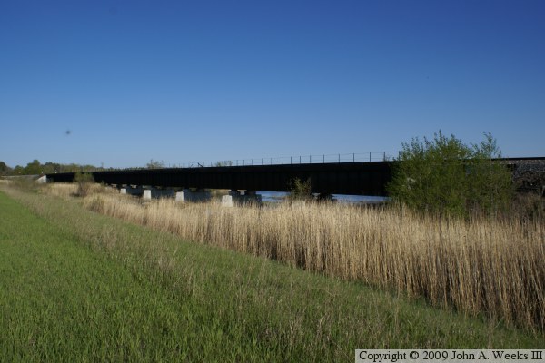
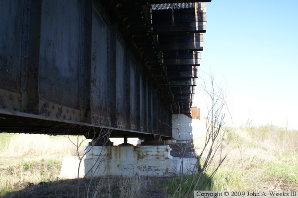
These two photos are similar views photographed several years apart. The photo above is from earlier in spring just after a high water period has matted down the grass. The photo below is from later in spring after the grass has had a chance to put on some growth.

BNSF Bridge Near Ball Club
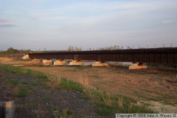
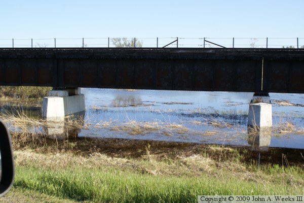
The photo above is the main river channel span. The photo below is a span located west of the main channel. This span is flooded due to high water from the spring run-off.

BNSF Bridge Near Ball Club
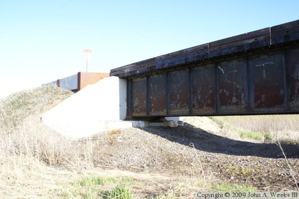
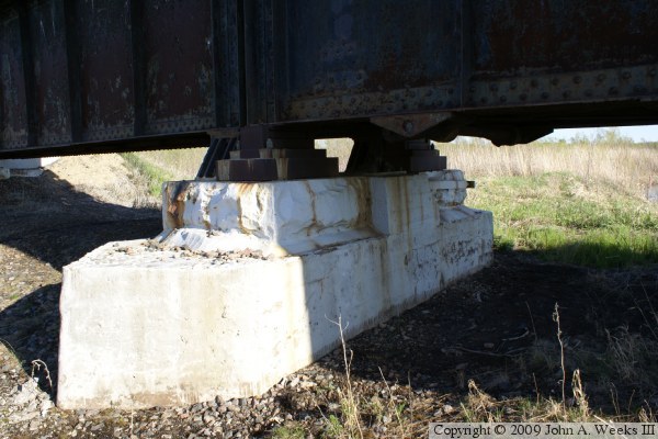
The photo above is the east bridge abutment. The photo below is the west bridge abutment.

BNSF Bridge Near Ball Club
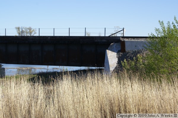
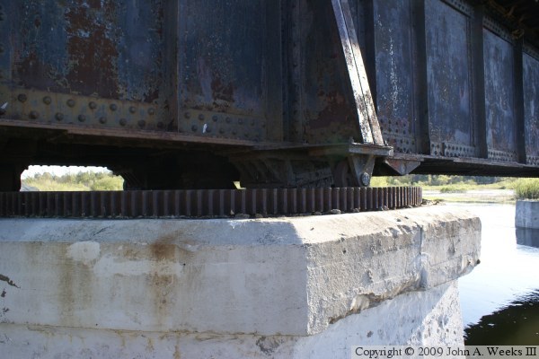
These two photos are views of the eastern-most bridge pier. The photo above is looking east at the south face of the bridge. The photo below is looking southeast at the north face of the bridge. The swing span is on the right side of the photo. Note the two different types of metal supports attached to the pier.

BNSF Bridge Near Ball Club
These two photos are close views of the small wheels that support the swing span. These wheels allow the bridge swing span to rotate. The large metal block acts as a stop to help align the bridge when it is closed, and it supports the weight of passing trains.

BNSF Bridge Near Ball Club
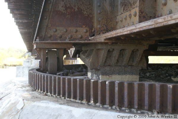
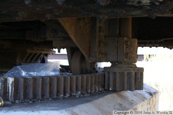
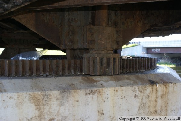
These two photos are views of the swing bridge drive mechanism. The large ring gear is attached to the pier, while the smaller gear is attached to a shaft. When the shaft is rotated, the bridge would pivot on its center point.

BNSF Bridge Near Ball Club

Made With Macintosh
Authored by John A. Weeks III, Copyright © 1996—2016, all rights reserved.
For further information, contact: john@johnweeks.com