| Highways, Byways, And Bridge Photography |
C&NW Railroad Bridge
C&NW Mississippi River Crossing At Winona
Winona, Minnesota
|
• Structure ID: |
N/A. |
|
• Location: |
River Mile 725.7. |
|
• River Elevation: |
646 Feet. |
|
• Railroad: |
Chicago & North Western. |
|
• Daily Traffic Count: |
0 (Bridge Is Closed). |
|
• Bridge Type: |
Steel Deck Plate Girder, Swingspan Is Removed. |
|
• Length: |
7,300 Feet (Estimated). |
|
• Width: |
16 Feet (Estimated), 1 Track. |
|
• Navigation Channel Width: |
160 Feet (Estimated). |
|
• Height Above Water: |
20 Feet (Deck, Estimated), 10 Feet (Low Steel, Estimated). |
|
• Date Built: |
1928, Crossing Dates To 1871.
|
The first bridge at this location was built by the Winona & Saint Peter
Railroad. It opened in May 26, 1871. The bridge was faulty and collapsed as
the first train attempted to cross the Mississippi River. The bridge was
rebuilt, and reopened in 1872. The Milwaukee Road used this bridge until the
Chicago & North Western bought out the Winona & Saint Peter line.
C&NW used the bridge until it became redundant in the mid-1970s. It was
closed December 24, 1977.
Since closing, parts of the bridge have been removed. Most notably, the
swing span has been removed from the Mississippi River main channel to
improve river navigation. In addition, the Minnesota side approach has
been removed, 15 deck plate girder spans across Latsch Island are gone,
and two short bridges over a slough have been removed from the Wisconsin side
of the crossing. What remains are a 540 foot series of deck plate girder
spans on the northeast side of the main channel of the Mississippi River,
14 empty piers, a 685 foot series of deck plate girder spans over the north
channel of the Mississippi River, and three segments of embankment (2,300
feet, 1,420 feet, and 675 feet).
This railroad bridge had a number of configurations over the years. The 1871
bridge had a wooden swing span. The 1872 bridge featured a 363 foot long
iron swing span. The swing span was a center pin design, where the moving
portion of the bridge was one long truss. This design was common, but they
were hard to balance. An 1899 photo shows a more modern iron and steel
swing span that was built from two smaller trusses that were joined over
the center pier. This photo also showed two approximately 220 foot long
through truss spans, then a number of 100 foot long pony truss spans. The
final bridge configuration was built in 1928. It reused the swing span
piers, but had a more modern steel swing bridge, a plate girder approach
span on the Winona side of the river, and 30 deck plate girder spans that
vary from 70 to 100 feet in length. The Wisconsin side of the river crossing
included about 4,500 feet of embankment with two smaller bridges of between
60 and 75 feet in length.
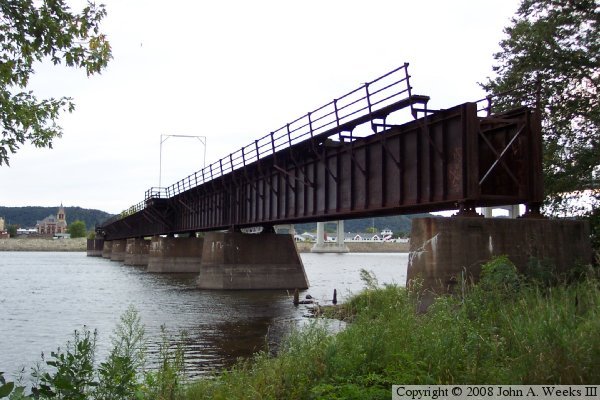
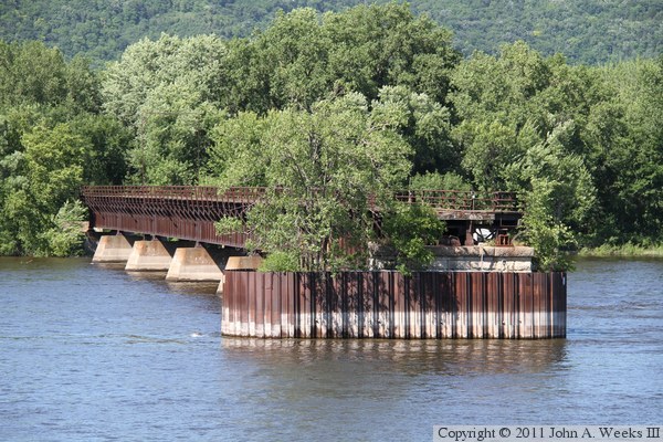
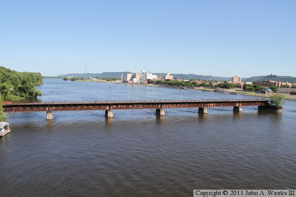
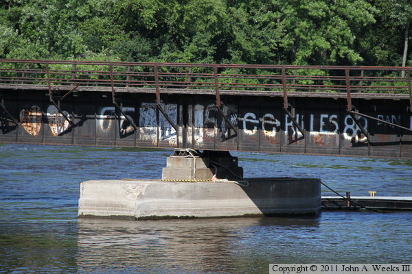
The photo above is the main channel span looking west towards Winona along
the south face of the structure. The swing span was located on the Winona
end of this structure. The closer end of the structure is where the
deck plate girder spans were removed from across the island between the
two channels of the Mississippi River.
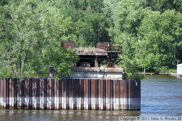
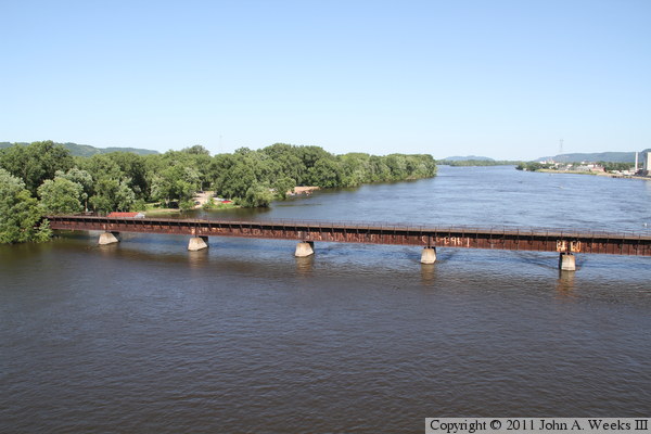
The photo above is looking southeast towards the main river channel structure
from the levee on the Minnesota side of the Mississippi. The east end of the
swing span landed on the pier on the near side of the river. The photo
below is another view of the main channel structure looking northeast from
the Winona riverfront.
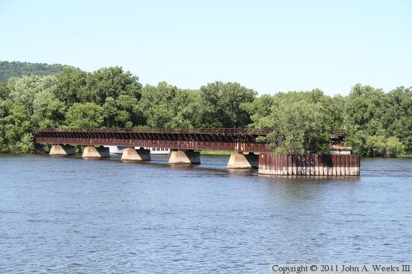
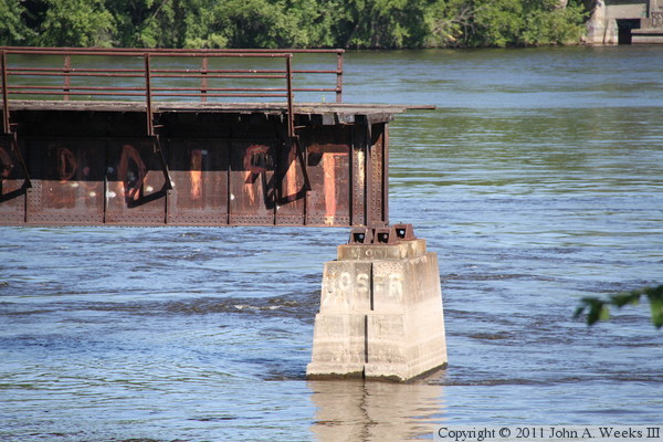
The photo above is a closer view of the end of the main channel bridge
looking to the northeast from the Winona riverfront. The photo below is
looking directly across the river navigation channel towards the bridge
remains. This pier is where the swing span met the first fixed bridge
span. This is an original pier dating back to either the 1871 or 1872
version of the bridge.
These two photos are looking southeast towards the main river channel
structure from the Winona riverfront. The photo below is from just upstream
of the bridge, while the photo below is taken from under the Winona highway
bridge.
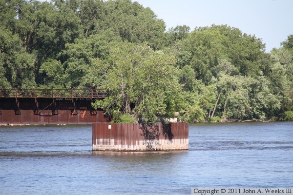
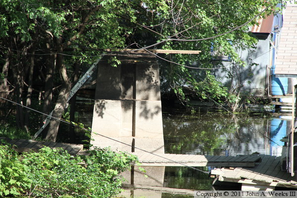
The photo above is looking downstream towards the pier where the swing
span once landed. The photo below is the same bridge pier, but seen
from high over the river from the sidewalk on the Winona highway bridge.

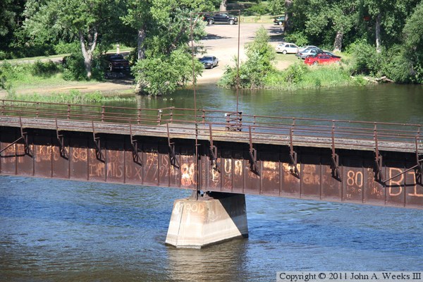
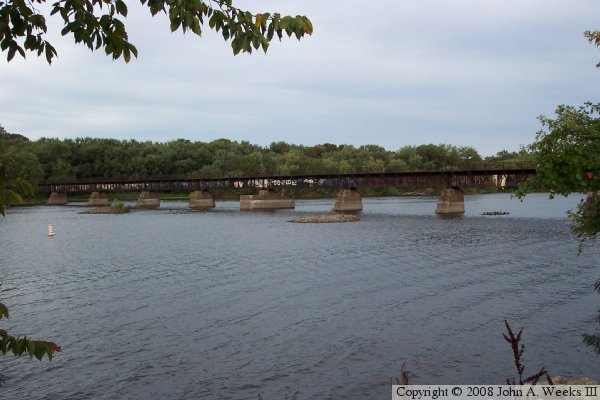
The photo below is looking downstream towards the main channel bridge
remains from the walkway on the nearby highway bridge over the Mississippi
River. The photo below is a close view of one of the bridge piers. Note the
bumpout on the walkway on the far side of the bridge, and the metal pipes
that once supported a signal detector for overheight rail cars.
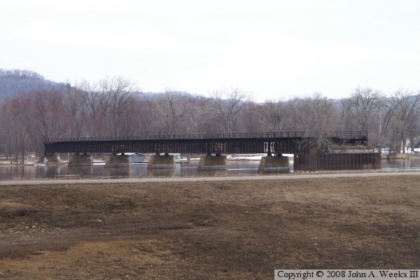
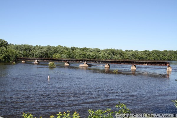
The photo above is another view of the main channel structure as seen from
high over the river on the highway bridge. The island on the left side of
the photo is Island Number 72, known locally as Latsch Island. The photo
below is the end of the deck truss bridge spans on the island.
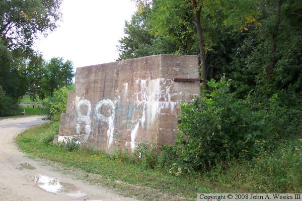
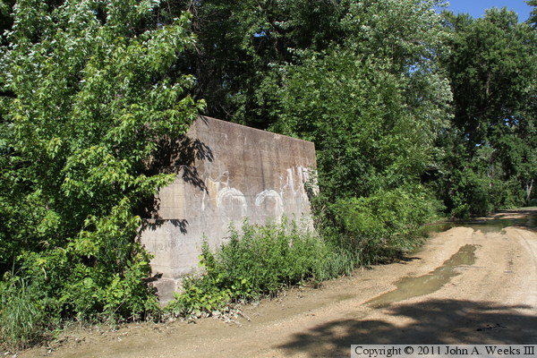
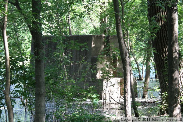
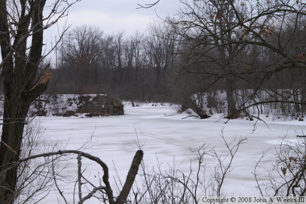
There are 14 bridge piers located between the two sections of deck plate
girder spans over the two river channels. These two photos are the first
pier located east of the main channel structure. The photo above is from
2007, while the photo below is from 2011. Note how far the trees have
grown out in this short period of time.
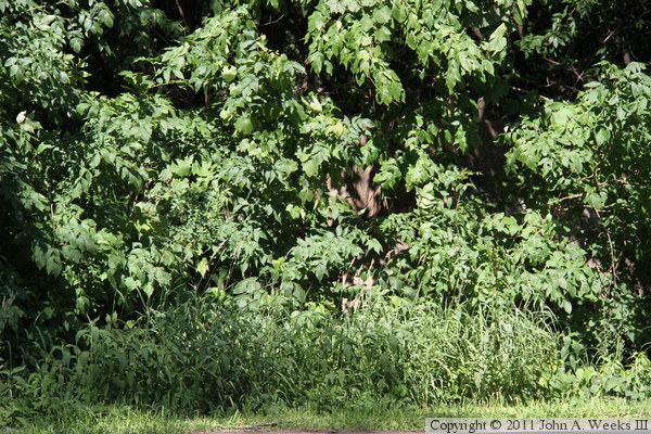
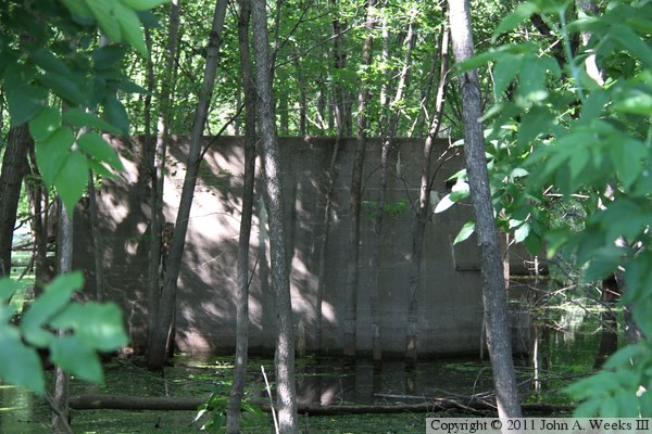
The photo above is the 2nd empty pier heading east, while the photo below
is the 3rd empty pier heading east. The pier above is difficult to see
despite being located only a few feet from the road leading to the Latsch
Wagon Bridge.
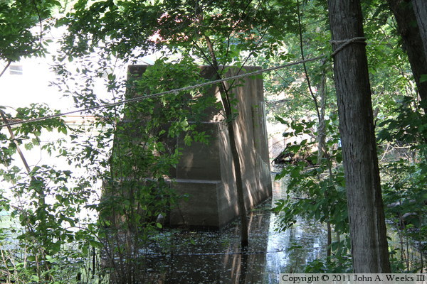
These two photos are two more empty bridge piers located in a small pool
between the two segments of steel deck plate girder bridge spans.
These two photos are two more empty bridge piers located among the many
houseboats that are tied up along the northeast side of Latsch Island.
The photo above is another empty bridge pier. This one is the 4th pier
from the start of the north channel section of the C&NW Bridge. The
photo below is the remaining bridge spans located over the north channel
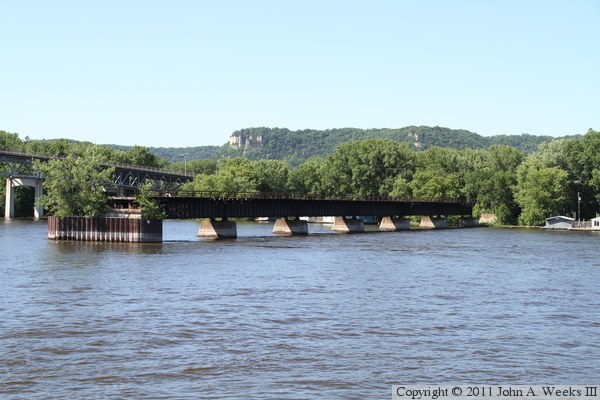
of the Mississippi River.
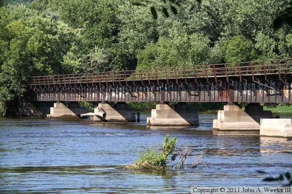
These two photos are looking east from the north channel highway bridge
towards the remaining deck plate girder spans of the C&NW Bridge located
over the north channel.
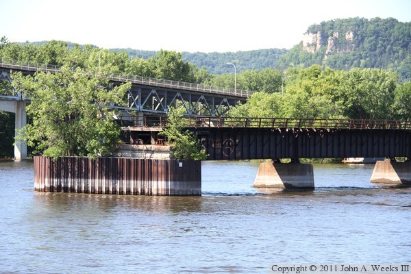
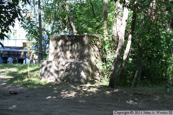
The photo below is a close view of a bridge pier on the north channel
section of the C&NW Bridge. This pier is shaped differently compared
to the other remaining concrete bridge piers. It is possible that this
was once the center pier of a swing span section, or it might be a concrete
encasement used to reinforce a failing bridge pier. The photo below is the
southwest end of the north channel bridge segment.
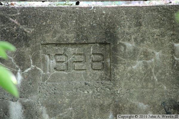
The photo above is the date mark on one of the concrete bridge piers.
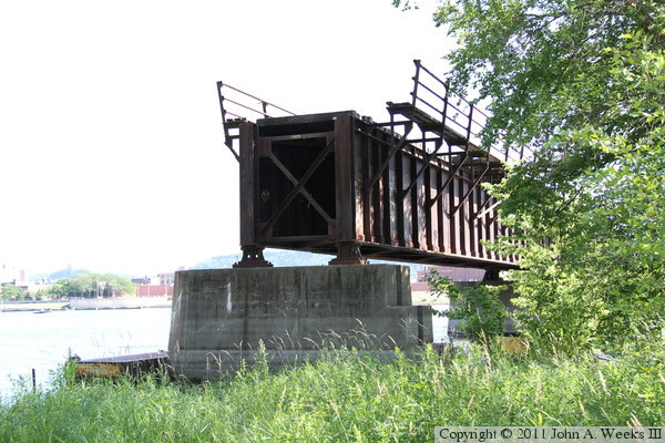
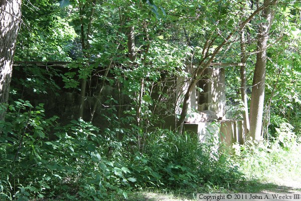
Below are the remains of a short bridge on this same rail crossing. The
bridge was located on the very east end of the crossing where the rail line
bends to the south. It is visible from Wisconsin highway WI-35. There is
another short span located along the railroad embankment between the BNSF
tracks and the north channel segment of the C&NW Bridge.
|
