Current Weather Conditions
John A. Weeks III
Saturday, April 20, 2024, 5:59:51 AM CDT
Home Photo Tours Rail Fan 12 Easy Steps
Aviation Spacecraft Highways & Bridges About The Author
 
Google Search
Maps   Groups   Images   Search
 
  Home
  • 12 Easy Steps
  • Aviation
  • Spacecraft
  • Highways & Bridges
    » Bridge Photography
      - MSP River Bridges
      - C & D Canal
      - Illinois River
      - Minnehaha Creek
      - Minnesota River
      - Mississippi River
        › Lake Itasca Area
        › Bemidji Area
        › Cass Lake - Ball Club
        › Grand Rapids Area
        › Blackberry - Crosby
        › Brainerd Lakes Area
        › Little Falls Area
        › St. Cloud Area
        › North Metro Area
        › Port Of Minneapolis
        › St. Anthony Falls Area
        › Mississippi Rvr Gorge
        › St. Paul Area
        › S St. Paul - Hastings
        › Red Wing - Winona
        › La Crosse Area
        › Lansing - Clinton
          · Lock & Dam #8
          · Black Hawk Bridge
          · Big Slough Bridge
          · Stevens Slough Br
          · Henderson Slough Br
          · Winneshiek Slough Br
          · Lock & Dam #9
          · Washington Street
          · Blackhawk Avenue
          · Twin Suspension Br
          · Marquette-Joliet Br
          · East Channel Bridge
          · WI Street Bridge
          · Iowa Street Bridge
          · St. Feriole Is RR
          · Lock & Dam #10
          · Lock & Dam #11
          · Eagle Point Bridge
          · Dubuque-Wisconsin
          · City Island Bridge
          · 16th Street Bridge
          · CN RR Bridge
          · Julien Dubuque Br
          · Lock & Dam #12
          · Savanna-Sabula Br
          · Running Slough Br
          · Sabula Rail Bridge
          · Lock & Dam #13
          · Lyons-Fulton Bridge
          · Gateway Bridge
          · Sunfish Slough Br
          · C&NW Clinton Br
          · C&NW IL Ch RR
          · C&NW Sunfish Sl
        › Quad Cities Area
        › Muscatine - Louisiana
        › St. Louis Area
        › Chester - Cairo
        › Miss - Tenn - Ark
        › Ark - Miss - Louisiana
        › Louisiana Structures
      - Missouri River
      - St. Croix River
      - St. Louis River
      - Wisconsin River
      - Best Miss River Photos
      - Cable Stayed Bridges
      - McGilvray Road Bridges
      - I-35W Bridge Disaster
      - Miscellaneous Bridges
      - Madison County Bridges
      - Hist Br Weekend 2013
    » Road Geek Topics
  • Photo Tours
  • Rail Fan
  • About The Author
 
Site Search By JRank
Highways, Byways, And Bridge Photography
Sabula Rail Bridge
Milwaukee Road Mississippi River Crossing At Sabula
Sabula, Iowa

Sabula Rail Bridge

• Structure ID:
• Location: River Mile 535.0.
• River Elevation: 583 Feet.
• Railroad: Iowa, Chicago, & Eastern Railroad.
• Daily Traffic Count: 3 Trains Per Day (Estimated).
• Bridge Type: Steel Through Truss W/Swing Span.
• Length: 16,800 Feet Overall (Estimated),
1,910 Foot Main Structure,
364 Foot Swing Span.
• Width: Single Track.
• Navigation Channel Width: 154 Feet Up River, 156 Feet Down River.
• Height Above Water: 18 Feet.
• Date Built: Opened 1906.
The first bridge here was built by the Milwaukee Road in 1882. It was an iron bridge. It served as the important river crossing bridge for the Milwaukee Road mainline to Kansas City. That bridge was removed, and a steel bridge was built in 1906 to accommodate heavier railroad traffic. The Milwaukee Road was bought by the Soo Line on the last day of 1985. The Soo Line merged into the Canadian Pacific. The Canadian Pacific sold this line to the I & M Rail Link in 1987. That line reincorporated in 2002 as the Iowa, Chicago, & Eastern Railroad, commonly called the ICE.

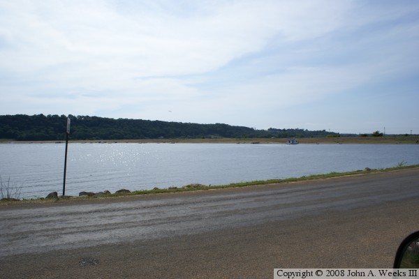
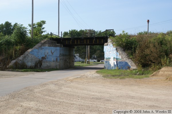
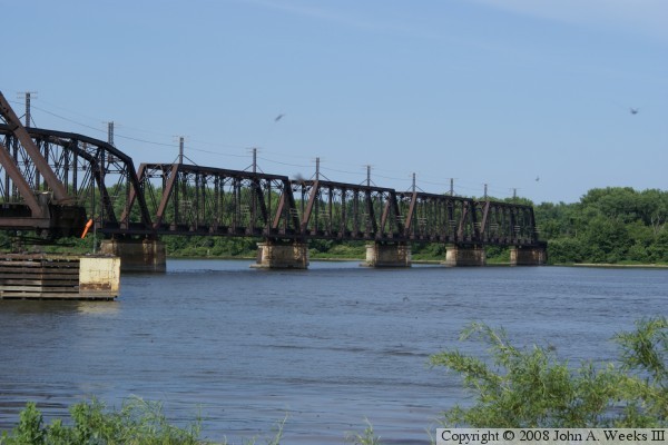
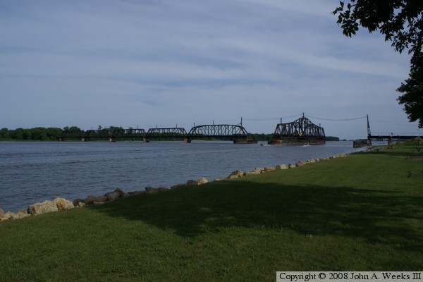
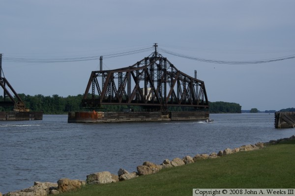
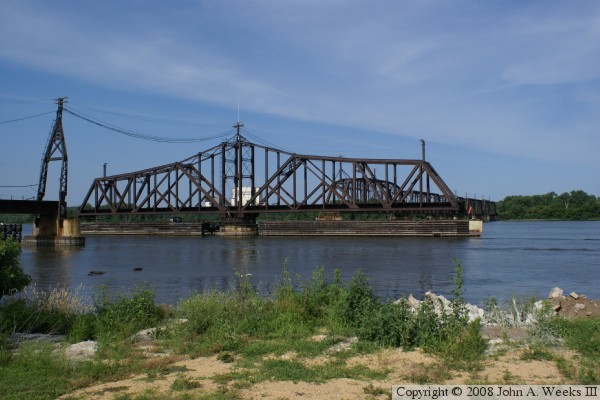
The river crossing is long and circuitous. The crossing starts on the west side of the river in Iowa. The line has a Y that is mostly a causeway built over water. From there, a 3,170 foot long causeway carries the rail line into the island city of Sabula, Iowa. The city itself is 1,000 feet wide. The rail line is on an elevated earthen embankment across the entire city. There is one small bridge in the causeway to allow a street to cross under the railroad. To the east of Sabula is the main channel of the Mississippi River. The steel structure is 1,910 feet long, of which 364 feet is a swing span. Both sides of the pivot point are navigable, with the northbound channel being 2 feet narrower than the southbound channel. The steel structure ends on the east side of the main channel. The photos would suggest that this is the end of the crossing. Instead, what looks like the Illinois mainland on the east side of the Mississippi River is actually just a thin island between the main channel and Edick Lake. Here, the rail line follows this chain of islands and a causeway for two miles north. The rail line then crosses Savanna Slough and the Plum River before landing on the Illinois side of the river. This causeway is nearly 11,000 feet long.


Sabula Rail Bridge
Sabula Rail Bridge
Sabula Rail Bridge
Sabula Rail Bridge
Sabula Rail Bridge

Made With Macintosh
Authored by John A. Weeks III, Copyright © 1996—2016, all rights reserved.
For further information, contact: john@johnweeks.com