Current Weather Conditions
John A. Weeks III
Friday, April 19, 2024, 2:55:55 AM CDT
Home Photo Tours Rail Fan 12 Easy Steps
Aviation Spacecraft Highways & Bridges About The Author
 
Google Search
Maps   Groups   Images   Search
 
  Home
  • 12 Easy Steps
  • Aviation
  • Spacecraft
  • Highways & Bridges
    » Bridge Photography
      - MSP River Bridges
      - C & D Canal
      - Illinois River
      - Minnehaha Creek
      - Minnesota River
      - Mississippi River
        › Lake Itasca Area
        › Bemidji Area
        › Cass Lake - Ball Club
        › Grand Rapids Area
        › Blackberry - Crosby
        › Brainerd Lakes Area
        › Little Falls Area
        › St. Cloud Area
        › North Metro Area
        › Port Of Minneapolis
        › St. Anthony Falls Area
        › Mississippi Rvr Gorge
        › St. Paul Area
        › S St. Paul - Hastings
        › Red Wing - Winona
        › La Crosse Area
        › Lansing - Clinton
          · Lock & Dam #8
          · Black Hawk Bridge
          · Big Slough Bridge
          · Stevens Slough Br
          · Henderson Slough Br
          · Winneshiek Slough Br
          · Lock & Dam #9
          · Washington Street
          · Blackhawk Avenue
          · Twin Suspension Br
          · Marquette-Joliet Br
          · East Channel Bridge
          · WI Street Bridge
          · Iowa Street Bridge
          · St. Feriole Is RR
          · Lock & Dam #10
          · Lock & Dam #11
          · Eagle Point Bridge
          · Dubuque-Wisconsin
          · City Island Bridge
          · 16th Street Bridge
          · CN RR Bridge
          · Julien Dubuque Br
          · Lock & Dam #12
          · Savanna-Sabula Br
          · Running Slough Br
          · Sabula Rail Bridge
          · Lock & Dam #13
          · Lyons-Fulton Bridge
          · Gateway Bridge
          · Sunfish Slough Br
          · C&NW Clinton Br
          · C&NW IL Ch RR
          · C&NW Sunfish Sl
        › Quad Cities Area
        › Muscatine - Louisiana
        › St. Louis Area
        › Chester - Cairo
        › Miss - Tenn - Ark
        › Ark - Miss - Louisiana
        › Louisiana Structures
      - Missouri River
      - St. Croix River
      - St. Louis River
      - Wisconsin River
      - Best Miss River Photos
      - Cable Stayed Bridges
      - McGilvray Road Bridges
      - I-35W Bridge Disaster
      - Miscellaneous Bridges
      - Madison County Bridges
      - Hist Br Weekend 2013
    » Road Geek Topics
  • Photo Tours
  • Rail Fan
  • About The Author
 
Site Search By JRank
Highways, Byways, And Bridge Photography
Lock & Dam #13
Mississippi River Lock & Dam
Fulton, Illinois

Lock & Dam #13

• Structure: Lock & Dam #13.
• Location: River Mile 522.5.
• Dam Width: 14,079 Feet Overall, 1,066 Foot Wide Dam Structure.
• River Elevation (Pool): 583 Feet.
• River Elevation (Outflow): 572 Feet.
• Water Fall: 11 Feet.
• Annual Lock Traffic: 4,345 Vessels, 18,028,000 Tons (2005).
• Date Opened: 1938.
Lock & Dam #13 is somewhat unusual in that it is located in the middle of the river. There are lengthy earthen dikes on each side of the main control structure. In fact, access, from the Illinois side, is by driving a mile and a half along the earthen embankment.

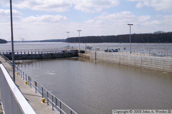
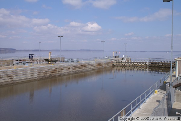
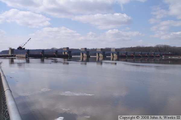
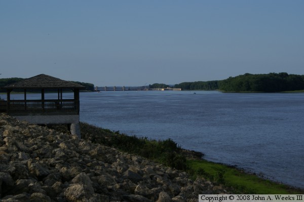
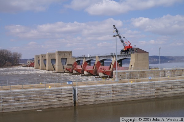
The main dam structure is 1,066 feet long, and features 10 Tainter gates and 3 wider roller gates. The Illinois side consists of a 8,940 foot earth embankment, while the Iowa side has a 4,073 foot earth embankment which includes a 1,650 foot secondary spillway. The locks are typical of the Mississippi River locks being 110 feet wide by 600 feet long. Many of the Mississippi River locks have a second uncompleted auxiliary lock, as does Lock & Dam #13. The auxiliary lock has the upper entrance doors installed and working, but no lower exit doors. The auxiliary lock could be opened if the main lock were to fail.


Lock & Dam #13
Lock & Dam #13
Lock & Dam #13
Lock & Dam #13

Made With Macintosh
Authored by John A. Weeks III, Copyright © 1996—2016, all rights reserved.
For further information, contact: john@johnweeks.com