|
|
| Highways, Byways, And Bridge Photography |
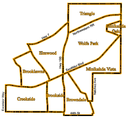
Saint Louis Park, MN, Ward #2
Neighborhood Boundary Signs
|
|
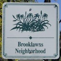
Brooklawns
The neighborhood name Brooklawns is due to its location near the
Minnehaha Creek. The neighborhood sign depicts a wetlands scene
with cattail plants.
|
|
|
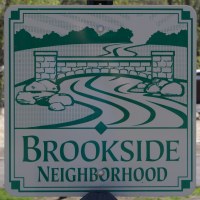
Brookside
Brookside is also named due to Minnehaha Creek, which runs through the
neighborhood. The neighborhood sign depicts a bridge crossing over the
creek.
|
|
|
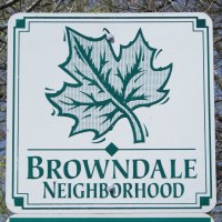
Browndale
Browndale is built on the former Browndale farm owned by industrialist Henry
Brown. The neighborhood sign depicts a tree leaf to commemorate the rows
of elm trees that once lined Browndale Avenue.
|
|
|
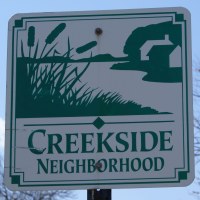
Creekside
Creekside is another neighborhood named for its proximity to Minnehaha
Creek. The neighborhood sign also depicts a wetlands scene.
|

|
|
Elmwood
Historic Elmwood was once an independent city that was closely tied to
the railroad industry. The neighborhood sign commemorates and early
railroad depot located along the Soo Line Railroad mainline.
|
|
|
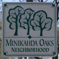
Minikahda Oaks
Minikahda Oaks is one of two neighborhoods named due to its location next
to the Minikahda Country Club. The neighborhood sign depicts the grove
of oak trees in the neighborhood.
|
|
|
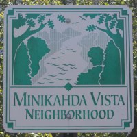
Minikahda Vista
Minikahda Vista is also named due to its location next to the Minikahda
Country Club. The neighborhood sign depicts a scene overlooking the
small stream that runs through the neighborhood.
|
|
|
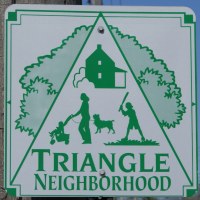
Triangle
The Triangle neighborhood takes its name from the wedge shaped land
located between Minnetonka Blvd and Highway 7. The neighborhood sign
depicts several family-oriented symbols.
|

|
|
Wolfe Park
This neighborhood is not signed as of the summer of 2010.
|
|
|
