| Highways, Byways, And Bridge Photography |
The Remembrance Garden At Night
A Photo Tour Of The I-35W Bridge
Memorial Remembrance Garden On A
Warm Summer Night In August, 2011
The I-35W bridge collapse memorial is known as the Remembrance Garden. It is
located about one-quarter mile west of the new I-35W Saint Anthony Falls Bridge
along West River Parkway. It is about a block east of the Guthrie Theater
and located directly north of Gold Medal Park. The garden was dedicated on
August 1, 2011, at 6:05 PM, exactly 4 years to the minute from the the
moment of the tragedy. This is a photo tour of the garden as seen around
midnight just days after it was unveiled.
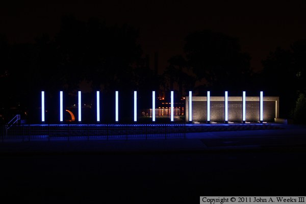
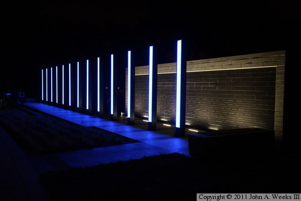
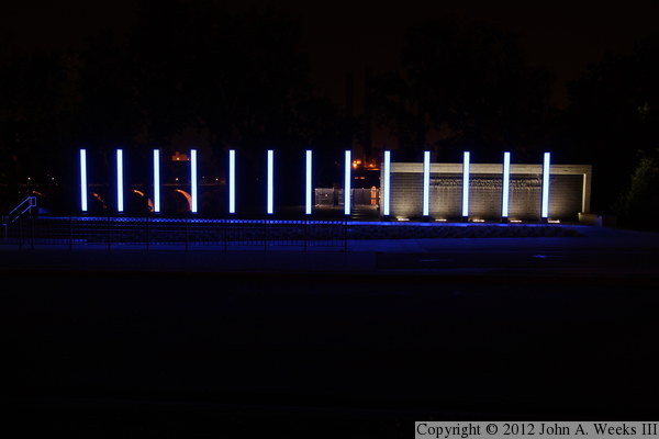
The photo above is the Remembrance Garden as seen looking north across
West River Parkway. The stone structure to the right is the water wall,
which is engraved with the names of survivors. The vertical columns have
the names of the people who died in the tragedy. The red arc on the left
is one span of the Stone Arch Bridge, while the lights in the center are
the observation deck and the Southeast Steam Plant (the later located on
the far side of the river).
Note—these materials are covered by copyright and may not be
used without written permission.
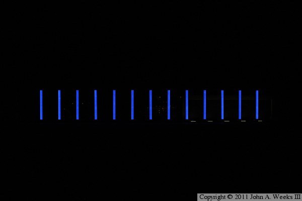
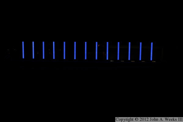
This photo is the same view as above, but with a shorter exposure to show the
true color the light on the 13 vertical columns. The blue color of the
columns matches the blue lighting on the new Saint Anthony Falls Bridge located
a quarter mile east of the memorial.
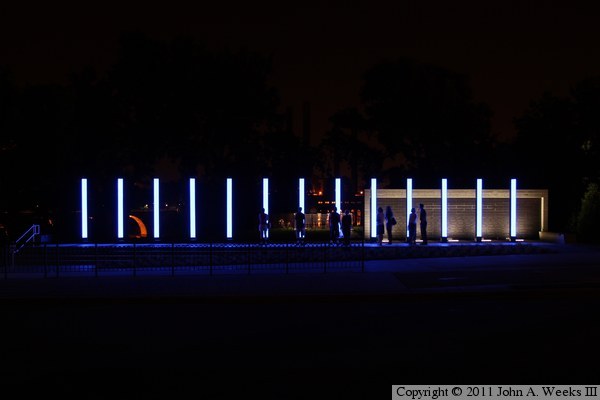
This photo is identical to the photo at the top of the page, but includes
people visiting the memorial. I saw a steady stream of visitors despite being
around midnight. A number of riders on the bicycle trail stopped to see the
memorial, as well as a number of people who walked over from the Guthrie
Theater.
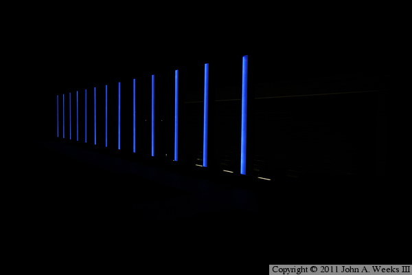
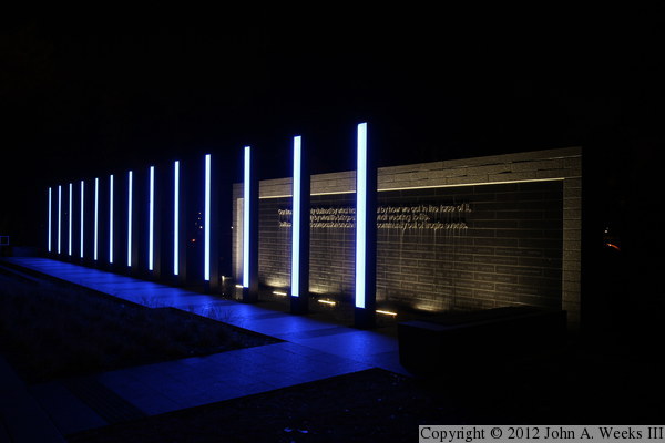
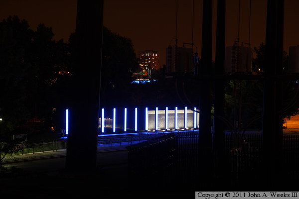
This is a view of the memorial looking west from the walking and bicycle
trail that passes in front of the memorial. The photo is exposed to show
the blue color of the columns.
This is the same photo, but exposed longer to show the water wall. The
water wall had been vandalized the day before I visited, so the lettering
at the top of the dark brown area had been removed for repair.
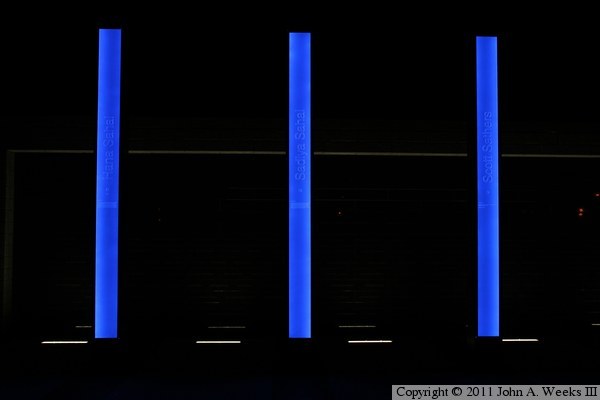
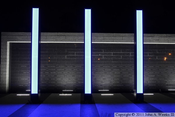
This is a close view of three columns, each of which represents one of the
fatalities in the bridge collapse. The panels are made from steel and use
LED lights to illuminate the lettering etched in a glass panel. They are
10-1/2 feet tall and are space approximately 6 feet apart.
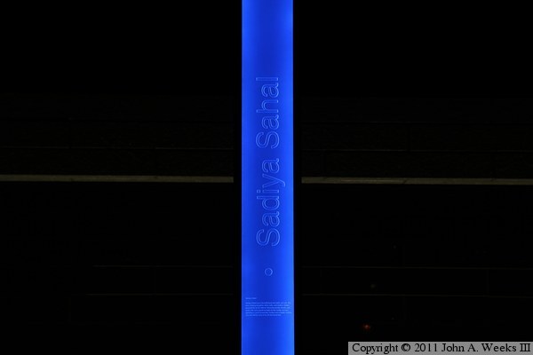
This is a closer view of the lettering etched into one of the columns.
This column represents Sadiya Sahal. Sahal was 23 years old. She had
recently graduated from a nursing assistant course, and was excited about
having earned her drivers license. She was driving with her 2 year old
daughter, Hana, to Saint Paul to visit relatives when they became stuck in
traffic on the I-35W Bridge. Both Sadiya and Hana perished in the collapse.
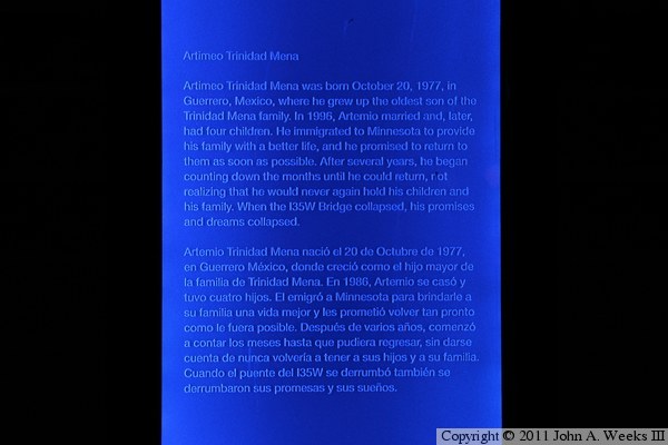
This is a close view of one of the biography for Artemio Trinidad-Mena.
Trinidad-Mena was a Mexican citizen who was working in the Twin Cities
area. He left a wife and four children. His story is also written in
Spanish to reflect the language of his homeland.
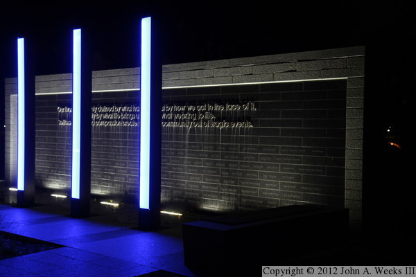
This is the same photo as the close view of the three columns above, but is
exposed longer to show the water wall. The darker stone near the top of the
wall is where the lettering was vandalized shortly after the memorial was
unveiled.
The letters on the memorial were reinstalled on Monday, September 12, 2011,
after having been removed for over a month following the vandalism that
occurred on August 3, 2011. The vandalism has never been solved, nor is it
known why only certain letters were removed. This view is looking west
from the sidewalk and bicycle trail that passes in front of the memorial.
This is a closer view of the survivor wall after the letters were reinstalled.
In order to prevent a repeat of the letter theft, workers used larger
threaded studs and a stronger adhesive to attach the letters. In addition,
a security camera was installed directly across the street.
This is a view of the survivor wall from across the street in Gold Medal Park.
The inscription reads, “Our lives are not only defined by what happens,
but by how we act in the face of it, not only by what life brings us, but by
what we bring to life. Selfless actions and compassion create enduring
community out of tragic events.”
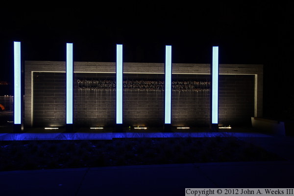
This photo is a wider view from across the street showing the entire memorial.
It is very similar to the photo at the top of the page, but it shows the
memorial with the lettering on the survivor wall.
This view is the same as the photo directly above, but is a much shorter
exposure that shows the true color of the blue light on the 13 columns.
The photo above is a view of the memorial from the top of the mound in Gold
Medal Park. This would be a perfect viewing location if it wasn't for the
giant electrical tower sitting directly in the way. The building in the
background is student housing on the University of Minnesota campus. The
blue line just below the building is the I-35W Saint Anthony Falls Bridge.
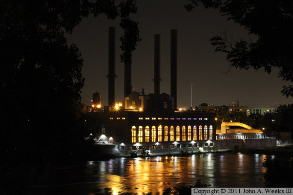
The photo below is the Southeast Steam Plant as seen from the observation
deck at the memorial. The steam plant once powered the Twin Cities street
car system, but now generates steam to heat the buildings on the U of M campus.
|
