Current Weather Conditions
John A. Weeks III
Friday, March 29, 2024, 12:00:20 AM CDT
Home Photo Tours Rail Fan 12 Easy Steps
Aviation Spacecraft Highways & Bridges About The Author
 
Google Search
Maps   Groups   Images   Search
 
  Home
  • 12 Easy Steps
  • Aviation
  • Spacecraft
  • Highways & Bridges
    » Bridge Photography
      - MSP River Bridges
      - C & D Canal
      - Illinois River
      - Minnehaha Creek
      - Minnesota River
      - Mississippi River
        › Lake Itasca Area
        › Bemidji Area
        › Cass Lake - Ball Club
        › Grand Rapids Area
        › Blackberry - Crosby
          · Blackberry Bridge
          · Old Blackberry Br
          · Jacobson Bridge
          · MN-232 Bridge
          · Soo Line Br (Palisade)
          · US-169 Br (Aitkin)
          · Aitkin Low Hd Dam
          · Aitkin Flood Channel
          · Aitkin Co. Hwy 1 Br
          · Aitkin Co. Hwy 22 Br
          · Punteney Bridge
          · MN-6 Br (Crosby)
        › Brainerd Lakes Area
        › Little Falls Area
        › St. Cloud Area
        › North Metro Area
        › Port Of Minneapolis
        › St. Anthony Falls Area
        › Mississippi Rvr Gorge
        › St. Paul Area
        › S St. Paul - Hastings
        › Red Wing - Winona
        › La Crosse Area
        › Lansing - Clinton
        › Quad Cities Area
        › Muscatine - Louisiana
        › St. Louis Area
        › Chester - Cairo
        › Miss - Tenn - Ark
        › Ark - Miss - Louisiana
        › Louisiana Structures
      - Missouri River
      - St. Croix River
      - St. Louis River
      - Wisconsin River
      - Best Miss River Photos
      - Cable Stayed Bridges
      - McGilvray Road Bridges
      - I-35W Bridge Disaster
      - Miscellaneous Bridges
      - Madison County Bridges
      - Hist Br Weekend 2013
    » Road Geek Topics
  • Photo Tours
  • Rail Fan
  • About The Author
 
Site Search By JRank
Highways, Byways, And Bridge Photography
Blackberry Bridge
Mississippi River Highway Crossing
Near Blackberry, MN

Blackberry Bridge

• Structure ID: NBI 31516
• Location: River Mile 1171.7
• River Elevation: 1,241 Feet
• County: Itasca
• Highway: Itasca County Highway 441
• Daily Traffic Count: 820 (2001)
• Bridge Type: Concrete Girder
• Bridge Length: 295 Feet, 72 Feet
• Bridge Width: 36 Feet, 2 Lanes
• Height Above Water: 22 Feet
• Date Built: 1978
The Blackberry Bridge is one of the 13 concrete girder bridges of the 16 highway bridges between and including Brainerd to Grand Rapids. This one is located in a very scenic area, as are all the bridges in this section of the Mississippi River. For travelers heading south, this is the last Mississippi River crossing before a stretch of about 50 miles of wilderness where there are no main highways, and even the Great River Road is mostly unpaved.

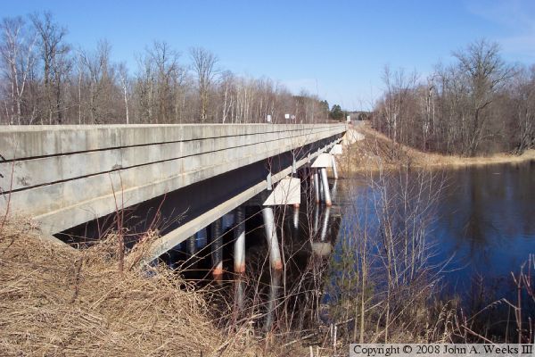
The bridge itself is a very typical concrete girder bridge. It has three sets of piers. The piers use the tubular steel pilings construction. Each pier has a slanted pile at each end to add side to side stability. The center pier has two slanted piles on each end, set at angles to each other. This pier gives the bridge additional stability along its long axis.

This bridge replaced a 1927 era bridge that was located on a different highway alignment. The big clue to the location of the old bridge is a side road named "Old Bridge Road".


Blackberry Bridge
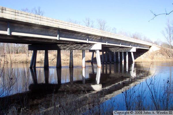
The photo above is a view of the river crossing from the northeast corner 
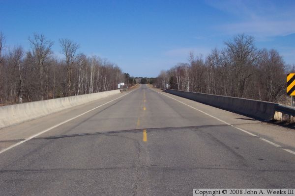
of the structure. The photo below is a view looking west down the length of the bridge deck. The photo at the top of the page is a view from the river level northeast of the structure.

Blackberry Bridge
Blackberry Bridge
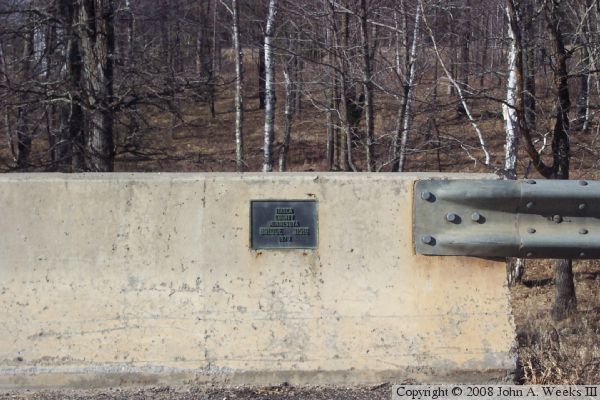
The photo above is the bridge plate. The photo below is the guide sign 
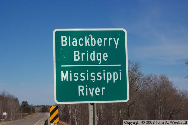
with the river and bridge names.

Blackberry Bridge

Made With Macintosh
Authored by John A. Weeks III, Copyright © 1996—2016, all rights reserved.
For further information, contact: john@johnweeks.com