| Highways, Byways, And Bridge Photography |
Soo Line Bridge
Mississippi River Trail Crossing
Palisade, MN
|
• Location: |
River Mile 1086.5 |
|
• River Elevation: |
1,202 Feet |
|
• County: |
Aitkin |
|
• Bridge Type: |
Steel Through Truss |
|
• Bridge Length: |
357 Feet, 104 Foot Longest Span |
|
• Bridge Width: |
16 Feet |
|
• Height Above Water: |
34 Feet |
|
• Date Built: |
1910 |
This railroad bridge was built as part of the Soo Line mainline across
north central Minnesota. The Soo Line crosses the Mississippi River a
second time in Bemidji, and that bridge has also been converted into a
rails-to-trails bridge.
When built, this bridge was over 1,000 feet long. Over time, the Soo
Line filled in all but the two approach spans. That leaves the configuration
that we see today, a truss main span, and two deck plate girder side spans.
Major fill work was added in 1943 and 1959, with the current configuration
being completed in 1964. The rail line was abandoned in 1985, and opened
as an early rails-to-trails project in 1988.
The rails-to-trails program seeks to preserve historic railroad rights of
ways by converting them into regional trails. The trails bring in
tourism. If a national emergency warrants rebuilding the railroad, the
right of way is graded and ready to go.
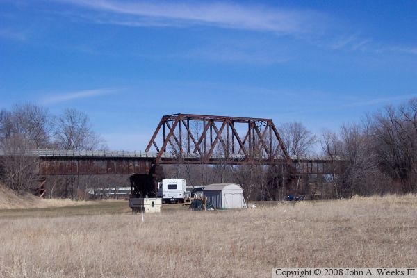
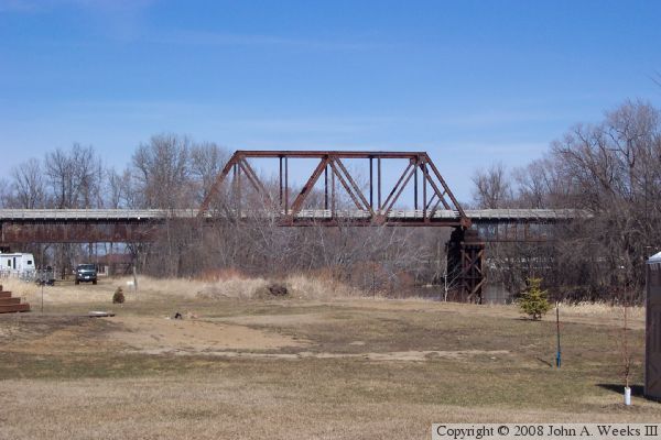
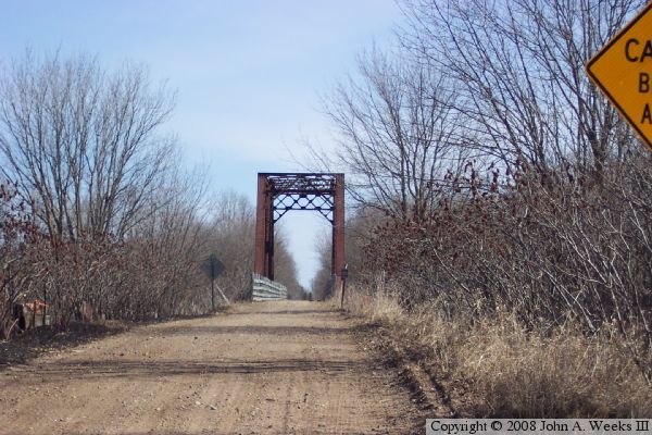
The photo above is a view of the bridge from the service road leading
into the RV park. The MN-232 highway bridge is visible in the background.
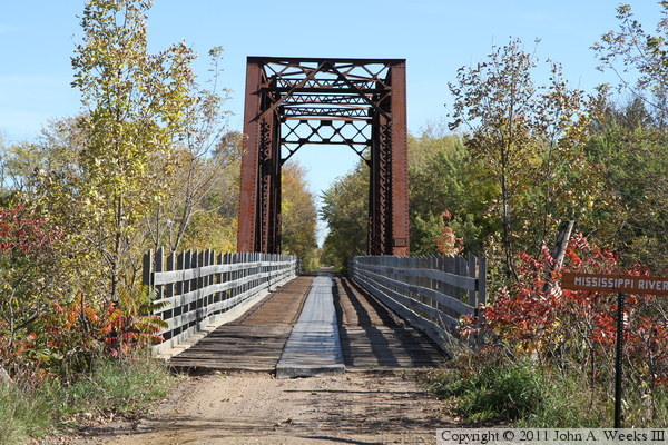
The photo below is looking east down the trail and across the bridge as
seen from the highway that runs just west of the structure. The
embankment was cut down as part of the conversion to be a trail bridge
to allow the trail to meet the highway.
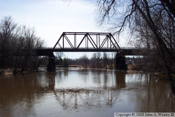
These two photos are views looking downstream to the south from the nearby
highway MN-232 bridge. The view is looking directly into the mid-day sun.
The photo above is from early spring before the trees leafed out, while the
photo below is from late autumn after the trees started to turn colors.
The brown water color is again apparent.
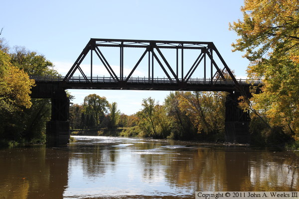
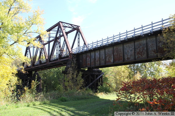
The photo above is looking upstream to the north towards the main truss
span of the Soo Line Bridge at Palisade from along the west bank of the
Mississippi River. The photo below is a view looking upstream to the north
from the RV park on the west side of the river. The white railing has been
added to the bridge as part of its conversion to be a trail bridge.
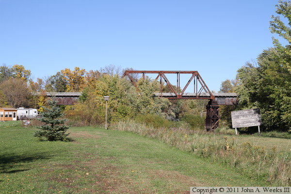
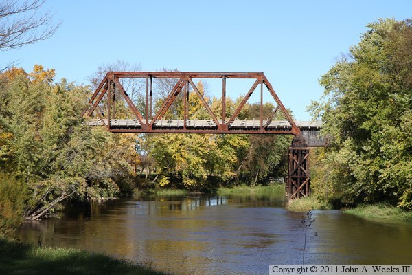
The photo above is a view looking north from the Great River Road at the
south edge of the RV park that is located adjacent to the bridge. The
Great River Road originally continued north and passed under the steel
deck girder span of the bridge. The road was rerouted west around the
RV park after the Soo Line sold the bridge to the State of Minnesota.
The state removed the embankment leading to the bridge, allowing the road
to cross the former railroad right-of-way 640 feet west of the river.
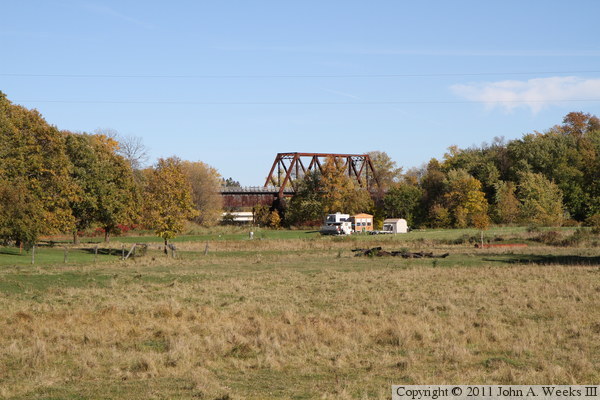
The photo below is looking northeast towards the bridge from the new
alignment of the Great River Road.
The photo above is the north face of the Soo Line Bridge where the Great
River Road once passed under the structure. The photo below is a view
looking across the river under the bridge. These are difficult photos
given the bright sun to the south and the darkness under the structure.
There are trees south of the bridge, making shots from that angle
impractical.
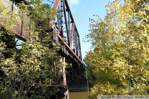
There is one very small gap in the trees south of the bridge, allowing these
two views of the sunny side of the structure. The photo above is looking
across the Mississippi River, while the photo below is looking up towards
the truss structure.
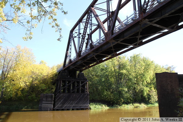
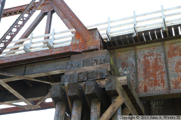
The photo above is the west main bridge pier, which consists of a series
of wooden piles. The photo below is a closer view of the structure at the
top of the bridge pier. These photos are overexposed to allow the detail
in the structure to be more easily seen.
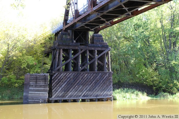
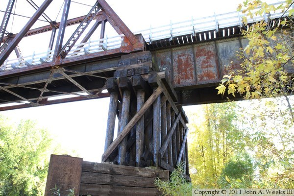
The photo above is the east main bridge pier. This section of the river
was once navigable for steam boats, which explains the need for the bridge
fenders. An additional fender is located upstream of each pier to protect
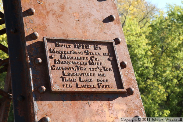
the piers from ice. The photo below is the bridge plate. It is interesting
in that it states the bridge capacity in addition to the builder.
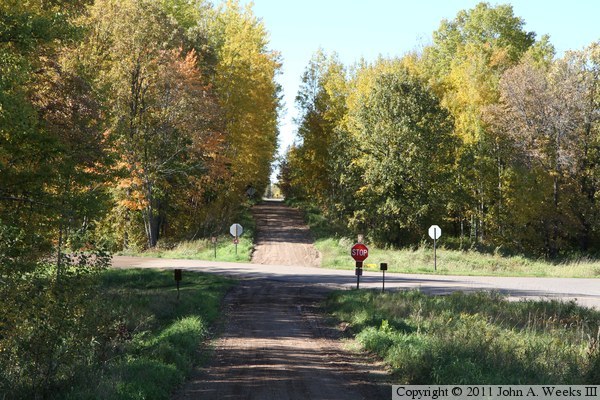
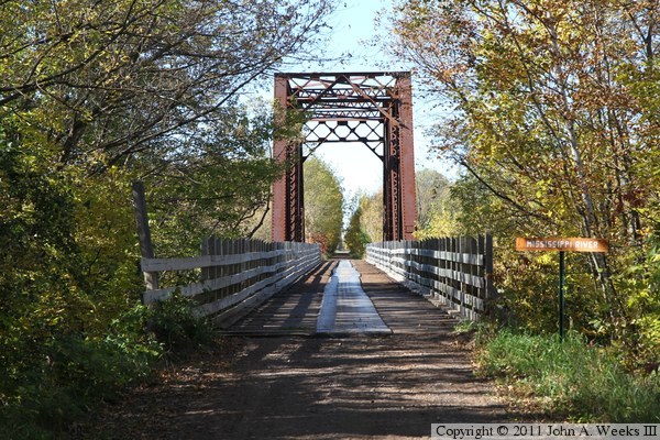
The photo above is looking west down the Soo Line Trail. The trail dips
down toward the Great River Road where the railroad right-of-way was
excavated to allow for the new path taken by the road. The photo below
is looking east towards the bridge from near the highway.
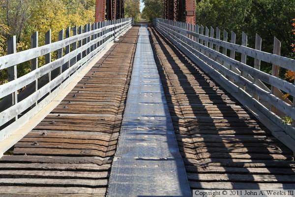
The photo above is the west end of the steel deck plate girder span as seen
from the Soo Line Trail. The photo below is a closer view of the deck. A
strip of conveyor belt runs the length of the bridge deck to make the
crossing a little smoother for bicycles.
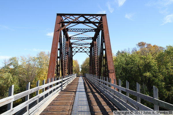
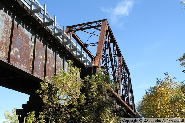
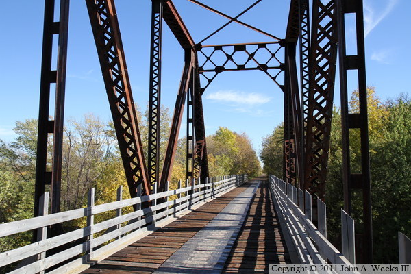
The photo above is the west bridge portal. The photo below is looking northeast
out the side of the bridge truss from near the center of the main truss span.
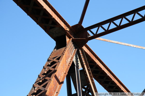
The photo above is a detail view of a steel joint at the top of the bridge
truss. The crisscross pattern joining the beams is very characteristic of
a bridge from near the turn of the 20th century. The photo below is looking
east out of the east end of the main bridge truss.
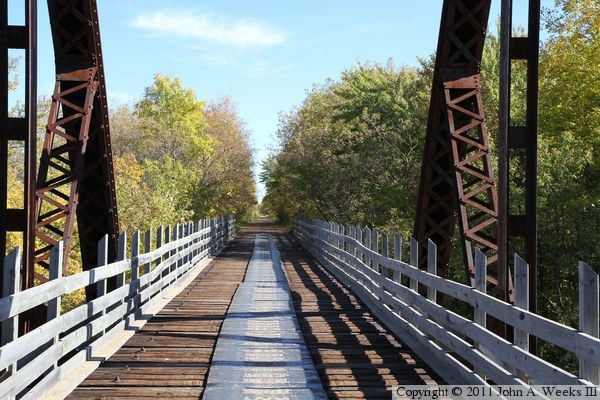
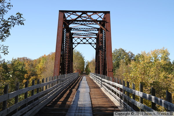
These two photos are looking west down the length of the bridge deck. The
photo above is approaching the bridge on the Soo Line Trail, while the photo
below is crossing the steel deck plate girder span on the east side of
the Mississippi River channel.
|
