Current Weather Conditions
John A. Weeks III
Wednesday, May 8, 2024, 4:11:02 PM CDT
Home Photo Tours Rail Fan 12 Easy Steps
Aviation Spacecraft Highways & Bridges About The Author
 
Google Search
Maps   Groups   Images   Search
 
  Home
  • 12 Easy Steps
  • Aviation
  • Spacecraft
  • Highways & Bridges
    » Bridge Photography
      - MSP River Bridges
      - C & D Canal
      - Illinois River
      - Minnehaha Creek
      - Minnesota River
      - Mississippi River
        › Lake Itasca Area
        › Bemidji Area
        › Cass Lake - Ball Club
        › Grand Rapids Area
        › Blackberry - Crosby
        › Brainerd Lakes Area
        › Little Falls Area
        › St. Cloud Area
        › North Metro Area
        › Port Of Minneapolis
        › St. Anthony Falls Area
        › Mississippi Rvr Gorge
        › St. Paul Area
        › S St. Paul - Hastings
        › Red Wing - Winona
        › La Crosse Area
          · Lock & Dam #7
          · Dresbach Bridge
          · Round Lake Bridge
          · French Slough Bridge
          · Rest Area Bridge
          · Black River Channel
          · Hiawatha Islands Br
          · Clinton Street Bridge
          · Fisherman's Bridge
          · CP RR La Crosse
          · CP RR East Channel
          · CP RR French Slough
          · CP RR Black Rr Br
          · Pettibone Park Br
          · The Miss River Br
          · West Channel Bridge
          · Isle La Plume Foot Br
          · Niedbalski Bridge
          · Green Island Bridge
          · Goose Island Bridge
        › Lansing - Clinton
        › Quad Cities Area
        › Muscatine - Louisiana
        › St. Louis Area
        › Chester - Cairo
        › Miss - Tenn - Ark
        › Ark - Miss - Louisiana
        › Louisiana Structures
      - Missouri River
      - St. Croix River
      - St. Louis River
      - Wisconsin River
      - Best Miss River Photos
      - Cable Stayed Bridges
      - McGilvray Road Bridges
      - I-35W Bridge Disaster
      - Miscellaneous Bridges
      - Madison County Bridges
      - Hist Br Weekend 2013
    » Road Geek Topics
  • Photo Tours
  • Rail Fan
  • About The Author
 
Site Search By JRank
Highways, Byways, And Bridge Photography
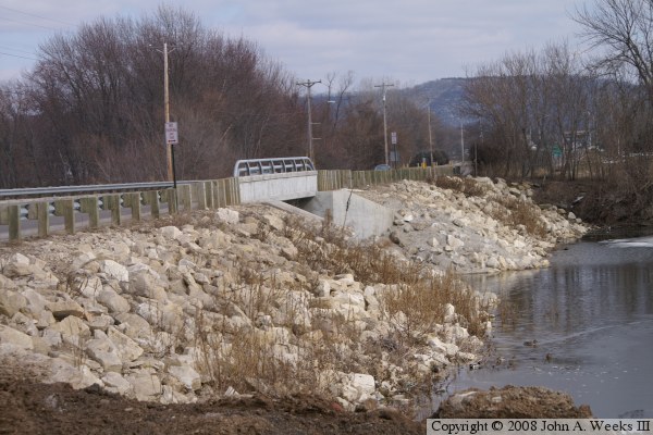
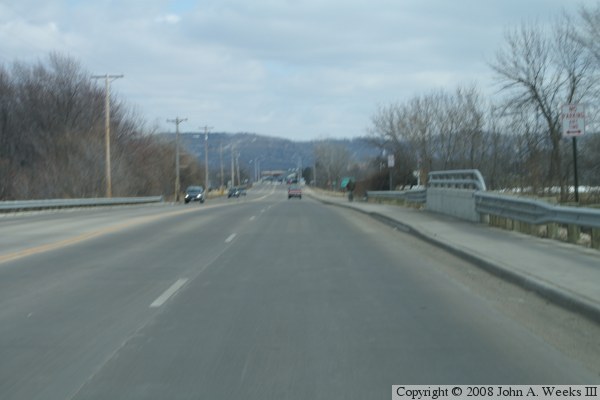
Fisherman's Bridge
Clinton Street Mississippi River Crossing At La Crosse
La Crosse, Wisconsin

Fisherman's Bridge

• Structure ID: NBI B32021100000000.
• Location: River Mile 700.3.
• River Elevation: 631 Feet.
• Highway: Clinton Street.
• Daily Traffic Count: 12,000 (2003).
• Bridge Type: Concrete Girder, Concrete Deck.
• Length: 50 Feet.
• Width: 52 Feet, 4 Lanes.
• Navigation Channel Width: Non-Navigable.
• Height Above Water:  
• Date Built: 2004.
This small bridge crosses a backwater slough of the merged Mississippi River and Black River known as Richmond Bay. It is located near a bar and restaurant once known as the Fisherman's Inn, hence the name. It is a popular fishing spot for channel catfish. Clinton Street is also known as County Road B, and it is only street level crossing from the Wisconsin mainland onto French Island (I-90 also crosses onto French Island, but as an Interstate highway rather than a street).

Fisherman's Bridge

Made With Macintosh
Authored by John A. Weeks III, Copyright © 1996—2016, all rights reserved.
For further information, contact: john@johnweeks.com