Current Weather Conditions
John A. Weeks III
Saturday, May 18, 2024, 7:24:45 PM CDT
Home Photo Tours Rail Fan 12 Easy Steps
Aviation Spacecraft Highways & Bridges About The Author
 
Google Search
Maps   Groups   Images   Search
 
  Home
  • 12 Easy Steps
  • Aviation
  • Spacecraft
  • Highways & Bridges
    » Bridge Photography
      - MSP River Bridges
      - C & D Canal
      - Illinois River
      - Minnehaha Creek
      - Minnesota River
      - Mississippi River
      - Missouri River
      - St. Croix River
        › Upper St. Croix River
        › Lower St. Croix River
          · Nevers Dam
          · St. Croix Falls Dam
          · US-8 Bridge
          · Highway 243 Bridge
          · Cedar Bend RR Br
          · Arcola High Bridge
          · WI Central RR Ruin
          · St. Croix Boom Site
          · Stillwater Lift Bridge
          · New St Croix R Br
          · C&NW RR Bridge
          · Walnut Street Cswy
          · Toll Bridge (Old)
          · I-94 Interstate Br
          · Point Douglas Draw
          · BNSF RR Bridge
      - St. Louis River
      - Wisconsin River
      - Best Miss River Photos
      - Cable Stayed Bridges
      - McGilvray Road Bridges
      - I-35W Bridge Disaster
      - Miscellaneous Bridges
      - Madison County Bridges
      - Hist Br Weekend 2013
    » Road Geek Topics
  • Photo Tours
  • Rail Fan
  • About The Author
 
Site Search By JRank
Highways, Byways, And Bridge Photography
New Saint Croix River Crossing
Proposed MN-36/WI-64 Saint Croix River Crossing
Stillwater, MN

New Saint Croix River Crossing

• Structure ID:
• Location: River Mile 22.0.
• River Elevation: 675 Feet.
• Highway: Future MN-36, WI-64.
• Traffic Count:
• Bridge Type: Concrete Extradosed.
• Length: 3,010 Feet (Estimated).
• Width: 4 Lanes.
• Navigation Channel Width: 500 Feet (Estimated).
• Height Above Water: 140 Feet (Estimated).
• Date Built: Projected 2012 To 2014.
A new bridge to span the Saint Croix River has been talked about for decades. The existing bridge, the Stillwater Lift Bridge, is old and narrow. It is located right downtown Stillwater, which means that through and rush hour traffic has to compete with local and tourist traffic. The result is a huge traffic mess in an area that deserves to be much more calm and relaxed.

Local stakeholders have opposed the new bridge for years. They cite the fact that Stillwater is the birthplace of Minnesota, the area is historic in nature, and the river is designated a wild and scenic river. They advocate that a new bridge would spoil the scenery. They also refuse to give up the lift bridge, stating that it is also a historic attraction.

At the same time, population pressures are pushing Twin Cities area residents into western Wisconsin in ever growing numbers. People who live on the Wisconsin side say that they deserve a reasonable highway connection to the Twin Cities. Indeed, a new bridge would likely open the flood gates for migration into western Wisconsin. Land owners would love to see that happen.

The bridge process fell apart in the late 1990s as a vast majority of the stakeholders simply would not accept a new bridge of any kind. The process was restarted in the early 2000s as part of a new federal program to speed up the environmental impact study process. Of seven projects in that program, the other six have since been built. A new sleek and thin bridge design has been approved by all concerned parties, the environmental impact study is approved, and initial funding is in place. This is enough to start some of the preparation work, and get ready to start foundations. Some of the prep work that has been lumped into this project is to remove an equal number of local eyesore structures and reclaim spoiled land to make up for the visual impact of the new bridge.

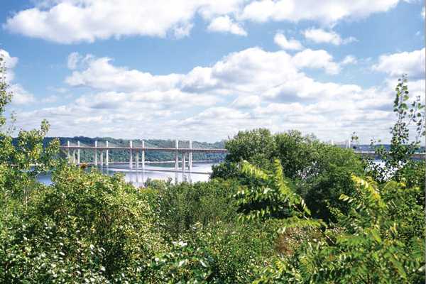
The bridge itself will be only the second extradosed bridge to be built in the United States. An extradosed bridge is similar to a cable stayed bridge, but with a major difference. In a cable stayed bridge, the cables hold up the deck segments. That requires tall towers and a steep angle for the cables. An extradosed bridge uses the shorter towers to support the deck segments near the tower. The relatively shallow angle of the cables means that they mostly pull the deck segments together rather than holding them up. The result is that the segments are held tightly together, so they essentially perform as single beams. The extradosed style is more expensive than a beam bridge, yet cheaper than a cable stayed bridge. It requires fewer pylons than a beam bridge, but more than a cable stayed bridge.

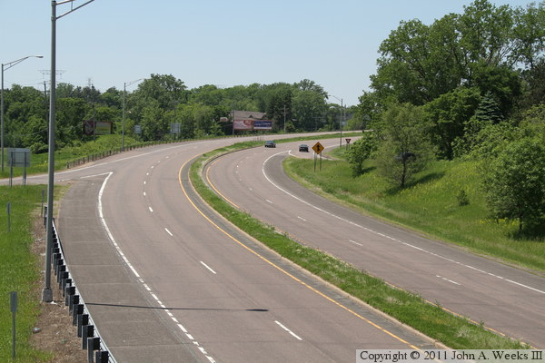
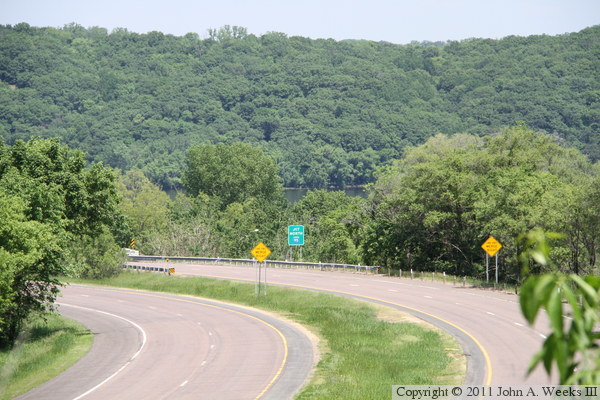
The bridge will connect MN-36 to WI-64. It will be located directly east of the expressway section of MN-36 that skirts the south side of Stillwater. The river makes a 45-degree jog to the west, so the bridge will cross northeast and southwest, directly perpendicular to the flow of water. Once the bridge lands in Wisconsin, a segment of freeway will head north to connect to a recently built freeway bypass of Somerset.

Update—it appears that the bridge project has fallen apart again. The National Park Service has withdrawn their approval of the bridge project. Their approval is a key factor given the river's status as a wild and scenic river.

Update—as of early 2011, support is again building for the bridge. Both of Minnesota's Senators, Amy Klobuchar and Al Franken, support the project, as well as Representative Michele Bachmann. They are attempting to introduce a bill in Congress that would make a special law to override the National Park Service, granting government approval to build the bridge.

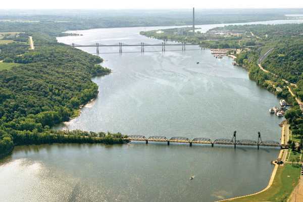
The image above is from the bridge project handouts. It depicts the river crossing and the freeway link to Minnesota.


New Saint Croix River Crossing
The photo above is a view looking west towards highway MN-36 on the Minnesota side of the Saint Croix River. MN-36 enters Stillwater from the west as a limited access freeway, then turns into an expressway through the west side of the city. It then starts down the bluffs and makes a turn to the north. The photo below, looking to the east, is the turn to the north where MN-36 joins MN-95 and becomes a two lane road. The new bridge would begin at this location, cross the Saint Croix River (visible in the center of the photo), then head northeast to join WI-64..

New Saint Croix River Crossing
The photo above is a view looking east across the Saint Croix River at the site of the proposed river crossing. The image below, taken from the project handouts, depicts the new bridge inserted into an aerial photo looking south from the area above the existing Stillwater Lift Bridge.

New Saint Croix River Crossing
These two images are also from the project handouts. The image above depicts the river spans as seen from the water level. The image below is a view of the bridge as seen from the river bluffs.

New Saint Croix River Crossing

Made With Macintosh
Authored by John A. Weeks III, Copyright © 1996—2016, all rights reserved.
For further information, contact: john@johnweeks.com