| Highways, Byways, And Bridge Photography |
Saint Croix Falls Dam
Saint Croix River Dam
Saint Croix Falls, WI
|
• Location: |
River Mile 53.6. |
|
• Structure Type: |
Concrete Gravity. |
|
• Structure Width: |
675 Foot Dam, 291 Foot Powerplant, 785 Foot Dike. |
|
• River Elevation (Pool): |
755 Feet. |
|
• River Elevation (Outflow): |
696 Feet. |
|
• Water Fall: |
59 Feet. |
|
• Date Built: |
1907. |
Native American activity goes back 5,000 years in this area. European
settlers moved into the area in the early 1800s. Many were attracted by
the potential mechanical power of the falls, which had a natural fall
of 55 feet. But the locals and various logging interests fought over
rights to the falls for so many years that Saint Croix Falls ended up
getting into the game late. Once the first sawmill opened, it was
run so poorly that it only cut a tiny percentage of the logs that were
transported downriver. While the local sawmill was unable to ramp up
in production, logs bypassed the cities to go down river to sawmills
as far south as Saint Louis.
Once the logging era was nearly played out, Northern States Power gained
rights to the falls. They constructed the concrete arched dam that we
see today. It has a 675 foot long arched dam 59 feet tall, one wide gate
that serves both as a log sluice and overflow gate, a power plant that
is 291 feet wide, and a secondary dike on the Minnesota side that is 785
feet long. The dam went on-line in 1907. It produces 25-megawatts of
electrical power. Funds from selling the power is used to offset local
property taxes, resulting in Saint Croix Falls having lower total taxation
than a typical Wisconsin resident would expect to pay.
To help build the dam, NSP also purchased the Nevers Dam 11 miles upstream.
The Nevers Dam was used to hold back water at critical points in the project
to allow construction to move forward more quickly. After the new hydro
dam went on-line, the Nevers Dam was used to smooth out the flow of water
arriving at Saint Croix Falls allowing the power dam to maximize its output.
The Nevers Dam became a maintenance problem, and was later ordered to be
kept open certain times of the year. With the Nevers Dam no longer able
to store any seasonal run-off water, it became less useful to NSP. As
a result, shortly after the Nevers Dam was damaged in the spring run-off
in 1954, NSP choose to remove Nevers Dam the following year.
As the turn of the century approached, environmentalists started calling
for the Saint Croix Falls Dam to be removed. They state that the uneven
river flow down stream hurts the fish population and it helps the growth
of invasive Zebra Mussels. While it is unlikely that the dam will be
removed, it is fun to think how spectacular the restored waterfalls would
be, and what its potential positive impact on tourism might be.
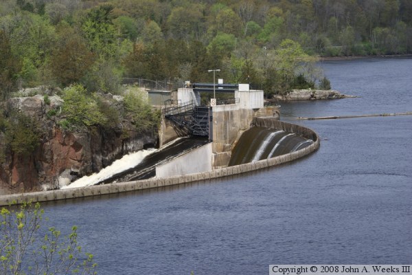
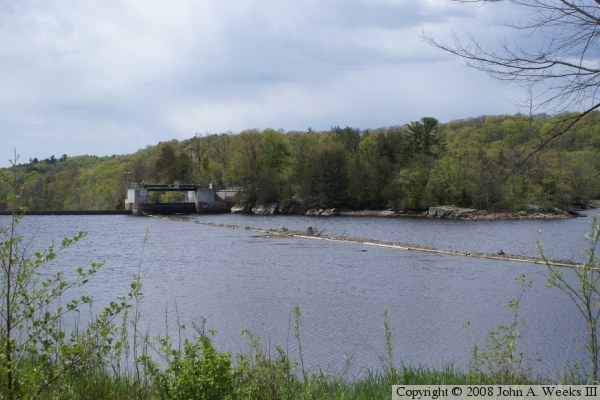
The photo at the top of the page is a view of the back side of the
horseshoe shaped main dam structure. The photo below is a view of the
dam looking north upriver from the US-8 highway bridge at Taylors Falls.
The dam is easily visible using a telephoto lens.
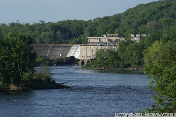
These two photos are views of the powerhouse. The photo above is the
side of the powerhouse and top of the electrical sub-station on the east
side of the river. The photo below is a view of the upriver side of the
powerhouse as seen from the overlook at the dam site.
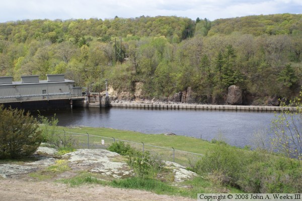
The photo above is the channel leading to the powerhouse intake as seen
from the overlook on the east side of the Saint Croix River. The photo
below is a view looking upriver from the overlook.

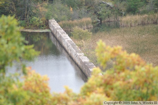
These two photos are views of the dam from the upriver side of the
structure. The photo above is the log sluice gate. The photo below
is the intake of the powerhouse.
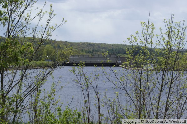
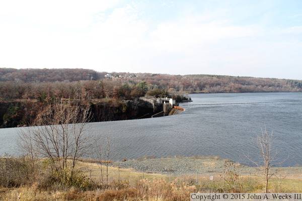
The photo above is looking southeast from an overlook on the Minnesota
side of the river towards a section of dam structure on the west side
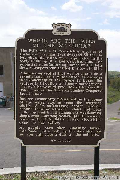
of the river valley. The photo below is the marker at the overlook
located on the Wisconsin side of the river.

These two photos, and the 12 that follow, are updated photos from 2011 (though
I didn't post them until 2015). The photo above is a close view of the dam
and the single sluice gate as seen from the Wisconsin side of the river.
The photo below is a view from the same location, but an overview shot
showing the water backed up behind the dam structure.

These two photos are views of the Saint Croix River Visitor Center, located
on the Wisconsin side of the river in St. Croix Falls. It has an excellent
view of the dam. They show a movie that gives an overview of the river and
how the National Wild and Scenic Rivers Act came to be, and its connection
to the Saint Croix River.

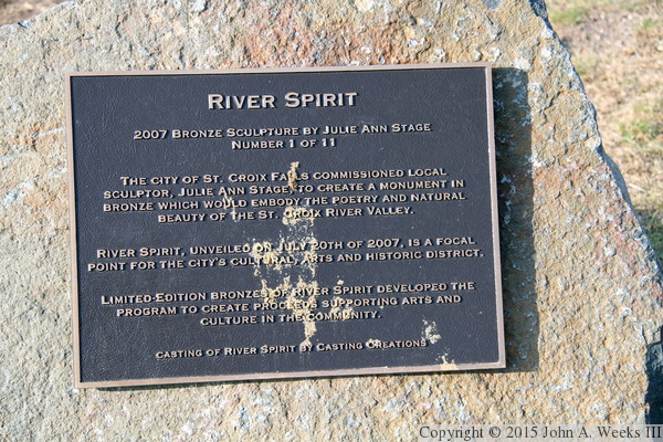
The photo above is a sculpture named ‘River Spirit’ located at
the visitor center, while the photo below is the plaque that describes the
artwork.
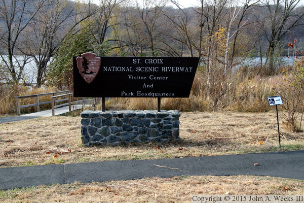
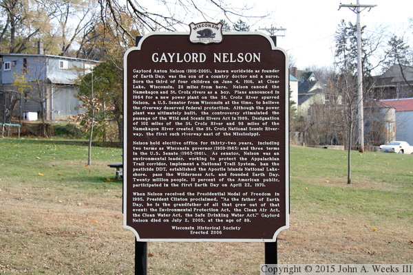
The photo above is the sign at the visitor center. The photo below is a
Wisconsin state historical marker discussing Gaylord Nelson. Nelson, who
was born in the area, was the Governor of Wisconsin as well as a Senator,
and is remembered as the founder of Earth Day.
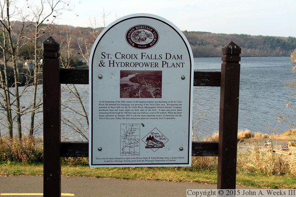
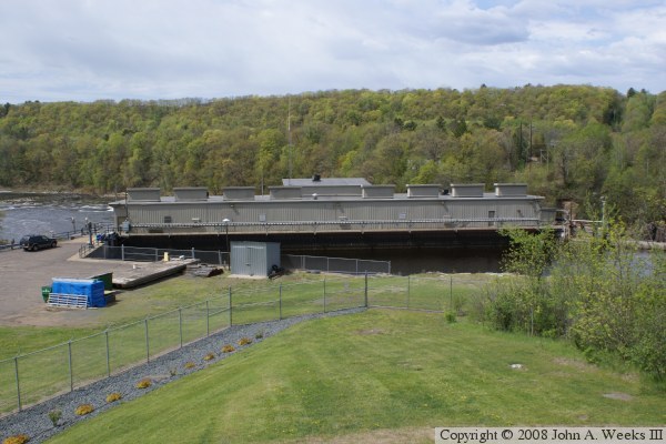
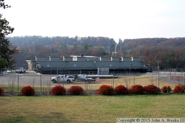
The photo above is a sign describing the dam and power plant that was funded
by a grant from the Wisconsin Department of Tourism. The photo below is the
upriver side of the power plant. This building is several stories tall, but
only the upper story is visible above the top of the dam.

The photo above is the sluice gate in the dam as seen from the upriver
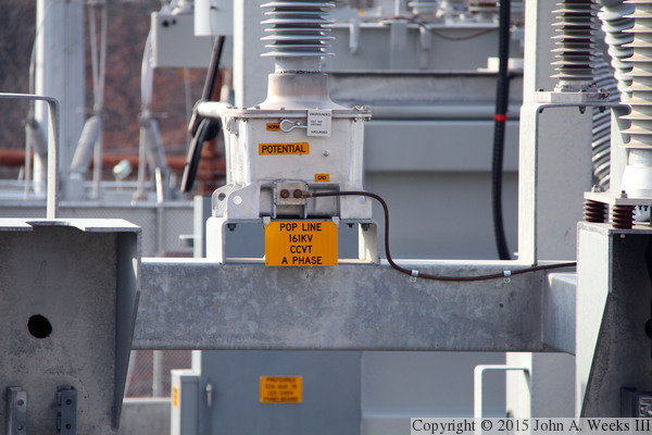
side. The photo below is a detail view of some of the equipment in the
power substation located near the power plant.

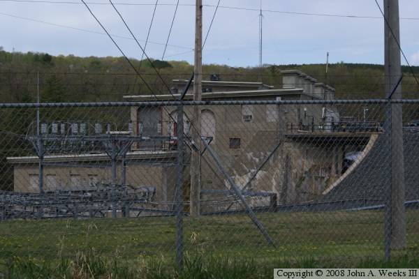
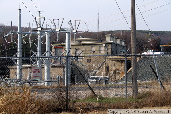
The photo above is the power substation located near the power plant, while
the photo below is a view of the power plant (and the top of the substation)
from a different angle.
|
