| Highways, Byways, And Bridge Photography |
Walnut Street Causeway Bridge
Former US-12 Saint Croix River Crossing
Hudson, WI

|
• Structure ID: |
NBI: P55070900000000 (WI). |
|
• Location: |
River Mile 16.7. |
|
• River Elevation: |
675 Feet. |
|
• Highway: |
Walnut Street, Former US-12. |
|
• Traffic Count: |
0. |
|
• Bridge Type: |
Steel Girder, Concrete Deck. |
|
• Length: |
154 Feet. |
|
• Width: |
24 Feet, 2 Traffic Lanes. |
|
• Navigation Channel Width: |
Non-Navigable. |
|
• Height Above Water: |
11 Feet. |
|
• Date Built: |
Opened 1940. |
The Walnut Street Causeway Bridge is part of the former Hudson Toll Bridge,
now fondly remembered as the Old Toll Bridge. The river crossing consisted of
this smaller bridge on the Wisconsin side of the crossing, a half-mile long
earthen causeway, and then a main channel bridge steel truss span on the
Minnesota side of the river.
The original bridge at this location was built in 1913. It was worn out and
narrow, so it was replaced with a more modern bridge in 1940. The 1940 bridge
was retired in 1951 when a new US-12 bridge was built about a half-mile
downstream resulting in the Toll Bridge being closed. While the main channel
span was quickly removed and recycled, the causeway bridge remained in place.
Today, the causeway bridge allows for pedestrians and bicycles to use
the causeway. One can walk or bike out to the very end, which was the
location of the toll booth. It is a nice spot to watch boat traffic,
and there is a small sandy beach. The other use for the causeway bridge
is to support tour boats. The tour boats dock along the causeway, and
passengers walk a short distance from shore to board the vessels. Vehicles
in support of the boats, such as those bringing out food, ice, and
mechanical parts, are also allowed to use the causeway.
The photo above is looking northwest towards the Walnut Street Causeway
from high over the river on the bluffs in Birkmose Park. Minnesota is
in the background while Hudson, Wisconsin, is on the near shore.
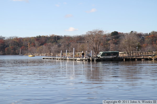
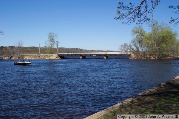
These two photos are views of the south face of the causeway looking west
from Lakefront Park in Hudson. The photo above is a shallow angle that
includes the boat dock on the Wisconsin side of the Saint Croix River.
The photo below is a little wider angle from slightly downstream of the
causeway.

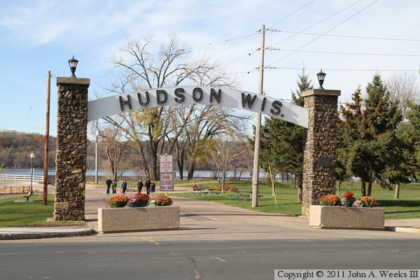
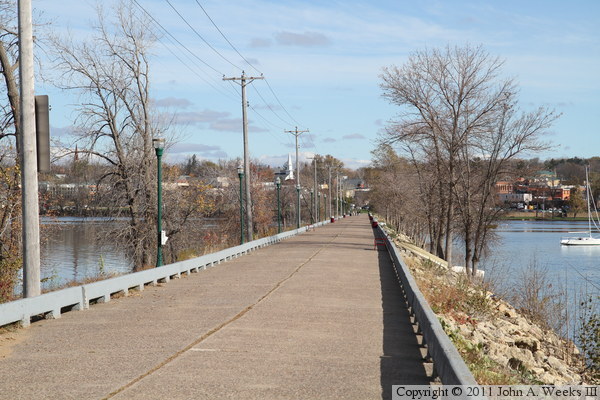
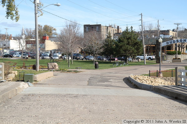
Our journey to the end of the causeway starts here at the famous Hudson
archway on a chilly autumn afternoon in 2010. The photo below is looking
west down the center of the causeway.
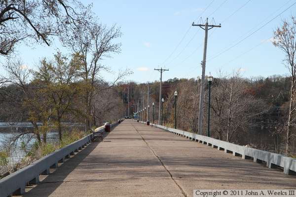
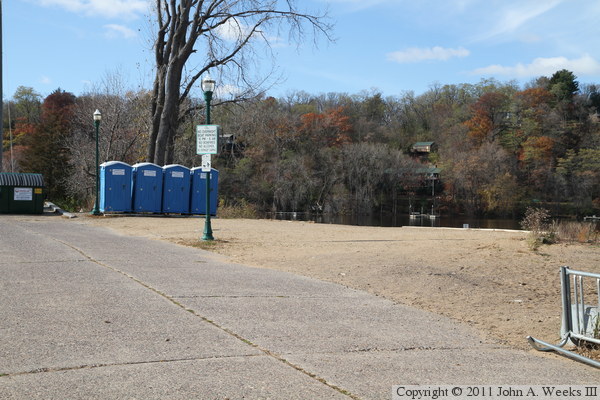
The photo above is a view looking west down the causeway from about one-third
of the way towards the site of the old Toll Bridge. The photo below is
the park at the end of the causeway. Since the afternoon sun was in the
west, most of the photos of the causeway were taken while walking back towards
the Wisconsin shore.
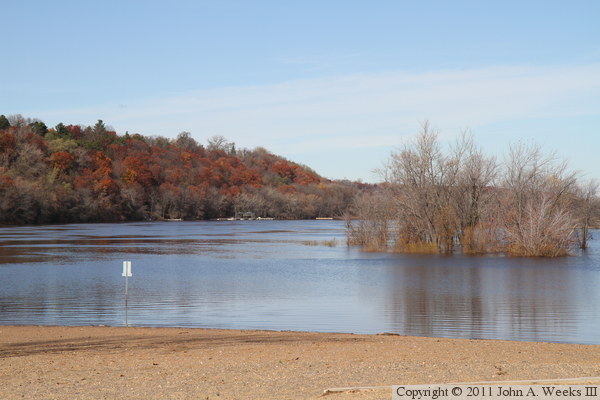
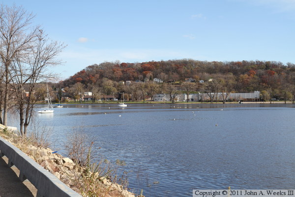
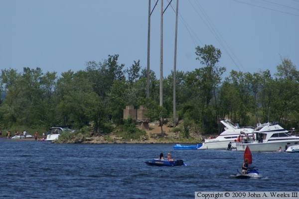
The photo above is looking north from the park at the end of the causeway.
A large sandbar has built up over the past century that is a popular
beach area for both folks walking in from Hudson and those arriving by
boat. The water is several feet higher than normal, resulting in the small
island to the north being flooded. The photo below is looking east towards
Hudson along the north face of the causeway.
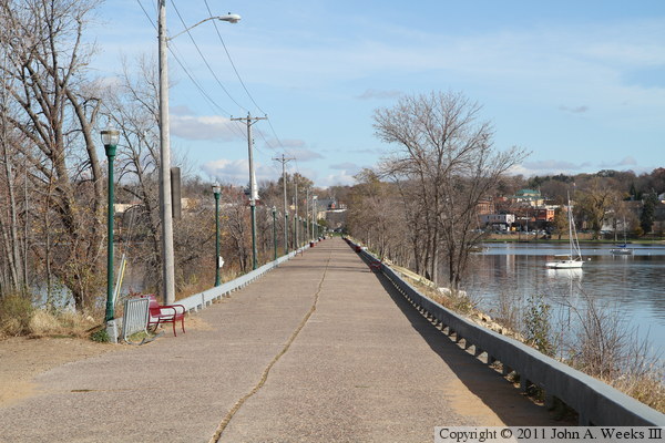
These two photos are views looking back towards Hudson from the west end
of the Walnut Street Causeway. The photo above is looking down the center
of the old highway, while the photo below is looking along the south edge
of the road.
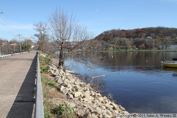
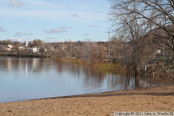
These two photos are looking southeast towards Hudson. The photo above
shows the riprap along the edge of the causeway along with some of the
accumulation of debris and old boats that have washed up in the flood.
The photo below is looking towards Hudson. Birkmose Park is on top of the
bluff in the background.
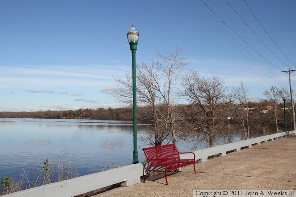
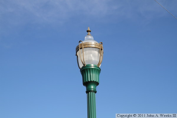
The causeway park is very well done and well maintained. The photo above
is an example of the decorative lighting. Park benches are located in
several places along the half-mile long road allowing for places to rest
or simply to watch the activity on the river. The photo below is a detail
view of one of the street lamps.

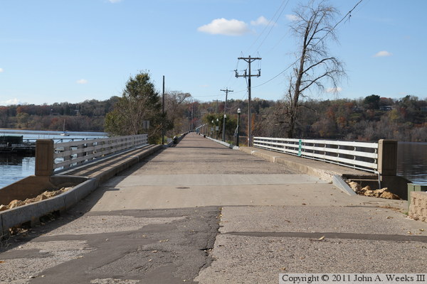
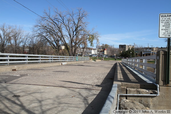
These two photos are views of the bridge at the east end of the causeway,
both looking east down the length of the bridge deck. The photo above
is looking down the center of the bridge. The photo below is a view from
the southwest corner of the structure.
The photo above is Hudson as seen from the center of the bridge, which
shows the slight curve in Market Street as it approaches the causeway. The
photo below is the end of our journey as we head towards the Hudson arch.


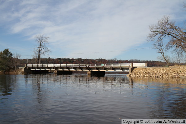
These two photos are views of the south face of the bridge at the east end
of the causeway as seen from Lakefront Park in Hudson. The photo above is
from near the causeway, while the photo below is from several dozen feet
downstream of the causeway.

The photo above is the bridge plate, which suggests that this structure was
built in 1940. This was long after the Toll Bridge was built, so this
bridge probably replaced an earlier through truss bridge. The photo below
is a view of the causeway bridge from the boat dock attached to the south side
of the causeway.

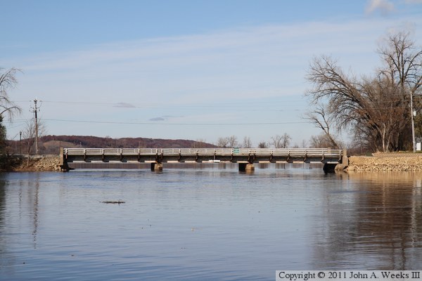
These two photos are looking north towards the south face of the causeway
bridge. The photo above is from a period of high water in the fall of 2010.
The photo below is a similar view from the spring of 2006 when the water
was also higher than normal.
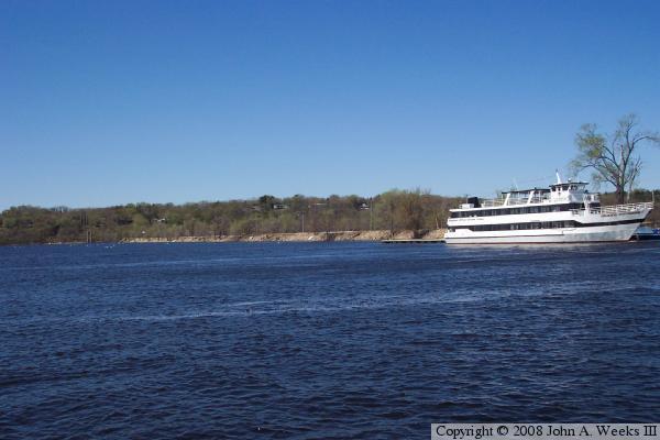
The photo above is looking northwest towards the causeway from Lakefront
Park in Hudson. A tour boat is tied up to the dock that is attached to the
causeway. The photo below is the west end of the causeway as seen
from a riverside park on the Minnesota side of the Saint Croix River.
|
