Current Weather Conditions
John A. Weeks III
Saturday, April 20, 2024, 11:33:37 AM CDT
Home Photo Tours Rail Fan 12 Easy Steps
Aviation Spacecraft Highways & Bridges About The Author
 
Google Search
Maps   Groups   Images   Search
 
  Home
  • 12 Easy Steps
  • Aviation
  • Spacecraft
  • Highways & Bridges
    » Bridge Photography
      - MSP River Bridges
      - C & D Canal
      - Illinois River
      - Minnehaha Creek
      - Minnesota River
      - Mississippi River
        › Lake Itasca Area
        › Bemidji Area
        › Cass Lake - Ball Club
        › Grand Rapids Area
        › Blackberry - Crosby
        › Brainerd Lakes Area
        › Little Falls Area
        › St. Cloud Area
        › North Metro Area
        › Port Of Minneapolis
        › St. Anthony Falls Area
        › Mississippi Rvr Gorge
        › St. Paul Area
        › S St. Paul - Hastings
        › Red Wing - Winona
        › La Crosse Area
        › Lansing - Clinton
        › Quad Cities Area
        › Muscatine - Louisiana
          · Lock & Dam #16
          · Norbert F. Beckey Br
          · Lock & Dam #17
          · Keithsburg RR Br
          · Lock & Dam #18
          · Great River Bridge
          · Burlington RR Br
          · Ft Madison/Niota Br
          · Des Moines Rpds Can
          · Lock & Dam #19
          · Keokuk Municipal Br
          · Keokuk-Hamilton Br
          · Lock & Dam #20
          · Quincy Rail Br
          · Quincy Bay Rail Br
          · Quinsippi Island Br
          · The Pier Restaurant
          · Quincy Bayview Br
          · Quincy Soldier's Mem
          · Lock & Dam #21
          · Wabash Bridge
          · Mark Twain Mem Br
          · Lock & Dam #22
          · Champ Clark Bridge
          · Louisiana RR Br
          · Lock & Dam #24
          · Lock & Dam #25
          · Sandy Slough Bridge
        › St. Louis Area
        › Chester - Cairo
        › Miss - Tenn - Ark
        › Ark - Miss - Louisiana
        › Louisiana Structures
      - Missouri River
      - St. Croix River
      - St. Louis River
      - Wisconsin River
      - Best Miss River Photos
      - Cable Stayed Bridges
      - McGilvray Road Bridges
      - I-35W Bridge Disaster
      - Miscellaneous Bridges
      - Madison County Bridges
      - Hist Br Weekend 2013
    » Road Geek Topics
  • Photo Tours
  • Rail Fan
  • About The Author
 
Site Search By JRank
Highways, Byways, And Bridge Photography
Great River Bridge
US-34 Mississippi River Crossing At Burlington
Burlington, Iowa

Great River Bridge

• Structure ID: NBI 000000000023441.
• Location: River Mile 404.20.
• River Elevation: 518 Feet.
• Highway: US-34.
• Daily Traffic Count: 10,700 (2002).
• Bridge Type: Cable Stayed.
• Length: 2,267 Feet Overall.
• Width: 5 Traffic Lanes.
• Navigation Channel Width: 644 Feet.
• Height Above Water: 60 Feet.
• Date Built: Opened October 4, 1993.
The new Great River Bridge in Burlington, Iowa, was the start of a ten year project to transform the riverfront from a rundown and most abandoned industrial area to a gem of a waterfront district that combines parks, commercial, and residential spaces. The bridge is a very graceful single tower cable stay bridge. It replaced the 1918 era MacArthur Bridge.

The bridge was under construction during the 1993 flood. The bridge was above the waterline during the flood, so construction continued during the food. The construction offices were flooded out, so a temporary office was set up in a old semi-trailer. At the peak of the food, the old bridge, the MacArthur, was the only bridge open between the Quad Cities and Saint Louis. The MacArthur was finally shut down for 4 days, not because of issues with the bridge, but from concerns that the vibrations of the bridge would weaken the nearby levees.

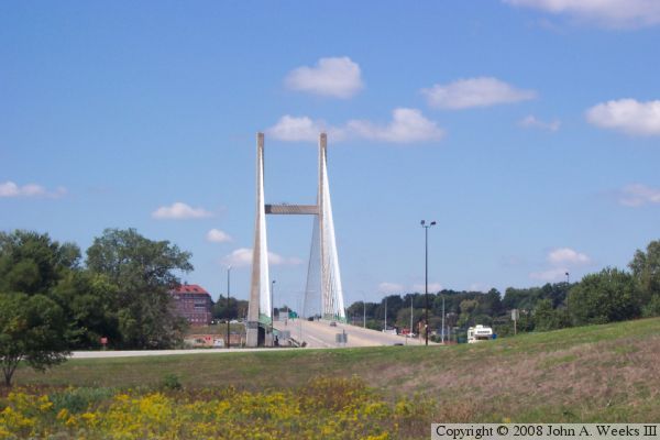
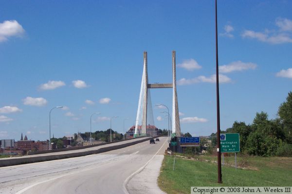
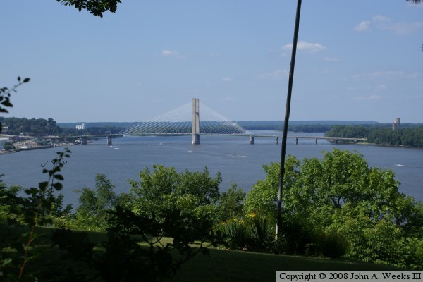
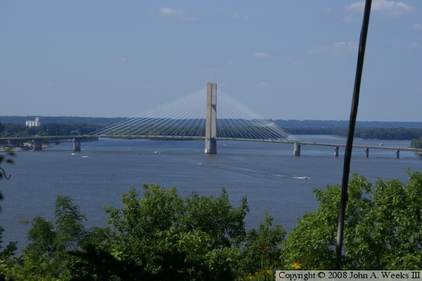
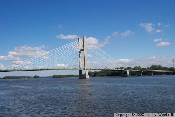
The Great River Bridge is interesting from several vantage points. First, it is a single tower cable stay bridge, unusual for such a large river crossing. Second, it is asymmetrical. That is, the suspended deck on one side of the tower is shorter than the deck on the other side of the tower. Third, it has an unequal number of stay cables. There are 13 pair on the east side, 14 pair on the west side. Fourth, the suspended deck does not fully cross the main river channel. Rather, the east side has a steel girder causeway leading up to the main bridge that spans a third of the channel. The main tower is about in the center of the river. Finally, the bridge has 8 lifter cables to ensure that it stays level. Those cables run from the main tower to the deck on the east side, connecting to the deck east of the first short pier. These cables lift the deck east of the sort pier, which puts downward force on the deck in the suspended span. This helps prevent some of the hump that would occur as temperatures change, and materials expand and contract.

The main tower is reported to be 370 from bedrock to the top. I have not found a number for how high the tower is above the waterline. I estimate that it is 300 feet based on measuring photographs.


Great River Bridge
Great River Bridge
Great River Bridge
Great River Bridge

Made With Macintosh
Authored by John A. Weeks III, Copyright © 1996—2016, all rights reserved.
For further information, contact: john@johnweeks.com