Current Weather Conditions
John A. Weeks III
Thursday, April 18, 2024, 9:26:26 AM CDT
Home Photo Tours Rail Fan 12 Easy Steps
Aviation Spacecraft Highways & Bridges About The Author
 
Google Search
Maps   Groups   Images   Search
 
  Home
  • 12 Easy Steps
  • Aviation
  • Spacecraft
  • Highways & Bridges
    » Bridge Photography
      - MSP River Bridges
      - C & D Canal
      - Illinois River
      - Minnehaha Creek
      - Minnesota River
      - Mississippi River
        › Lake Itasca Area
        › Bemidji Area
        › Cass Lake - Ball Club
        › Grand Rapids Area
        › Blackberry - Crosby
        › Brainerd Lakes Area
        › Little Falls Area
        › St. Cloud Area
        › North Metro Area
        › Port Of Minneapolis
        › St. Anthony Falls Area
        › Mississippi Rvr Gorge
        › St. Paul Area
        › S St. Paul - Hastings
        › Red Wing - Winona
        › La Crosse Area
        › Lansing - Clinton
        › Quad Cities Area
        › Muscatine - Louisiana
          · Lock & Dam #16
          · Norbert F. Beckey Br
          · Lock & Dam #17
          · Keithsburg RR Br
          · Lock & Dam #18
          · Great River Bridge
          · Burlington RR Br
          · Ft Madison/Niota Br
          · Des Moines Rpds Can
          · Lock & Dam #19
          · Keokuk Municipal Br
          · Keokuk-Hamilton Br
          · Lock & Dam #20
          · Quincy Rail Br
          · Quincy Bay Rail Br
          · Quinsippi Island Br
          · The Pier Restaurant
          · Quincy Bayview Br
          · Quincy Soldier's Mem
          · Lock & Dam #21
          · Wabash Bridge
          · Mark Twain Mem Br
          · Lock & Dam #22
          · Champ Clark Bridge
          · Louisiana RR Br
          · Lock & Dam #24
          · Lock & Dam #25
          · Sandy Slough Bridge
        › St. Louis Area
        › Chester - Cairo
        › Miss - Tenn - Ark
        › Ark - Miss - Louisiana
        › Louisiana Structures
      - Missouri River
      - St. Croix River
      - St. Louis River
      - Wisconsin River
      - Best Miss River Photos
      - Cable Stayed Bridges
      - McGilvray Road Bridges
      - I-35W Bridge Disaster
      - Miscellaneous Bridges
      - Madison County Bridges
      - Hist Br Weekend 2013
    » Road Geek Topics
  • Photo Tours
  • Rail Fan
  • About The Author
 
Site Search By JRank
Highways, Byways, And Bridge Photography
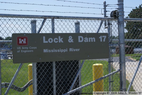
Lock & Dam #17
Mississippi River Lock & Dam
New Boston, Illinois

Lock & Dam #17

• Structure: Lock & Dam #17.
• Location: River Mile 437.1.
• Dam Width: 3,250 Feet Overall, 1,211 Foot Main Structure.
• River Elevation (Pool): 536 Feet.
• River Elevation (Outflow): 528 Feet.
• Water Fall: 8 Feet.
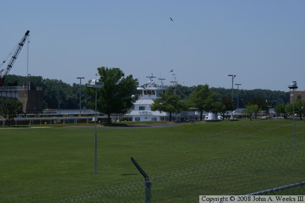
• Annual Lock Traffic: 2,645 Vessels, 22,597,000 Tons (2005).
• Date Opened: May 14, 1939.
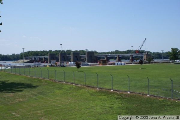
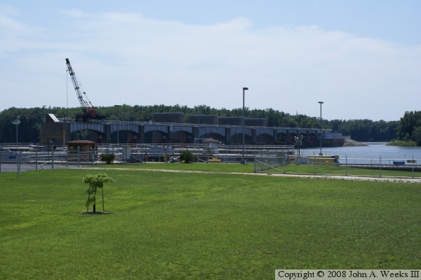
Lock & Dam #17 is very much like its upstream sister structure Lock & Dam #16. Like that dam, #17 has a structure holding back the main river channel that runs between the Illinois side of the river and connects to Otter Tail Island. An earthen low water dam blocks the secondary channel known as Turkey Chute, which runs from the island to the Iowa side of the great river. The main dam consists of 3 roller gates and 9 Tainter gates. The lock structure has a standard 600 foot long by 110 foot wide main lock, plus an unfinished auxiliary lock.

Lock & Dam #17
Lock & Dam #17
Lock & Dam #17

Made With Macintosh
Authored by John A. Weeks III, Copyright © 1996—2016, all rights reserved.
For further information, contact: john@johnweeks.com