County 110 appears to exist for no apparent reason. It really doesn't
go anywhere, nor does it connect anything. The fact that only about 200
vehicles a day reinforces that opinion. The road is actually in very
nice condition, and appears to be well maintained. That again is a bit
unexpected given that this road was upgrade from a national forest road
that was cut out of the wilderness during the logging era a hundred years
ago. The only real reason I can find to explain this road is that it is
a short-cut between Two Harbors and Silver Bay, major taconite shipping
areas, and the mines of the eastern Iron Range.
County 110 is also known as Skibo Lookout Road. The road is named after
a former fire watch tower located on a hill a few miles south of the Saint
Louis River. This hill has a commanding view of the area and was an ideal
location for a fire watch tower. The tower has since been removed. The
site is now a wayside vista point with a parking area. There is a fantastic
view from this site.
The bridge is a generic precast concrete girder bridge, typical of what
MN-DOT would build when an economical and maintenance free bridge is
needed. What is a bit uncommon is that the bridge is a single span. It
does not have any support piers, and is supported only at the ends by
the abutments. While the bridge has no decorative features, it does
have the modern style of guardrail.
The driving surface on the bridge is asphalt. That again is a bit
unusual. The bridge deck most likely is concrete. At some point since
the bridge was built, the highway was repaved. Rather than cutting out
the pavement near the bridge and matching the blacktop to the bridge
deck, the paving crew simply paved right over the bridge. There is
no harm in doing this, but it is a waste of material, and it adds
unplanned weight to the bridge.
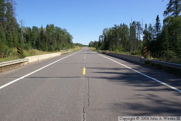
The photo above is looking south down the center of the deck of the Skibo
Lookout Road Bridge. Given the low traffic count, one would probably have
to stand in this location for a considerable amount of time before they
would have any risk of being run over.
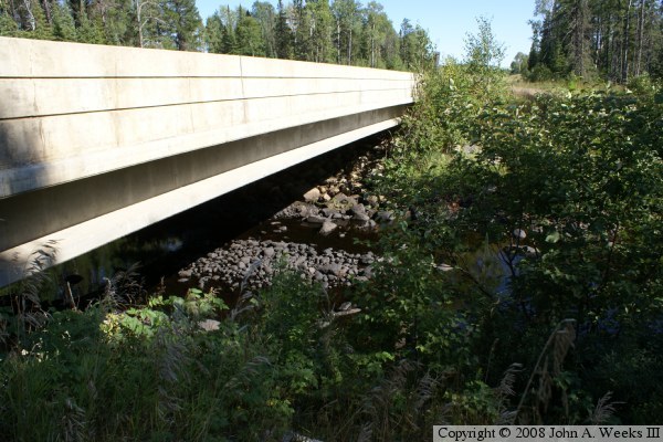
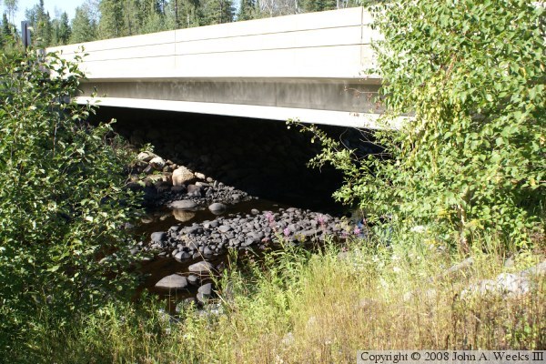
These two photos are the downriver west side of the Skibo Lookout Road
Bridge. The photo above is looking south across the Saint Louis River
from the northwest corner of the structure, while the photo below is looking
north across the Saint Louis River from the southwest corner of the bridge.
The water level is very low in these late summer views, exposing the black
rock that forms the bed of the river channel.
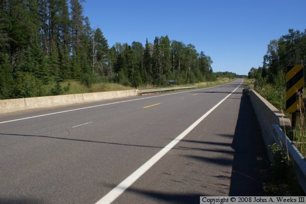
The photo above is looking southeast across the bridge deck from the
northwest corner of the structure. The low afternoon sun located behind
the photographer makes for a very nice deep blue sky on one of those rare
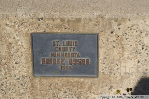
clear sky days. The photo below is the bridge plate.
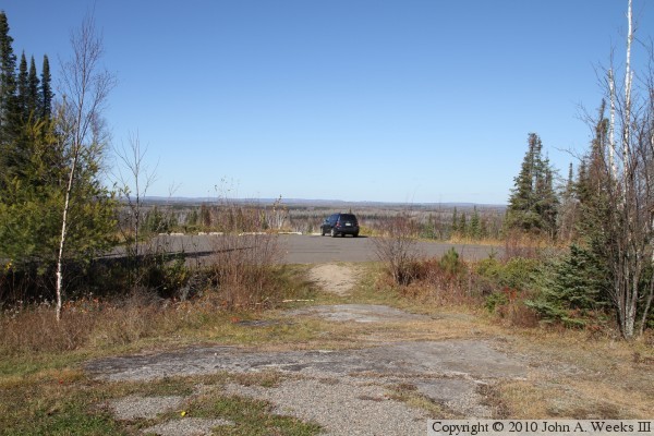
The photo above is looking north from the Skibo Overlook, a parking area
maintained by the National Forest Service at the site of the former Skibo
Lookout Tower. The Saint Louis River is about 3 miles north of this location.
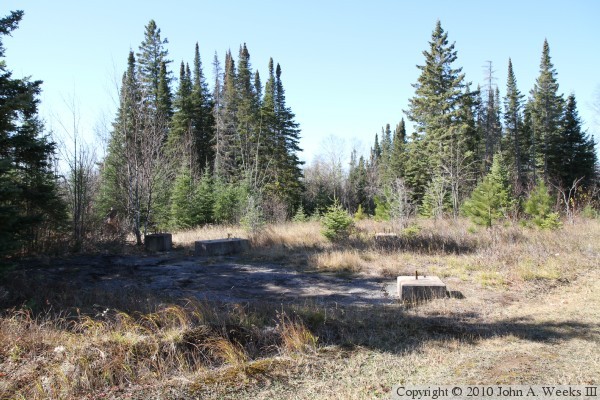
The photo below is the foundation where the lookout tower once stood.