Current Weather Conditions
John A. Weeks III
Friday, May 3, 2024, 4:43:04 PM CDT
Home Photo Tours Rail Fan 12 Easy Steps
Aviation Spacecraft Highways & Bridges About The Author
 
Google Search
Maps   Groups   Images   Search
 
  Home
  • 12 Easy Steps
  • Aviation
  • Spacecraft
  • Highways & Bridges
    » Bridge Photography
      - MSP River Bridges
      - C & D Canal
      - Illinois River
      - Minnehaha Creek
      - Minnesota River
      - Mississippi River
      - Missouri River
      - St. Croix River
      - St. Louis River
        › St. Louis Headwaters
          · N Shore Mining RR
          · ATV Trail Bridge
          · Skibo Mill Site
          · Skibo Bridge
          · Skibo Lookout Road
          · NF-790 Trail Bridge
          · Moose Line Road Br
        › Upper St. Louis River
        › Forbes - US-53 Area
        › Up Mid St. Louis River
        › Lw Mid St. Louis River
        › Fond du Lac Reservatn
        › Cloquet - Scanlon
        › Jay Cooke State Park
        › Twin Ports Harbor
      - Wisconsin River
      - Best Miss River Photos
      - Cable Stayed Bridges
      - McGilvray Road Bridges
      - I-35W Bridge Disaster
      - Miscellaneous Bridges
      - Madison County Bridges
      - Hist Br Weekend 2013
    » Road Geek Topics
  • Photo Tours
  • Rail Fan
  • About The Author
 
Site Search By JRank
Highways, Byways, And Bridge Photography
ATV Trail Bridge
Saint Louis River Trail Crossing
Hoyt Lakes, MN

ATV Trail Bridge

• Structure ID: N/A
• Location: River Mile 194.0
• River Elevation: 1,668 Feet
• Trail: ??? (Possibly An Unnamed Trail)
• Daily Traffic Count: N/A
• Bridge Type: Steel Girder, Wooden Deck
• Bridge Length: 65 Feet (Estimated), 32 Foot Longest Span (Estimated)
• Bridge Width: 8-1/2 Feet
• Bridge Width: Non-Navigable
• Height Above Water: 7 Feet
• Date Built: ???
This bridge is known as the ATV Trail Bridge. It is located very near the headwaters of the Saint Louis River just downstream of Seven Beaver Lake. It is the second bridge to cross the river heading downstream, with the nearby Northshore Mining Railroad Bridge being the furthest upstream bridge to cross the Saint Louis River.

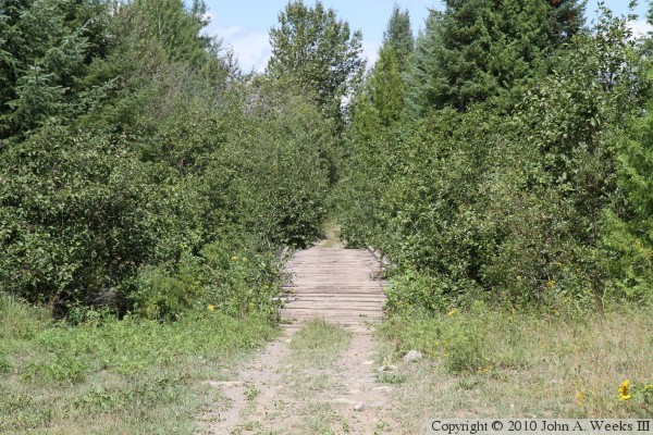
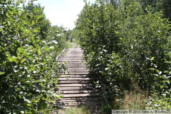
I searched state and county maps but was unable to find an ATV or winter snowmobile trail that runs along the Northshore Mining Railroad. As a result, it does not appear that this bridge is part of a named trail. There are a tangle of trails throughout the Superior National Forest, most of which follow old logging roads from the early part of the 20th Century.

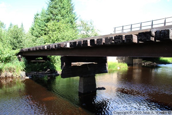
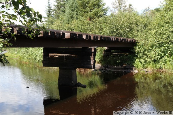
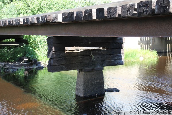
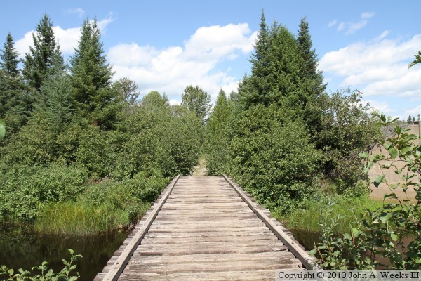
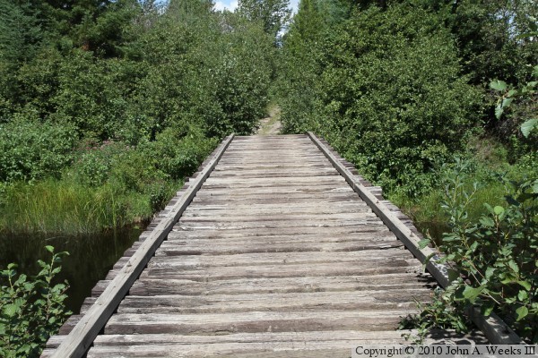
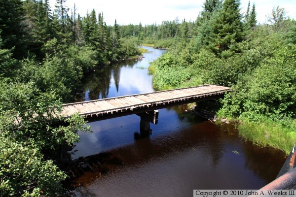
At first glance, the bridge structure is very simple. It consists of two parallel steel I-beams with railroad ties forming the deck. But after looking at the structure a bit, a few interesting features become apparent. First, most modern trail bridges are factory built prefabricated units, but this appears to be an impromptu design. Second, the bridge is set above the elevation of the trail, so it needs to have short ramps at each end of the bridge. Third, the concrete pier is very narrow, and only rises halfway to the beams. This requires an awkward looking stack of railroad ties to make up the gap. Next, it appears that the abutments were also raised at one point in time. Finally, it appears that the concrete pier is much older than the rest of the bridge.

In putting this together, I get the impression that this is a second generation bridge built on the remains of an older bridge. I suspect that a very simple bridge was built during the logging era, possibly for a narrow gauge railroad. That bridge was low to the water, and it was probably pulled up when the railroad was pulled out. It might have been used to haul logs to the Saint Louis River so they could be dumped into the river and floated to the Skibo Mill seven miles downstream. Then, when the snowmobile became popular in the late 1970s and early 1980s, or when ATVs became popular in the 1990s, this new bridge might have been built on the remains of the old bridge abutments and pier. The new bridge would have been built higher to provide more clearance for high water during the spring runoff. The bridge does not appear on a 1991 aerial photo, but does appear on 2003 aerial photos, which puts a lower and upper date on when it could have been built. I would love to know more about the history of this bridge. If anyone knows more of the story, please fill me in.

The photo above is looking northwest towards the ATV Trail Bridge, located just 40 feet downstream of the Northshore Mining Railroad Bridge.


ATV Trail Bridge
These two photos are views of the ATV Trail Bridge from the south bank of the Saint Louis River. The photo above is looking towards the upstream west face of the bridge, while the photo below is looking towards the downstream east face of the structure.

ATV Trail Bridge
ATV Trail Bridge
The photo above is close view of the center bridge pier as seen from the south river bank. The awkward construction of the pier is visible, consisting of a stack of railroad ties sitting on a concrete pedestal. The photo below is the first view of the bridge when heading northbound on the ATV trail.

ATV Trail Bridge
ATV Trail Bridge
These two photos are slightly different views looking northbound down the length of the bridge deck. The photo above shows the treeline, with the Northshore Mining Bridge being visible to the left of the ATV Bridge. The photo below is closer view of the bridge deck, which consists of railroad ties laid across the steel girders.

ATV Trail Bridge
ATV Trail Bridge
The photo above is looking south across the river down the center of the bridge deck. There is a ramp at each end of the bridge. The photo below is a close view of the ramp at the north end of the structure. Note that the ties on the ramp are slightly shorter than the ties on the deck in that they do not extend beyond the two parallel runners at the edge of the deck.

ATV Trail Bridge

Made With Macintosh
Authored by John A. Weeks III, Copyright © 1996—2016, all rights reserved.
For further information, contact: john@johnweeks.com