| Highways, Byways, And Bridge Photography |
Skibo Mill Site
Historic Saint Louis River Mill Site
Hoyt Lakes, MN
|
• Structure Type: |
Lumber Mill And Dam (Ruins) |
|
• Location: |
River Mile 187.1 |
|
• River Elevation: |
1652 Feet Upstream, 1646 Feet Downstream |
|
• Date Built: |
??? |
The Skibo Mill site is the location of a sawmill that operated during the
early part of the 20th Century. The location was picked because the Saint
Louis River is choked with boulders for a twenty mile stretch southeast of
Hoyt Lakes. This location was the southernmost spot that logs could be
floated downriver from the headwaters area. Logs would be hauled to the
river and to Seven Beaver Lake by ox team over winter roads and set on the
ice. When the ice melted, the logs would float down to the Skibo Mill.
They would be stored in the mill pond as the saw crew cut through this
inventory of logs.
At this time, I know very little about the Skibo Mill. It apparently was
built and owned by the Oliver Company, which was a pioneer in mining on
the Iron Range. The first railroad route to the iron range, the Duluth &
Iron Range, serviced their mines, crossing the Saint Louis River five miles
downstream at Skibo. The station at Skibo was named after Skibo Castle, the
Scottish summer home of Andrew Carnegie. The D&IR built a spur from Skibo
to the mill site. This railroad spur was abandoned after the mill closed.
It is now a gravel road that leads to the boat landing just above the dam
ruins.
When I first visited this site, I did not know what I was looking at, but I
did realize that this was an old dam of some type. After doing a bit of
research, I have learned that there might be additional ruins of the sawmill
in the woods and of the log elevator just upstream. As a result, I made a
second visit to the site in autumn of the same year.
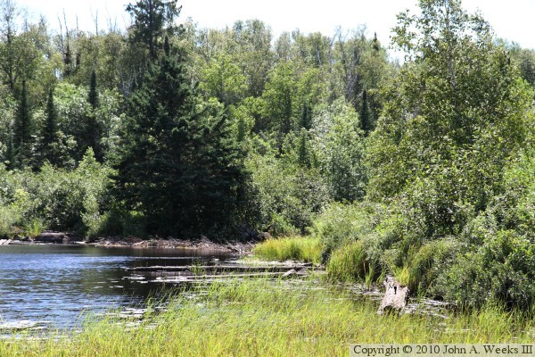
The photo above is the upriver side of the mill dam at the Skibo Mill site.
This mid-summer view is from the boat landing located where the mill elevator
once pulled logs from the river. The mill dam remains are overgrown with
trees and brush, and the dam itself is breached.
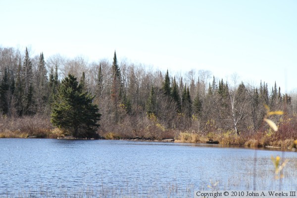
The photo above is an autumn view looking west towards the upstream side of
the mill dam. This is a similar view to the photo at the top of the page,
but taken from 200 feet further upstream. With the brush having lost its
leaves in the fall, it was possible to make my way to the downstream side
of the dam. The photo below is looking south across the main river channel.
The pile of rocks in the middle of the channel likely was once a rock crib
that supported two wooden gates that blocked the river.
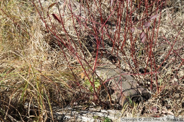
The photo above appears to be the remains of a wooden gate on the north
side of the river. The mound on the right side of the photo appears to be
a rock crib that is still intact. The photo below is a pile of railroad
ties that are almost fully overgrown. This was my first hint that more
remains of the mill might still exist.
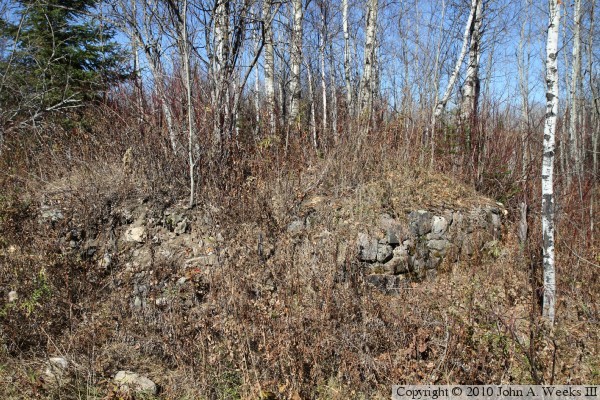
The photo above is a round rock wall that has a clump of white birch trees
growing out of the center. This is the remains of the foundation that once
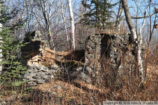
supported a tall silo used to store sawdust. The photo below is a large
rectangular structure that is made up of rocks and concrete on the outside,
and brick on the inside. This appears to have been the firebox for the
boiler that powered the sawmill.
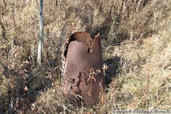
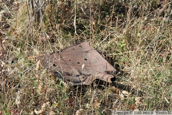
The photo above is the remains of a conical metal tube. It is about two feet
tall and about 10 inches across at the top. I am not sure if this is an
upside down bucket where the bottom rusted off, or if it was a support for
something. It seems to be firmly anchored into the ground. The photo below
is a rusty shovel.
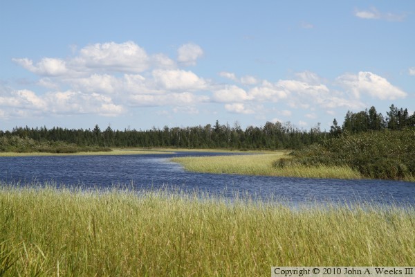
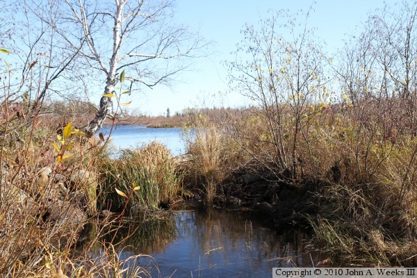
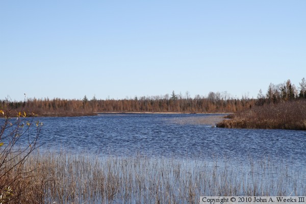
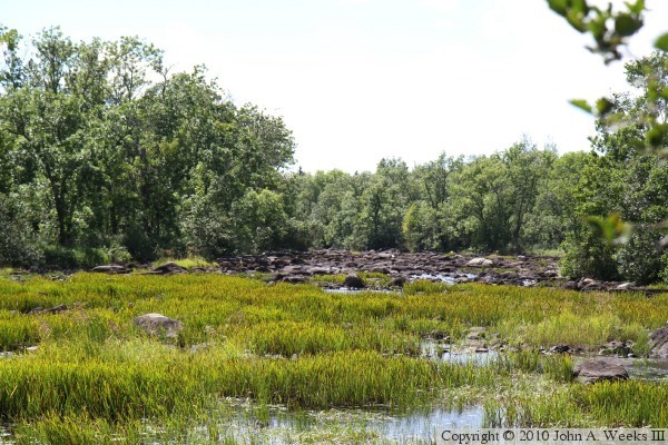
These two photos are views looking upstream at the former dam pool. The photo
above is a summer view, the photo below is from the autumn. This area is
noted for its wild rice, the light green stuff that looks like grass in the
photo above. In the photo below, the remnants of the rice crop is visible
on both sides of the river.
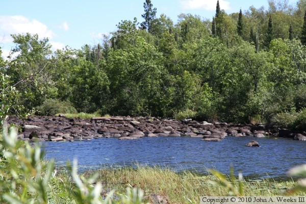
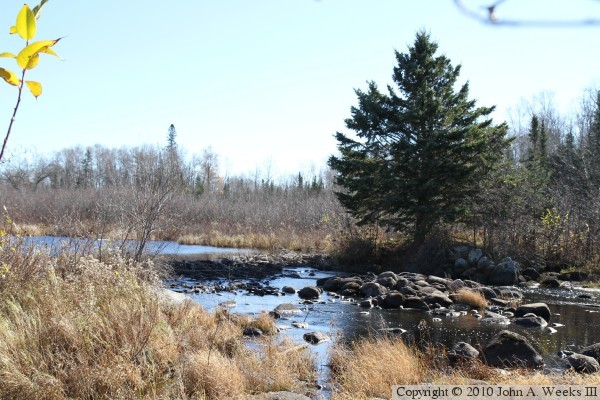
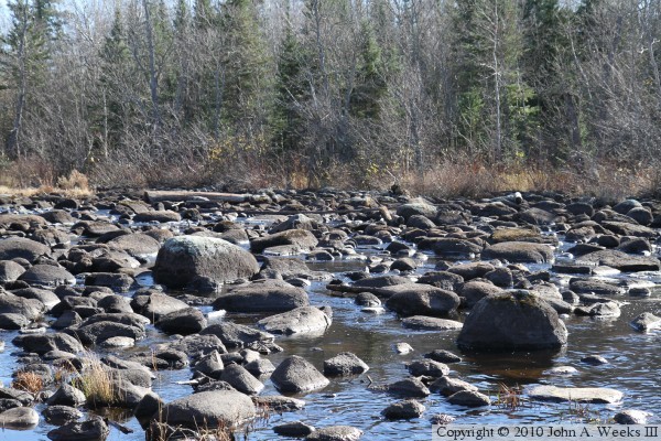
The Saint Louis River drops 40 feet in the mile downstream of the Skibo
Mill dam. This often leaves the river flowing through rocky stretches where
the river is hardly even visible. The photo above is looking upstream from
a location 500 feet downstream of the dam. The photo below is a
closer view looking across the river channel. There are a number of places
where it is not possible to canoe through these rock piles, requiring canoeists
to portage.
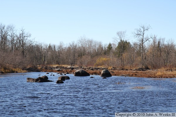
These two photos are looking downstream from the same vantage point. Not
only is the river strewn with rocks, but it is also choked with weeds. This
is another lengthy spot that forces canoeists to portage.
|
