This bridge crosses the Saint Louis River near the small village of Skibo,
located a few miles southeast of Hoyt Lakes, MN. The bridge site dates back
to 1883 when the Duluth & Iron Range Railroad was being built between the
iron mines near Tower and the ore loading dock at Two Harbors. Initially, the
D&IR used long wooden trestles to cross swamps and valleys. Over time,
these were all filled in and more permanent bridges were built over rivers.
I do not know the specific date that this bridge was built. The quality of
the steel and the use of concrete suggests that it was after 1900. The use
of rivets suggests that it was built prior to World War II. It was originally
built for a double-tracked mainline, but only one track is currently in use.
The first D&IR ore train ran on July 31, 1884. The D&IR was bought
by Illinois Steel in 1887, which later became United States Steel in 1901.
The railroad was merged with the Duluth, Missabe, and Northern Railway in
1938 to become the Duluth, Missabe, & Iron Range Railway. The DM&IR
was sold a number of times to owners such as Transtar and Great Lakes
Transportation. It was purchased by the Canadian National Railway in 2004.
Skibo was once the site of a large logging operation. A yard with several
tracks located just north of the Saint Louis River once supported pulp
storage and loading operations. A large saw mill was located a few miles
upstream and was served by a spur that branched off at Skibo. This saw
mill cut timber supports that were used in underground mining. The underground
mines played out in the first half of the 20th century, so cut timber was
no longer needed. Logging was done by the 1920's, which also reduced the
importance of Skibo. In fact, iron mining was all but done by the 1960s,
and this branch of the DM&IR was heading towards abandonment. A new
process for concentrating low grade iron ore into Taconite pellets brought
a resurgence to the mining industry and is the primary cargo being hauled
over this former D&IR line, with smaller quantities of limestone being
hauled back to the Taconite plants to be used in ore processing being a
secondary cargo.
Skibo was named after Skibo Castle, the summer home of Andrew Carnegie on the
north shore of Dornoch Firth in the north of Scotland. The station at
Skibo, however, was named Norman, after a long time station master on the
D&IR.
There is no easy way to visit this bridge. It is illegal to walk along
railroad tracks in Minnesota, and the CN aggressively enforces its no
trespassing policy. Despite its remote location, there are enough people
living in the area and rail traffic that there is a good chance of being
spotted. The legal way to the bridge site is to locate the road leading to
the Skibo Mill site. It will intersect a logging road that was the old
railroad spur to the mill site. At that point, there is a trail leading
south through the woods to a canoe landing. From the canoe landing, head
west along the north side of the river. There is an overgrown and little
used trail used by canoeists to portage around boulder fields in the river.
This trail crosses the railroad line about 100 feet north of the bridge.
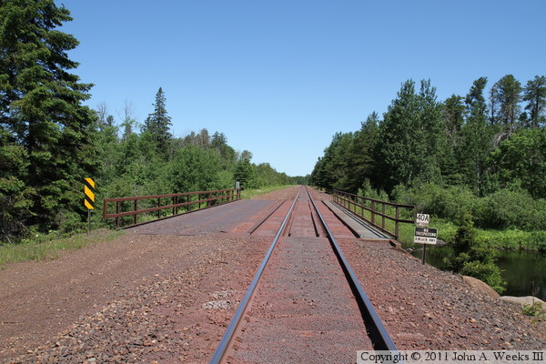
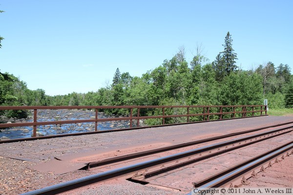
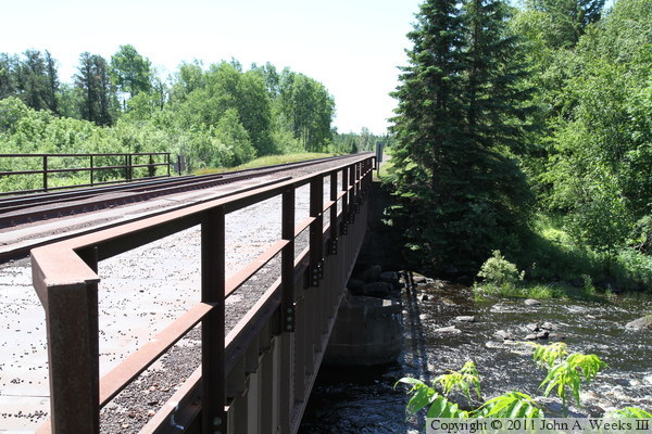
The photo above is looking north down the length of the bridge deck. The
active railroad is on the east side of the bridge deck, while the tracks
have been removed from the west side of the bridge.
The photo below is looking northeast from near the southwest corner of the
structure. The photo below is looking northwest from near the southeast
corner of the structure. The Saint Louis River flows from right to left in
these two views.
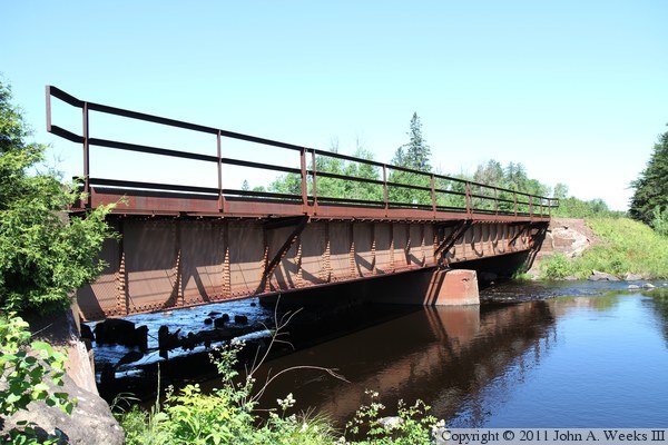
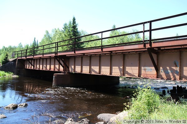
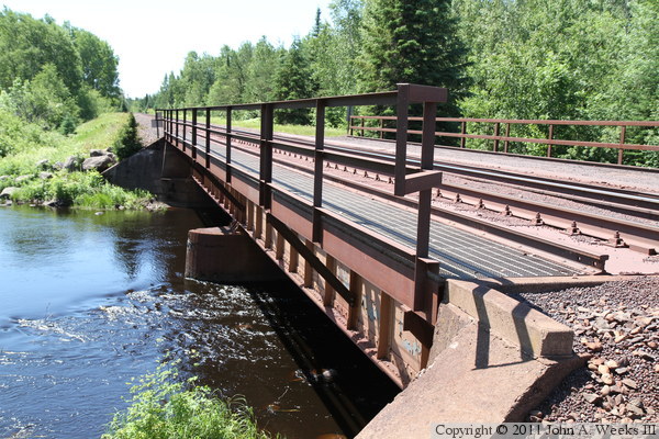
These two photos are views of the upstream east face of the bridge. The
photo above is from the southeast corner of the structure, while the photo
below is from the riverbank near the northeast corner of the bridge. It
is dark under the bridge deck, which results in a slight overexposure of the
grass, trees, and sky.
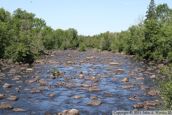
The photo above is looking northeast across the bridge deck, showing a
downstream view of the Saint Louis River. The photo below is a closer
view of the river heading downstream from the Skibo Bridge. The water is
at least 2 feet higher than normal due to heavy spring and early summer
rains. Normally, the river is a mass of dark black rocks that make it
difficult to see the water. This forces canoeists to portage past this
section of river.
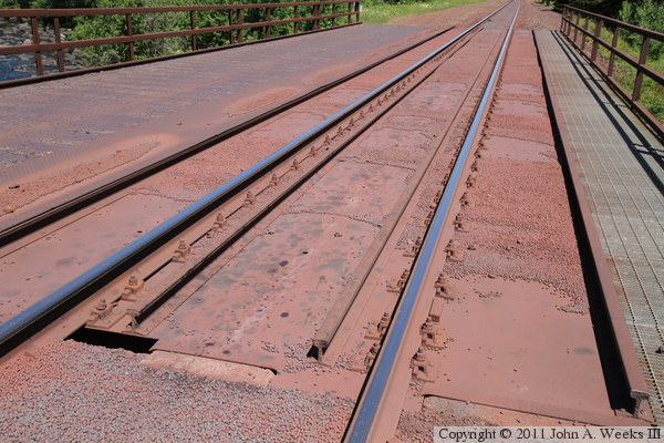
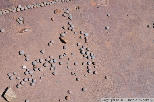
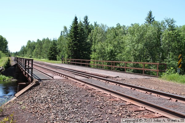
The photo above is the bridge deck. The shiny rails are used by trains.
The additional four rails are guards that attempt to prevent derailed
wheels from sliding off of the bridge. The photo below is a close view of
taconite pellets on the bridge deck. This rail line exists to haul taconite
from the mines to a port at Two Harbors. The pellets sometimes spill off
or cars, and they cover the railroad right of way. Smooth round balls on
a smooth bridge deck makes walking dangerous.
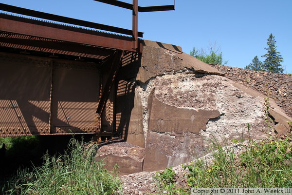
The photo above is the north bridge abutment. The light pattern on the
steel and concrete is due to bright sunlight shining through the metal
grating on the walkway on the east side of the bridge. The photo below
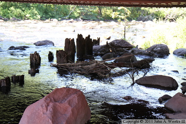
is the remains of pilings located under the bridge. This is likely from
an earlier wooden trestle since this type of steel bridge should not
have required falsework pilings to support the construction.
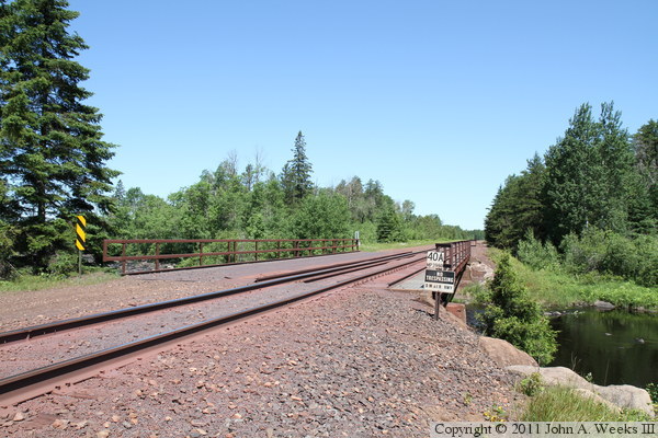
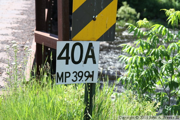
The photo above is a mile marker sign at the north end of the bridge. This
post is 39.91 railroad miles north of Two Harbors. The photo below is looking
south along the downstream west face of the bridge.
These two photos are from the northeast corner of the structure. The
photo above is looking along the east face of the bridge, while the
photo below is looking diagonally across the bridge deck.
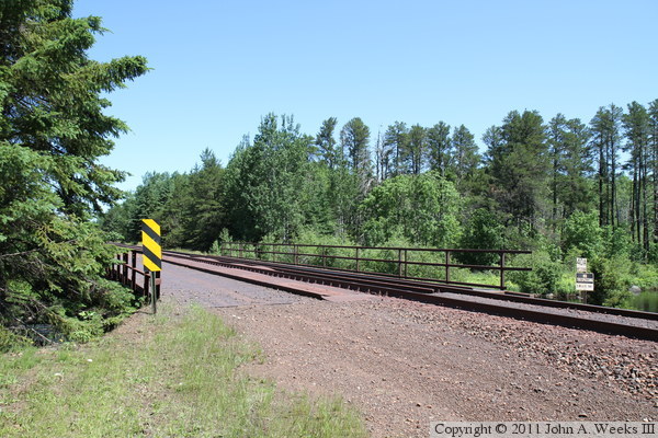
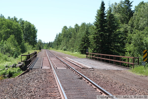
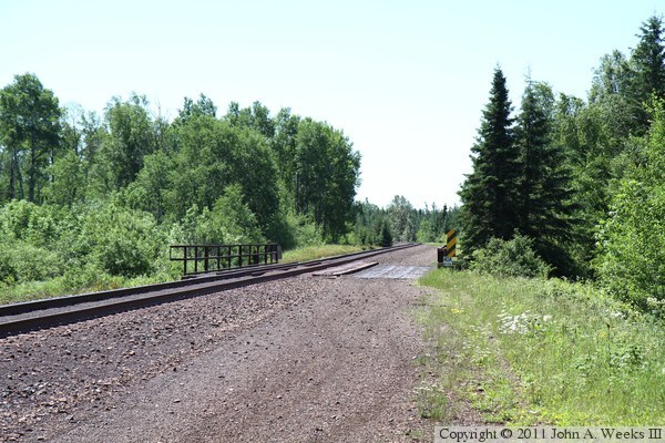
In these final two views of the Skibo Bridge, we are looking to the south
into the midday sun. The photo above is looking south down the length of
the bridge deck, while the photo below is looking southeast from where the
canoe portage trail crosses the railroad right-of-way.