Current Weather Conditions
John A. Weeks III
Friday, May 3, 2024, 9:13:27 PM CDT
Home Photo Tours Rail Fan 12 Easy Steps
Aviation Spacecraft Highways & Bridges About The Author
 
Google Search
Maps   Groups   Images   Search
 
  Home
  • 12 Easy Steps
  • Aviation
  • Spacecraft
  • Highways & Bridges
    » Bridge Photography
      - MSP River Bridges
      - C & D Canal
      - Illinois River
      - Minnehaha Creek
      - Minnesota River
      - Mississippi River
      - Missouri River
      - St. Croix River
      - St. Louis River
        › St. Louis Headwaters
          · N Shore Mining RR
          · ATV Trail Bridge
          · Skibo Mill Site
          · Skibo Bridge
          · Skibo Lookout Road
          · NF-790 Trail Bridge
          · Moose Line Road Br
        › Upper St. Louis River
        › Forbes - US-53 Area
        › Up Mid St. Louis River
        › Lw Mid St. Louis River
        › Fond du Lac Reservatn
        › Cloquet - Scanlon
        › Jay Cooke State Park
        › Twin Ports Harbor
      - Wisconsin River
      - Best Miss River Photos
      - Cable Stayed Bridges
      - McGilvray Road Bridges
      - I-35W Bridge Disaster
      - Miscellaneous Bridges
      - Madison County Bridges
      - Hist Br Weekend 2013
    » Road Geek Topics
  • Photo Tours
  • Rail Fan
  • About The Author
 
Site Search By JRank
Highways, Byways, And Bridge Photography
Northshore Mining Rail Bridge
NSM Saint Louis River Railroad Crossing
Hoyt Lakes, MN

Northshore Mining Rail Bridge

• Structure ID: N/A
• Location: River Mile 194.1
• River Elevation: 1,668 Feet
• Railroad: NSM (Northshore Mining Railroad)
• Daily Traffic Count: 8 Trains Per Day
• Bridge Type: Steel Plate Girder
• Bridge Length: 65 Feet (Estimated), 65 Foot Longest Span (Estimated)
• Bridge Width: 30 Feet (Estimated), 2 Tracks (One Track In Use)
• Navigation Channel Width: Non-Navigable
• Height Above Water: 13 Feet
• Date Built: 1955
A large deposit of low grade iron ore called taconite was discovered near Babbitt, MN, in the late 1800s. Taconite wasn't economically feasible to mine, so the land was held in reserve by a series of mining companies. A process to concentrate taconite was developed in the 1920s, and in 1939, a group of large steel companies purchased this 9,000 acre deposit. The joint venture was called Reserve Mining Company because they thought, at that time, that they would simply hold this site in reserve until the higher grade ore was played out.

Conditions changed with WWII. It was decided in 1944 to being mining operations. This was a massive undertaking. The city of Silver Bay was established to support a large taconite pellet plant that was built on the shore of Lake Superior. A harbor had to be built, as well as a 47 mile long railroad to connect the mine to the pellet plant. This railroad was called the Reserve Mining Railroad. It opened in 1955.

The Reserve Mining Company was a major taconite producer for over 20 years. But world economic conditions changed in the late 1970s. Demand for steel took a major drop in 1982. Reserve scaled back production, and finally closed on July 31, 1986. The mining operations, pellet plant, harbor, and railroad sat idle for several years. In the spring of 1989, demand for taconite increased, so two companies attempted to purchase the Reserve Mining Company. The Cleveland Cliffs company lost out to Cyprus Minerals, so the mine became Cyprus Northshore in 1990. Cleveland Cliffs purchased the former Reserve Mining Company in 1994. The railroad took the name Northshore Mining Railroad.

Traffic volume today is four trains per day loaded, with four empty trains returning northbound. It takes about two hours to make the run downhill from Babbitt to Silver Bay, two hours to dump the train using a rotary dumper, and two hours to return to the mine. The rail line was once fully double-tracked. However, with lower train volumes and larger trains, much of the route is single track with CTC (centralized traffic control) signals controlling train movements.

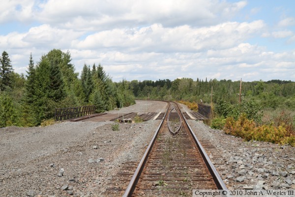
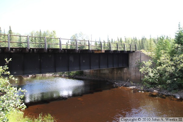
The Northshore Mining Railroad Bridge over the Saint Louis River is one of those places where you really have to want to visit before you will actually make the trip. It is located 3-1/2 hours from my home in the Twin Cities by car. Once you arrive in the area, it is a 6 mile drive down a forest road, then a 3 mile trip along a 4x4 trail, and then a 1/4-mile walk on the ATV trail. What you are rewarded with is a view of the very first bring over the Saint Louis River when heading downstream from its headwaters at Seven Beaver Lake. A nearby ATV trail bridge makes this trek even more worthwhile as you get two bridges for the price of one adventure. Bring plenty of insect repellent, however.

Prior to my visit to this bridge in the summer of 2010, I had this site confused with the nearby LTV/Erie Mining Railroad. The LTV line closed in 2001. As a result, I was very surprised to see shiny rails on this rail line. This is a good example of why one should always expect a train to be coming, even if they think that a route is abandoned or unused.

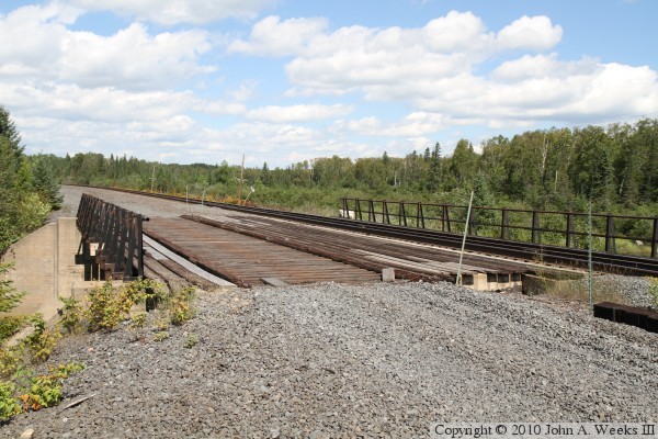
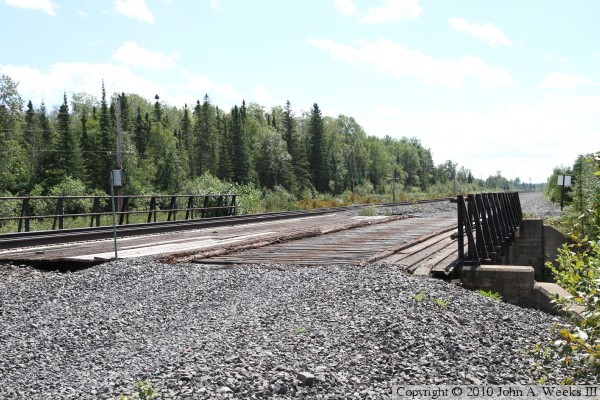
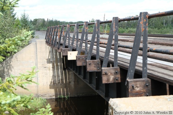
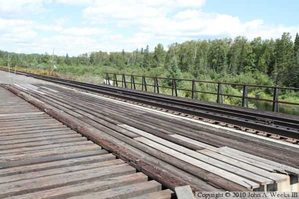
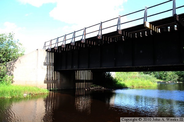
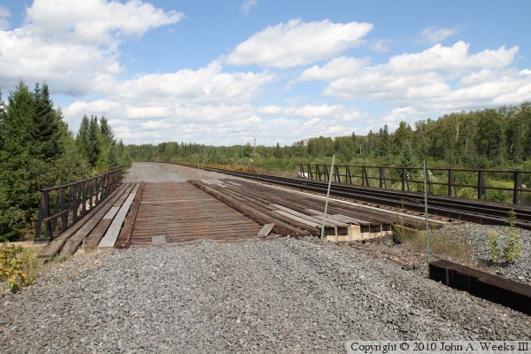
The photo above is looking north down the length of the Northshore Mining Rail Bridge along the length of the unused west roadbed. The photo above is a similar view looking down down the center of the active rail line. Note the use of guard rails between the tracks to prevent any derailed cars from falling into the Saint Louis River.


Northshore Mining Rail Bridge
The photo above is looking northeast across the bridge deck from the southwest corner of the structure. The photo below is a similar photo looking southeast from the opposite end of the bridge. Seven Beaver Lake, the source of the Saint Louis River, is located just beyond the treeline in the background of these two photos.

Northshore Mining Rail Bridge
The photo above is looking north along the bridge railing on the downstream west face of the structure. The photo below is looking across the bridge deck towards the railing on the upstream side of the bridge. The Saint Louis River flows along the east side of the railroad line for a bit after existing Seven Beaver Lake, and then it turns and passes under this bridge.

Northshore Mining Rail Bridge
The photo above is the downstream west face of the Northshore Mining Railroad Bridge as seen from the north shore of the Saint Louis River while standing on the deck of the nearby ATV Trail Bridge. The photo below is a view of the bridge girders and abutment as seen from the south bank of the Saint Louis River. Both photos are overexposed to show details of the dark bridge structure.

Northshore Mining Rail Bridge
These two photos are both views of the downstream west face of the Northshore Mining Railroad Bridge. The photo above is a view from the nearby ATV Trail Bridge. The photo below is from water level along the south bank of the Saint Louis River.

Northshore Mining Rail Bridge

Made With Macintosh
Authored by John A. Weeks III, Copyright © 1996—2016, all rights reserved.
For further information, contact: john@johnweeks.com