|
|
| Highways, Byways, And Bridge Photography |
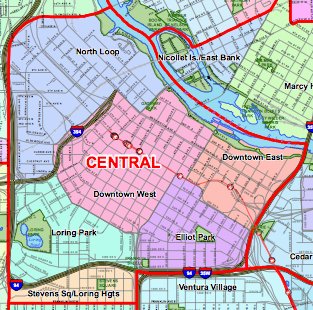
Minneapolis Central Community
Neighborhood Boundary Signs

|
|
Downtown East
Downtown East is named due to its location in downtown Minneapolis. The
eastern section of downtown was once the hub of milling and railroad
activity, but today, it is less developed than its neighbor to the west.
This neighborhood is not signed as of the spring of 2008.
|

|
|
Downtown West
Downtown West is named due to its location in downtown Minneapolis. While
this was once the western half of the city, the city core has developed
in the heart of Downtown West, making it the center of the downtown area
and home to the tall skyscrapers that dot the skyline.
This neighborhood is not signed as of the spring of 2008.
|

|
|
Elliot Park
Elliot Park is named for the large park of the same name. The park is named
in honor of Dr. Joseph Elliot, who farmed this land and later donated the
land to the city to create a large park.
|
|
|
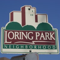
Loring Park
Loring Park is named for the large park of the same name. The park is named
in honor of Charles Loring, the first superintendent of the Minneapolis park
system. The park is situated around Loring Lake, a very scenic area located
at the southwest corner of downtown.
|
|
|
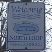
North Loop
The North Loop neighborhood takes its name from its location at the
northwest corner of the highway system that forms a loop around downtown
Minneapolis.
|
|
|
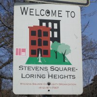
Stevens Square - Loring Heights
Stevens Square is an area of three story housing units built in the early
1900s. The development is named in honor of Colonel John Stevens, an
early settler. The western part of the neighborhood is located on higher
ground that overlooks Loring Lake. It was only natural to call this area
Loring Heights.
|
|
|
