| Highways, Byways, And Bridge Photography |
Denver Millennium Bridge
Pedestrian/Bicycle Crossing At Denver
Denver, Colorado
| • Bridge: |
Denver Millennium Bridge |
| • City: |
Denver |
| • State: |
Colorado |
| • Country: |
USA |
| • Carries: |
Pedestrians & Bicycles |
| • Crosses: |
Railroad, Light Rail |
| • Date Opened: |
April 22, 2002 |
| • Total Length: |
130 Feet (Estimated) |
| • Longest Span: |
130 Feet (Estimated) |
| • Tower Height: |
200 Feet (Estimated) |
| • Deck Width: |
80 Feet (Estimated) |
| • Number Of Spans: |
1 |
| • Height Above Railroad: |
25 Feet (Estimated) |
Denver found itself with both a problem and an opportunity in the late
1980's: what to do with a large area of mostly abandoned industrial land
that was now a contaminated brownfield that was situated on the west
side of their downtown. Redevelopment was spurred on when the new
baseball stadium for the Colorado Rockies was built in this area. However,
a series of railroad tracks were proving to be a barrier to additional
projects.
The first step in solving this problem was to consolidate all of the
railroad tracks into a single right-of-way, called the Consolidated Main
Line. Both the BNSF (then the Santa Fe) and Union Pacific mainlines were
merged into a single path that runs just east of the South Platte River.
This did not eliminate the barriers, but it did open up the riverfront
area to full development and left just one obstacle to be crossed.
The solution to allow people to cross the railroad line is the Denver
Millennium Bridge. This is one of the most unusual bridge structures that
I have seen, but it had a very difficult problem to solve. How to get people
up and over a narrow railroad corridor without creating an ugly concrete
monstrosity or a long narrow cattle chute. It had to be inviting, accessible,
and avoid any closed in space that would scare people away. This was
accomplished by creating a suspended platform that had little ground level
structure. The platform created a large open public space. Long tall
stairways on each end were an unfortunate requirement, but elevators were
provided for access and bicycle channels were included to make it easier
for cyclists to use the bridge.
The end results of this project is a gateway path consisting of 3 different
bridges (Denver Millennium Bridge, Platte River Bridge, and the Highland
Bridge) that crosses 3 barriers (railroad tracks, South Platte River, and
Interstate highway I-25) to join downtown Denver with the western
neighborhoods. In the process, a large area of public green space was
created and the development in the area has been successful beyond all
early prediction. It has also become a hub that connects a number of
regional trails such as the Colorado Front Range Trail, South Platte
River Trail, and Cherry Creek Trail.
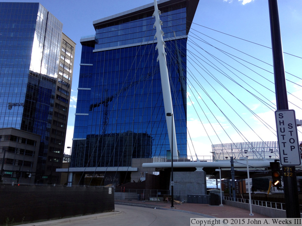
The photo above is a view of the north face of the Denver Millennium Bridge
as seen from the walkway leading to the nearby light rail station. The large
blue building directly behind the bridge is the DaVita headquarters building
(DaVita is a large medical services company that is known for their
dialysis centers located across the country).
Note—these are iPhone 5 photos which imposes an upper limit on their
quality.
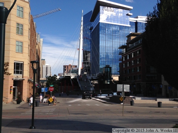
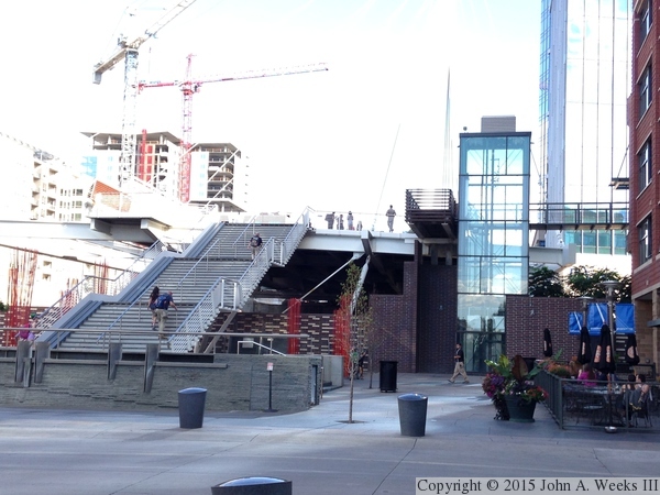
The photo above is a view of the bridge as seen from the walkway leading
from the Commons Park and the Platte River Bridge. Much of the structure is
in a deep shadow due to the proximity of the nearby tall buildings. The photo
below, taken from within that shadow, gives a better view of the structure
and the stairway leading up to the bridge deck. There is no abutment on
the west end of the bridge, rather, it is fully suspended from the stay
cables. There are only a few stabilizing cables and anchors on this end
of the bridge.
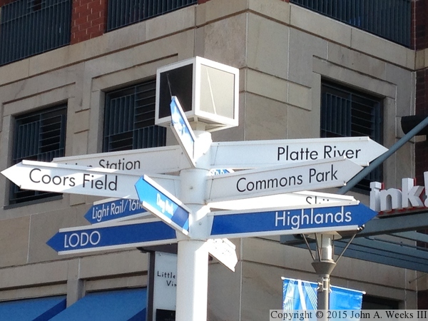
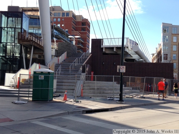
The photo above is a directional guide sign located just west of the
Denver Millennium Bridge. This structure sits at the apex of a number
of downtown neighborhoods, attractions, and transportation corridors.
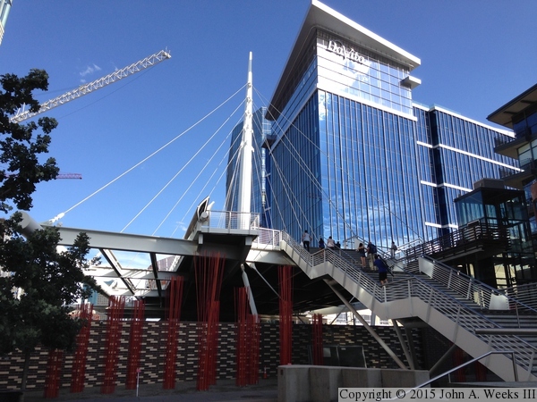
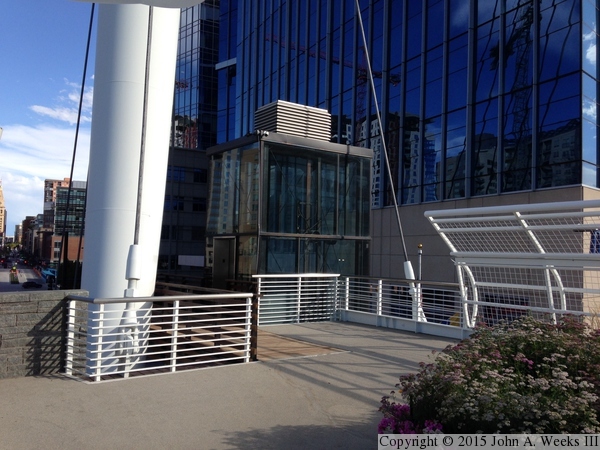
The photo below is overexposed to bring out the details of the area
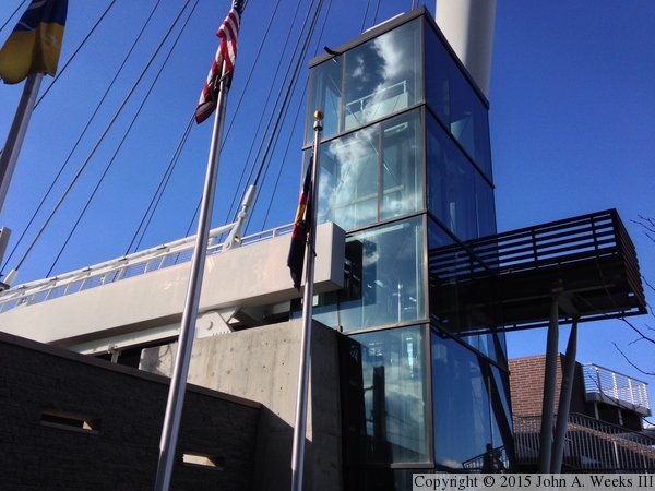
that is within that deep shadow on the west end of the bridge. The
glass structure is an elevator to allow access to the bridge deck.
There are elevators on each end of the bridge.
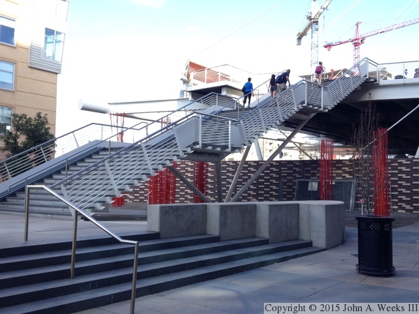
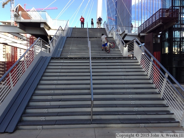
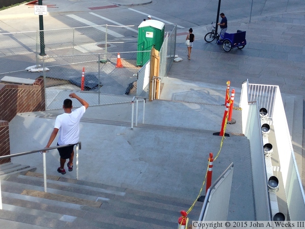
These two photos are views of the stairway on the west end of the bridge.
The photo above is a side view, while the photo below is a head-on view.
The black material on the left side of the stairway is a bicycle channel
that makes it easier to take bikes up or down the stairway. The person
who is halfway up the stairs with a bicycle did not understand this
feature.
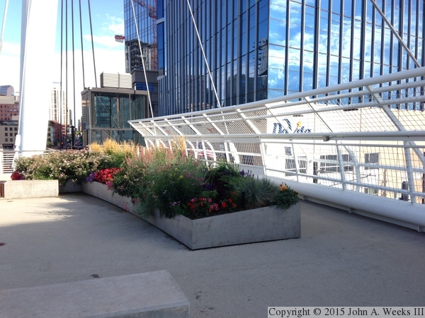
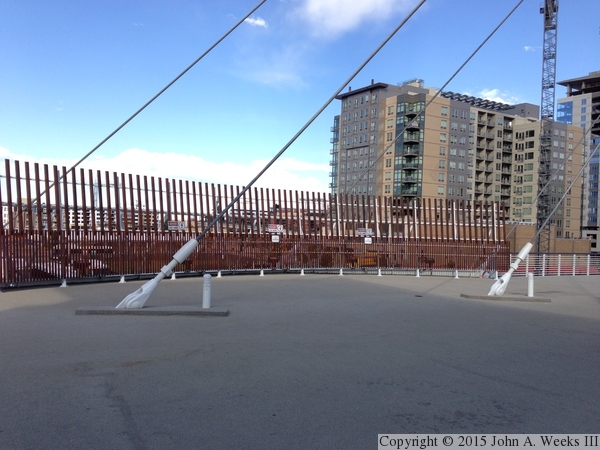
These two photos are views looking across the bridge deck. The photo above
is the south side of the bridge which has a metal railing and features an
urban flower garden. The photo below is the north side of the bridge deck.
The railings are again tall in an attempt to prevent people from throwing
objects into the path of trains that run under the bridge.
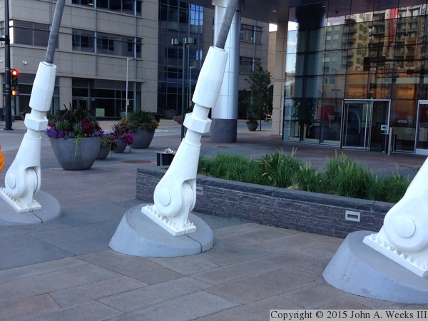
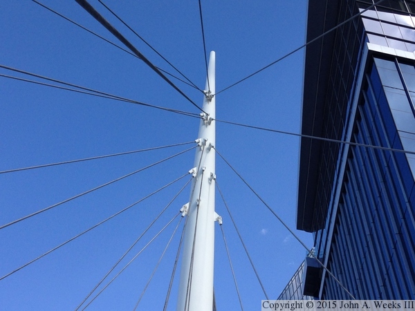
The photo above is the bridge deck area near the main bridge tower. We
also see two stay cables that support the bridge deck. The photo below
shows three cable attachment points located at ground level just east of
the bridge. These cables support the tower, which in turn supports the
bridge deck.
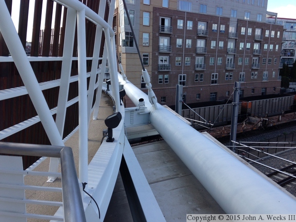
These two photos show some of the bridge structure on the north side
of the deck. The deck is built on a lattice of steel beams, and the beams
are supported by stay cables suspended from the main bridge tower.
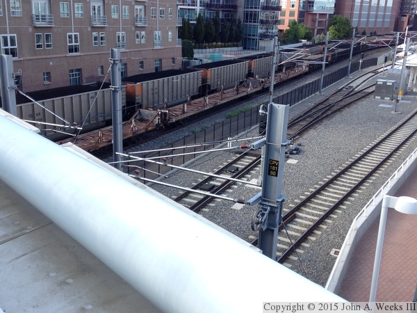
These two photos are views of the railroad infrastructure looking north
from the bridge deck. The photo above shows the Consolidated Main Line
(left) that carries BNSF and Union Pacific traffic (such as the coal unit
train parked on one of the tracks) and the light rail tracks (right) that
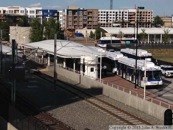
is electrified with an overhead catenary wire. The photo below shows the
bus station that connects to the light rail. The curved with roof in
the background is also a bus station that connects to Union Station,
the regional railroad passenger station.
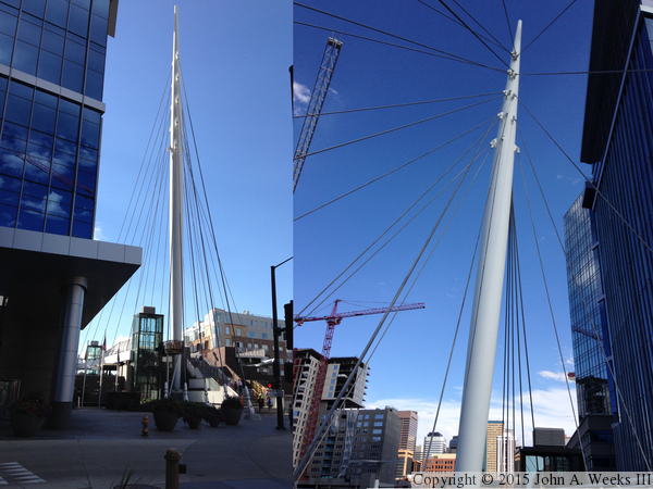
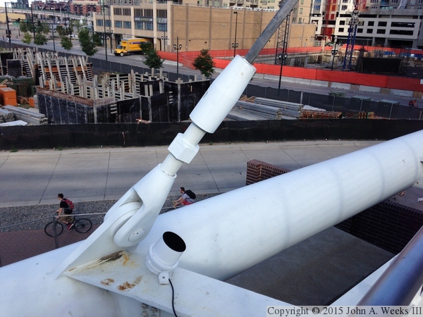
The photo above is two different views of the main bridge tower. The
left side is looking west, while the right side is looking towards the
east. The photo below is a close view of the cable attachment points on
the main bridge tower.
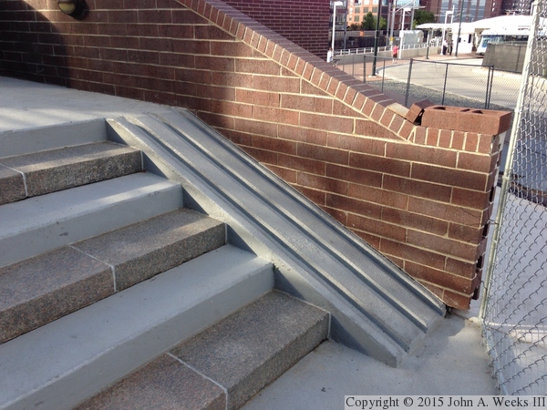
The photo above is looking down along the east stairway leading down to
ground level. The photo below is a closer view of one of the flights of
stairs showing the bicycle channel, which is made from concrete on this
side of the bridge (as opposed to rubber on the west side of the bridge).
The east stairway was in the process of being rebuilt when I visited in
the summer of 2014.
The photo above is a ground level view of the east stairway leading to
the bridge deck. The photo below is the elevator tower located on the
east end of the structure.
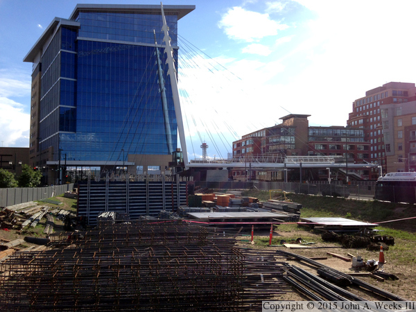
The photo above is a view looking south towards the north face of the
Denver Millennium Bridge. The vantage point is the north side of a
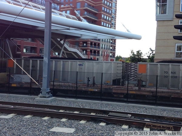
construction site near the Union Station bus terminal. The photo
below is a ground level view under the bridge. The light rail tracks
are in the foreground, with the heavy rail tracks on the other side of
the black chain link fence. Both tracks are occupied, the closer with
a long line of flatbed cars, and the second track with a coal unit
train. The coal train was loaded in the Power River Basin of southern
Wyoming. It is headed to a power generating plant in Texas owned NRG-Texas,
formerly called Texas GenCo.
|
