Current Weather Conditions
John A. Weeks III
Thursday, April 18, 2024, 7:08:52 PM CDT
Home Photo Tours Rail Fan 12 Easy Steps
Aviation Spacecraft Highways & Bridges About The Author
 
Google Search
Maps   Groups   Images   Search
 
  Home
  • 12 Easy Steps
  • Aviation
  • Spacecraft
  • Highways & Bridges
    » Bridge Photography
      - MSP River Bridges
      - C & D Canal
      - Illinois River
      - Minnehaha Creek
      - Minnesota River
      - Mississippi River
      - Missouri River
      - St. Croix River
      - St. Louis River
      - Wisconsin River
      - Best Miss River Photos
      - Cable Stayed Bridges
        › Arthur Ravenel Jr Br
        › Bill Emerson Mem Br
        › Clark Bridge
        › Cochrane-Africatown
        › Dames Point Bridge
        › Ed Hendler Bridge
        › Frank Gatski Mem Br
        › Fred Hartman Bridge
        › Glass City Skyway
        › Greenville Bridge
        › Hale Boggs Mem Br
        › John J Audubon Br
        › O'Connell Bridge
        › Penobscot Narrows Br
        › Quincy Bayview Br
        › Sen C Bond Bridge
        › Sen Wm V. Roth Jr. Br
        › Sunshine Skyway Br
        › Sidney Lanier Bridge
        › Talmadge Memorial Br
        › The Great River Bridge
        › US Grant Bridge
        › Varina-Enon Bridge
        › Veterans Memorial Br
        › Weirton-Steubenville
        › Wm H. Natcher Bridge
        › Wm H. Harsha Bridge
        › Zakim/Bunker Hill Br
          — — — — — — — —
        › Alex Fraser Bridge
        › Centennial Bridge
        › Coatzacoalcos II Bridge
        › La Plata River Bridge
        › Vancouver Skybridge
          — — — — — — — —
        › Indian River Inlet
        › Pomeroy-Mason Bridge
        › Ronald Reagan Mem
          — — — — — — — —
        › Charles W. Dean Br
        › Ironton-Russell Br
        › Ohio R Br (Downtown)
        › Ohio R Br (East End)
          — — — — — — — —
        › 6th Street Viaduct (N)
        › 6th Street Viaduct (S)
        › 21th Street Bridge
        › Arthur DiTommaso Br
        › Badger Road Bridge
        › Beach Road Bridge
        › East Fork Bridge
        › Lake Underhill Br
        › Lane Avenue Bridge
          — — — — — — — —
        › Bluff Dale Bridge
          — — — — — — — —
        › Bob Kerrey Ped Br
        › Big Rock Creek Br
        › Cross Seminole Trail
        › First Avenue Skyway
        › Gold Strike Park Br
        › Hennepin Co Med Ctr
        › Keeper Of The Plains
        › Martin Olav Sabo Br
        › Millennium Bridge
        › Mortensen Plaza
        › MSP Airport Skyway
        › Platte River Bridge
        › Reiman Bridge
        › Rhythm City Sky Br
        › Sundial Bridge
        › US-41/45 Ped Bridge
      - McGilvray Road Bridges
      - I-35W Bridge Disaster
      - Miscellaneous Bridges
      - Madison County Bridges
      - Hist Br Weekend 2013
    » Road Geek Topics
  • Photo Tours
  • Rail Fan
  • About The Author
 
Site Search By JRank
Highways, Byways, And Bridge Photography
Lake Underhill Bridge
FL-408 Lake Underhill Crossing At Orlando
Orlando, Florida

Lake Underhill Bridge

• Bridge: Lake Underhill Bridge
• Structure ID: NBI 750121, 750247
• City: Orlando
• State: Florida
• Country: USA
• Carries: FL-408 Tollway
• Crosses: Lake Underhill
• Date Opened: 1973, Rebuilt 2007 To 2009
• Total Length: 1716 Feet, 1704 Feet (Two Parallel Spans)
• Longest Span: 82 Feet
• Tower Height: 50 Feet
• Deck Width: ??? Feet
• Number Of Lanes: 12 Total, 6 Per Span
• Number Of Spans: 21
• Height Above Water: ??? Feet
• Traffic Count: 114,500 (2008)
While the Lake Underhill Bridge looks like a cable stayed bridge, it is not. The bridge towers and stay cables are nothing more than decorative elements, making this a faux cable stayed bridge. Despite not being a true cable stayed bridge, this structure is still interesting and visually exciting.

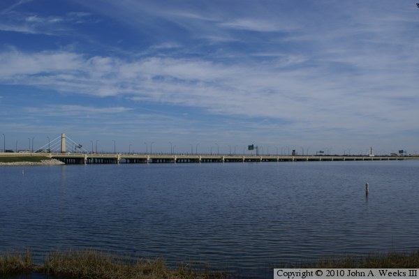
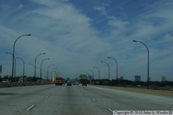
The Lake Underhill Bridge carries highway SR-408 tollway traffic over a small lake that is located just south of the Orlando Executive Airport on the northeast side of the city. The bridge first opened in 1973 as two parallel concrete girder bridges carrying 3 lanes of traffic on each span. Traffic on the 408 tollway increased dramatically in the 1990s, and the road was very congested following the turn of the century. The city and state wished to expand the tollway.

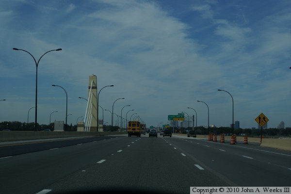
The SR-408 tollway was planned in several segments. The segment that includes the Lake Underhill Bridge was 1 mile in length and was budgeted for $77-million of the $500-million total for the SR-408 project. The plan was to widen the bridge from 6 lanes to 12 lanes, with 5 through lanes and one auxiliary lanes on each bridge span. Construction began in 2007, and the new traffic lanes were opened in November of 2009.

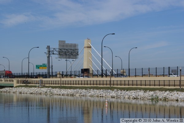
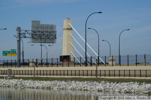
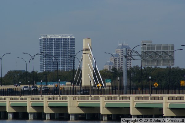
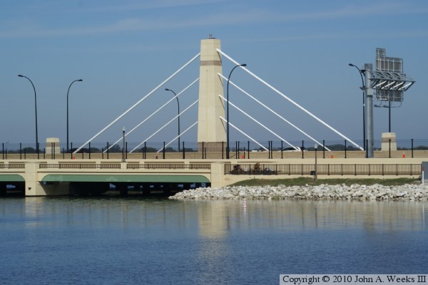
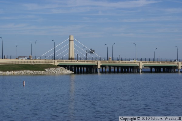
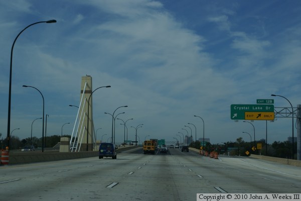
A controversy erupted when it was learned that $10-million of the $77-million budget for this project was set aside for amenities such as a pedestrian bridge, sound walls, lighting, and aesthetic elements. In particular, the two faux cable stayed towers were widely criticized as a waste of the $1.5-million price tag. Highway planners countered that this bridge would serve as a gateway for travelers entering Orlando from the east, and it was important to have a signature structure as part of the highway. Others who were in favor of the faux cable stay design thought that the 50-foot towers were far too short to be a signature design element.

In the end, the towers went up, the bridge is finished, traffic is moving again, and the city of Orlando has its eastern city gateway on the SR-408 tollway. The bridge turned out very nice, and decorative features really dress up what would otherwise be a very boring concrete girder bridge.

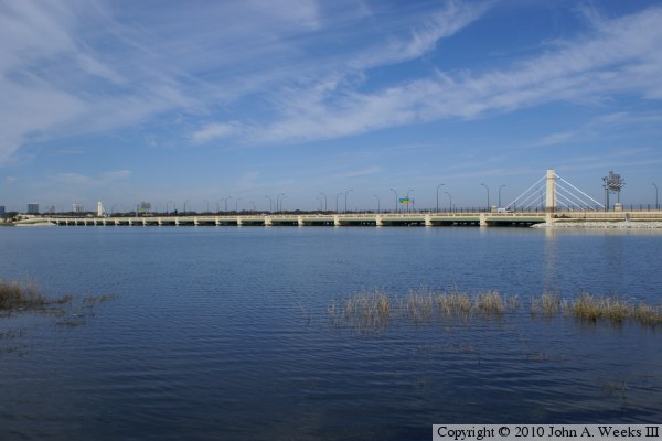
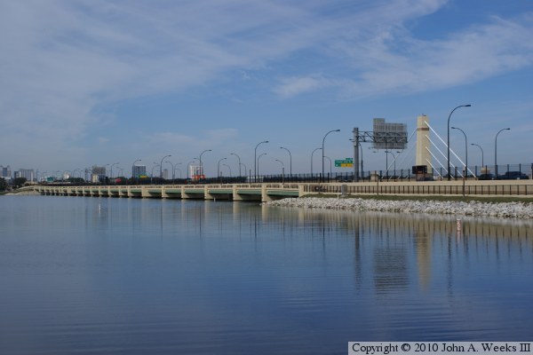
The photo above is looking northwest towards the south face of the Lake Underhill Bridge. The Orlando city downtown is visible in the distance beyond the west end of the structure. The east bridge tower is in the foreground. The bridge features 21 concrete girder spans, each about 82-feet long. A few spans are a bit shorter given that the two parallel bridges have slightly different overall lengths. The vantage point for this photo is a fishing pier located in Lake Underhill Park.


Lake Underhill Bridge
These two photos are views looking northwest towards the east bridge tower. The vantage point is a fishing pier located in a city park on the south side of Lake Underhill. The photo above is a little wider view, while the photo below is a closer view of the bridge tower.

Lake Underhill Bridge
The photo above is a telephone view of the bridge tower at the west end of the Lake Underhill Bridge. The photo below is looking directly north towards the east bridge tower. The first of the 21 over water spans is visible in this view.

Lake Underhill Bridge
The photo above is looking northwest towards the south face of the Lake Underhill Bridge. The east bridge tower is at the right side of the photo. The photo below is looking northeast towards the south face of the bridge, with the west bridge tower on the left side of the photo.

Lake Underhill Bridge
The photo below is a closer view of the bridge tower at the west end of the Lake Underhill Bridge. The photo below is the first of three photos showing a typical bridge crossing heading westbound on the highway SR-408 tollway. This photo is entering the east end of the westbound bridge span. The east bridge tower is located in the gap between the two parallel bridge spans.

Lake Underhill Bridge
These two photos continue our crossing of the Lake Underhill Bridge heading westbound. The photo above is a view from mid-span. The photo below is just exiting the west end of the structure with the west bridge tower located in the gap between the two parallel bridge spans.

Lake Underhill Bridge

Made With Macintosh
Authored by John A. Weeks III, Copyright © 1996—2016, all rights reserved.
For further information, contact: john@johnweeks.com