| Highways, Byways, And Bridge Photography |
Holmes Street Pedestrian Bridge
Minnesota River Regional Trail Crossing
Shakopee, MN
|
• Structure ID: |
NBI: 4175. |
|
• Location: |
River Mile 27.0. |
|
• River Elevation: |
693 Feet. |
|
• Highway: |
Former US-169, Former MN-101. |
|
• Daily Traffic Count: |
0. |
|
• Bridge Type: |
Steel Deck Truss. |
|
• Length: |
620 Feet. |
|
• Width: |
2 Lanes. |
|
• Navigation Channel Width: |
Non-Navigable. |
|
• Height Above Water: |
???. |
|
• Date Built: |
Opened 1927, Rehabilitated 2010. |
This bridge once carried US-169 across the Minnesota River. In 1993,
a new prestressed concrete girder bridge was built just downstream.
US-169 was moved to this new bridge. Later, a bypass was built around
Shakopee, along with the new Bloomington Ferry Bridge, and US-169 was
moved to this new freeway. The old bridge at Shakopee was set aside
to be used as a regional trail bridge.
Local officials have long known that this bridge would eventually
require some level of repairs and refurbishment. That cost is well above
what is normally budgeted for upkeep of a regional trail. The urgency
of these repairs came to light after the I-35W bridge disaster. Like
the I-35W bridge, this is a steel deck truss bridge, complete with lots
of rust, areas that are hard to inspect, and gusset plate issues. A
deck truss bridge has a metal latticework of beams under the highway
roadway. There are very few bridges like this remaining in the state
of Minnesota, so it would be a historical disaster to lose it. Other
deck truss bridges include the WI-243/MN-243 bridge at Osceola and the
MN-123 bridge at Sandstone.
Update—this old bridge is finally getting its long awaited
rehabilitation. The bridge was closed in February, 2010, for repairs and
historic preservation. The work will also include installing ADA-compliant
concrete ramps that will allow wheelchair access. The bridge is expected
to reopen on September 17, 2010. This project is being funded by the
American Recovery and Reinvestment Act.
Update—in reading the documents on the rehabilitation project, I have
learned that this bridge has an official name. The only name that I have
heard used for this bridge in the past is the Old Shakopee Bridge. The
official name is the Holmes Street Pedestrian Bridge.
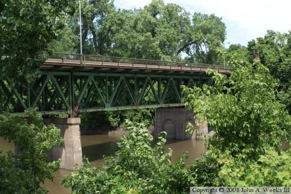
The photo above is a view of the downriver side of the northernmost of the
two main river spans looking through the trees from the south side of the
Minnesota River. The photo below is the downriver side of the bridge as
seen from the water level from a vantage point located under the north
end of the new highway bridge.
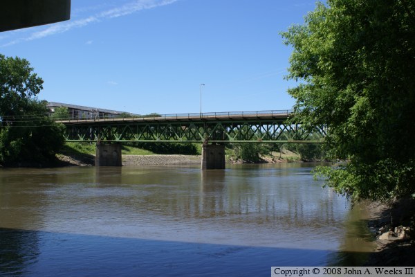
These two photos are views of the bridge looking through the trees along
the edge of the river. The photo above is the downriver face of the
bridge as seen from the south bank of the Minnesota River. The photo
above is a similar view from the north side of the river.
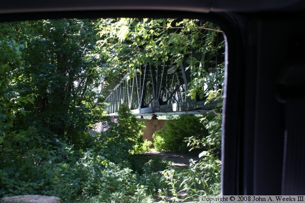
The photo above is a view of the bridge looking towards the northwest
from the stairway that leads down to the park located below the bridge.
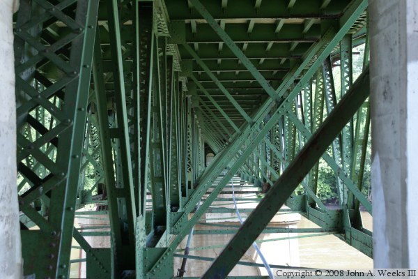
The photo above is a view looking through the truss structure under
the bridge. The truss span has a main beam running down the center of
the bridge as well as on the outside edges of the truss.
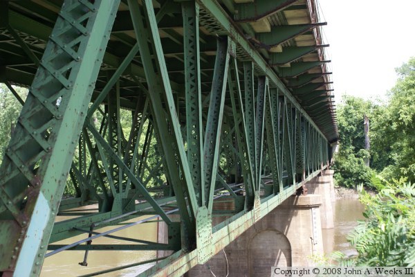
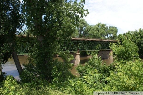
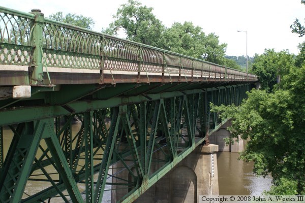
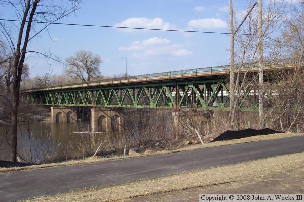
The photo above is the east side of the truss structure, which is the
downriver side of the bridge. The photo below is the west side of the
truss structure, which is the upriver side of the bridge. Both views
are looking to the north from the south side of the Minnesota River.
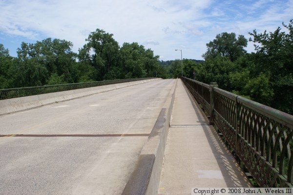
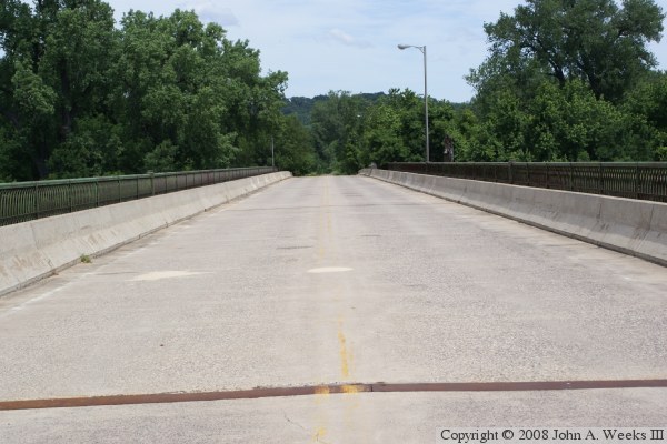
These two photos are looking north down the length of the bridge deck.
The photo above is from the sidewalk at the southeast corner of the bridge.
The sidewalk is separated from the former traffic lanes by a concrete
barrier. The photo below is from the center of the bridge deck. Remnants
of the double yellow line between the former traffic lanes can still be
seen.
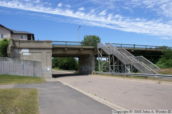
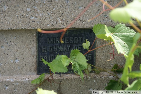
The photo above is the south bridge abutment. The structure crosses over
Levee Drive before crossing the main channel of the Minnesota River. The
steps leading to the bridge deck were built when the park below the bridge
was improved following the construction of the new bridge. The photo below
is the bridge plate located on the inside of the concrete railing at the
southeast corner of the structure.
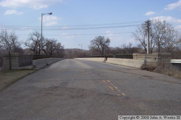
These two photos are a bit older, and were taken in early spring before
the trees and grass greened up. The photo above is looking north along
the length of the bridge deck. The photo below is looking northeast from
just upstream on the south side of the main river channel. Note that the
indented arch feature of the piers has been carried over to the piers on
the new bridge.
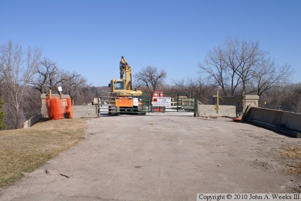
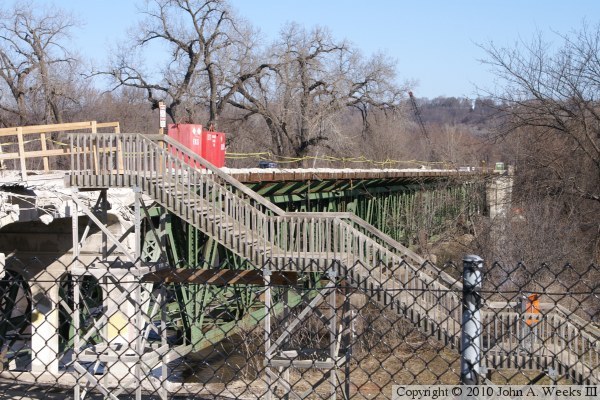
These two photos, and the next six that follow, are views of the Holmes Street
Pedestrian Bridge during its rebuild and during the flood of 2010. The photo
above is the south bridge approach. The photo below is looking north down the
length of the bridge deck.
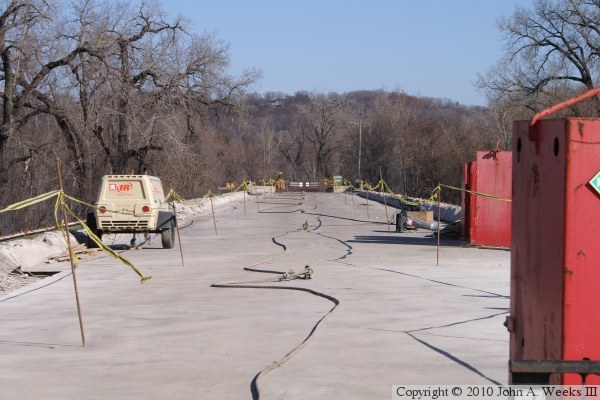
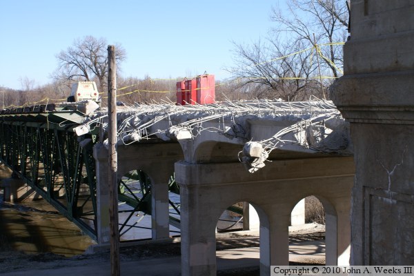
The photo above shows the tangle of rebar left where the bridge deck and
railings are being removed from the structure on the upriver west side of
the structure. The photo below is a view looking north along the downriver
east side of the bridge.

These two photos are views looking west from the deck of the highway 101
Shakopee Bridge, a vantage point that is available only because the highway
bridge is closed due to flooding. The photo above is the two concrete
girder spans at the south end of the bridge. The photo below are the two
concrete girder spans at the north end of the bridge. A road passes under
the left span, but is under water due to the flood.
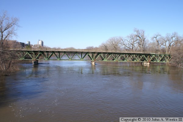
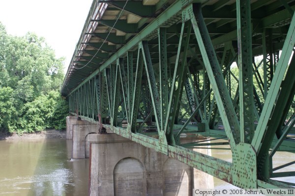
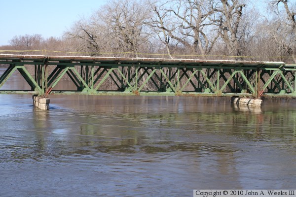
These two photos are views of the truss spans looking west from the deck of
the highway 101 Shakopee Bridge. The photo above is the river channel spans,
while the photo below is a closer view of one of those spans. The water has
dropped a few feet from the crest. It has been right to the top of the
concrete piers.
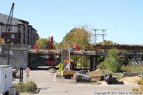
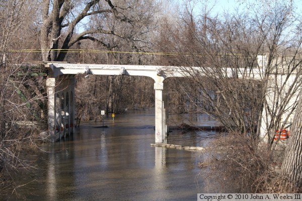
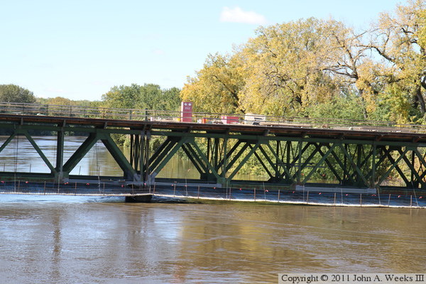
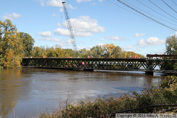
This photo, and the five that follow, were taken during the unusual autumn
2010 flood on the Minnesota River. The vantage point is the nearby highway
MN-101 Lewis Street Bridge, which was closed due to high water. The photo
above is looking west towards the approach spans on the south end of the
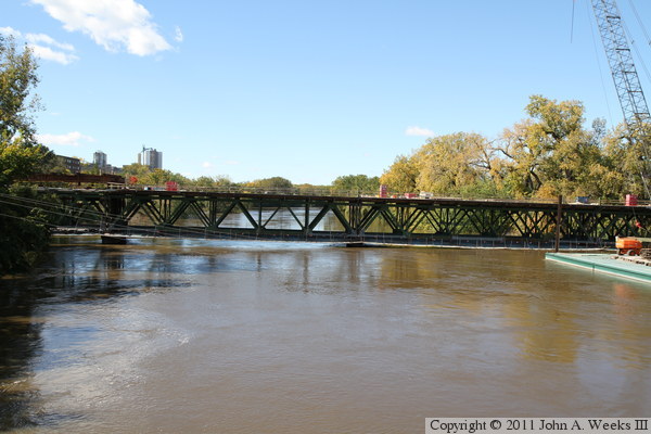
structure. The photo below is the main river channel spans, which are of
the steel deck truss design.
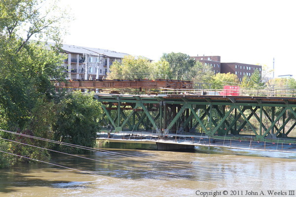
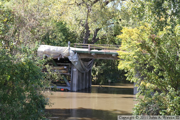
The photo above is the southernmost deck truss spans. The steel structure
above the bridge deck is being used to support the steel truss span while
some of the structural members and gusset plates are replaced. The photo
below is the mid-river spans. The white colored areas on the steel are
pieces that were replaced or repaired.
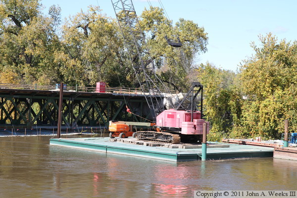
The photo above is a work barge that is used to support some of the heavy
equipment that is being used on the job. The vertical posts on the barge
can be driven into the riverbed to keep the barge stationary. The photo
below is the north end of the deck truss spans and the first of two
concrete approach spans. A road passes under this concrete span. A road
sign is visible sticking up above the water just beyond the bridge.
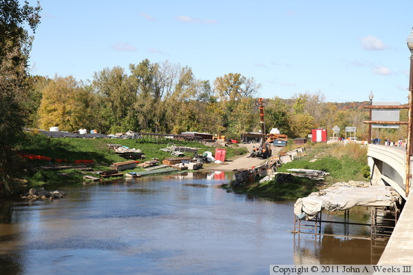
The photo above is the work site on the north end of the bridge. This boat
landing is temporary for the project. The state DNR maintains a boat landing
on the downstream side of the highway MN-101 bridge, but the bridge was too
low for the barge to travel under when loaded, so this temporary ramp was
built. The photo below is the upstream side of the Holmes Street Pedestrian
Bridge as seen from the Shakopee side of the river.
|
