Current Weather Conditions
John A. Weeks III
Friday, April 19, 2024, 1:10:19 AM CDT
Home Photo Tours Rail Fan 12 Easy Steps
Aviation Spacecraft Highways & Bridges About The Author
 
Google Search
Maps   Groups   Images   Search
 
  Home
  • 12 Easy Steps
  • Aviation
  • Spacecraft
  • Highways & Bridges
    » Bridge Photography
      - MSP River Bridges
        › 10th Avenue Bridge
        › Arcola High Bridge
        › Betty Adkins Bridge
        › Bloomington Ferry
        › Bloomington Fry Tr
        › BNSF RR Bridge
        › Boom Island Foot Br
        › Broadway Avenue Br
        › C&NW Bridge (1)
        › C&NW Bridge (2)
        › Camden Bridge
        › Cedar Avenue Bridge
        › Cedar Ave Br (Old)
        › Cedar Ave Bicycle Br
        › Cedar Bend RR Br
        › Chaska Bridge (Old)
        › Chaska Swing Bridge
        › Chaska Trestle
        › Coon Rapids Dam
        › CP RR Bridge
        › Dan Patch Line Br
        › Dartmouth Bridge
        › East Channel Bridge
        › East Channel RR Br
        › East River Flats Br
        › Endless Bridge
        › F. W. Cappelen Mem
        › Father Henn Bluffs
        › Father Louis Henn Br
        › Ferry Street Bridge
        › First Avenue Bridge
        › Fort Road Bridge
        › Fort Snelling Br (Old)
        › Fort Snelling High Br
        › Great Western Bridge
        › Grey Cloud Channel
        › Grey Cloud Island Br
        › Grey Cloud Trail Br
        › Hastings High Bridge
        › Hastings Spiral Br
        › Holmes St Ped Bridge
        › Highway 243 Bridge
        › I-35W Bridge
        › I-35W Bridge (Old)
        › I-494 Bridge
        › I-694 Bridge
        › Interstate Bridge
        › Intercity Bridge
        › L St. Anthony F L&D
        › Lafayette Bridge
        › Lake Street Bridge
        › Lewis Street Bridge
        › Lexington Bridge
        › Lions Levee Pk Foot
        › Lock & Dam #1
        › Lock & Dam #2
        › Long Meadow Bridge
        › Lower Bridge
        › Lowry Bridge (Old)
        › Meeker Island L&D
        › Mendota Bridge
        › Merriam Street Br
        › Mill Ruins Park Br
        › Milwaukee Road Br
        › M&StL Bridge
        › Miss River Bridge 15
        › MN-101 Bridge
        › MN-41 Backchannel
        › MN-41 Back Ch (Old)
        › MN-41 Bridge
        › New Saint Croix Br
        › New Trunk-41 Bridge
        › Nicollet Island RR Br
        › North Miss Park Pier
        › NP Bridge #9
        › NP RR Bridge
        › Pike Island Bridge
        › Plymouth Bridge
        › Point Douglas DB
        › Raspberry Island Br
        › Richard P. Braun Br
        › Robert Street
        › Rock Island Swing Br
        › Runway 30 Light Br
        › Short Line Bridge
        › Smith Avenue High
        › Southeast Steam Plant
        › St. Anthony Falls Br
        › St. Anthony Falls Lab
        › St. Anthony Falls PP
        › St. Croix Boom Site
        › St. Croix Falls Dam
        › Stillwater Lift Br
        › Stone Arch Bridge
        › Third Avenue Bridge
        › Toll Bridge (Old)
        › U St. Anthony F L&D
        › US-8 Bridge
        › Wabasha Street Bridge
        › Wakota Bridge
        › Wakota Bridge (Old)
        › Walnut Street CW
        › Washington Ave Br
        › WI Central RR Br
        › WI Central RR Ruins
        › Wright Co Hwy 42
      - C & D Canal
      - Illinois River
      - Minnehaha Creek
      - Minnesota River
      - Mississippi River
      - Missouri River
      - St. Croix River
      - St. Louis River
      - Wisconsin River
      - Best Miss River Photos
      - Cable Stayed Bridges
      - McGilvray Road Bridges
      - I-35W Bridge Disaster
      - Miscellaneous Bridges
      - Madison County Bridges
      - Hist Br Weekend 2013
    » Road Geek Topics
  • Photo Tours
  • Rail Fan
  • About The Author
 
Site Search By JRank
Highways, Byways, And Bridge Photography
Third Avenue Bridge
Third Avenue Mississippi River Crossing
Minneapolis, MN

Third Avenue Bridge

• Structure ID: NBI: 2440.
• Location: River Mile 854.10.
• River Elevation: 801 Feet.
• Highway: 3rd Avenue S.
• Daily Traffic Count: 18,500 (2002).
• Bridge Type: Concrete Arch.
• Length: 2,223 Feet, 211 Foot Longest Span.
• Width: 4 Traffic Lanes, 78 Feet.
• Navigation Channel Width: 150 Feet.
• Height Above Water: 42 Feet.
• Date Built: Opened June 13, 1918, Reopened November 1980.
In the early part of the 20th century, the city of Minneapolis had three major road bridges across the Mississippi River in the downtown area. This included the Upper Bridge (at Plymouth Avenue), the Third Bridge (Hennepin Avenue), and the Lower Bridge.

The Lower Bridge crossed the river between 10th Avenue on the Minneapolis side of the river to 2nd Avenue on the Saint Anthony side of the river. This bridge was built in 1874 as part of the agreement where the cities of Minneapolis and Saint Anthony agreed to merge. The Lower Bridge was a deck truss bridge built on a series of masonry piers, and crossed the river on a diagonal. This bridge deteriorated to the point where it was closed in 1934, and it was removed in 1943. One bridge pier still exists sitting in the water near the east edge of the river near the University steam plant.

The issue with the Lower Bridge is that it was designed for pedestrian and wagon traffic typical in the late 1800s. It could did not hold up to the pounding from automobiles, and it could not support heavy trucks. The structure was also too light to support street cars. The growing city needed another river crossing. In fact, as Central Avenue was becoming the center of commerce north of the river, and the new highway 65 was planned to follow Lyndale Avenue and Central Avenue, it turns out that the Lower Bridge was not in the best location.

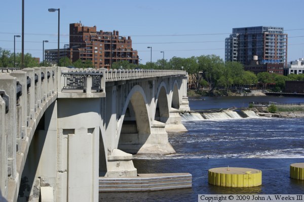
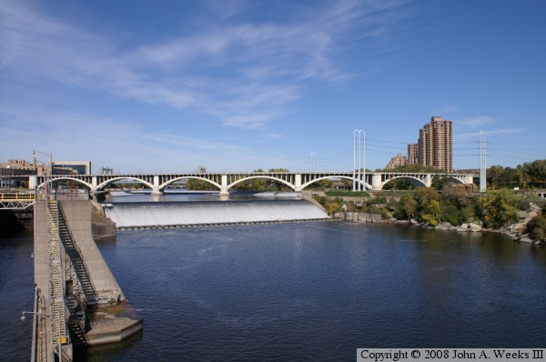
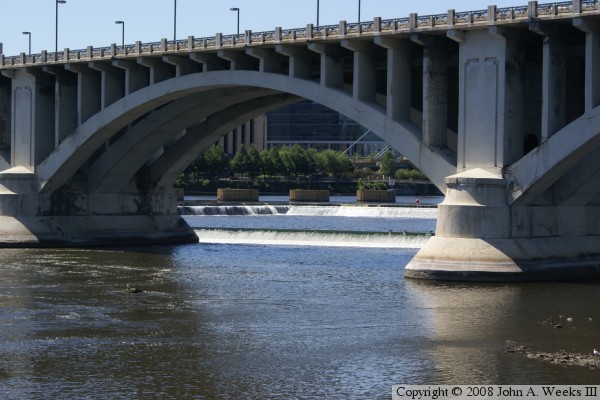
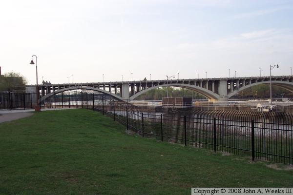
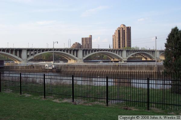
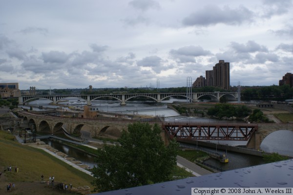
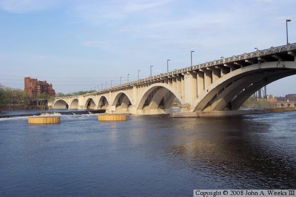
To meet these needs, the City of Minneapolis started the process of building a new bridge that would connect from Third Avenue on the downtown side of the river to Central Avenue on the north side of the river. The bridge was designed in-house by Frederick Cappelen, a famous city bridge engineer. The bridge was started in 1916 and was finished in June of 1918. The curves in the bridge were dictated by the rock in the upper level of the Saint Anthony falls. The bridge needed good rock, and had to avoid locations where the rock was fractured. Once piers were built, large wooden structures called falsework was erected to support the arches while they were built. Once the arches were completed, the falsework was removed, and the spandrels and deck was installed.

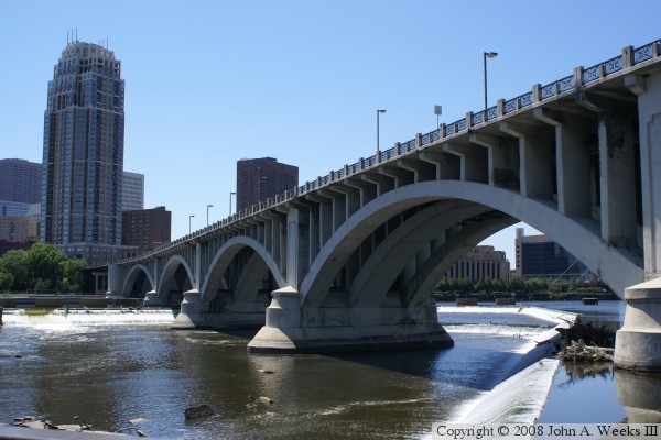
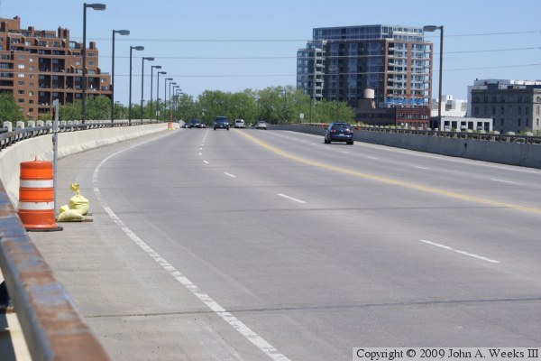
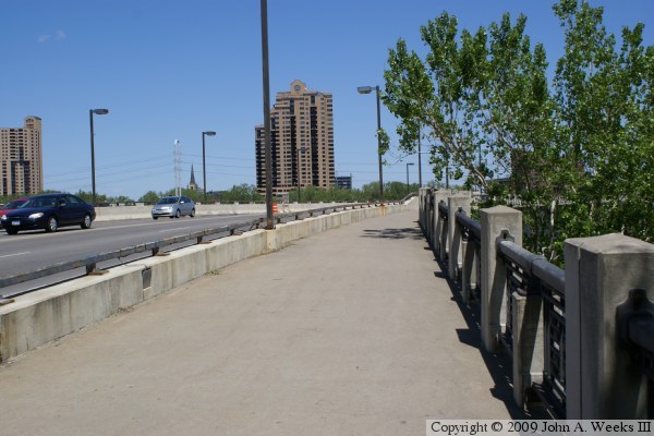
As a result of its location on the edge of the falls, the bridge was known as the Saint Anthony Falls Bridge when it first opened. That name fell out of favor, and the bridge is now known simply as the Third Avenue Bridge. The Saint Anthony Falls name has since been applied to the new I-35W bridge. The Third Avenue Bridge is the longest S-curve shaped concrete arch bridge in the world. The bridge was marked as highway MN-65 until the mid-2000s.

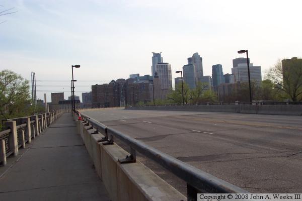
By the 1970s, the Third Avenue Bridge had deteriorated badly. There was a debate whether it could be saved. The goal was to save the bridge since it is such a magnificent structure. However, if that was cost prohibitive, a new bridge would be needed. As it turned out, it was decided to replace everything from the arches up including the spandrels, deck, and guardrails. Once construction was underway, it was found that the bridge was in even worse condition that expected. At that point, it is likely that it would have been cheaper to abandon the project and tear the bridge down, but the city decided to continue with the project and refurbish the bridge. The rebuilt bridge opened in late 1980.

The photo above was taken late in the evening in the spring of 2005. The low angle light from the sun was able to get in behind the concrete supports and light up the inside of the bridge. The photo below is another image taken during the golden hour just before sunset. Here, we see the bridge bathed in yellowish sunlight while the buildings in the background appear to be in black and white due to being in the shade. This photo won the 2012 Othmar H. Ammann Award for best photo.


Third Avenue Bridge
Third Avenue Bridge
The photo above is a view of the southeast face of the bridge as it crosses the upper reaches of Saint Anthony Falls. The photo below is a view from the downtown side of the river as seen from the Stone Arch Bridge looking northeast towards the Third Avenue Bridge. This is one of the few locations where you can see the entire bridge without obstructions.

Third Avenue Bridge
Third Avenue Bridge
These two photos were taken from Water Power Park. This vantage point allows you to get close to the east side of the main channel towards the middle of the Third Avenue Bridge. It is a great vantage point to see both the bridge, and the smaller dams located just upstream of the larger main drop. The river is interesting here because there is a sheet of rock just under the water. Despite the high water flow, the river is only inches deep in this area (through the navigation channel is far deeper).

The photo above is a detailed look at one of the arches in the Third Avenue Bridge. The bridge arch is interesting because it has a third rib running down the middle, whereas most concrete arch bridges have only two ribs. The photo below is a view of the west half of the bridge.


Third Avenue Bridge
Third Avenue Bridge
These two photos are views of the Third Avenue Bridge as seen from the West River Parkway. The vantage point is on the west side of the river located near the upstream entrance to the upper lock and dam. The tall buildings in the photo below are condominium projects at River Place and Saint Anthony Main.

Third Avenue Bridge
Third Avenue Bridge
The photo above was taken just days after the I-35W bridge disaster. It was a rainy Saturday morning, as were most days following the bridge collapse. The vantage point is the Endless Bridge at the Guthrie Theater looking towards the northwest.

The photo below is a view of the bridge deck as seen from street level at the north end of the bridge. The bridge offers an excellent view of the city skyline, especially at night.


Third Avenue Bridge
Third Avenue Bridge
The photo above is a view of the bridge deck as seen from the upstream side of the bridge on the downtown side of the river. The photo below is also a view from the downtown side of the river, this time of the walkway on the downriver side of the structure.

Third Avenue Bridge

Made With Macintosh
Authored by John A. Weeks III, Copyright © 1996—2016, all rights reserved.
For further information, contact: john@johnweeks.com