Current Weather Conditions
John A. Weeks III
Friday, April 19, 2024, 12:47:26 AM CDT
Home Photo Tours Rail Fan 12 Easy Steps
Aviation Spacecraft Highways & Bridges About The Author
 
Google Search
Maps   Groups   Images   Search
 
  Home
  • 12 Easy Steps
  • Aviation
  • Spacecraft
  • Highways & Bridges
    » Bridge Photography
      - MSP River Bridges
        › 10th Avenue Bridge
        › Arcola High Bridge
        › Betty Adkins Bridge
        › Bloomington Ferry
        › Bloomington Fry Tr
        › BNSF RR Bridge
        › Boom Island Foot Br
        › Broadway Avenue Br
        › C&NW Bridge (1)
        › C&NW Bridge (2)
        › Camden Bridge
        › Cedar Avenue Bridge
        › Cedar Ave Br (Old)
        › Cedar Ave Bicycle Br
        › Cedar Bend RR Br
        › Chaska Bridge (Old)
        › Chaska Swing Bridge
        › Chaska Trestle
        › Coon Rapids Dam
        › CP RR Bridge
        › Dan Patch Line Br
        › Dartmouth Bridge
        › East Channel Bridge
        › East Channel RR Br
        › East River Flats Br
        › Endless Bridge
        › F. W. Cappelen Mem
        › Father Henn Bluffs
        › Father Louis Henn Br
        › Ferry Street Bridge
        › First Avenue Bridge
        › Fort Road Bridge
        › Fort Snelling Br (Old)
        › Fort Snelling High Br
        › Great Western Bridge
        › Grey Cloud Channel
        › Grey Cloud Island Br
        › Grey Cloud Trail Br
        › Hastings High Bridge
        › Hastings Spiral Br
        › Holmes St Ped Bridge
        › Highway 243 Bridge
        › I-35W Bridge
        › I-35W Bridge (Old)
        › I-494 Bridge
        › I-694 Bridge
        › Interstate Bridge
        › Intercity Bridge
        › L St. Anthony F L&D
        › Lafayette Bridge
        › Lake Street Bridge
        › Lewis Street Bridge
        › Lexington Bridge
        › Lions Levee Pk Foot
        › Lock & Dam #1
        › Lock & Dam #2
        › Long Meadow Bridge
        › Lower Bridge
        › Lowry Bridge (Old)
        › Meeker Island L&D
        › Mendota Bridge
        › Merriam Street Br
        › Mill Ruins Park Br
        › Milwaukee Road Br
        › M&StL Bridge
        › Miss River Bridge 15
        › MN-101 Bridge
        › MN-41 Backchannel
        › MN-41 Back Ch (Old)
        › MN-41 Bridge
        › New Saint Croix Br
        › New Trunk-41 Bridge
        › Nicollet Island RR Br
        › North Miss Park Pier
        › NP Bridge #9
        › NP RR Bridge
        › Pike Island Bridge
        › Plymouth Bridge
        › Point Douglas DB
        › Raspberry Island Br
        › Richard P. Braun Br
        › Robert Street
        › Rock Island Swing Br
        › Runway 30 Light Br
        › Short Line Bridge
        › Smith Avenue High
        › Southeast Steam Plant
        › St. Anthony Falls Br
        › St. Anthony Falls Lab
        › St. Anthony Falls PP
        › St. Croix Boom Site
        › St. Croix Falls Dam
        › Stillwater Lift Br
        › Stone Arch Bridge
        › Third Avenue Bridge
        › Toll Bridge (Old)
        › U St. Anthony F L&D
        › US-8 Bridge
        › Wabasha Street Bridge
        › Wakota Bridge
        › Wakota Bridge (Old)
        › Walnut Street CW
        › Washington Ave Br
        › WI Central RR Br
        › WI Central RR Ruins
        › Wright Co Hwy 42
      - C & D Canal
      - Illinois River
      - Minnehaha Creek
      - Minnesota River
      - Mississippi River
      - Missouri River
      - St. Croix River
      - St. Louis River
      - Wisconsin River
      - Best Miss River Photos
      - Cable Stayed Bridges
      - McGilvray Road Bridges
      - I-35W Bridge Disaster
      - Miscellaneous Bridges
      - Madison County Bridges
      - Hist Br Weekend 2013
    » Road Geek Topics
  • Photo Tours
  • Rail Fan
  • About The Author
 
Site Search By JRank
Highways, Byways, And Bridge Photography
Broadway Avenue Bridge
CSAH-66 Mississippi River Crossing
Minneapolis, MN

CSAH-66 Bridge

• Structure ID: NBI: 27608.
• Location: River Mile 855.40.
• River Elevation: 801 Feet.
• Highway: CSAH-66.
• Daily Traffic Count: 21,300 (2001).
• Bridge Type: Steel Girder.
• Length: 857 Feet, 186 Foot Main Span.
• Width: 4 Traffic Lanes.
• Navigation Channel Width: 186 Feet.
• Height Above Water: 22 Feet.
• Date Built: Opened July 1987.
The first crossing at this location was a wooden bridge built in 1857. That structure washed away in a flood during 1859. A new bridge was built 28 years later, opening in 1887. It consisted of four Pratt style truss spans. That bridge was raised in 1950 to allow small tow boats and barges to navigate the river in north Minneapolis. Traffic levels and truck weights made the 1887 bridge obsolete, and it was closed and demolished in 1985.

One section of the 1887 bridge still survives. It was floated downriver, and installed over the backchannel of the Mississippi River to carry Merriam Street between Nicollet Island and the north shore of the river adjacent to Saint Anthony Main.

The current bridge opened in the summer of 1987. It is a very generic looking modern steel girder bridge with a concrete deck. It has little in the way of decorative features. In fact, about the only ornamentation on the structure are the tapered concrete piers. The bridge, however, has a natural grace. Its thin lines and the broad river channel combine to give the bridge an appearance of elegant simplicity.

The Broadway Avenue Bridge sits at a notable location. The 45th parallel crosses the Mississippi River about 290 feet north of the bridge. That means that the bridge is almost exactly halfway between the equator and the north pole.

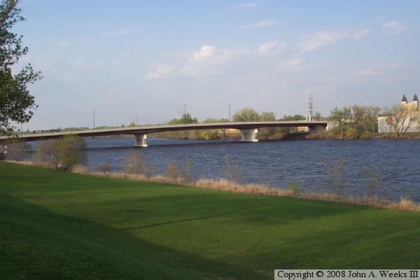
The photo above is a profile view of the bridge taken from the West 
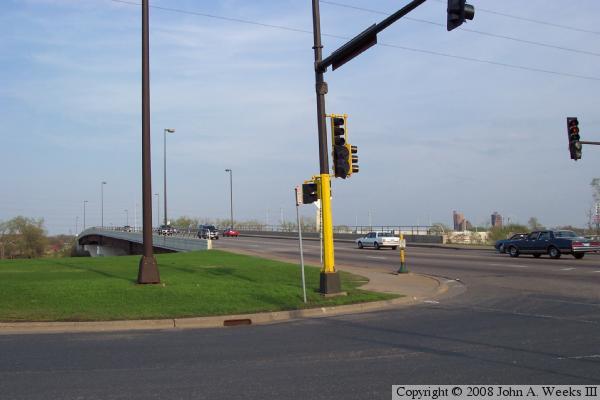
River Parkway just south of the structure. The photo below is the west end of the bridge as viewed from the intersection of West River Parkway and Broadway Avenue.


CSAH-66 Bridge
CSAH-66 Bridge
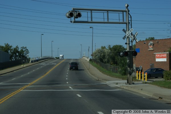
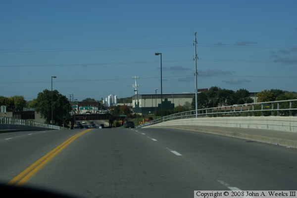
The photo above is the first of four photos showing a typical bridge crossing heading west from the east side of the Mississippi River. In this photo, we are starting up the hill towards the east end of the bridge. In the photo below, we are entering the east end of the bridge.

CSAH-66 Bridge
CSAH-66 Bridge
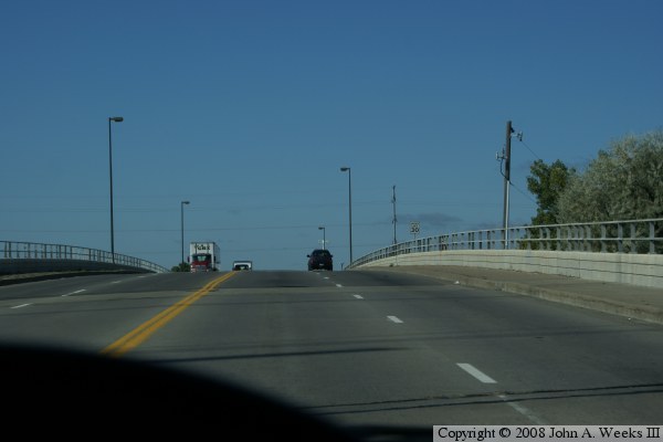
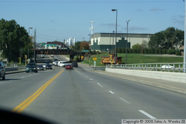
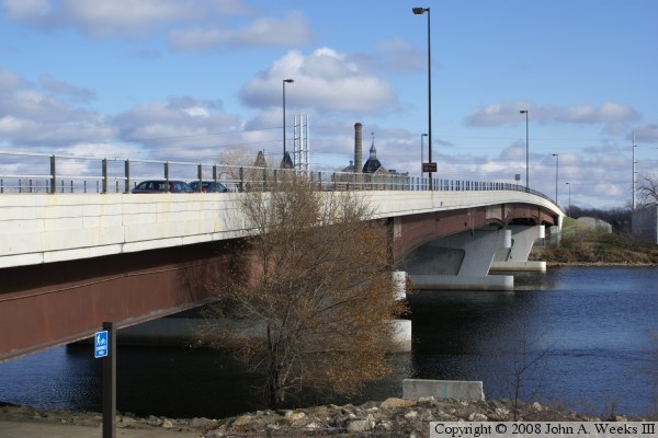
The photo above is a view from the peak of the hump over the main navigation channel. The land on each side of the river is relatively low, but the channel span has to be high enough to allow tow boats to pass under the bridge structure. In the photo below, we are nearing the west end of the bridge. Note the railroad caboose in dip at the bottom of the hill. That caboose serves as an advertising sign for the Broadway Pizza restaurant.

CSAH-66 Bridge
CSAH-66 Bridge
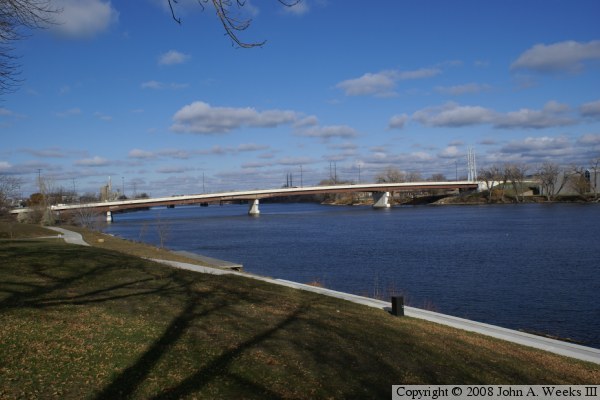
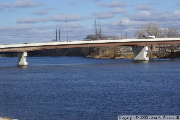
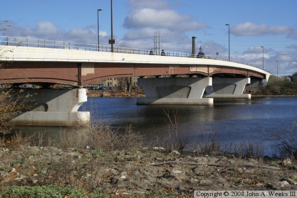
The photo above is view of the entire Broadway Avenue bridge taken from the riverfront park on the west side of the river. The photo below is a close view of the main channel of the Mississippi River.

CSAH-66 Bridge
CSAH-66 Bridge
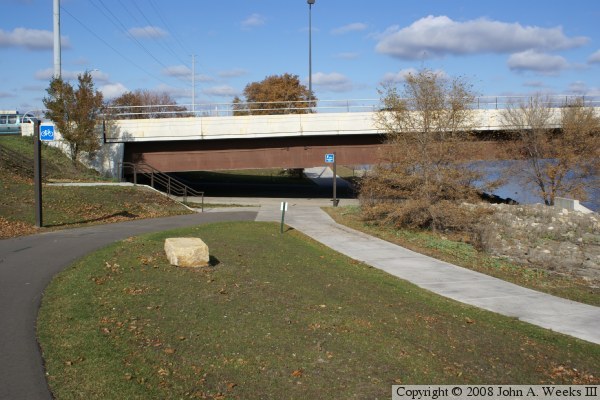
The photo above shows the west abutment of the bridge, and the regional trail that crosses under the bridge structure. Trail users need to be careful since the headroom is relatively low under the bridge. The photo below is a view of the bridge from the riverfront.

CSAH-66 Bridge
CSAH-66 Bridge
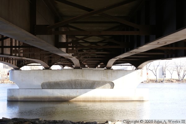
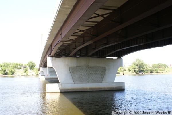
The photo above is a view of the details in the concrete and steel work. While the steel girders appear to curve outward, that is an optical illusion. The photo below is a view of the bridge looking down the downstream side of the bridge from river level.

CSAH-66 Bridge
CSAH-66 Bridge
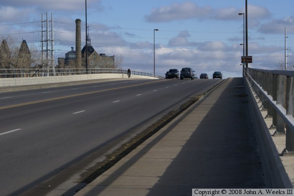
The photo above is a view of the bridge from an overlook that is at bridge level. The photo below is a view of the bridge deck from the sidewalk. While a bit hard to see in these photos, the 2008 photos show that a Mississippi River street sign has been installed on street light poles in each direction, something that is not present in the 2006 photos at the top of the page. These signs feature a National Park Service logo, and were paid for by the park service as part of the build-out of the Mississippi National River and Recreation Area.

CSAH-66 Bridge
CSAH-66 Bridge
These two photos are views of the bridge from the east side of the Mississippi River. The photo above is the north face of the bridge. The photo below is the south face of the bridge.

CSAH-66 Bridge

Made With Macintosh
Authored by John A. Weeks III, Copyright © 1996—2016, all rights reserved.
For further information, contact: john@johnweeks.com