| Highways, Byways, And Bridge Photography |
Mendota Bridge
MN-55 Minnesota River Crossing
Minneapolis, MN to Mendota Heights, MN
|
• Structure ID: |
NBI: 4190. |
|
• Location: |
River Mile 1.9. |
|
• River Elevation: |
686 Feet. |
|
• Highway: |
MN-55. |
|
• Daily Traffic Count: |
32,500 (1996). |
|
• Bridge Type: |
Concrete Arch. |
|
• Length: |
4,119 Feet. |
|
• Width: |
71 Feet, 4 Lanes. |
|
• Navigation Channel Width: |
165 Feet. |
|
• Height Above Water: |
74 Feet. |
|
• Date Built: |
Opened November 8, 1926. |
The area near the confluence of the Mississippi and Minnesota Rivers
is rich with history. On a geological time frame, waters released at
the end of the ice age carved the deep river gorges. In more recent
times, this was an important meeting site for local native tribes.
Later, it was the site of early settlement in Minnesota, anchored
by nearby Fort Snelling.
Prior to this bridge being built, there was a rail line that crossed
the Minnesota River at this location. This rail line ran south out
of Saint Paul, crossed to the south side of the river on the Omaha
Bridge, then branched off the Omaha Line behind the Sibley House (now
a historical landmark). From there, a trestle crossed the Minnesota
main channel, and the line curved to run between Fort Snelling and
the Mississippi River. The rail line eventually ran through Minnehaha
Park and into Minneapolis along Hiawatha Avenue. This was the main
route between the passenger terminals in Minneapolis and Saint Paul
until the Milwaukee Road built a bridge between the Lake Street Bridge
and Franklin Avenue. That new route was much shorter than this route,
so it was nicknamed the "Short Line", and the new bridge was called the
Shortline Bridge.
Due to the settlements in the area and a ferry boat that crossed the
Minnesota River, many early roads converged into the area near the
confluence of the two river. As a result, it was only natural that
this would be the location of a great bridge.
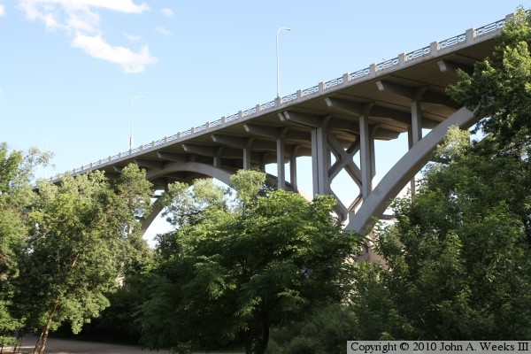
The Mendota Bridge was designed by famous bridge designer C.A.P. Turner,
who designed other river bridges in the area including the Arcola High
Bridge. The bridge consists of 13 huge reinforced concrete arches.
Vertical supports extend upwards from the arches to support a traffic
deck that is 4,119 feet long. The Mendota Bridge was the longest
concrete arch bridge in the world when it opened in late 1926. Some locals
refer to the bridge as the 'Mile Long Bridge', but in fact, the bridge is
about 1,100 feet short of being a mile long.
By the late 1980s, the Mendota Bridge was showing its age. In addition,
it had narrow lanes, no shoulders, and the sidewalk was not protected
from traffic. The bridge was closed in 1992 for repairs. The project
completely removed the traffic deck and many of the vertical members.
The remaining vertical members and the arches were repaired as needed.
A new wider traffic deck was installed. The bridge was reopened in 1994.
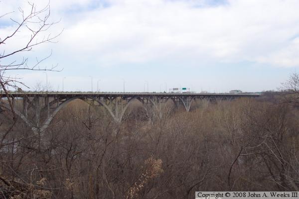
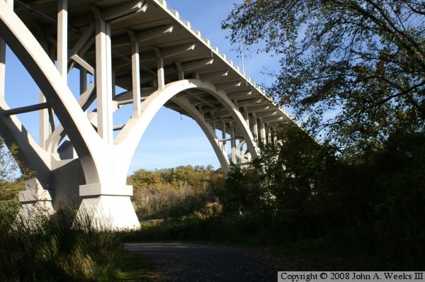
The photo above is a view from the parking lot of a church located on
the northeast corner of the bridge. This is perhaps the only location
where a vast majority of the bridge can be seen from ground level.

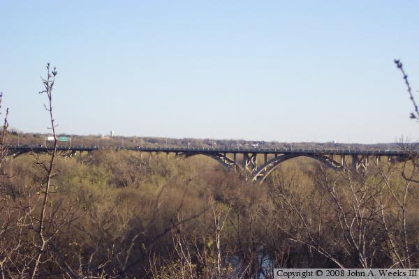
These two photos were attempts to capture the full length and height of the
bridge in one view. That turns out to be impossible given the trees and
vegetation. The photo above is a ground level view of two of the 13 arches.
These arches are about 300 feet long by 75 feet tall. The photo below is
a view of the tops of 5 arches, which is less than one-half of the bridge.
The photo above is a view of the east end of the bridge as seen from street
level. The large building on the far side of the bridge is the Whipple
Federal Office Building, which houses, among others, offices for Fish
and Wildlife, DOD, and Homeland Security. The photo below is a view
of the west end of the bridge looking east.
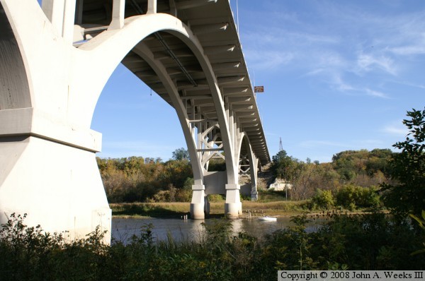
These two photos are a view of the arch that spans the main channel of the
Minnesota River. In the photo above, we have a view of the bridge
structure that supports the traffic deck. In the photo below, we see
the entire main span as it crosses the river. These photos were taken
from the boat landing parking lot looking to the east.
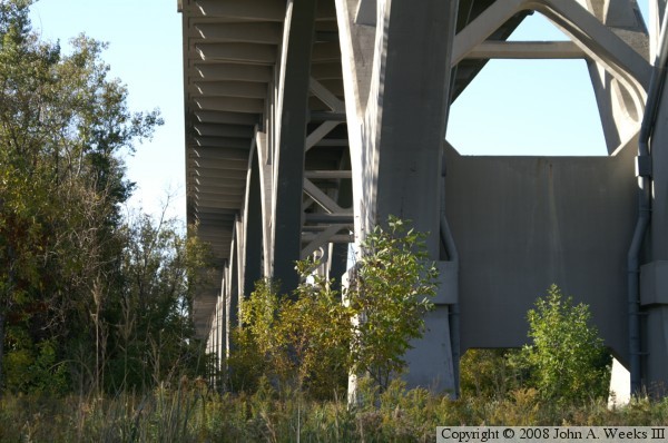
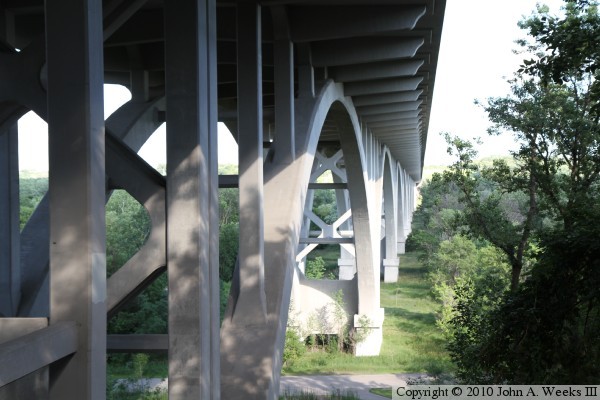
These two photos are views of the bridge structure from under the bridge.
The photo above is looking west from the boat landing parking lot. The
photo below is looking east from near the Fort Snelling State Park visitors
center.
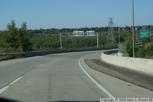
These two photos are the first of six photos that show a typical crossing
of the Mendota Bridge heading west from Mendota Heights on the east end of
the bridge to Richfield on the west end of the bridge. The photo above is
a view of the downhill curve on the east end of the bridge prior to
entering the bridge. The photo below is a view just as we enter the east
end of the bridge.
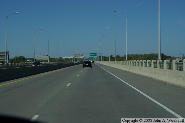
These two photos continue our journey across the Mendota Bridge. The photo
above is a view from the center of the span over the Minnesota River. The
photo below is a view from one-half way across the bridge.
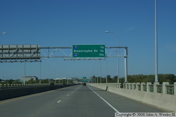
These two photos are the last of six photos showing a typical crossing of
the Mendota Bridge. In the photo above, we are three-quarters of the way
across the bridge. The photo below is a view just as we exit the bridge.
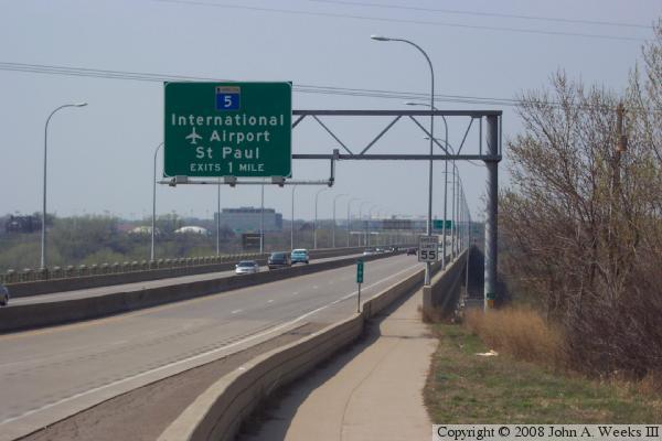
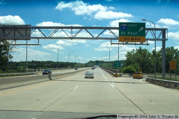
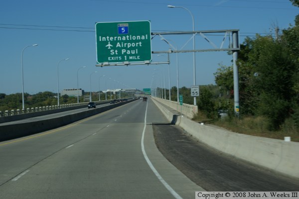
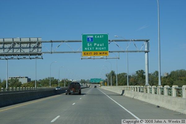
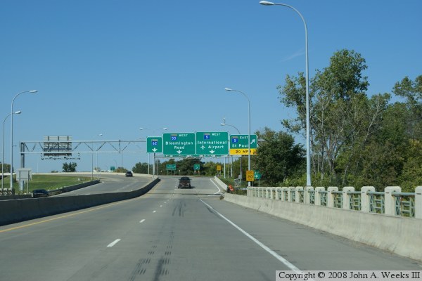
The big green signs overhead give a motorist a number of options, including
the MN-62 Crosstown Freeway, MN-55 heading downtown, MN-5 towards the
airport, and MN-5 towards Saint Paul. Note the latter exit is a very sharp
corner at the very end of the bridge.
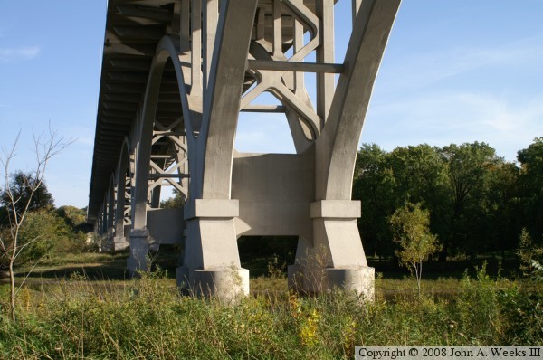
The photo above is looking southeast towards one of the spans near the western
end of the Mendota Bridge as seen from near the Visitor Center at Fort
Snelling State Park. The photo below is looking east along the south side
of the Mendota Bridge from a location under the bridge deck near the west
bridge abutment.
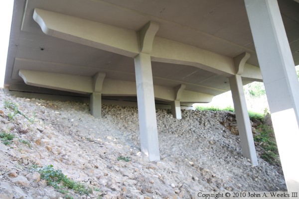
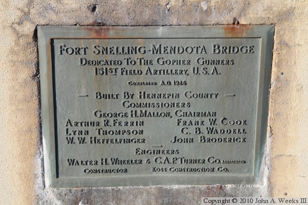
The photo above is the west abutment of the Mendota Bridge. The photo
below is an original bridge plate that is located along the sidewalk near
the northwest corner of the structure.
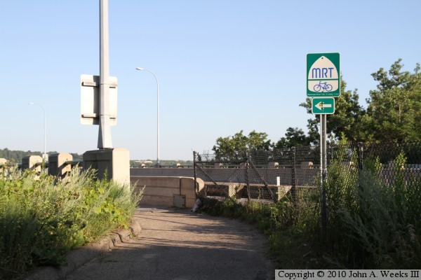
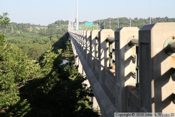
The photo above is a view looking southeast along the regional trail that
leads to the sidewalk on the north side of the bridge at the west end of
the structure. The photo below is looking east down the length of the north
sidewalk and the westbound traffic lanes.
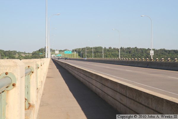
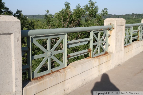
The photo above is a detail view of the concrete supports and metalwork that
make up the bridge railing. The photo below is looking east along
the north face of the Mendota Bridge.
|
