| Highways, Byways, And Bridge Photography |
Toll Bridge (Old)
Former US-12 Saint Croix River Crossing
Hudson, WI

|
• Structure ID: |
N/A. |
|
• Location: |
River Mile 16.7. |
|
• River Elevation: |
675 Feet. |
|
• Highway: |
Former US-12. |
|
• Traffic Count: |
0. |
|
• Bridge Type: |
Steel Truss. |
|
• Length: |
3,100 Feet Overall, 600 Foot Main Span (Estimated). |
|
• Width: |
2 Traffic Lanes. |
|
• Navigation Channel Width: |
160 Feet (Estimated). |
|
• Height Above Water: |
80 Feet (Estimated). |
|
• Date Built: |
Opened 1913, Closed 1951. |
The Hudson Toll Bridge was built in 1913, and it closed in 1951 after a new
US-12 bridge was built one-half mile downstream. Today, people refer to the
bridge as the Old Toll Bridge. Toll income from the bridge resulted in City
of Hudson residents paying little or no property taxes for many years.
The river crossing consisted of a short bridge on the Wisconsin side of
the Saint Croix, a half-mile long causeway, and then a spindly structure
over the main channel. This structure had a very steep steel ramp, a
truss section over the main channel, and another very steep steel ramp
going up the hill on the Minnesota side. While the causeway is still in
use, the main channel bridge was dismantled shortly after it closed in
1951. The piers still exist, and the approach road still exists on the
west side. The main span truss bridge was relocated to Venron County,
Wisconsin, where it was installed over the Kickapoo Rover on State Trunk
Highway 131 near the site of the failed LaFarge Dam project. The bridge
was finally demolished in 1986 after it was abandoned when WI-131 was
rebuilt on a new alignment.
Old timers recall that Ford Model T cars often had a hard time climbing the
bridge on the Minnesota side. Those cars had a transmission with metal bands.
As the bands wore down, they would begin to slip. Drivers often found that
they could back up the hill since reverse was used much less and the reverse
band in the transmission would not be wore down quite as far.
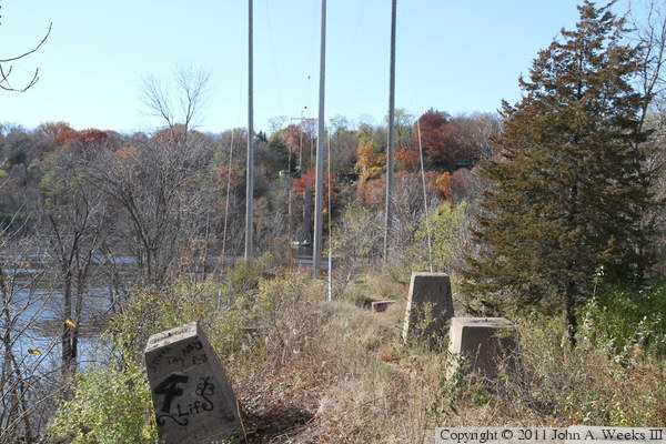
The photo above is an overview of the western half of the former river
crossing. The causeway is on the right, and the river channel span was
located near the center of the photo.

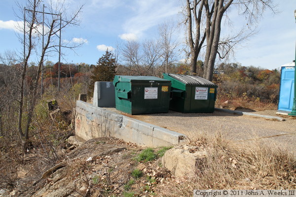
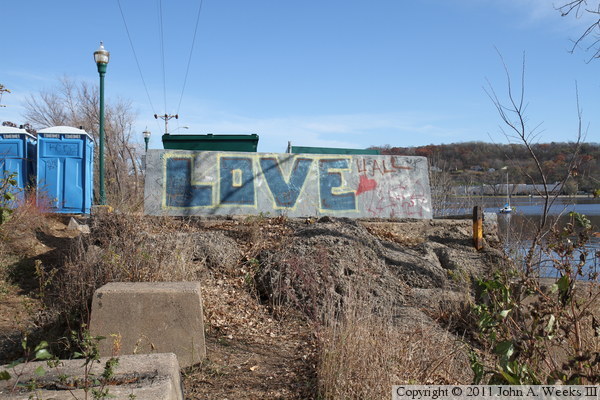
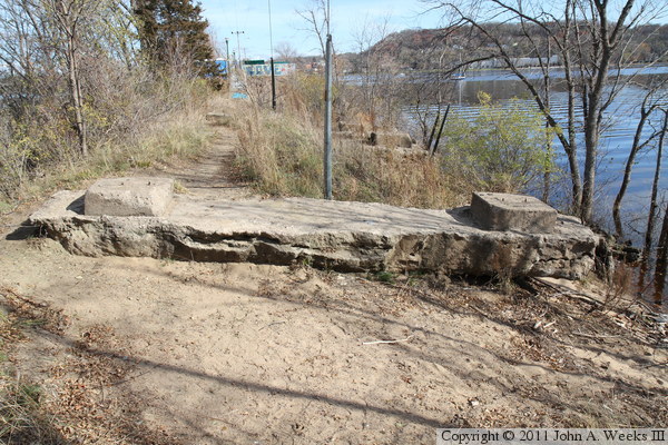
These two photos are views of the Toll Bridge abutment on the east side of
the main channel crossing at the end of the Walnut Street Causeway. The
photo above is looking west down the center of the old highway, while the
photo below is looking northwest towards the bridge abutment. There is a
park at the end of the Walnut Street Causeway, so the bridge abutment
is used for a pair of dumpsters, while the foundation of the old toll booth
is used for a pair of portable toilets.
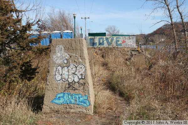
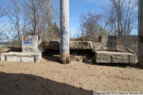
The photo above is looking east towards the bridge abutment. The photo below
is one of the bridge pier foundations. The east bridge approach span sat
on this foundation. The steel structure was simply cut off and the
foundation was left in place when the bridge was removed.

These two photos are looking west from the remaining bridge abutment on the
east end of the bridge site. A number of bridge pier foundation blocks
remain. Flooding over the years has eroded the causeway fill, resulting
in the blocks having shifted or tipped over into the river. The photo
above is looking west down the center of the causeway, while the photo below
is looking along the south face of the causeway.

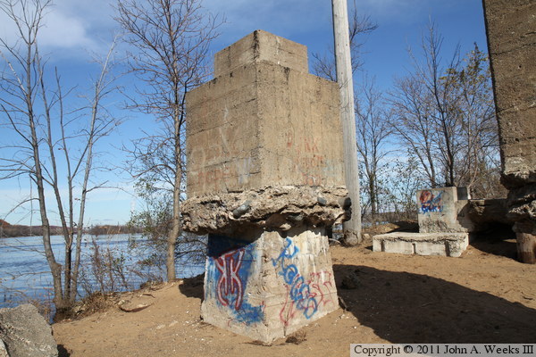
The photo above is looking back towards the remaining bridge abutment, with
one of the concrete foundation blocks in the foreground. The photo below
is looking west across the main river channel from near the bridge abutment.
This view shows that the bridge would have been relatively even after
crossing one-half mile of causeway.
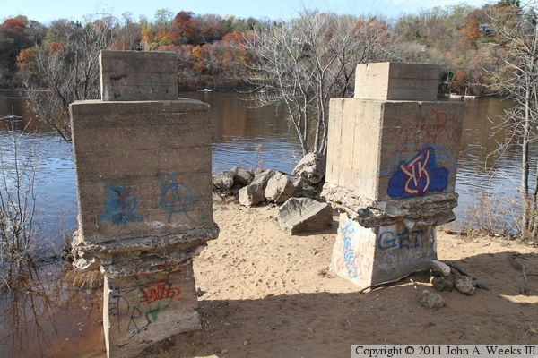
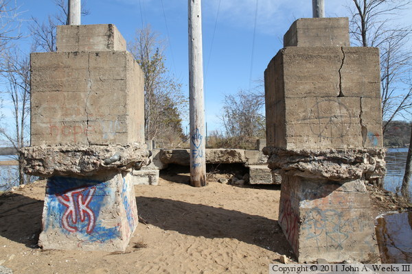
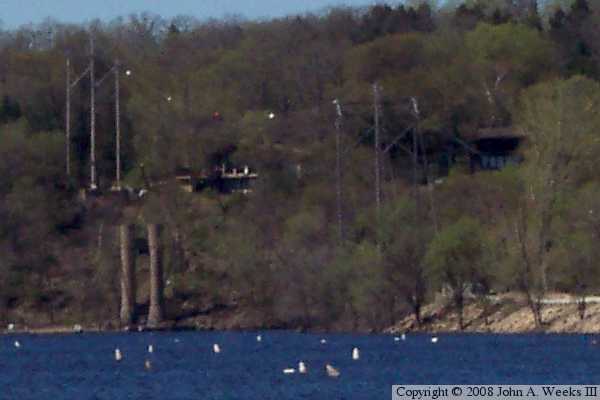
These two photos are views of two lower profile bridge pier foundations.
Both have seen some erosion. The high-line pole in the photo below was
placed after the bridge had been dismantled. A high-tension power line
now spans the Saint Croix River at this location, using the causeway to
support the river channel electrical towers.
These two photos are views of the last set of bridge pier foundation blocks
at the west end of the Walnut Street Causeway. The photo above is looking
northwest across the river, while the photo below is looking east towards
Wisconsin.
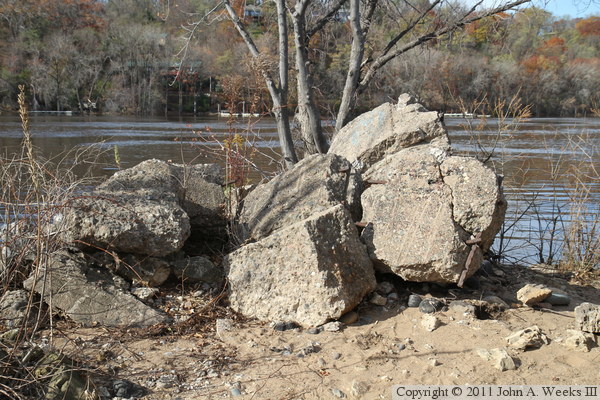
The photo above is a view looking northeast towards one of the two foundation
blocks at the end of the causeway. It appears that almost three feet of
soil has eroded from the end of the causeway since the bridge was taken down.
The photo below are remains of the east main bridge pier. This pier consisted
of a pair of tall concrete cylinders much like the remaining main bridge
pier on the west side of the river channel.
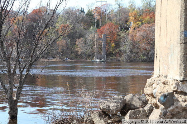
These two photos are views looking west across the main channel of the
Saint Croix River. They are a bit washed out due to looking directly into
the bright afternoon sun. The photo above is the far side of the river
channel, showing the remaining main bridge pier on the Minnesota side
of the river crossing. The photo below is a view from just behind the
last remaining piers on the east side of the river channel.
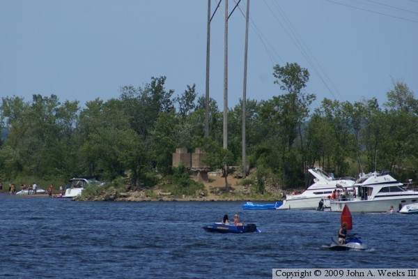
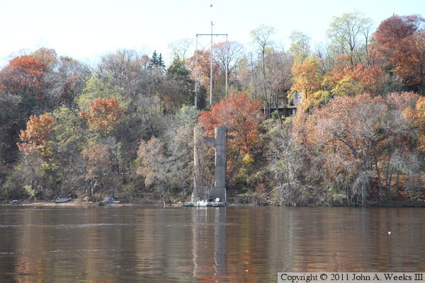
The photo above is the end of the Walnut Street causeway as seen from a
riverside park on the west side of the Saint Croix River. A set of
concrete bridge piers are visible in the center of the photo. The photo
below is a telephoto view of the remaining bridge piers on the west side of
the river crossing as seen from a riverside park in Hudson on the east
side of the Saint Croix River. This shows the power line that crosses
the river channel at the site of the old Toll Bridge.
|
